
Last updated on March 3rd, 2026
Looking for the best hikes in Glacier National Park? This guide includes details on each hike plus everything you need to know before you go!
We’ve been lucky enough to visit Glacier National Park twice now, and it continues to be our favorite national park of all time! The scenery here is (WOW!) unreal. There are more than 700 miles of trails to explore, over two dozen named glaciers, countless waterfalls, and lakes so blue they almost don’t look real. While you can see a lot just by driving the Going-to-the-Sun Road, hiking is arguably the best way to experience Glacier.
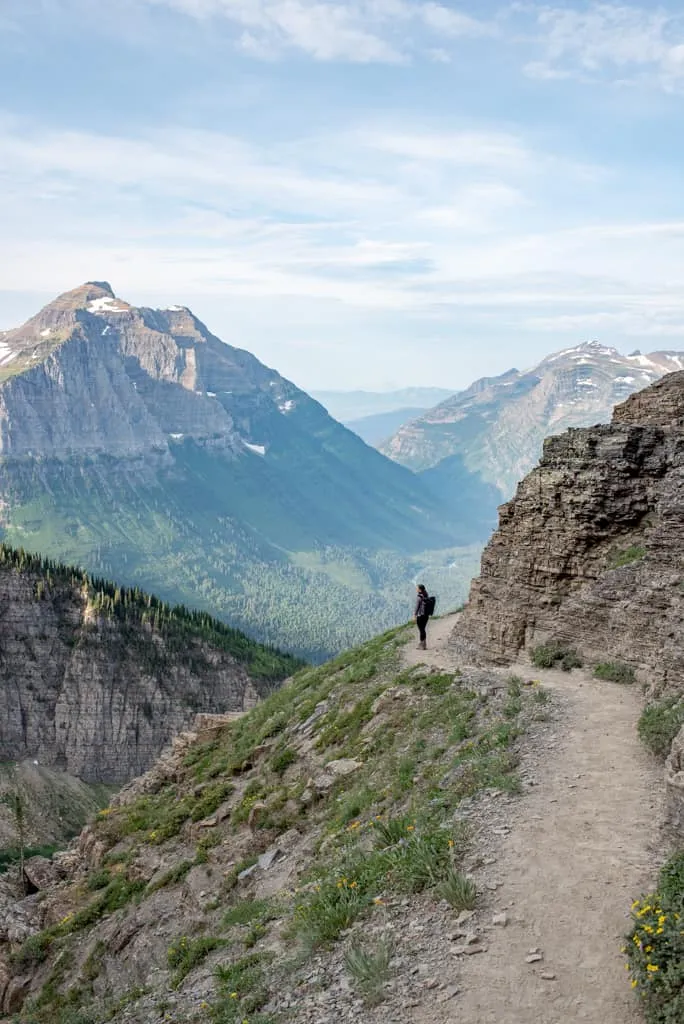
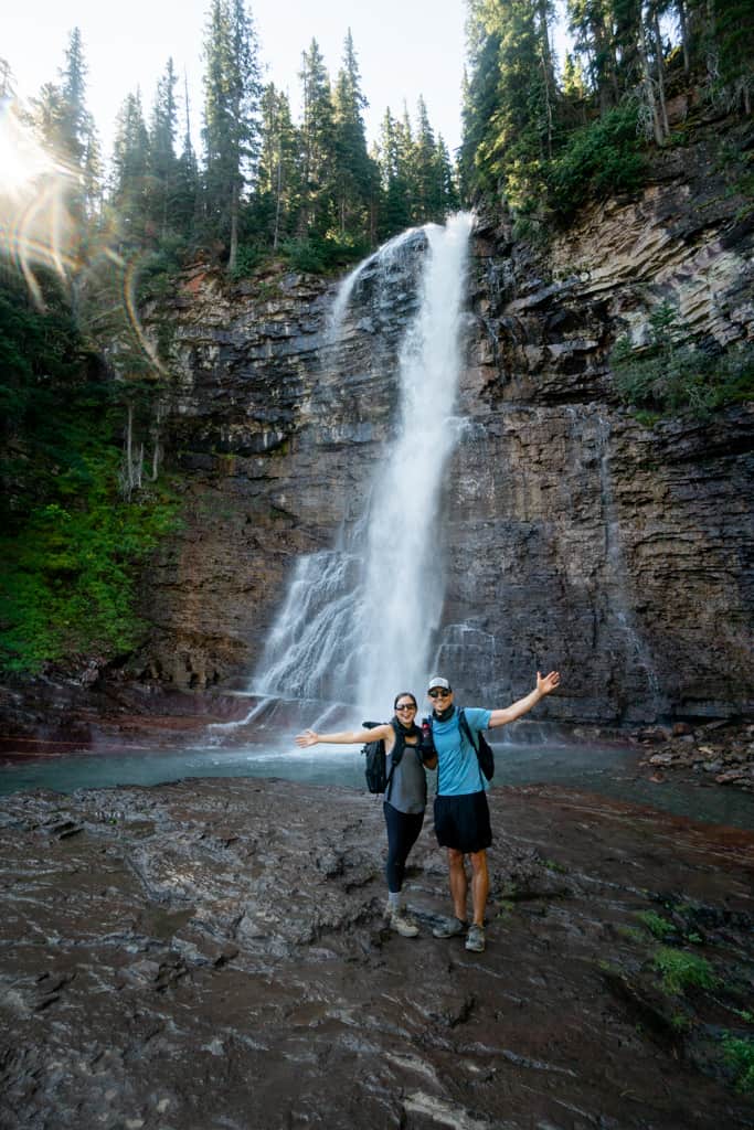
Our first trip to Glacier was back in 2020 during COVID, when a lot of the park was closed. Even so, we managed to hike the Highline Trail (which is still our favorite hike ever!), along with a bunch of other trails, and we left dreaming of coming back. In 2025, we finally returned and explored even more, including the Two Medicine area!
While you really can’t go wrong with any trail, we’ve put together a guide to the best hikes in Glacier National Park. We’re sharing everything you need to know before hiking Glacier’s best trails, complete with distances, elevation gain, difficulty, maps, and tips before you go!
NOTE: How to use this guide
Since Glacier is such a huge park, we’ve organized this guide by area and then ordered the hikes by distance within each section. That way, whether you’re based near St. Mary, Logan Pass, Lake McDonald, Many Glacier, or Two Medicine, you’ll know exactly which trails to check out without needing to zig-zag all over the park.
This list focuses on day hikes only (although a few of them are pretty long and will take up most of your day). They range from short and easy walks to longer, more challenging day hikes, but all of them are worth checking out.
Looking for more things to do in Glacier National Park?
- 40+ Fun Things to Do in Glacier National Park
- 13 Best Things to Do at Two Medicine in Glacier National Park
- The Perfect 3 Day Glacier National Park Itinerary for First-Time Visitors
- The Ultimate 4 Day Glacier National Park Itinerary
- 5 Day Glacier National Park Itinerary: Explore the BEST areas of the park!
- Driving the Going-to-the-Sun Road
- How to hike Glacier National Park’s Pitamakan-Dawson Loop
- Hiking the Highline Trail to Grinnell Glacier Overlook
Want to Learn More as you explore?
We highly suggest downloading the Guide Along – Glacier (totally worth the cost!!) audio tours to navigate you on the road. Even when you don’t have service it knows where you are and provides commentary and history about the area. As well as alerts you when to stop for specific sights. These guides are fun to listen to and the narrator feels like a fun friend in the car with you!
Best hikes in Glacier National Park
Apgar
The Apgar area is right by the park’s west entrance, making it super easy to access. It’s also where you’ll find Apgar Village with the main visitor center, places to eat, and gear rentals. It’s a good spot for shorter hikes or for days when you don’t want a long drive.
1. Apgar Lookout
Distance (round trip): 7.1 miles
Elevation gain: 1,906 feet
Difficulty: Hard
Trail map & current conditions
Apgar Lookout is one of the best hikes near the west entrance of Glacier, making it super convenient if you’re staying around Lake McDonald or Apgar Village.
The trail climbs steadily through the forest, but once you pop out near the top, you’ll be greeted with gorgeous views of Lake McDonald and the surrounding mountains.
At the very top is the Apgar fire lookout, built in 1929. We love that the old structure is still standing, even though it’s no longer in use. This hike has very little shade, so plan to head out early or be prepared for lots of sun exposure.
Going-to-the-Sun Road

The Going-to-the-Sun Road is easily one of the most scenic drives in the entire country. It’s 52 miles long and connects the west side of the park to the east. Along the way, you’ll find some of Glacier’s most iconic hikes. This area includes trails near Lake McDonald, Logan Pass, and Saint Mary.
Something to keep in mind: vehicle length is restricted to 21 feet on this road, so larger RVs or trailers won’t make the cut.
You can watch our full experience driving the Going-to-the-Sun Road here. And if you’re planning your own trip, be sure to read our blog post about the best stops on the Going-to-the-Sun Road, plus tips for making the most of it!
Lake McDonald
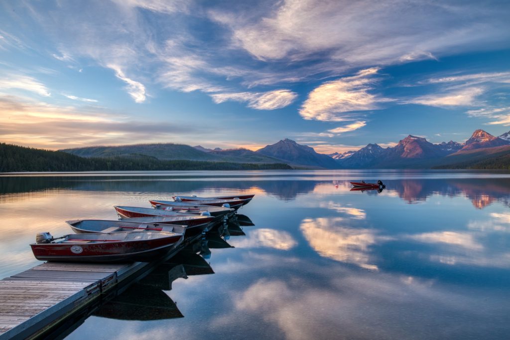
Lake McDonald is the largest lake in Glacier and the first big landmark you’ll see when entering from the west side.
This area is also home to the historic Lake McDonald Lodge, which has been around since 1913 and is worth a quick stop to check out the Swiss chalet–style architecture.
2. Trail of the Cedars

Distance (round trip): 0.9 miles
Elevation gain: 49 feet
Difficulty: Easy (wheelchair accessible)
Trail map & current conditions
Trail of the Cedars is a very easy, short hike featuring a scenic boardwalk that winds through massive cedar and hemlock trees (some of the oldest in the park!). The trail also crosses Avalanche Creek, where you’ll get a great view of the narrow, churning gorge.
This hike is beautiful on its own, but we love that it connects directly to Avalanche Lake, so you can easily pair the two together if you want a longer adventure.
3. Johns Lake Loop
Distance (round trip): 2 miles
Elevation gain: 190 feet
Difficulty: Easy
Trail map & current conditions
Johns Lake Loop is a great, easy hike. The trail takes you past Johns Lake, a small pond, and even gives you a peek at the northeast end of Lake McDonald. You’ll also cross McDonald Creek a couple of times on pretty wooden bridges. The loop officially begins at the Johns Lake Trailhead and does cross the road twice, so just be mindful of traffic.
4. Avalanche Lake
Distance (round trip): 5.9 miles
Elevation gain: 757 feet
Difficulty: Moderate
Trail map & current conditions
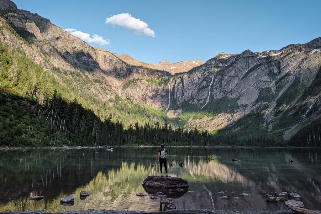
Avalanche Lake is one of the most popular day hikes, and it’s easy to see why! Starting from Trail of the Cedars, this hike starts by wandering through a forest of red cedars and western hemlocks, on a raised boardwalk.
The hike then climbs gradually past Avalanche Creek before opening up to Avalanche Lake, which is surrounded by Bearhat Mountain, Little Matterhorn, and multiple waterfalls cascading into the water that originate from Sperry Glacier.
Because it’s popular, expect crowds, especially midday in the summer. We’d recommend hitting the trail early in the morning or later in the evening for a quieter experience (sunset here is incredible!). Pack a snack or lunch and plan to hang out for a bit at the lake!
Logan Pass
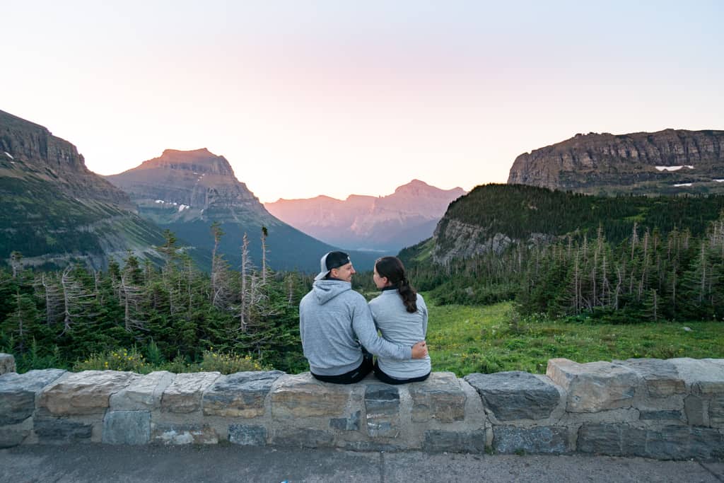
Logan Pass is one of the main attractions on the Going-to-the-Sun Road and is home to some of the most famous hikes in the park. Sitting on the Continental Divide at over 6,600 feet, it’s the highest point along the road!
Because of its popularity, parking is notoriously tough, so we recommend arriving early or later in the afternoon. As of July 1, 2026, parking at Logan Pass will be limited to 3 hours per car. This should help, but we are sure it will still be tough to get a spot throughout the day.
5. Hidden Lake Overlook
Distance (round trip): 2.7 miles
Elevation gain: 551 feet
Difficulty: Moderate
Trail map & current conditions
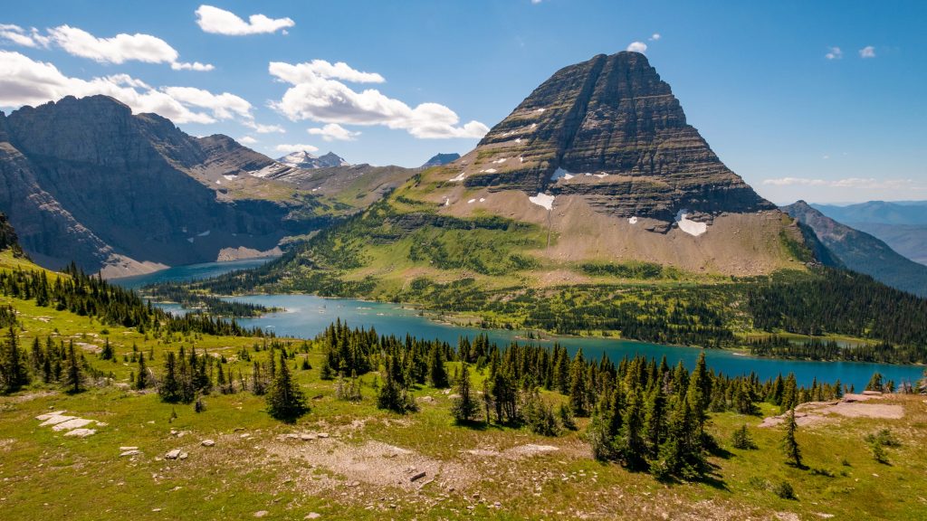
Hidden Lake overlook is one of the most popular hikes on Logan Pass and starts right at the Logan Pass Visitor Center. The trail is short but climbs steadily on a combo of boardwalk and dirt paths through gorgeous alpine meadows.
On this hike, you’ll go up and over Hidden Lake Pass, with views of Clements Mountain on one side and Reynolds Mountain on the other.
The overlook gives you an awesome view of Hidden Lake tucked beneath Bearhat Mountain, and if you’re up for a longer adventure, you can continue down to the lake itself. Heads up, though, part of the trail is steep, rocky, and exposed to a big drop-off, so sturdy hiking boots are a good idea.
One more thing to know: this trail often closes in midsummer due to bear activity (it happened during our visit!), so definitely check the status before you head out.
6. Mount Oberlin
Distance (round trip): 3.6 miles
Elevation gain: 1,502 feet
Difficulty: Hard
Trail map & current conditions
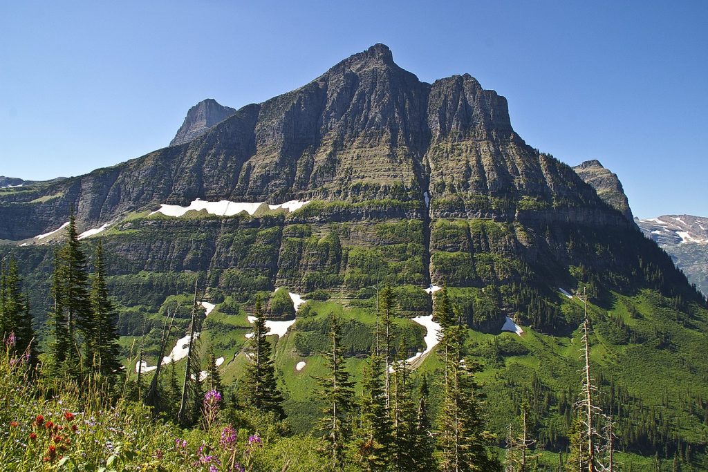
Despite being labeled as a “mountaineering” route on AllTrails, Mount Oberlin is much more approachable than it sounds. The trail climbs through gorgeous alpine terrain and gives you nonstop views the whole way up. At the summit, you’re rewarded with sweeping views of the valleys below, waterfalls, and a full panorama of mountains!
You’ll need to do a little bit of trail finding in spots, and there are some steeper sections that make it more of a challenge, plus some scrambling. So make sure that is something you’re comfortable with before you go.
We haven’t hiked this one ourselves yet, but a hiker we met on another trail raved about it and told us it was one of their favorites, so it’s definitely at the top of our list for next time.
7. Highline Trail


Distance: 14.9 miles (can be reduced by ending at the Loop shuttle stop)
Elevation gain: 2,621 feet
Difficulty: Hard
Trail map & current conditions
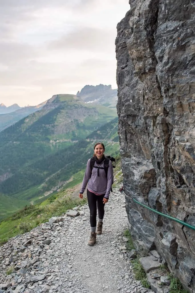
The Highline Trail is not only one of the most beautiful trails in the park, but quite possibly one of the most beautiful trails in the United States! Starting from Logan Pass, it follows a trail carved into the mountainside with nonstop views of the valley and surrounding peaks. Early on, there’s a short stretch along a super narrow ledge with a hand cable, but after that, the trail widens out and it’s pure alpine magic.
If you have the time and energy, you can add side trips to Grinnell Glacier Overlook (a steep spur trail with epic views of Grinnell Glacier) or continue on to the Granite Park Chalet (a historic backcountry hut that makes for a great lunch stop). You can either finish the hike at the Loop shuttle stop to shorten the hike, or return the way you came.
Note: Since this hike will take much longer than 3 hours, you cannot park at the Logan Pass parking lot. Instead purchase a shuttle ticket in advance. More information about shuttles below!
If the Highline Trail in Glacier National Park is on your list, we wrote a detailed guide with route options, what to pack, and our experience on the trail, so be sure to check it out!
St. Mary

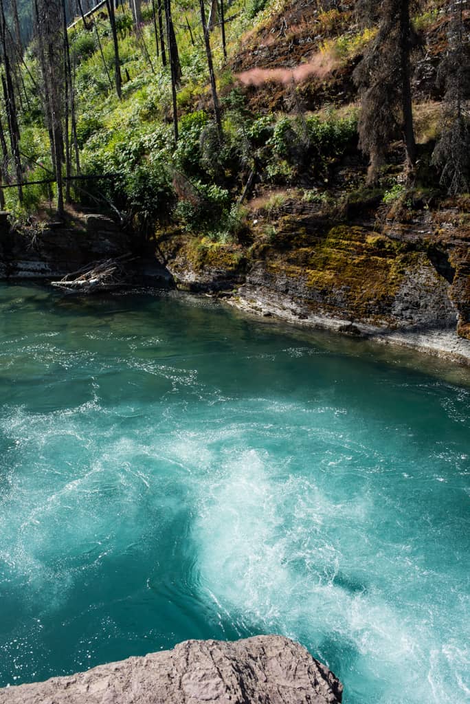
The St. Mary area sits on the east side of the Going-to-the-Sun Road and is known for its waterfall hikes, big alpine passes, and stunning lake views. This part of the park has also been affected by fire, so you’ll see areas of burned forest with wildflowers and wide open views.
This area usually feels less hectic than Logan Pass while still packing in plenty of epic scenery.
8. Baring Falls

Distance (round trip): 0.7 miles
Elevation gain: 111 feet
Difficulty: Easy
Trail map & current conditions
Baring Falls is one of the easiest hikes in St. Mary district of the park along the Going-to-the-Sun Road. Starting from the Sunrift Gorge pullout and shuttle stop, the trail follows Baring Creek to a 25-foot waterfall that tumbles through a narrow gorge before spilling into St. Mary Lake. You’ll cross a footbridge right in front of the falls, and if the water is high, you might even feel the mist as you walk across!
Fun fact: The creek and waterfall were named after the Baring brothers, London bankers, who visited the area in the late 1880s.
9. Sun Point Nature Trail

Distance (round trip): 1.9 miles
Elevation gain: 206 feet
Difficulty: Easy
Trail map & current conditions
The Sun Point Nature Trail is a short but scenic hike starting from the Sun Point parking area. Back in the early days of the park, this was the site of the Going-to-the-Sun Chalet, a bustling lodge that welcomed travelers before it was torn down in the 1940s.
The trail drops down toward St. Mary Lake and passes through part of the forest that burned in the 2015 Reynolds Creek Fire. From here, you can either turn back for a quick 1.9-mile out-and-back or continue farther along the trail. The extension takes you to Baring Falls, then to St. Mary Falls, and then just a bit farther to Virginia Falls, one of the most impressive waterfalls in the park.
10. St. Mary Falls & Virginia Falls


Distance (round trip): 3.1 miles
Elevation gain: 452 feet
Difficulty: Moderate
Trail map & current conditions
This is one of the most popular waterfall hikes in Glacier National Park, and for good reason! Starting from the St. Mary Falls shuttle stop or trailhead, the trail passes through a burn area from the 2015 Reynolds Creek Fire before dropping down to the St. Mary River. Not long after, you’ll hear the roar of the 35-foot St. Mary Falls, which tumbles in three tiers into a pool below.
From here, the trail continues along Virginia Creek, passing smaller cascades before reaching Virginia Falls, a gorgeous 50-foot waterfall that crashes down a rocky cliff. Along the way, you’ll also get mountain views of Dusty Star, Almost-a-Dog, and Little Chief towering above the valley.
Parking can be tricky since this area is so popular, so we definitely recommend taking the shuttle from Sun Point or Rising Sun if you’re visiting in the summer.
11. Siyeh Pass
Distance (point to point): 9.9 miles
Elevation gain: 2,247 feet
Difficulty: Hard
Trail map & current conditions
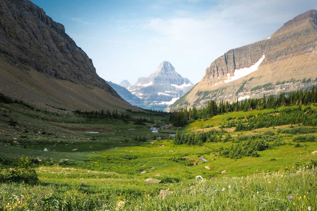
Siyeh Pass is one of the best hikes in the park if you’re after big mountain views. The trail begins by following Siyeh Creek, and then opens up into Preston Park, a gorgeous valley of wildflower meadows surrounded by mountains. From there, the climb continues until you reach the top of the pass.
If you can, set up a car shuttle so you can hike it point to point and finish at Sunrift Gorge. You can also extend the hike by adding on Piegan Pass.
Fun fact: the pass was named by George Bird Grinnell after a Blackfeet man named Sai-yeh, which translates to “Crazy Dog” or “Mad Wolf.”
12. Otokomi Lake
Distance (round trip): 10.9 miles
Elevation gain: 2,316 feet
Difficulty: Hard
Trail map & current conditions
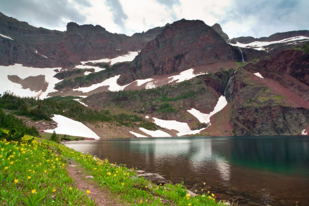
Otokomi Lake is a beautiful hike in Glacier National Park that starts right behind the Rising Sun Campground store (or you can hop off at the Rising Sun shuttle stop) and follows Rose Creek all the way up into Rose Basin.
Along the way, you’ll pass a handful of waterfalls, walk through berry patches including huckleberries and thimbleberries, and get some awesome mountain views. It’s definitely a climb, and there isn’t much shade, but the lake at the end is gorgeous. Plus, it’s a great spot to fish.
Fun fact: the lake was named after Otokomi, a part-Blackfoot man who joined George Bird Grinnell on his early expeditions here. In the Blackfeet language, Otokomi means “Yellow Fish.”
13. Gunsight Lake
Distance (round trip): 13.8 miles
Elevation gain: 1,843 feet
Difficulty: Hard
Trail map & current conditions
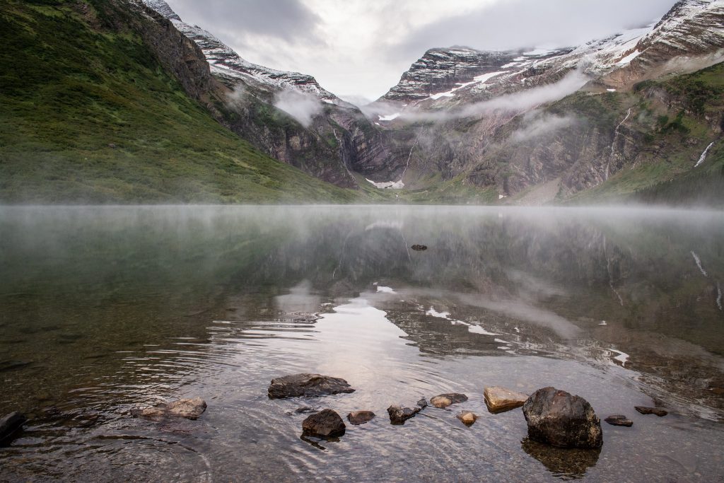
The hike to Gunsight Lake starts at the Jackson Glacier Overlook and is long, but easily one of the most beautiful trails in Glacier. The route winds past creeks, Florence Falls, and meadows, with views of Fusillade Mountain towering above you. You’ll cross a suspension bridge near Reynolds Creek, pass Mirror Pond, and spot peaks like Mt. Jackson, Mt. Logan, and Gunsight Mountain along the way.
And for those wanting a bigger adventure, this trail is also part of the popular multi-day route over Gunsight Pass.
14. Piegan Pass
Distance (point to point): 16.1 miles
Elevation gain: 3,116 feet
Difficulty: Hard
Trail map & current conditions
Piegan Pass is one of the best hikes in Glacier National Park for nonstop alpine views. The trail begins along Siyeh Creek and passes through a thick spruce-fir forest before breaking out above the treeline. From here, you’ll get incredible views of Jackson Glacier across the valley, Piegan Glacier resting below Piegan Mountain, and even Blackfoot Glacier (which is the largest glacier in the park!).
At the top of the pass, you’ll be surrounded by Angel Wing, Bishop’s Cap, and Mount Gould along the Garden Wall, with views that stretch all the way into the Many Glacier Valley.
You can hike this as a point-to-point if you have a car shuttle, either starting at the Piegan Pass Trailhead or the Many Glacier Hotel. Another option is to connect it to the Siyeh Bend Trail for a shorter version.
Two Medicine

Tucked away on the southeastern side of the park, Two Medicine is one of Glacier’s quieter districts. Back in the day, it was a bustling hub, with the old Two Medicine Chalet welcoming visitors who arrived by train. The chalet may be gone now, but the history is still very much alive.
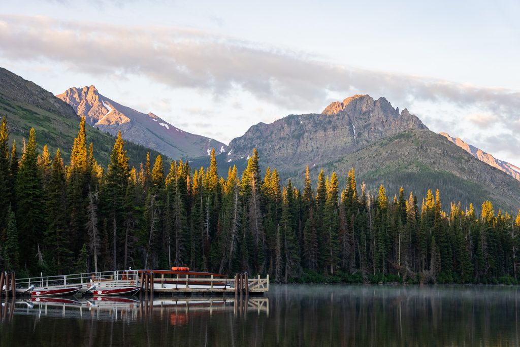
Parking is usually easier here, and you can even hop on a scenic boat tour across Two Medicine Lake to cut off some mileage on a few hikes.
If you want to see exactly how we spent three dreamy days here, watch our Two Medicine video on YouTube! And if you’re planning your own trip, we wrote a blog post with the best things to do in Two Medicine, plus tips to help you plan your trip!
15. Running Eagle Falls
Distance (round trip): 0.7 miles
Elevation gain: 29 feet
Difficulty: Easy
Trail map & current conditions
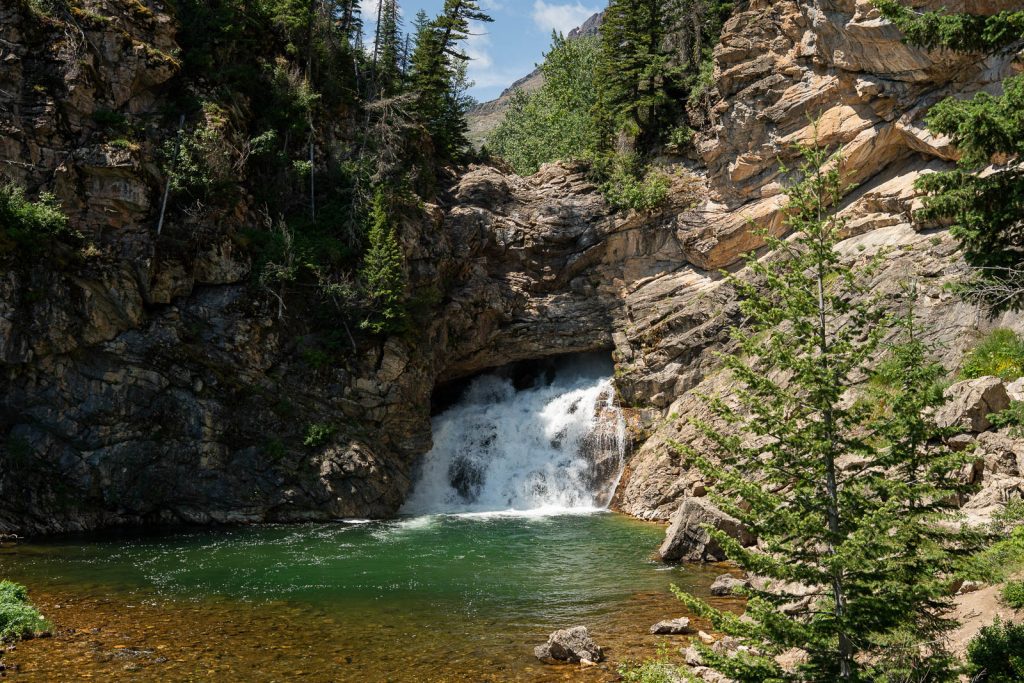
Running Eagle Falls, also known as “Trick Falls,” is one of the most unique waterfalls in Glacier National Park. The trail is short, flat, and it’s one of only two wheelchair-friendly trails in the park!
The falls get their nickname because there are actually two waterfalls here. In the spring, water rushes over the upper ledge in a 40-foot drop, partially hiding the lower falls. Later in the summer, the flow slows down and water seems to pour straight out of the cliff itself, creating a 20-foot waterfall that looks like it’s coming out of a cave.
Fun fact: The name “Running Eagle” honors Pitamakan, a woman warrior of the Blackfeet Nation in the early 1700s. She led successful war parties and was the only woman in the tribe ever to be given a man’s name!
16. Paradise Point
Distance (round trip): 1.4 miles
Elevation gain: 154 feet
Difficulty: Easy
Trail map & current conditions
Paradise Point is an easy walk from the South Shore Trailhead at Two Medicine Lake, and it leads to one of the most scenic spots in the whole park. From the beach, you’ll have a gorgeous view of Rising Wolf Mountain, with Mt. Helen and Lone Walker Mountain off to the side, plus Sinopah and Painted Tepee Peak perfectly framing the lake.
17. Twin Falls
Distance (round trip): 2 miles (if you take the boat shuttle across Two Medicine)
Elevation gain: 1140 feet
Difficulty: Easy
Trail map & current conditions
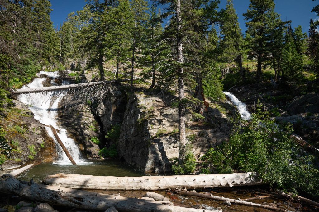
Twin Falls is one of the prettiest waterfall hikes in Glacier National Park’s Two Medicine area. The trail is relatively flat, winding through forest and meadows with plenty of chances to snack on huckleberries in late summer.
You’ll cross a boardwalk over a boggy stretch and a footbridge before reaching the falls, which tumble side by side down the cliffs of Pumpelly Pillar. The two cascades are about 50 feet apart before they join again near the base, making it such a gorgeous sight.
You can hike here entirely on foot or shave off a couple of miles by taking the boat across Two Medicine Lake, which is a fun option. And if you’re not ready to turn around yet, it’s only another 1.3 miles to Upper Two Medicine Lake, an easy hike to add on with almost no elevation gain.
18. Aster Falls & Aster Park Overlook
Distance (round trip): 2.6 miles (to Aster Falls) or 4 miles (to Aster Park)
Elevation gain: 450 feet (to Aster Falls) or 800 feet (to Aster Park)
Difficulty: Easy/Moderate
Trail map & current conditions
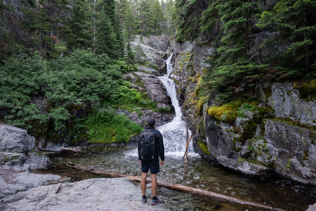
This is one of the easier hikes in the Two Medicine area, but it’s still packed with epic scenery. The trail takes you through the forest and past beaver ponds before ending at a gorgeous 20-foot waterfall tucked into the trees.
It’s short enough to pair with other hikes nearby, like Paradise Point or Twin Falls, but you can also make it longer by continuing up to Aster Park Overlook for sweeping lake views or even farther to Rockwell Falls.
19. Rockwell Falls
Distance (round trip): 6.7 miles
Elevation gain: 419 feet
Difficulty: Moderate
Trail map & current conditions
The hike to Rockwell Falls in Glacier National Park follows the shoreline of Two Medicine Lake before heading up a forested valley to one of the prettiest waterfalls in the area.
Along the way, you’ll wander past a series of beaver ponds (which are prime spots to see moose!). After crossing both a suspension bridge and a footbridge, you’ll arrive at Rockwell Falls, a multi-tiered cascade with the main drop tumbling about 30 to 40 feet.
20. Scenic Point
Distance (round trip): 7.7 miles
Elevation gain: 2,365 feet
Difficulty: Hard
Trail map & current conditions
Scenic Point is one of the best hikes in Glacier National Park’s Two Medicine area, and it totally lives up to its name! The trail itself owes its existence to the Great Northern Railway, which built many of the early routes in the park.
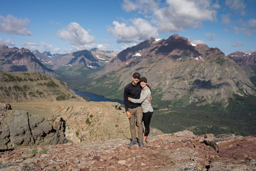
On this hike, you’ll pass through a ghost forest of whitebark pines, killed off by disease more than a century ago. After that, the trail climbs steadily from the valley floor up into the alpine, where at the top you can see nearly the entire Two Medicine Valley, including Lower, Middle, and Upper Two Medicine Lake, plus Appistoki Peak on one side and Mt. Henry on the other.
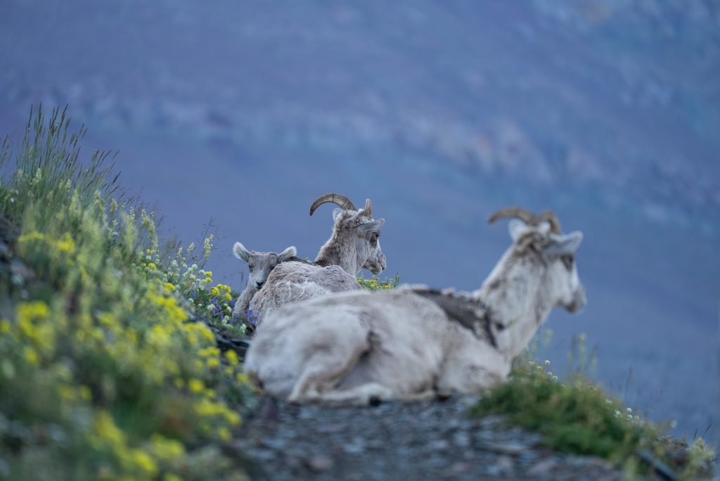
The trail is exposed, so it can get windy, but on a clear day, the scenery is unreal. When we did this hike, we saw nearly two dozen bighorn sheep along the way (including babies!).
21. No Name Lake
Distance (round trip): 9.7 miles
Elevation gain: 1,305 feet
Difficulty: Moderate
Trail map & current conditions
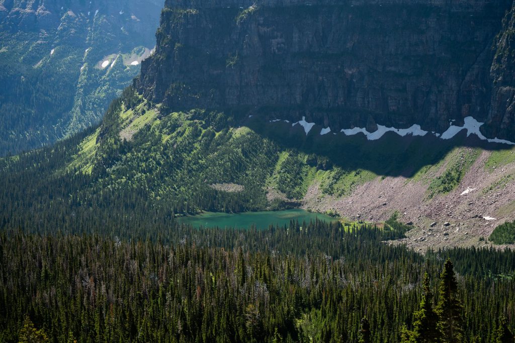
No Name Lake is a beautiful alpine lake tucked into the mountains of Pumpelly Pillar and Mt. Helen above Two Medicine. The hike begins from the North Shore Trailhead in the Two Medicine Campground, but you can shave off about 4 miles round trip by hopping on the shuttle boat across Two Medicine Lake.
The trail winds through lush forest with ferns and huckleberries before crossing a footbridge and gradually making its way into the basin. Some sections can be pretty brushy, and we even spotted fresh bear scat here, so keep your bear spray handy!
The lake has a secluded little beach on the northwestern shore, which is perfect for a snack break and soaking in the views. Just beyond the beach, there’s also a backcountry campground with a few tent sites if you’d like to snag an overnight permit.
22. Upper Two Medicine Lake
Distance (round trip): 11.5 miles
Elevation gain: 1,036 feet
Difficulty: Moderate
Trail map & current conditions
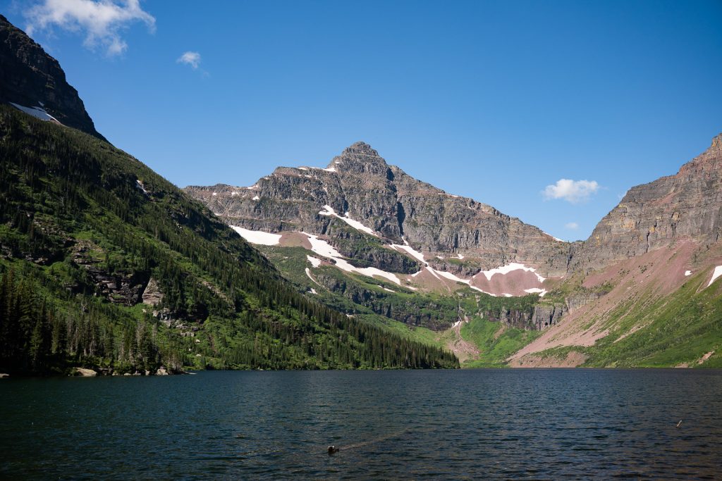
Upper Two Medicine Lake is tucked into a stunning basin beneath Mount Helen, Pumpelly Pillar, and Lone Walker Mountain, and it’s easily one of the most beautiful spots in this part of Glacier.
The hike begins on the South Shore Trail, winding through the forest, crossing streams, and even taking you over a couple of fun suspension bridges. Along the way, you can make short side trips to Paradise Point, Aster Falls, or Aster Park, which all add extra waterfalls and viewpoints to your day.
If you’d like to cut down the mileage, the Two Medicine boat cruise is a great option! You can ride it round-trip or just one way and hike back the other direction.
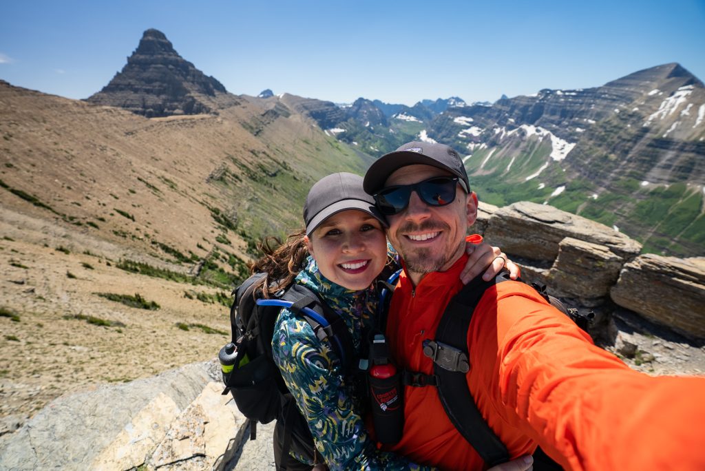
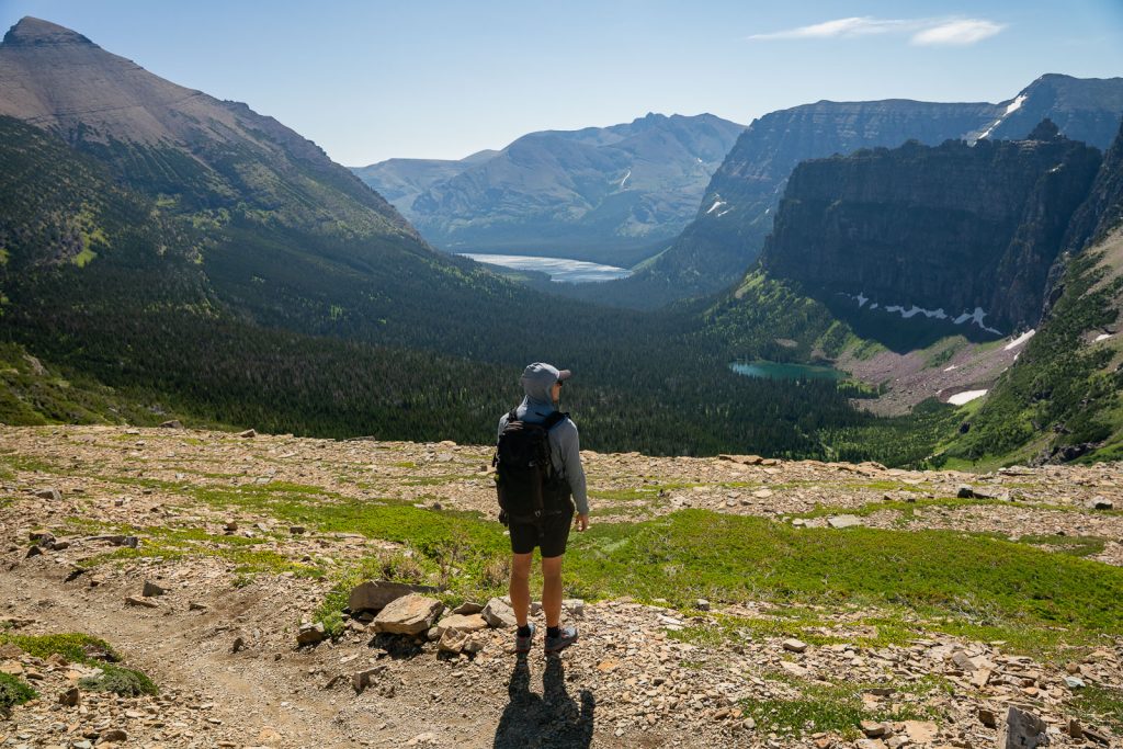
23. Pitamakan-Dawson Loop
Distance (loop): 18.8 miles
Elevation gain: 3,779 feet
Difficulty: Hard
Trail map & current conditions
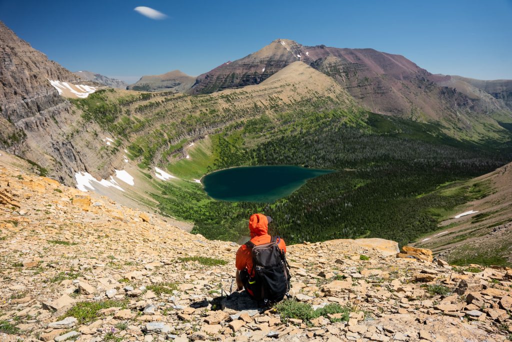
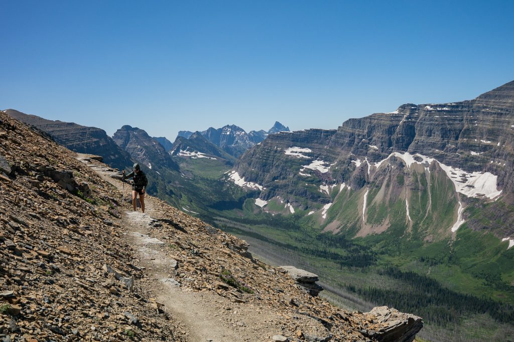
The Pitamakan-Dawson Loop is one of the most sought-after backpacking loops and is often ranked as one of the top hikes in the entire national park system! Both passes are famous for their incredible views (and crazy strong winds!).
Throughout this hike, you’ll see mountain peaks, beautiful lakes, and get to hike along a narrow mountainside. This was hands-down our favorite hike in the area! But it is tough and long, so we only recommend it for those with a lot of endurance and hiking experience.
If you don’t have the time (or energy!) for the full loop, you can still hike to Pitamakan Pass or Dawson Pass as an out-and-back. Or camp for the night at the backcountry campsites at Oldman Lake and No Name Lake.
To learn more about this trail, including your different options to hike it and a trail breakdown, check out our detailed guide to hiking the Pitamakan–Dawson Loop!
Many Glacier
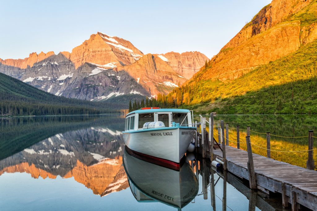
Many Glacier is often called the most scenic part of the park, and from everything we’ve seen (and heard from other hikers), it really does feel like the heart of Glacier. Towering peaks surround a valley filled with lakes, waterfalls, and some of the park’s most famous trails. This area is also home to the historic Many Glacier Hotel, which was built in 1915 and still overlooks Swiftcurrent Lake today.
You can also take the boat tours (for a fee) across Swiftcurrent Lake and Lake Josephine, which can cut off a chunk of mileage on certain hikes, plus it’s another fun thing to do!
We unfortunately haven’t been able to hike here yet because of road closures during both of our visits. But below are the hikes at the very top of our list for next time!
24. Apikuni Falls
Distance (round trip): 1.8 miles
Elevation gain: 580 feet
Difficulty: Moderate
Trail map & current conditions
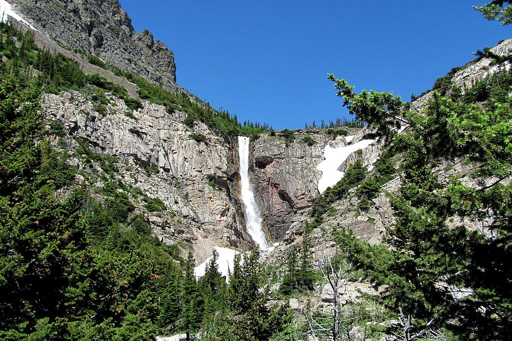
Apikuni Falls (sometimes spelled “Appekunny”) is a short but steep hike in Glacier National Park’s Many Glacier area. The trail climbs steadily from the Poia Lake Trailhead before opening up to views of a stunning waterfall that drops more than 100 feet in two dramatic tiers. The upper section free-falls right off the cliff, while the lower section cascades down the rock face, with smaller falls tumbling below.
Fun fact: The name “Apikuni” comes from the Blackfeet word for “spotted robe.”
25. Grinnell Lake
Distance (round trip): 7.8 miles
Elevation gain: 462 feet
Difficulty: Moderate
Trail map & current conditions
Grinnell Lake is one of the most beautiful hikes in Glacier National Park, leading to a lake fed by meltwater from Grinnell Glacier. This glacier fills Upper Grinnell Lake before spilling down into this lower basin.
The trail begins near Swiftcurrent Lake by the Many Glacier Hotel, but if you want to save some mileage, you can hop on the two shuttle boats that cross Swiftcurrent Lake and Lake Josephine, shaving about 5 miles off the round trip. Along the way, you’ll cross a suspension bridge, walk over a series of wooden boardwalks, and pass the short spur to Hidden Falls (definitely worth a stop!).
26. Iceberg Lake
Distance (round trip): 9.6 miles
Elevation gain: 1,459 feet
Difficulty: Moderate
Trail map & current conditions
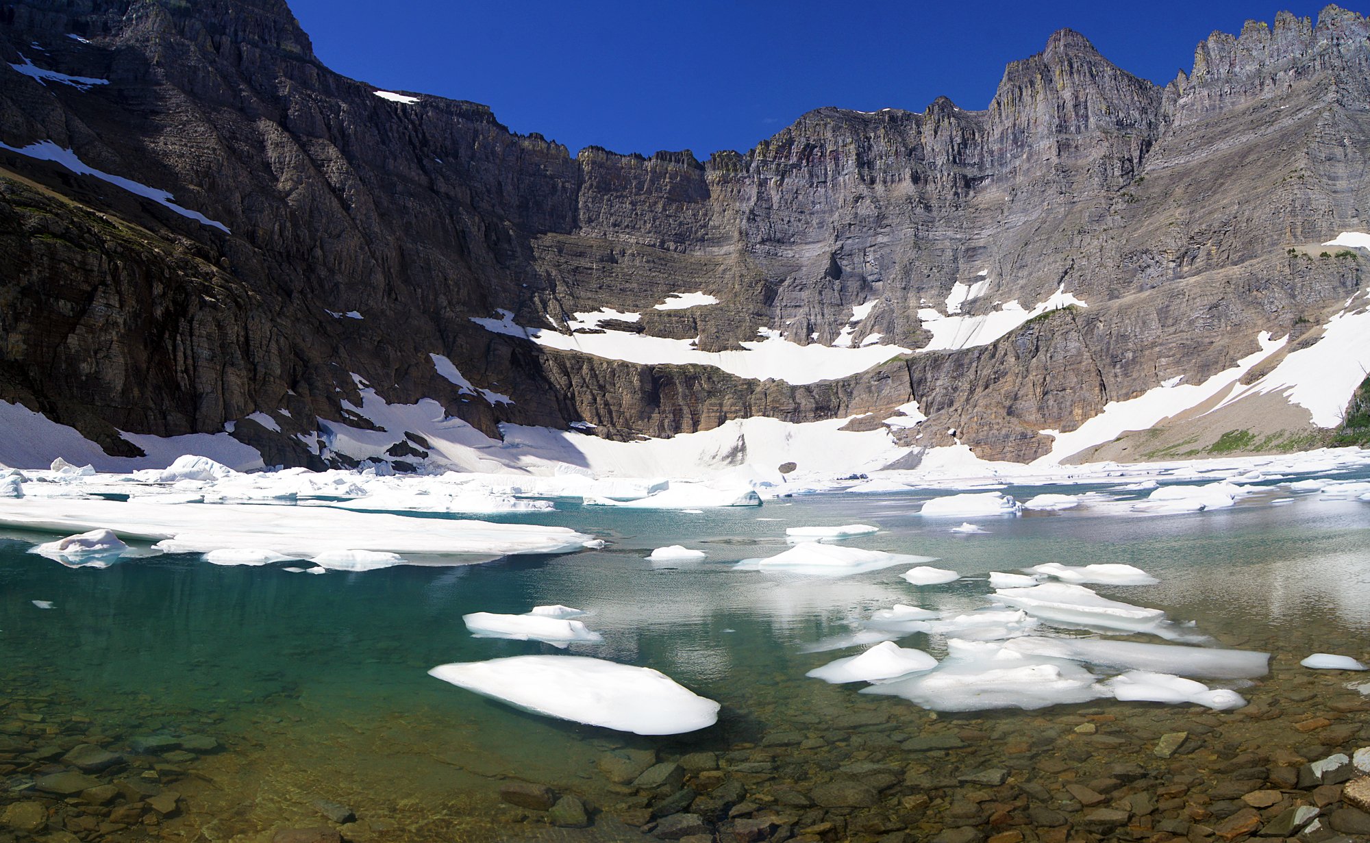
The Iceberg Lake Trail is one of the best hikes in the park, and easily one of the most iconic in the Many Glacier area. The trail begins near the Swiftcurrent Motor Inn, and winds through forests and meadows with gorgeous wildflowers.
The lake itself sits in a massive cirque, surrounded by towering walls of Mount Wilbur, Iceberg Peak, and the Continental Divide. Because it’s tucked so deeply into the shadows of these peaks, the water stays icy cold, and chunks of ice float in the water well into the summer (some brave hikers even take a plunge!).
27. Ptarmigan Tunnel
Distance (round trip): 10.6 miles
Elevation gain: 2,362 feet
Difficulty: Hard
Trail map & current conditions
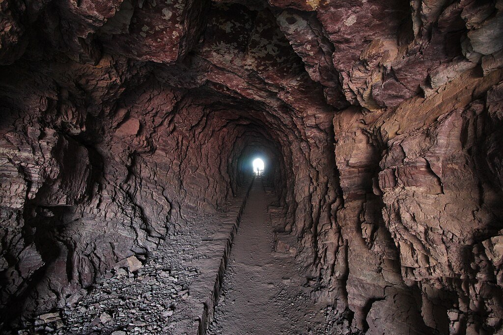
The hike to Ptarmigan Tunnel is one of the most unique experiences in Glacier National Park because of the tunnel itself, which is a 250-foot man-made passage blasted through the Ptarmigan Wall in the 1930s by the Civilian Conservation Corps.
After a steady climb through forest and alpine terrain, you’ll get gorgeous views of Mount Grinnell, Swiftcurrent Mountain, and Mount Wilbur towering above the valley.
You can actually walk through the tunnel (bring a headlamp!) and pop out the other side to see the Belly River Valley, with peaks like Natoas and Crosley Ridge in the distance and Elizabeth Lake below.
28. Grinnell Glacier
Distance (round trip): 10.9 miles
Elevation gain: 2,080 feet
Difficulty: Hard
Trail map & current conditions
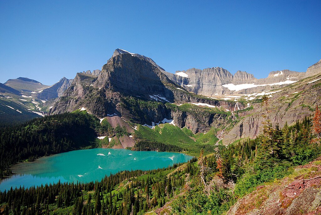
If we could only pick one Many Glacier hike, it would be Grinnell Glacier. This trail has it all! Turquoise lakes, cascading waterfalls, wildflower meadows, and nonstop mountain views the entire way. The hike climbs steadily before ending at Grinnell Glacier, one of the park’s most famous (and sadly, shrinking) glaciers.
To make the day a little shorter, you can shave off nearly 5 miles round-trip by taking the two shuttle boats across Swiftcurrent Lake and Lake Josephine.
29. Cracker Lake
Distance (round trip): 12.5 miles
Elevation gain: 1,617 feet
Difficulty: Hard
Trail map & current conditions
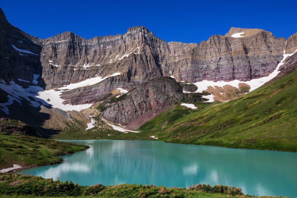
Cracker Lake has some of the bluest water in all of Glacier, and the hike to get there is just as beautiful. Starting near the Many Glacier Hotel, the trail winds its way through forests and meadows, with a few creek crossings and log bridges along the way, before opening up to one of the most incredible alpine lakes in the park.
Tucked below the towering cliffs of Mount Siyeh, Cracker Lake glows a milky blue color thanks to glacial silt suspended in the water (which is absolutely unreal!). You can do this as a long day hike or spend the night at the Cracker Lake backcountry campground, but either way, it’s easily one of the best hikes in Glacier National Park.
A+K Tip: If you want to check this hike, make sure to check its status beforehand, as it closes often due to bears.
30. Swiftcurrent Pass (and Swiftcurrent Mountain)
Distance (round trip): 14.2 miles (pass only) or 16.4 miles (with Swiftcurrent Mountain)
Elevation gain: 2,500–3,400 feet
Difficulty: Hard
Trail map & current conditions
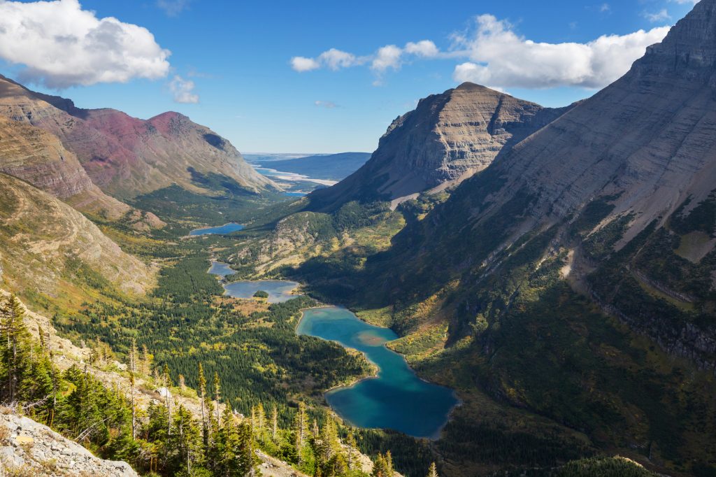
This is one of the toughest hikes in Many Glacier, but also one of the most rewarding. The trail climbs steadily through Swiftcurrent Creek’s beautiful basin, passing Fishercap, Redrock, Swiftcurrent, and Bullhead Lakes.
Once you reach the far end of Bullhead Lake, the trail climbs up a series of steep switchbacks to the pass, where you’ll be surrounded by mind-blowing views of the continental divide.
If you’re up for even more adventure, you can take a spur trail up to the top of Swiftcurrent Mountain. The climb is steep, but from the summit (home to the historic Swiftcurrent Lookout), you’ll be standing at the highest point in Glacier National Park that you can reach by an established trail!
Highway 2
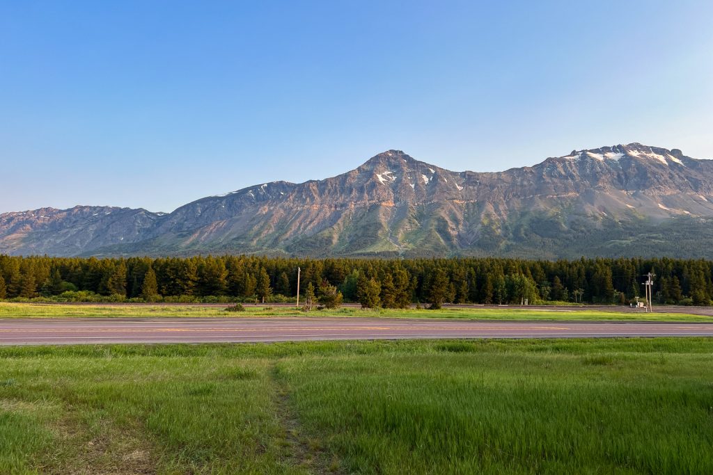
Running along the southern border of Glacier, Highway 2 doesn’t get as much attention as Going-to-the-Sun Road or Many Glacier, but there are still a few trails worth checking out. It’s a quieter way to explore the park and a good option if you want to escape the crowds.
31. Firebrand Pass
Distance (round trip): 10.3 miles
Elevation gain: 2,037 feet
Difficulty: Hard
Trail map & current conditions
Named after the devastating 1910 wildfires that burned millions of acres across Montana and beyond, Firebrand Pass is one of Glacier’s more rugged and less-traveled hikes.
The trail starts in open meadows with views of Little Dog, Summit, and Calf Robe Mountains before climbing into aspen and pine forest. As you gain elevation, the forest opens up to wildflower-filled meadows and eventually leads to the pass, where strong winds are common (hence the name!).
At the top, you’ll be rewarded with sweeping views of the southern edge of the park that feel worlds away from the busier districts.
North Fork

The North Fork is Glacier’s wild northwest corner and feels way more remote than the rest of the park.
To get here, you’ll need to drive miles of gravel roads, and there are strict vehicle length restrictions, so it’s definitely more of an adventure just to reach. Because of that, it sees way fewer crowds.
32. Numa Lookout
Distance (round trip): 11.3 miles
Elevation gain: 2,992 feet
Difficulty: Hard
Trail map & current conditions
The hike to Numa Lookout is one of the highlights of the North Fork area. Starting near Bowman Lake Campground, you’ll follow the shoreline before climbing steeply through the forest up Numa Ridge.
At the top sits the historic Numa Ridge Fire Lookout, a wooden tower built in 1933 that’s still staffed today.
From the lookout, you’ll get panoramic views in every direction, including Bowman Lake stretching out below, the peaks of the North Fork Valley, and even Reuter and Kintla Peaks off in the distance.
Fun fact: Nature writer Edward Abbey spent a summer working here in 1975!
33. Quartz Lake Loop
Distance (round trip): 13.1 miles
Elevation gain: 2,641 feet
Difficulty: Hard
Trail map & current conditions
The Quartz Lake Loop is one of the only true loop hikes in Glacier in the North Fork district. Starting near Bowman Lake, the trail winds through forest and meadows before visiting three beautiful lakes: Quartz Lake, Middle Quartz Lake, and Lower Quartz Lake. Quartz Lake is the highlight, with turquoise water framed by the rugged peaks of the Livingston Range.
Hiking clockwise makes the climb easier and saves the best views for last. And there are backcountry campgrounds at Quartz and Lower Quartz if you want to stay overnight.
Things to Know Before Hiking in Glacier National Park
Park entrance fee
Glacier does require an entrance fee, which is $35 for 7 days. However, if you plan to visit multiple national parks within a year, we highly recommend theAmerica the Beautiful pass, which is $80 and covers all national parks, plus a ton of other federal lands.
Logan Pass Parking Time Limit
Starting July 1, parking for private vehicles at Logan Pass will be capped at three hours. The new limit is designed to improve turnover so more visitors have a chance to enjoy the area.
A three-hour window is enough time to hike to Hidden Lake Overlook, stop by the visitor center, or catch an interpretive program.
If you’re planning a longer hike that starts at Logan Pass, like the Highline Trail to Granite Park Chalet or down to the Loop Trailhead, you’ll need to secure a shuttle ticket.
Overnight parking will no longer be allowed at Logan Pass, except for permitted backcountry campers and registered guests staying at Granite Park Chalet.
Shuttle Tickets Need to be Purchased in Advance
In 2026, the shuttle system at Glacier National Park will offer express service to Logan Pass for visitors planning longer alpine hikes. These shuttles go directly to Logan Pass and won’t stop at Avalanche or allow boarding without a ticket.
Tickets will be released in two phases: some 60 days in advance starting May 2 at 8 a.m. MDT (rolling), and the rest at 7 p.m. MDT for next-day entry beginning June 30. They’re first-come, first-served through Recreation.gov or the call center, cost $1 each, and aren’t sold in the park.
Parking fills up FAST
Especially at popular trailheads like Logan Pass and Many Glacier. Plan to arrive early in the morning (around sunrise) or later in the afternoon to avoid circling lots endlessly.
Vehicle restrictions
The Going-to-the-Sun Road has length and width restrictions, so oversized RVs and trailers aren’t allowed. If you’re driving something big, double-check the rules before heading up.
Be alert for wildlife
Glacier is bear country (plus many other animals!). Always carry bear spray, know how to use it, and stay aware on the trail. And never, ever approach or feed wildlife.
Check for trail closures
Speaking of bears, it’s super common for trails to be closed temporarily because of wildlife. We’ve had trails close on us multiple times due to bear activity, so it’s very much a real thing here. Always check the current trail status before you head out, either at the visitor center or online.
Dogs are not allowed
Pets aren’t allowed on any trails in Glacier, so if you’re traveling with a pup, make sure you have a plan for them before setting off.
What to Pack for the Best Hikes in Glacier National Park
Hiking shoes or boots
Trails can be rocky, muddy, or even snowy at higher elevations, so good footwear is a must. We love wearing our Altra Lone Peak trail running shoes.
Layers
A moisture-wicking base layer, a warm mid-layer, puffy jacket, and a rain jacket will keep you comfortable no matter what the weather throws at you.
Daypack
Bring along a backpack big enough to hold your food, water, and layers without weighing you down. We’ve used the REI Trail 40 Pack for years!
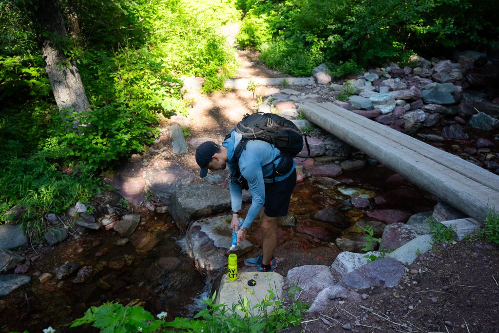
Plenty of water
At least 2–3 liters per person. A filter or purifier is smart if you’re going on a longer hike. We bring a 3 liter Camelbak and a Katadyn BeFree Water Filter Bottle on most hikes.
Snacks and lunch
Think easy-to-pack foods like bars, trail mix, or sandwiches to refuel on the trail. We wrote a whole post about our favorite hiking snacks if you need some ideas!
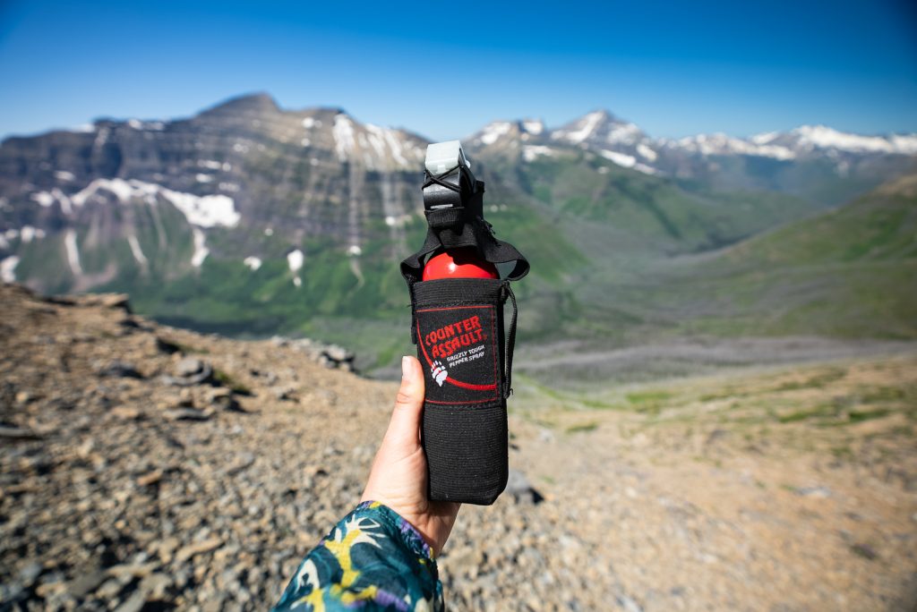
Bear spray
This is a must in Glacier. Carry bear spray where you can grab it quickly and make sure you know how to use it.
A+K Tip: You cannot fly with bear spray, so if you are flying to Glacier, make sure to buy bear spray when arriving. Or you can rent it, which is much cheaper. Bear Spray Shack has 24/7 bear spray rentals at various locations around the park.
Sun Protection
The sun is strong at higher elevations, even on cooler days. So you’ll definitely want to bring a sun hoodie, hat, sunscreen, and sunglasses. Adam wears KALIYADI sunglasses and Kathryn wears Ray-Bans.
Offline maps
Download maps on AllTrails since cell service is spotty. A paper map is also a good backup.
First aid kit
Make sure to pack a small first aid kit with bandages, blister care, and any personal meds.
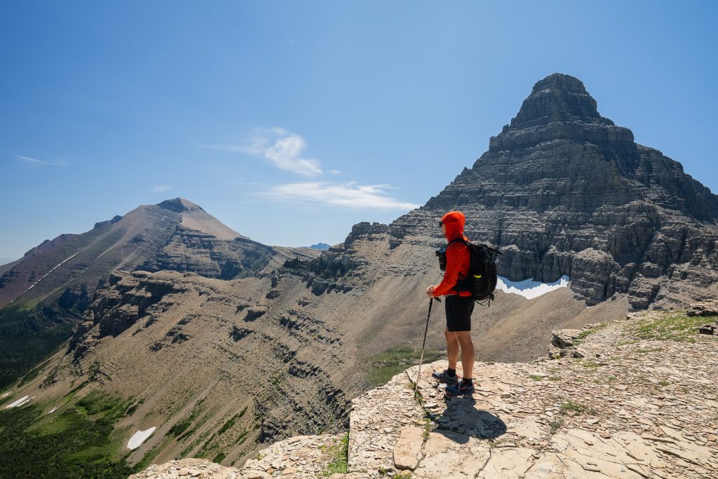
Trekking poles
Optional, but trekking poles are great for steep climbs and long descents.
Headlamp
Bring a headlamp case you end up finishing later than planned.
Bug spray
Mosquitos can be rough in early summer. Bug spray will be a life saver.
Camera
You’ll want it for the views! Check out all of our camera gear.
For an even more detailed breakdown, check out our full post on the 10 essentials for hiking. These are the things we carry on every single hike.
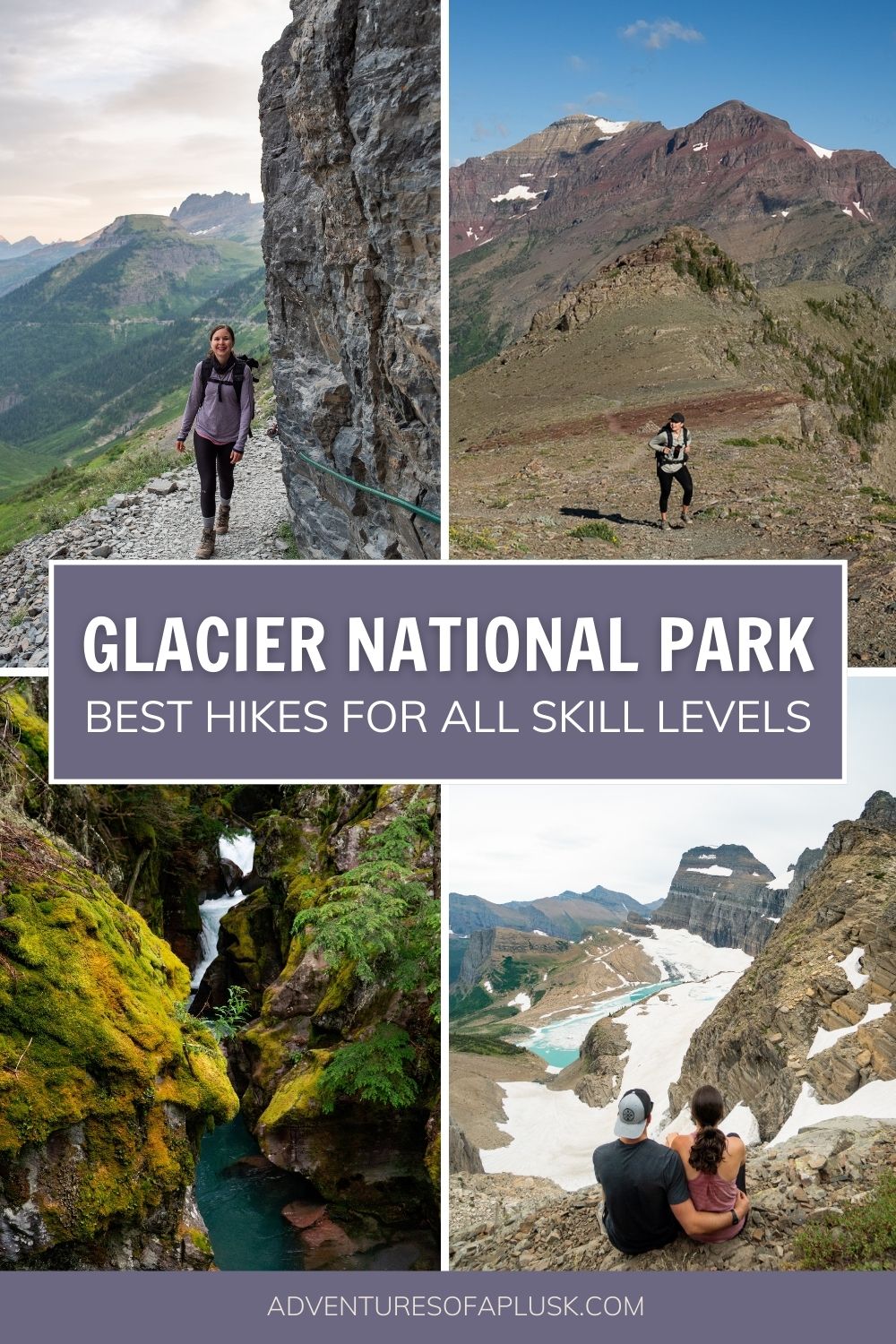
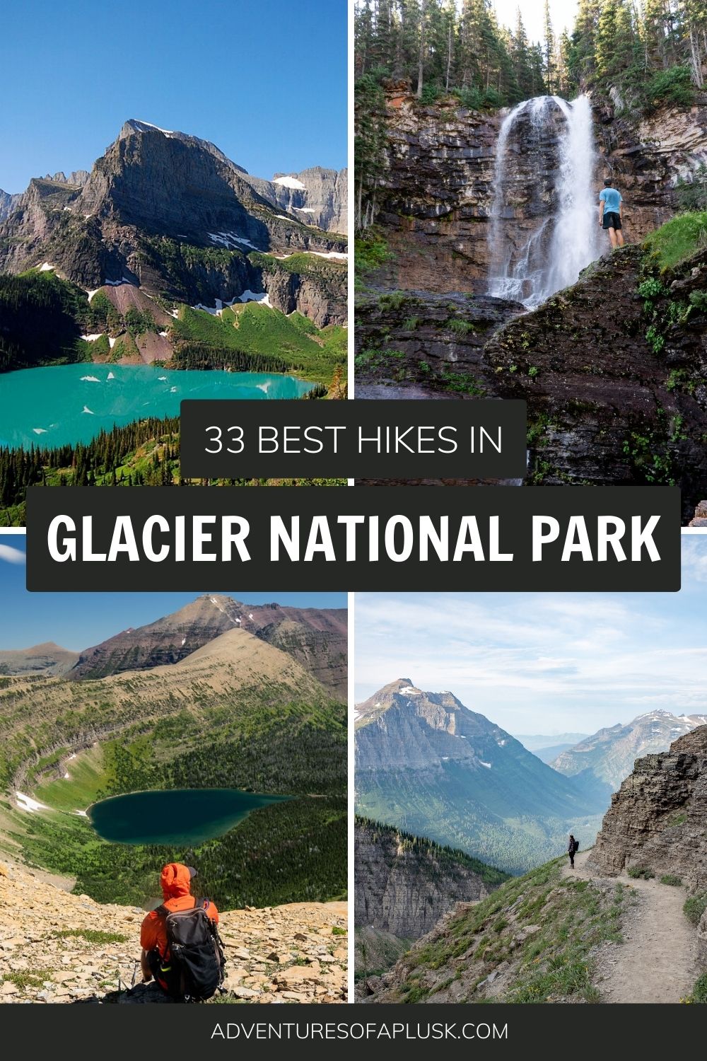
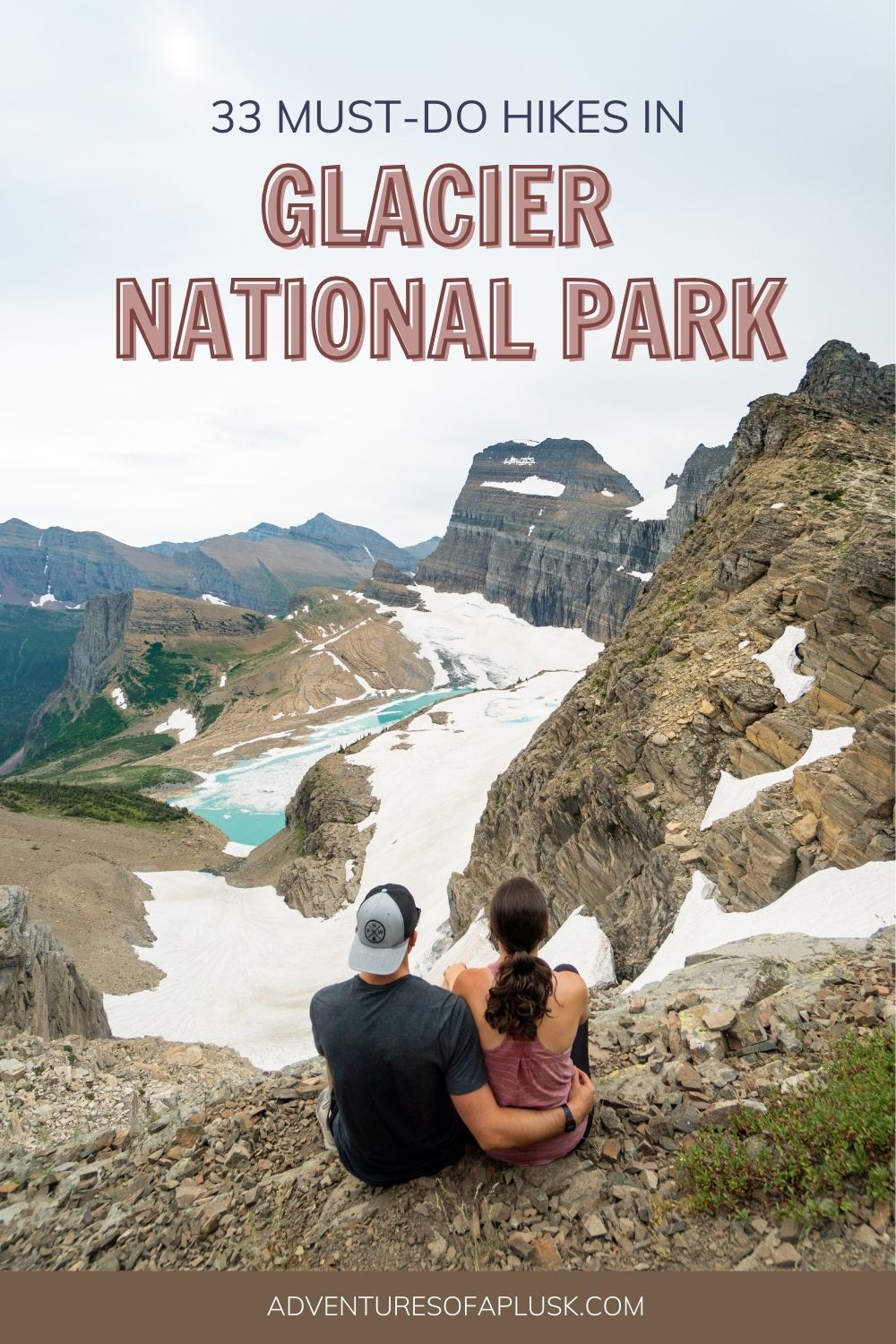
Save this guide with the best hikes in Glacier National Park
About the Author
This blog post was written by our writer Nicoll. Learn a bit about her below!
After six years of full-time travel, Nicoll is now a mountain-loving mama living in Colorado with her husband Jake, their sweet baby girl Teagan, and their pup Gunner. She loves hiking, riding her dirt bike, and finding joy in the little things.