
Last updated on October 4th, 2026
Want to experience the best road trips the USA has to offer? After exploring all 50 states, we’re sharing our favorite scenic routes, complete with top experiences, trip logistics, and where to eat along the way!
Over the last six years, our van Brisket has taken us to all 49 driveable states, through some of the most beautiful mountain passes, gorgeous coastlines, and stunning red rock deserts this country has to offer. And if there is one thing we’ve learned after over 140,000 miles on the odometer, it’s that the US is built for road tripping!
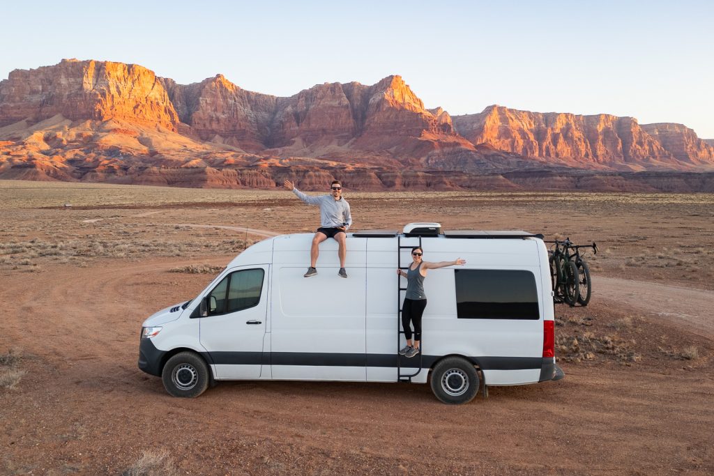
In this blog post, we are rounding up the absolute best USA road trips that we have personally experienced! We’re sharing the top experiences along the route, including the best hikes, hidden gems, and of course, our favorite local places to eat. Plus, we share details like how many days you need, the best time of year to visit, and links to additional guides so you can leave the planning stress behind.
This isn’t an exhaustive list of every single amazing drive in the country. Even though we’ve been to every state, there are still quite a few regions we are so excited to explore in even more depth in the future, like the Midwest and the East Coast! We plan to keep updating this post as we find new favorites.
- 23 Best USA Road Trips
- 1. Route 66 (The Mother Road)
- 2. West Texas & New Mexico Road Trip Loop
- 3. Southwest Colorado Road Trip Loop
- 4. Utah’s Mighty Five National Parks
- 5. Arizona Volcanoes, Canyons, & Red Rocks Route
- 6. Central California Coast & Big Sur Highway 1
- 7. California National Parks Road Trip
- 8. The Eastern Sierra Road Trip (California Highway 395)
- 9. The Loneliest Road in America (Nevada Highway 50)
- 10. Northwest Oregon Loop (Portland, Columbia Gorge & Oregon Coast)
- 11. Eastern Oregon Desert & Painted Hills Loop
- 12. Washington National Parks Route
- 13. Alaska Highway or Cassiar Highway Road Trip
- 14. The Kenai Peninsula Loop
- 15. Grand Teton to Yellowstone National Park Road Trip
- 16. The Dakotas Road Trip (Black Hills & Badlands to North Dakota)
- 17. Minnesota’s North Shore Road Trip (Duluth to Grand Portage)
- 18. Michigan’s Upper Peninsula
- 19. Upstate New York Road Trip (Niagara Falls to the Adirondacks)
- 20. West Virginia Road Trip
- 21. New England Fall Road Trip
- 22. Blue Ridge Parkway (Shenandoah to the Smokies)
- 23. Everglades & Florida Keys Road Trip
- Tips for your USA road trip
23 Best USA Road Trips
1. Route 66 (The Mother Road)
Route 66 is one of the most iconic road trips in the United States. While we have yet to do the entire 2,248-mile road trip from Chicago to Santa Monica, you can easily experience smaller sections on a shorter trip. Which is exactly what we’ve done! Driving even a segment of “The Mother Road” is packed with fun roadside attractions, vintage neon signs, historic towns, and plenty of delicious local food.
Days Needed: 3 to 7 days (depending on which segment you choose to tackle!)
Closest Airports: Chicago O’Hare (ORD), St. Louis (STL), Oklahoma City (OKC), Amarillo (AMA), Albuquerque (ABQ), Phoenix Sky Harbor (PHX), or Los Angeles (LAX).
Where to Start: You can pick up the route from almost any major hub. But popular starting points for shorter trips include Chicago, IL, Tulsa, OK, or Flagstaff, AZ.
Where to End: Chicago, IL or Santa Monica, California if you do the full thing, or any major city along the interstate system.
Best Time of Year: Spring through fall. Some areas along the route, especially through Illinois, Northern Arizona, and New Mexico, can get surprisingly cold and snowy in the winter!
Top Experiences Along Route 66


California
- Santa Monica Pier: Snap a photo at the iconic “End of the Trail” sign marking the official end of Route 66 over the Pacific Ocean.
- The Donut Man: Stop in Glendora for their legendary fresh strawberry or peach stuffed donuts. So good!
- Elmer’s Bottle Tree Ranch: Wander through a forest of hundreds of colorful bottle trees made from vintage glass and scrap metal.
- Mojave National Preserve & Amboy Crater: Take a detour into the desert to see massive sand dunes and hike up to the rim of an extinct volcanic cinder cone.
Arizona
- Oatman: Walk the old wooden sidewalks of this historic mining town and feed the wild burros that roam the streets!
- Flagstaff: Check out ancient native American dwellings at Walnut Canyon and explore cool volcanic landscapes at Sunset Crater.
- Grand Canyon National Park Detour: Take the quick detour north to see the epic views of the South Rim!
- Winslow: Stand on the corner (yes, just like the Eagles song!) and take a photo with the famous flatbed Ford.
- Petrified Forest National Park: Drive through the park to see ancient, petrified wood logs scattered across the desert badlands.
New Mexico
- Historic El Rancho Hotel: Head to Gallup and stay in the historic hotel that hosted classic Hollywood movie stars like John Wayne and Errol Flynn.
- Albuquerque: Take the Sandia Peak Tramway up 10,000 feet for epic mountain views, or time your trip for October to see hundreds of hot air balloons fill the sky!
- Tucumcari: Drive through town at night to see the gorgeous vintage neon signs lighting up historic motels like the Blue Swallow.
Texas
- Cadillac Ranch: Grab a can of spray paint and leave your mark on the ten half-buried, graffiti-covered Cadillacs sticking out of the dirt near Amarillo.
- The Big Texan Steak Ranch: Home of the famous 72-ounce steak challenge!
- Palo Duro Canyon State Park: Take a short detour southeast of Amarillo to explore the “Grand Canyon of Texas.” We highly recommend hiking the Lighthouse Trail!


Oklahoma
- The Blue Whale of Catoosa: One of the most famous Route 66 landmarks! You can actually walk right inside this giant, 80-foot-long blue whale sculpture.
- Buck Atom’s Cosmic Curios: Stop by this super fun gift shop in Tulsa to grab a souvenir and snap a photo with the 21-foot-tall Buck Atom space cowboy muffler man.
- Pops 66: Located in Arcadia, you can’t miss the giant 66-foot-tall soda bottle out front. Inside, they have over 700 varieties of cold sodas to choose from!
- Sid’s Diner: You absolutely have to try an authentic Oklahoma onion burger while you’re here.
Check out our detailed guide to 23+ unique stops on Route 66 from Tulsa to Oklahoma City to help plan your time!
Kansas
- Cars on the Route: Kansas holds the shortest section of the highway (only 13 miles!). But this restored Kan-O-Tex service station in Galena is a must for fans of the movie Cars, as it inspired the character Tow Mater!
Missouri
- Uranus Fudge Factory: A hilariously quirky roadside stop that fully leans into the comedy of its name. Go grab some delicious homemade fudge and enjoy the laughs!
- Route 66 Rocker: Snap a photo with what was once the world’s largest rocking chair standing right off the highway in Fanning.
- Meramec Caverns: Take a guided tour through a massive, historic cave system that was once used as a hideout by outlaw Jesse James.
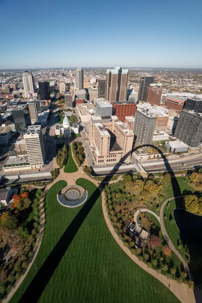
- St. Louis: Visit Gateway Arch National Park and take the tram ride 630 feet up to the top. Then treat yourself to some unique ice cream at Clementine’s Naughty & Nice Creamery!
Illinois
- Home of Abraham Lincoln: Stop in Springfield to tour Lincoln’s home and visit his historic tomb.
- Chicago: Celebrate the official beginning of Route 66! Grab a classic deep-dish pizza and snap a photo at the historic “Route 66 Begin” sign located downtown.
2. West Texas & New Mexico Road Trip Loop
If you want to experience some of the most dramatic, diverse desert landscapes in the country, this road trip loop through West Texas and Southern New Mexico is tough to beat! This route takes you from towering mountain peaks and massive underground caverns to endless white gypsum sand dunes and remote, artsy desert outposts.
Days Needed: 7 to 10 days, depending on how much you want to see in each area.
Closest Airports: El Paso International Airport (ELP).
Where to Start & End: El Paso, TX
Best Time of Year: Fall through winter. Desert temperatures soar well over 100°F in the summer months, making hiking dangerous. Visiting from October through April gives you beautiful, mild weather for exploring!
Top Experiences Along the Route



Big Bend National Park, Marfa & Terlingua
- Tackle the Lost Mine & Window Trails: Hike the 4.8-mile Lost Mine Trail for gorgeous views of the Chisos Mountains. Then, hike down The Window Trail to look out over the desert floor!
- Walk the Floor of Santa Elena Canyon: The scenic drive dead-ends at this breathtaking 1.7-mile trail leading directly into a sheer limestone gorge. On one side of the water is the US, and on the other is Mexico!
- Soak in the Historic Hot Springs: Relax in the natural 105°F thermal springs on the edge of the Rio Grande.
- Snap a Photo at Prada Marfa: Drive 30 minutes outside of town to see the famous, isolated “fake” luxury storefront in the middle of the desert. Fun fact: it contains actual Prada merchandise. But the designer bags have no bottoms and the shoes are all right-footed to deter roadside thieves!
- One Last BBQ Stop: On your way out of the region, make a final stop at DB’s Rustic Iron BBQ in Terlingua for an incredible brisket plate served up by an awesome local owner.
Guadalupe Mountains National Park
- Guadalupe Peak: Challenge yourself to hike to the “Top of Texas,” the highest point in the state sits at 8,751 feet! When we tackled this, we actually battled freezing snow, ice, and thick fog. We thought we’d have zero visibility, but right at the summit, we busted completely through the clouds into the sunshine. It was breathtaking!
- Wander the Devil’s Hall Trail: Hike through a rocky wash with a narrow natural rock hallway made of perfectly layered limestone tiles.
- McKittrick Canyon: If you are visiting in the late fall (October/November), this canyon comes alive with colorful autumn foliage.
Carlsbad Caverns National Park
- The Big Room: Take the elevator down (or walk the steep Natural Entrance trail) to explore the largest single cave chamber in North America. The paved loop takes you past stalactites, stalagmites, and massive rock formations.
- Bat Flight Program: If you visit between late May and October, watch hundreds of thousands of Brazilian free-tailed bats fly out of the cave entrance! The absolute best months to watch are August and September, because that’s when the new baby bats join the flight!
White Sands National Park
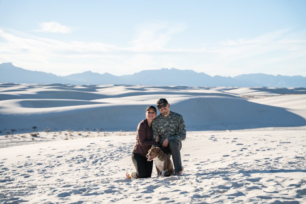
- Alkali Flat Trail: Walk straight into the heart of the world’s largest gypsum dunefield, it can actually be seen from space!
- Go Dune Sledding: Pick up a plastic saucer sled at the visitor center and spend an afternoon sledding down the bright white sand!
Check out our complete, detailed West Texas Road Trip Itinerary to map out your days! We also have guides for individual parks along this route, including How to spend one day at Carlsbad Caverns and the 11 best things to do at White Sands National Park!
3. Southwest Colorado Road Trip Loop
We spent two months exploring Southwest Colorado in our van. And to say we fell madly in love would be a massive understatement! This road trip is home to dramatic alpine peaks, interesting mining history, steam trains, and some of the most beautiful (and challenging!) hiking trails we have ever done.
Days Needed: 12 days
Closest Airports: Durango-La Plata County Airport (DRO) or Montrose Regional Airport (MTJ).
Where to Start & End: We highly recommend flying into Montrose (MTJ) and flying out of Durango (DRO) or vice versa. If you want to drive the full loop, you can start and end in Durango, looping up through Telluride to Black Canyon of the Gunnison, and back down via the Million Dollar Highway!
Best Time of Year: July through September. Just be prepared for afternoon thunderstorms in July and August!
A+K Tip: The elevation in Southwest Colorado is no joke! Most of these towns sit above 8,000 feet, and trailheads routinely top 10,000 feet. Give yourself at least 24 to 48 hours in Durango to acclimate, chug tons of water, and save your biggest hikes for the end of the trip.
Top Experiences Along the Route


Durango & Mesa Verde National Park
- Mesa Verde Cliff Dwellings: Explore Mesa Verde National Park’s ancient ancestral Puebloan cliff dwellings on a ranger-led tour to walk through Cliff Palace or Long House.
- Durango & Silverton Narrow Gauge Railroad: Hop aboard a historic steam train for a scenic ride through the Animas River Canyon to Silverton.
- Explore Downtown Durango: Wander down Main Avenue to check out the historic Strater Hotel, pop into the local shops, and grab a bite to eat. We loved the espresso at Taste and a breakfast burrito from Backcountry Gourmet (a food truck parked right next door!). For dinner, check out the food truck hub at 11th Street Station, or grab local bites at Taco Libre or Rice Monkeys.
Silverton & The Million Dollar Highway
- Wander Historic Silverton: Walk the unpaved streets of this rugged, old mining town at 9,300 feet. Then, grab a massive burger at Handlebars or wood-fired pizza and tacos at Avalanche Brewing Company.
- Drive the Million Dollar Highway: The Million Dollar Highway is a portion of US-550 between Silverton and Ouray. It is one of the most intense drives in the US, where you’ll drive a portion of road with no guardrails and steep cliffs!
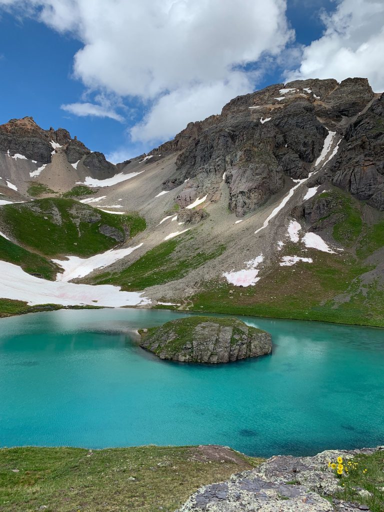
- Ice Lake & Island Lake Basin: This is one of the best hikes in all of Colorado! The climb is tough, but it leads you to alpine lakes with a blue color that doesn’t even look real.
Ouray (The “Switzerland of America”)
- Ouray Perimeter Trail: The Perimeter Trail is a 6-mile route that rings the entire town! It takes you past cascading waterfalls, deep gorges, and epic viewpoints without ever having to drive to a trailhead.
- Rent a 4×4 Jeep: Ouray is the off-roading capital of Colorado. Rent a Jeep or a side-by-side to conquer famous rugged mountain passes like Yankee Boy Basin or Alpine Loop to see old mining ruins and fields of wildflowers.
- Soak in the Ouray Hot Springs: Soak in the geothermal, mineral-rich pools surrounded by towering mountain walls.
Telluride
- Ride the Free Gondola: Take the free, 13-minute gondola ride connecting the town of Telluride to Mountain Village. The views of the San Juan Mountains are stunning, plus it’s dog-friendly!
- Bear Creek Falls & Bridal Veil Falls: Take a scenic stroll up to Bear Creek Falls, or check out Bridal Veil Falls, the tallest free-falling waterfall in Colorado!
Black Canyon of the Gunnison National Park
- Drive the South Rim Road: Black Canyon of the Gunnison National Park is home to some of the steepest, narrowest, and most dramatic canyon walls in North America. Drive the South Rim Road and stop at overlooks like Painted Wall to see sheer dark rock cliffs plunging 2,250 feet down to the Gunnison River.
- Hike the Inner Canyon: For the ultimate adventure, grab a wilderness permit and tackle a steep, unmaintained route (like the Gunnison Route) down to the canyon floor.
Check out our ultimate 12-Day Southwest Colorado Road Trip Itinerary for a breakdown of exactly how to map out this trip! We also have guides for individual stops along the way, including our Guide to Hiking the Ouray Perimeter Trail and our list of the top Things to Do at Black Canyon of the Gunnison National Park!
4. Utah’s Mighty Five National Parks
Southern Utah is hands down one of the best USA road trips. The landscapes out here are out of this world! Here you’ll find five national parks, all located relatively close to one another. Which makes it easy to see a massive variety of scenery in a short amount of time! Southern Utah is also one of the best places to try out van life, with lots of free, public land to camp on.
Days Needed: 10 days
Closest Airports: McCarran International Airport in Las Vegas (LAS) or Salt Lake City International Airport (SLC).
Where to Start & End: Fly into Las Vegas (LAS) and fly out of Salt Lake City (SLC)! You’ll start by driving 3 hours from Vegas to Zion, work your way east through the parks, and then make the 3.5-hour drive from Moab up to Salt Lake City.
Best Time of Year: Spring or Fall.
Top Experiences Along the Route
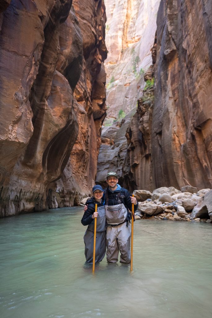


Zion National Park
- Wade through The Narrows: Hike the Narrows upstream into the Virgin River as it flows between 1,000-foot stone walls!
- Hike to Observation Point: Skip the lines (and permits!) at Angels Landing and take the East Mesa Trail to Observation Point instead. It leads to what we think is the absolute best view of Zion Canyon.
- Grab breakfast at Deep Creek Coffee Co.: Head into Springdale to fuel up with a delicious breakfast bowl or one of their awesome “BRO-ritos.”
Bryce Canyon National Park
- Watch the sunrise at Sunset Point: Watching the sun rise over the Bryce Amphitheater from Sunset Point is pure magic! The morning light makes the bright orange hoodoos look like they’re glowing.
- Navajo & Queens Garden Loop: Hike down into the canyon floor to walk among the world’s largest collection of hoodoos.
- Escape the crowds on Fairyland Loop: This 8-mile Fairyland Loop trip is one of our favorites in the park and offers incredible views of Boat Mesa.
Capitol Reef National Park
- Hike to Cassidy Arch: Kick off your morning by hiking up to this massive natural arch. The coolest part about this trail is that you can actually walk right out on top of the arch itself!
- Eat fresh pie at the Gifford Homestead: Stop by this historic homestead in the Fruita district for fresh, homemade fruit pies and giant cinnamon rolls. They sell out fast, so get there early!
Canyonlands National Park
- Photograph Mesa Arch at sunrise: Located in the Island in the Sky district, watching the sunrise catch the underside of this cliffside arch.
- Explore the Needles District: Head south to the Needles District, a less-visited, rugged section of the park to hike among towering, colorful sandstone spires that look like giant needles.
Arches National Park
- Watch the sunset at Delicate Arch: Make the steady uphill hike to sit on the slickrock bowl and watch the most iconic arch in Utah turn a fiery red as the sun goes down.
- Tackle the Devil’s Garden Trail: Scramble along narrow sandstone fins with sweeping views on both sides to see different natural arches along the full loop.
- Hit the Moab Food Trucks: Head into downtown Moab to grab some seriously delicious local eats at the food truck park.
Want to take all the stress out of planning this road trip? We wrote an entire 80+ Page Utah National Parks Road Trip eBook that includes our exact 10-day itinerary. Plus custom Google Maps, lodging recommendations, packing lists, and hidden gem stops along the way. You can download it straight to your phone for offline use!
You can also check out our completely free Ultimate 10-Day Utah National Parks Road Trip Guide on the blog. As well as free National Park guides like How to Spend One Day at Bryce Canyon and our Perfect 2-Day Zion National Park Itinerary, as well as our Capitol Reef National Park Itinerary and our 1-day Arches National Park Itinerary.
5. Arizona Volcanoes, Canyons, & Red Rocks Route
This scenic route features some of Northern Arizona’s most gorgeous scenery. You’ll travel from the deserts of Phoenix and Scottsdale up to the red rocks and vortexes of Sedona, through the pine forests and volcanic cinder cones of Flagstaff, and to the mile-deep expanses of the Grand Canyon. All before ending at the slot canyons and river bends of Page!
Days needed: 7-10 days.
Closest Airport: Flying into Phoenix Sky Harbor International Airport (PHX) is the easiest option for renting a vehicle. You could fly out of Phoenix as well or fly out of Las Vegas (LAS).
Where to Start & End: Start in Phoenix/Scottsdale and end in Page.
Best Time of Year: Spring (March–May) and Fall (September–November).
Top Experiences Along the Route

Scottsdale
- Hike Camelback Mountain: Hike this steep, rocky scramble up the Echo Canyon Trail and be rewarded with fantastic views of the entire metro area.
- Explore Old Town Scottsdale: Spend an afternoon exploring this cute, western-themed area! Wander the historic streets and grab some lunch bowls at Original Chop Shop (one of our favorites!). Then, hit up Ruze Cake House for boba teas topped with actual cotton candy!
Sedona
- Catch sunrise at Devil’s Bridge: Make the 3.9-mile hike to Devil’s Bridge for sunrise to see this gorgeous sandstone arch!
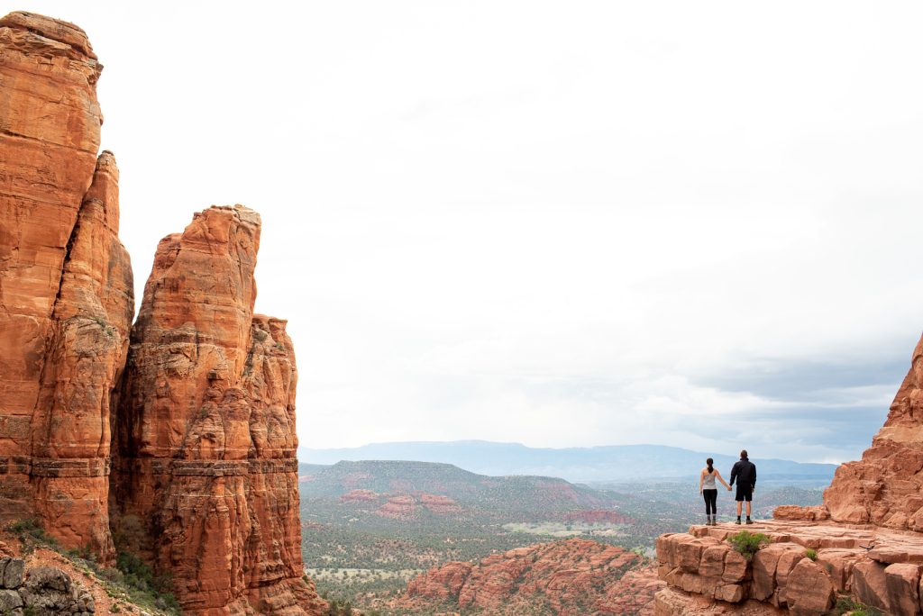
- Hike Cathedral Rock or Bell Rock: Scramble up the slickrock of Cathedral Rock for an incredible sunset. Or take an easier stroll around Bell Rock, two of the best hikes in Sedona!
Flagstaff
- Wander Downtown Flagstaff: Explore this historic mountain town nestled in the middle of the world’s largest contiguous ponderosa pine forest.
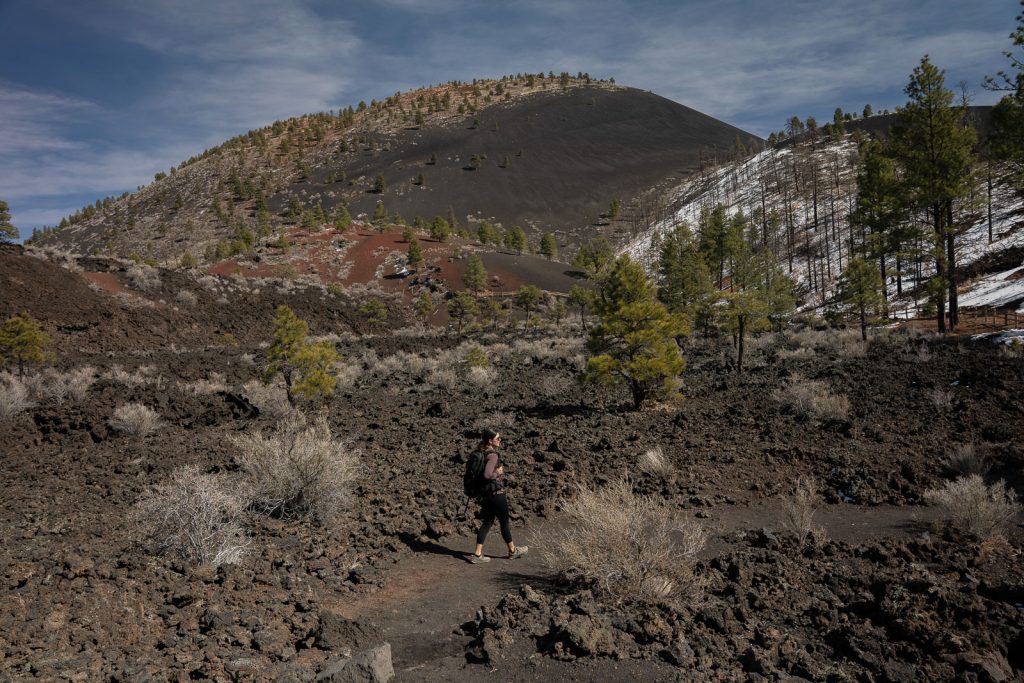
- Explore a volcanic cinder cone: Hike around Sunset Crater Volcano National Monument to walk across beautiful black lava fields. Then, head down the road to see ancient puebloan ruins at Wupatki National Monument.
Grand Canyon National Park
- Explore the South Rim: See the South Rim of the Grand Canyon, one of the Seven Wonders of the World. Walk a portion of the flat Rim Trail to Mather or Yavapai Point.
- Hike Bright Angel Trail: We highly recommend hiking down to the 1.5-mile or 3-mile resthouses on the Bright Angel Trail. Just remember that going back up is a lot harder than going down!
Page
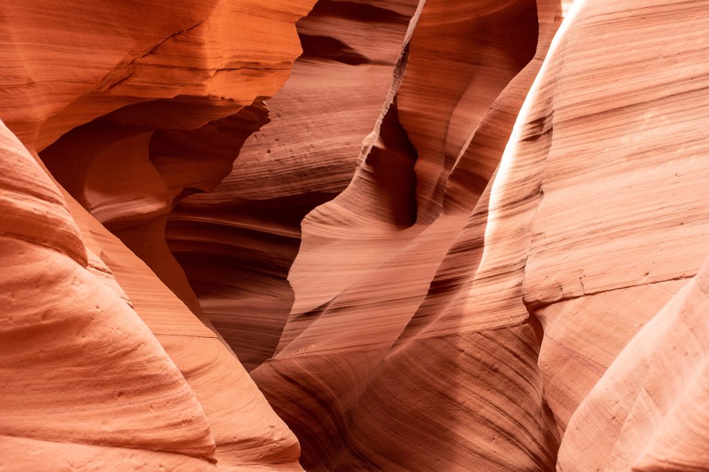
- Tour Antelope Canyon X: We absolutely loved touring Canyon X over Upper or Lower Antelope. It still treats you to those exact same sandstone slot canyon walls.
- See Horseshoe Bend: Take the short 1.5-mile walk out to the rim where you can stand 1,000 feet above a horseshoe-shaped bend in the Colorado River.
- Paddle Lake Powell: If you have extra time, spend a few hours kayaking or paddleboarding on Lake Powell.
Check out our detailed itineraries for 2 Days in Scottsdale, 2 Days in Sedona, 1 Day at the Grand Canyon South Rim, and 1 Day in Page to map out all of your daily hikes, overlooks, and food stops.
6. Central California Coast & Big Sur Highway 1
Out of the thousands of miles we have driven in the lower 48, our road trips along California’s Central Coast and the rugged Big Sur coastline have been some of the most stunning of them all!
We actually first fell in love with San Luis Obispo (or SLO, as the locals call it) during a quick cross-country road trip back in 2019 before we even had our van. It’s often called the “happiest place in America,” and we totally agree! We loved it so much that we made it a top priority to return with our van, and it has easily become one of our favorite spots on the entire California coast.
Days needed: 5-7 days
Closest Airports: San Luis Obispo (SBP), Los Angeles (LAX), San Francisco (SFO), or San Jose (SJC).
Where to start & end: We suggest starting in San Luis Obispo (or Los Angeles for easier airport access) and ending in San Francisco or San Jose.
Best time of year: Year-round! (Though late winter and spring are hands-down our favorite times for fewer crowds and green hills!)
Top Experiences Along the Route
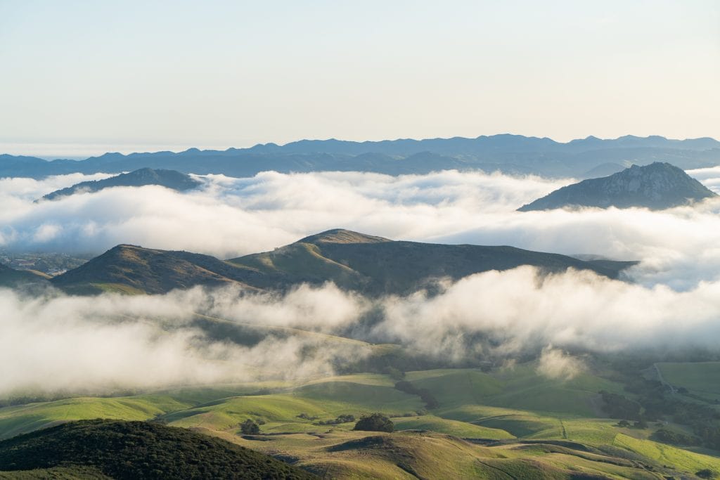

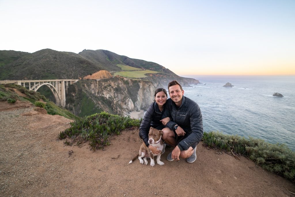

San Luis Obispo
- Explore Downtown SLO: Spend a day wandering around town! Get coffee at Scout Coffee, grab tri tip sandwiches at Firestone Grill, and make a quick stop at the famous (and gross!) Bubblegum Alley.
- Hike Bishop Peak or Valencia Peak: For panoramic views of the city and the surrounding volcanic plugs, hike the rocky switchbacks of Bishop Peak. If you want rugged coastal views, head into Montaña de Oro State Park and hike up Valencia Peak or stroll the Bluff Trail.
Morro Bay & Cayucos
- See Morro Rock: Pull over in Morro Bay to check out this colossal, 576-foot ancient volcanic mound sitting at the harbor’s entrance. This is also a great spot to watch sea otters floating in the bay!
- Get brown butter cookies in Cayucos: Make a pit stop at the Brown Butter Cookie Company in Cayucos. They hand-roll these sweet, salty, shortbread-like cookies that literally melt in your mouth.
Big Sur Coastline
- See McWay Falls: Take the short walk in Julia Pfeiffer Burns State Park to witness an 80-foot waterfall dropping straight onto the beach below.
- Cross Bixby Creek Bridge: This is the most photographed bridge in California for a reason. Pull off at the northern overlook to watch the ocean waves crash against the concrete arches, it’s pure magic!
- Hike Partington Cove: We absolutely loved this trail! It takes you through a historic 60-foot tunnel that opens up to an ocean cove.
- See sunset at Montaña de Oro State Park. This roadside park is our go-to for sunset!
A+K Tip: Highway 1 through Big Sur is highly prone to winter mudslides and road closures. These can shut down entire sections of the highway for months at a time. You can check the Caltrans website for road conditions before you finalize your route! Also, be sure to fill up your gas tank before you enter Big Sur. Gas stations along the cliffs are sparse and incredibly expensive!
Monterey & Carmel-by-the-Sea
- Drive the 17-Mile Drive: Cruise through Pebble Beach, stopping to see the iconic Lone Cypress clinging to its granite hillside and the roaring surf at Spanish Bay. There is a $12.50 fee to drive the road.
- Explore Point Lobos State Natural Reserve: Often called the “crown jewel” of the California state parks system, we loved hiking the Point Lobos Loop Trail to spot sea otters, harbor seals, and hidden coves.
To easily map out this stretch of the coast, check out our favorite Things to Do in San Luis Obispo. Then, navigate the most legendary stretch of Highway 1 using our Big Sur Road Trip Itinerary to the best pull-offs, redwood trails, and coastal views!
7. California National Parks Road Trip
California is home to nine incredible national parks, more than any other state in the country! However, trying to conquer all of them in one single USA road trip is almost impossible. Not only are they spread out over massive distances, but they also experience wildly different seasons. While you might want to visit the desert parks in the dead of winter, the mountain parks are buried under feet of snow until mid-summer!
So we suggest breaking them up into multiple trips. Here are a couple different options to choose from!
Option #1: The Desert & Coast


This road trip focuses entirely on California’s stunning desert landscapes and coastlines, taking you through Joshua Tree, Death Valley, Channel Islands, and Pinnacles National Park.
Days Needed: 10 days (or 3–5 days to focus on 1–2 parks!)
Closest Airports: San Diego International Airport (SAN), San Jose Mineta International Airport (SJC), or San Francisco International Airport (SFO).
Where to Start & End: Fly into San Diego (SAN), then drive north up the coast, and fly out of San Jose (SJC) or San Francisco (SFO).
Best Time of Year: November through April.
Joshua Tree National Park
- Keys View Sunrise: Start your day at the highest point in the park to catch gorgeous views of the Coachella Valley! Bring a jacket, it gets super windy and cold up there!
- Wander the Cholla Cactus Garden: Walk the short boardwalk loop through thousands of densely packed, fuzzy-looking Cholla cacti.
- Arch Rock & Heart Rock: Hike this fun, scenic loop to see a massive natural arch and search for a unique, hidden heart-shaped rock nearby.
Death Valley National Park
- Badwater Basin: Walk out onto the vast, blinding salt flats to stand at the lowest point in North America at 282 feet below sea level!
- Artists Palette: Take the scenic 9-mile drive through volcanic hills that look like they’ve been splashed with pastel pinks, greens, and purples. It’s a neat contrast to the rest of the desert!
- Zabriskie Point: Catch an epic sunrise here to watch the morning light hit the beautifully wrinkled, golden badlands.
Channel Islands National Park
- Sea Cave Kayaking: Hop on a boat out to Santa Cruz Island to kayak through water-carved volcanic sea caves. We highly recommend a 2.5-hour tour so you still have time to hike and look for the cute island foxes!
Pinnacles National Park
- High Peaks Trail: Climb through the steep rhyolite rock spires on California’s smallest national park. Keep your eyes peeled for endangered California Condors with their massive 9.5-foot wingspan!
Option #2: Sierra Nevada


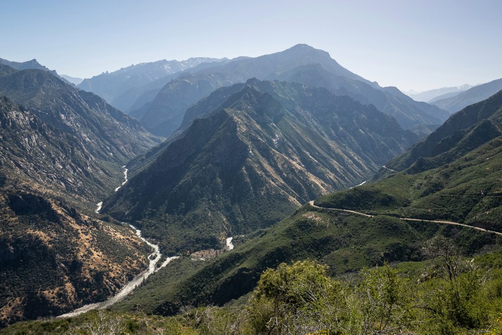
This mountain road trip takes you deep into the heart of the Sierra Nevada mountains to experience the giant trees, rushing waterfalls, and granite domes of Sequoia, Kings Canyon, and Yosemite National Park.
Days Needed: 10 days (or 3–5 days to focus on 1–2 parks!)
Closest Airports: Fresno Yosemite International Airport (FAT).
Where to Start & End: Start and end your trip at Fresno Yosemite International Airport (FAT).
Best Time of Year: July through September.
Sequoia National Park
- General Sherman Tree: Stand in complete awe beneath the largest living tree on Earth by volume! We highly recommend coming around sunrise before the crowds arrive.
- Moro Rock: Climb the 350 stone steps cut into this massive granite dome for sweeping views of the Great Western Divide.
Kings Canyon National Park
- Kings Canyon Scenic Byway: Wind your way down into one of the deepest canyons in North America, surrounded by towering granite walls and rushing river views.
- Zumwalt Meadow: Take a flat, gorgeous stroll through an alpine meadow framed by massive stone cliffs and the Kings River. Then stop by the Hume Lake snack shop for burgers and delicious handspun milkshakes!
Yosemite National Park
- Mist Trail to Vernal & Nevada Falls: Climb straight to the top of two massive waterfalls on one of the most popular trails in the park. We loved this hike, but go early to beat the crowds. And prepare to get soaked by the mist along the way!
- Explore Yosemite Valley: Rent a bike to explore iconic valley spots. Walk the dog-friendly Lower Yosemite Falls Trail, picnic at Sentinel Beach under Sentinel Rock, check out the Yosemite Museum, and grab a pint of ice cream at the Village Store.
- Glacier Point: Catch sunset at Glacier Point (no hike required!) to watch Half Dome turn a brilliant, fiery pink. We think this is one of the most breathtaking views in the country!
- Tioga Road Pass: Explore the high country along Tioga Road, California’s highest pass at 9,945 feet. Relax at Tenaya Lake, view Olmsted Point, or hike to May Lake or Cathedral Lakes.
Option #3: Northern California


This scenic route connects the incredible pinnacles of Pinnacles National Park, the steaming geothermal features of Lassen Volcanic, and the ancient giants of Redwood National and State Parks.
Days Needed: 10 days (or 3–5 days to focus on 1–2 parks!)
Closest Airports: San Jose Mineta International Airport (SJC), San Francisco International Airport (SFO), or Sacramento International Airport (SMF).
Where to Start & End: Fly into San Jose (SJC) or San Francisco (SFO) to tackle the east entrance of Pinnacles first. Drive north through Lassen Volcanic all the way to the redwoods, then loop south to fly out of Sacramento (SMF).
Best Time of Year: July through September.
Pinnacles National Park (East Entrance)
- Bear Gulch Cave: Kick off this itinerary on the east side of the park by hiking through a dark, exciting talus cave system that opens up to a gorgeous reservoir.
Redwood National and State Parks
- Howland Hill Road: Wind your car through a narrow, unpaved road cut directly through massive, ancient old-growth redwoods in Jedediah Smith Redwoods State Park. It is magical!
- Stout Memorial Grove: Take a flat, surreal walk through a majestic grove of redwoods to see some of our absolute favorite giant trees in the entire park.
Mt. Shasta & Burney Falls
- Mt. Shasta: On your drive over to Lassen, make a detour to explore the 14,179-foot Mt. Shasta stratovolcano.
- Gourmet Burgers at YAKS on the 5: You cannot leave the area without enjoying a burger here! It’s one of the BEST burgers we have ever had, with some fun and unique flavor combinations.
- McArthur-Burney Falls: Teddy Roosevelt dubbed this “the eighth wonder of the world,” and he wasn’t lying! You’ll find dozens of spring-fed waterfalls flowing 129 feet down moss-covered rocks.
Lassen Volcanic National Park
- Bumpass Hell: Take the 3-mile boardwalk trail to witness boiling mud pots, steaming sulfur vents, and roaring springs.
- Cinder Cone Trail: Head an hour northeast to climb to the absolute top of a real cinder cone!
- Hike Lassen Peak: This is the park’s volcanic peak standing at 10,457 feet tall. At the top, you’ll get views that stretch all the way to Mt. Shasta!
In our California National Parks eBook you can learn more about each park, the best things to do, and get detailed day by day itineraries. Plus custom Google Maps, lodging recommendations, packing lists, and hidden gem stops along the way. You can download it straight to your phone for offline use!
8. The Eastern Sierra Road Trip (California Highway 395)
If we had to pick just one region in California to road trip through, it would be the Eastern Sierra. Running along the rugged eastern spine of the Sierra Nevada mountains, this stretch of Highway 395 from Lone Pine to Bridgeport. Along the way you’ll see gorgeous desert valleys, towering alpine peaks, natural hot springs, and more!
Days Needed: 9–12 days
Closest Airports: Los Angeles International Airport (LAX), Harry Reid International Airport in Las Vegas (LAS), or Reno-Tahoe International Airport (RNO).
Where to Start & End: Because the Eastern Sierra is a bit remote, there are no major commercial airports right on the route. To eliminate backtracking, we highly recommend flying into Las Vegas (LAS) or Los Angeles (LAX) to start your trip at the southern end in Lone Pine. From there, you’ll head north up Highway 395 and fly out of Reno-Tahoe (RNO) at the end!
Best Time of Year: Summer to Early Fall (July through October).
Top Experiences Along the Route
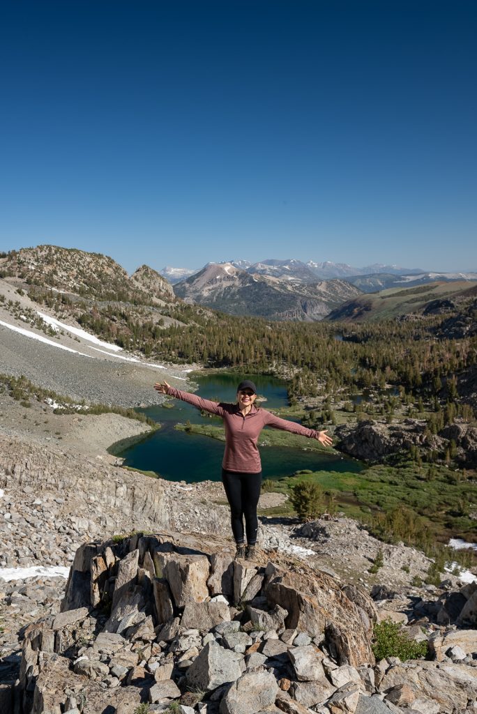

Lone Pine
- Drive Movie Road in the Alabama Hills: Explore this stunning Bureau of Land Management (BLM) area covered in giant, rounded boulders with the backdrop of Mount Whitney, the highest peak in the lower 48 at 14,505 feet! Drive the 5.7-mile Alabama Hills Movie Road to see iconic arches like Mobius Arch and famous Hollywood film locations.
- Fuel up at Alabama Hills Cafe: Grab a delicious breakfast burrito or plate of pancakes at this local favorite in town before heading out to hike. Don’t forget to snap a photo with the mural outside!
- Visit the Museum of Western Film History: Stop here before exploring the hills! It costs just an $8 suggested donation and gives you an incredible appreciation for the hundreds of Westerns, TV shows, and blockbusters (like Iron Man) filmed in the area.
Big Pine
- Hike to Big Pine Lakes: This trail takes you up into the Sierra Nevada to a group of stunning glacier-fed lakes. Second Lake is arguably the most beautiful alpine lake in the state, featuring vivid turquoise water caused by glacial runoff and the Temple Crag as a backdrop.
- Explore the Ancient Bristlecone Pine Forest: Climb 6,000 feet out of the valley floor along a windy mountain road. Then walk among the oldest living trees on Earth on the 1-mile Schulman Grove Discovery Trail.
- Chow down at Copper Top BBQ: Stop at Copper Top in Big Pine for some mouthwatering roadside barbecue. Especially their famous tri-tip and creamy mac and cheese.
Bishop
- Hike Little Lakes Valley Trail: This is one of the top day hikes in this region. It offers gorgeous Sierra mountain views as you wind past a string of alpine lakes.
- Stop at Erick Schat’s Bakery: This bakery bakes 25,000 loaves of bread a day! We highly recommend grabbing an apple fritter or a sandwich made on their world-famous sheepherder bread!
Mammoth Lakes
- Relax in the Mammoth Lakes Basin: Take a short drive from town to explore a cluster of five stunning alpine lakes in the Mammoth Lakes Basin. Our personal favorite is Lake George!
- Explore Devils Postpile National Monument: Hike to the monument to see basalt rock columns formed by cooling lava and carved out by ancient glaciers. While you’re there, hike to the beautiful 101-foot Rainbow Falls!
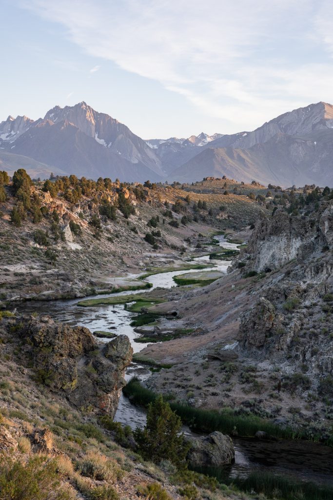
- Discover Hot Creek Geologic Site: Take the short interpretive trail down into the canyon to witness bubbling geothermal springs with the most vibrant blue colors caused by the ancient Long Valley Caldera volcanic eruption. For an epic view at sunrise or sunset, check out Brees Lookout!
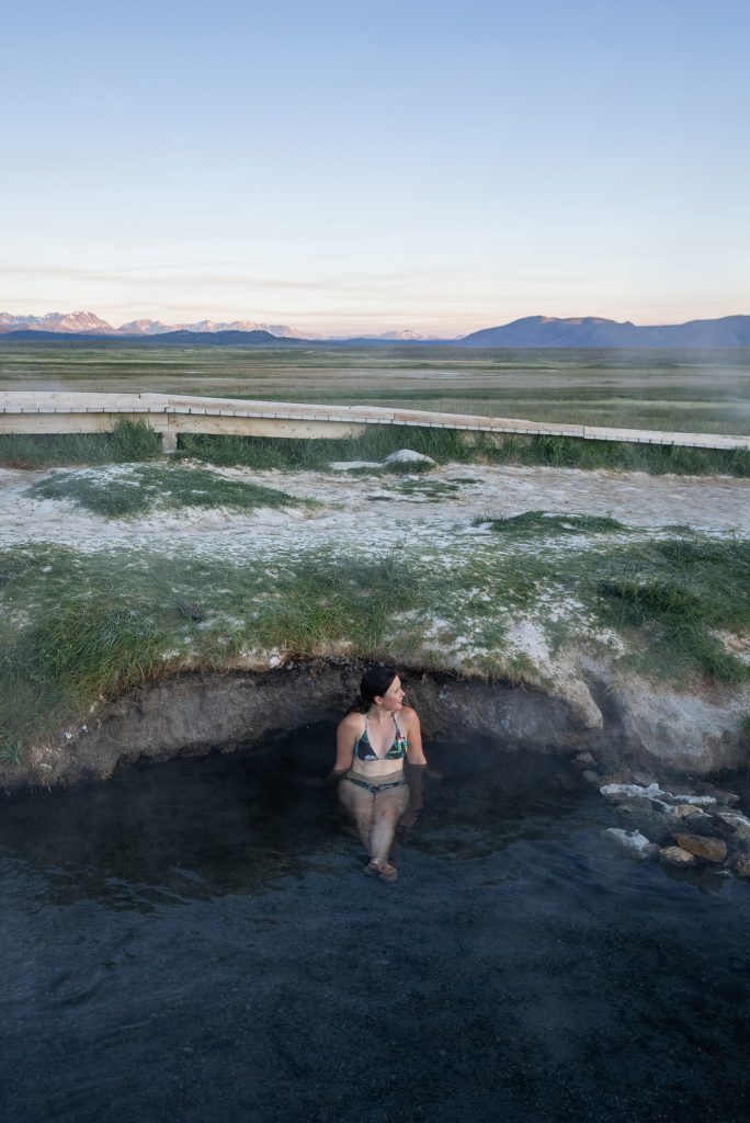
- Soak in Wild Willy’s Hot Spring: Wild Willy’s is our favorite hot spring on Highway 395! A beautiful wooden boardwalk leads you through the sagebrush to a couple of natural pools.
From exploring the ancient trees of the Bristlecone Pine Forest to soaking in natural hot springs outside Mammoth Lakes, use our Eastern Sierra Road Trip Itinerary to plan the perfect road trip!
9. The Loneliest Road in America (Nevada Highway 50)
This road trip takes you from the alpine shores of Lake Tahoe all the way across the state to one of the least-visited and most underrated gems in the entire National Park system, Great Basin!
Back in 1986, Life Magazine famously dubbed this stretch of Nevada highway the “Loneliest Road in America.” They warned travelers that there were no attractions and that you needed survival skills just to make it across. But that couldn’t be further from the truth!
This stretch of Highway 50 is packed with stunning desert mountain ranges, fascinating history, natural hot springs, and some of the coolest small mining towns we’ve ever visited.
Days Needed: 7 days (plus an optional 1–2 days to experience Lake Tahoe before you start!)
Closest Airports: Reno-Tahoe International Airport (RNO), Salt Lake City International Airport (SLC), or Harry Reid International Airport in Las Vegas (LAS).
Where to Start & End: Start near Reno, NV (after a few days in Tahoe!) and head east across the state, wrapping up your adventure at Great Basin National Park.
Best Time of Year: Late Summer to Early Fall (September through October).
Top Experiences Along the Route
Lake Tahoe, Carson City & Virginia City
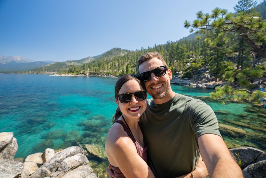
- Visit Lake Tahoe: While not technically on Highway 50, we love spending a few days exploring Lake Tahoe before hitting the road. We highly recommend biking the East Shore Trail, kayaking Emerald Bay, and hiking up to Monkey Rock for sunset!
- Wander through Carson City: Start with a coffee at Old World Coffee Roasters and a delicious breakfast at Villa Basque Café then take a stroll 2.5 miles along the historic Kit Carson Trail through Carson City’s historic district.
- Take a Haunted Detour to Virginia City: Take a quick hop off the highway to step back into 1859 at this silver-rush mining town. Walk the old wooden sidewalks, watch an outdoor comedy gunfight, and take a guided ghost tour of the infamous Washoe Club (considered one of the most haunted buildings in America!)
Fallon, Middlegate, & Austin
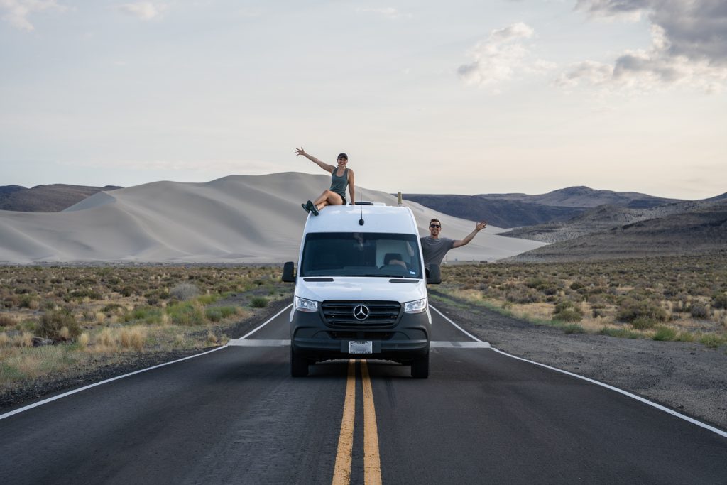
- Visit the Singing Sand at Sand Mountain: Pull off just east of Fallon at Sand Mountain Recreation Area to see a massive, 600-foot-tall sand dune. If the wind hits it just right, the dunes literally sing! A+K Tip: Go on a Tuesday or Wednesday to skip the $40 vehicle fee.
- Conquer the Monster Burger at Middlegate Station: Stop at this 1860s Pony Express station turned historic sagebrush saloon for lunch. If you’re feeling incredibly brave, try the famous Middlegate Monster Burger challenge!
- Toss a Pair of Shoes onto the Shoe Tree: Stop at this quirky roadside landmark where decades of travelers have tossed their old footwear into the branches.
- See Fossilized Marine Reptiles: Take a detour to Berlin Ichthyosaur State Park to explore a ghost town and tour the fossil shelter, home to 50-foot-long ancient marine reptile fossils from 225 million years ago.
- See Stokes Castle in Austin: Check out this strange, three-story stone tower built by a wealthy railroad baron in 1897 that was modeled after a Roman tower.
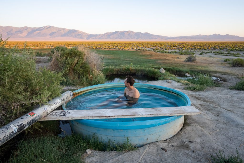
- Soak in Spencer Hot Springs: Drive down a dirt BLM road into the Big Smoky Valley to find multiple natural geothermal pools with incredible mountain views. Keep an eye out for wild burros along the road!
Eureka, Ely & Great Basin
- Visit Eureka: This was hands down our favorite town along the highway! Walk past the beautifully preserved historic brick buildings, grab a coffee at Eureka Depot, and email ahead to get a wild underground tunnel tour at Afterlife Antiques & Oddities.
- Ride the Nevada Northern Railway in Ely: Here, you can tour the historic steam locomotive shops and even take a ride on a real, century-old vintage steam train!
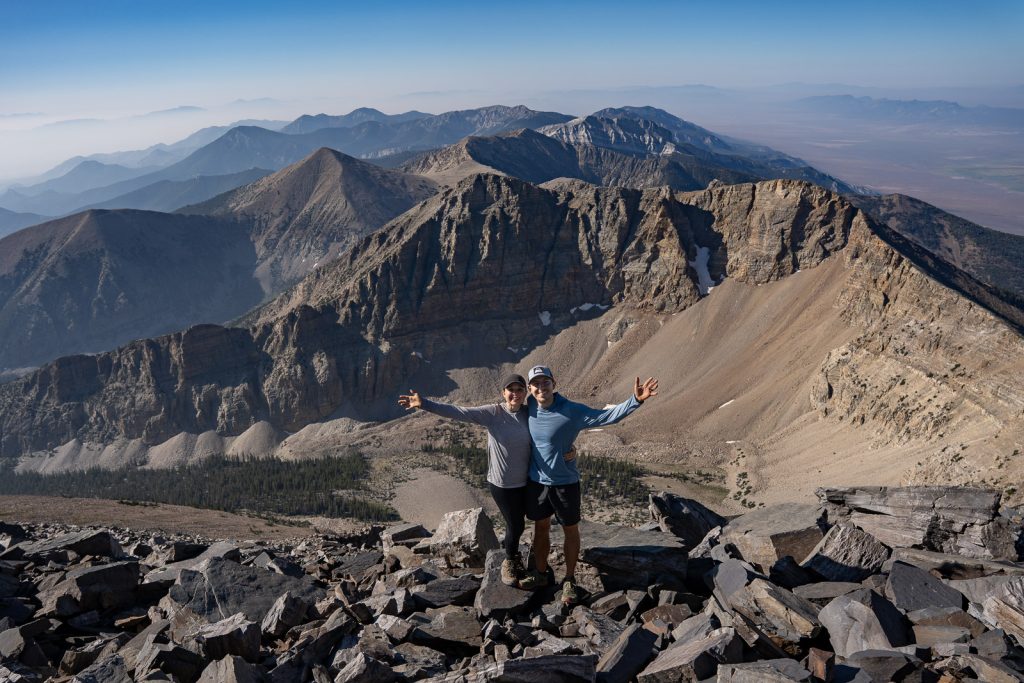
- Explore Great Basin National Park: Your road trip officially ends at one of the most underrated and least-visited national parks in the entire country, Great Basin National Park! Here you can explore ancient bristlecone pine groves and underground cave systems to Nevada’s only remaining glacier. Tour the Lehman Caves and hike to the top of Wheeler Peak (13,063 feet) for gorgeous views.
To map out your exact stops, check out our Loneliest Road in America Road Trip Itinerary to guide you all the way across the state to the ancient bristlecone pines of Great Basin National Park!
10. Northwest Oregon Loop (Portland, Columbia Gorge & Oregon Coast)
From the mossy waterfall corridors of the Columbia River Gorge to the moody sea stacks of the Pacific, Northwest Oregon is a dream road trip. This loop takes you from the delicious food scene and endless coffee shops of Portland to the roaring waterfalls of the Columbia River Gorge and to the rugged shores of Cannon Beach.
Days Needed: 5–7 days
Closest Airports: Portland International Airport (PDX).
Where to Start & End: You will start and end your trip at Portland International Airport (PDX)
Best time of year: Year-round! But late fall-early spring can be pretty rainy.
Top Experiences Along the Route


Portland
- Taste Portland’s Coffee & Food Scene: Grab a Reggie Deluxe biscuit sandwich at Pine State Biscuits, try mini doughnuts and chai flights at Pip’s Original Doughnuts & Chai, and grab a delicious Thai chicken and rice plate at Nong’s Khao Man Gai.
- Get Lost in Powell’s City of Books: Taking up an entire city block, it is the largest independent new and used bookstore in the entire world.
- Catch the Best City Views: Stroll through the International Rose Test Garden in Washington Park between May and October to admire over 10,000 blooming rose bushes for free. Afterward, make a quick stop at Pittock Mansion to capture an incredible panoramic view of the city skyline from above.
Columbia River Gorge
- Grab a meal at Sugarpine Drive-In. This spot has a delicious, creative menu unlike any drive-in you’ve ever visited. Make sure to try their seasonal sundae!
- Marvel at Multnomah Falls: This iconic 620-foot roaring waterfall is an absolute must-see! You can view it right from the lower platform or hike the 2.6-mile trail up to the historic bridge and the top of the falls.
- Hike behind a Waterfall at Ponytail Falls: Take a fun 2.6-mile loop trail to see both Horsetail Falls and Ponytail Falls. The absolute best part of this hike is that the trail actually goes behind Ponytail Falls!
Cannon Beach & The Oregon Coast
- Admire Haystack Rock: Drive 1.5 hours west of Portland to experience the moody magic of Cannon Beach. You might instantly recognize this shoreline from iconic movies like The Goonies!
- Explore the Town & Local Eats: Stroll through downtown to browse the shops. While here, grab a coffee and pastry at Sea Level Bakery + Coffee, our absolute favorite coffee shop in the area!
- Hike Ecola State Park: Take the 2.8-mile Clatsop Loop Trail from Indian Beach for coastal views through the trees. Afterward, enjoy a picnic at Ecola Point and hike down to the secluded shores of Crescent Beach.
- Relax at Oswald West State Park: Spend a morning exploring this gorgeous stretch of coast. Hike the 4.9-mile trail out to the cliffs of Cape Falcon, or climb up the south trailhead of Neahkahnie Mountain for an unbelievable view of the ocean.
- Find the Beach Waterfalls at Hug Point: Visit this state park at low tide to explore sea caves and walk right up to a waterfall that tumbles directly onto the sandy beach!
Start your trip exploring local coffee shops and independent bookstores with our guide to a Weekend in Portland. Then check out our guide to our go-to Weekend on the Oregon Coast to catch all the best stops around Cannon Beach!
11. Eastern Oregon Desert & Painted Hills Loop
Eastern Oregon is one of the most underrated USA road trips! We spent a couple of weeks road tripping around here and wished we had ventured east of the mountains so much sooner. This loop is packed with desert landscapes, painted hills, hidden hot springs, and alpine lakes that rival anything out west. Plus some of the best milkshakes you’ll ever have!
Days needed: 8 days
Closest Airport: Boise Airport (BOI) in Idaho.
Where to start & End: Boise, Idaho (the closest major airport, just 2 hours from your first stop!)
Best Time of Year: Late Spring (late May to mid-June) or Early Fall (early September to early October).
Top Experiences Along the Route
Leslie Gulch & Alvord Desert
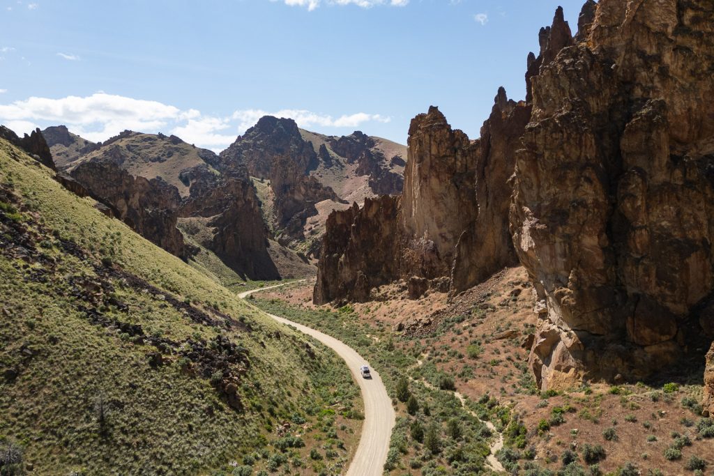
- Explore Leslie Gulch: Leslie Gulch is filled with rock spires and volcanic terrain. Hike the Juniper Gulch Trail to walk through the towering rocks, and go hang out by the Owyhee Reservoir. (Note: You’ll want a high-clearance vehicle for this unpaved road!)
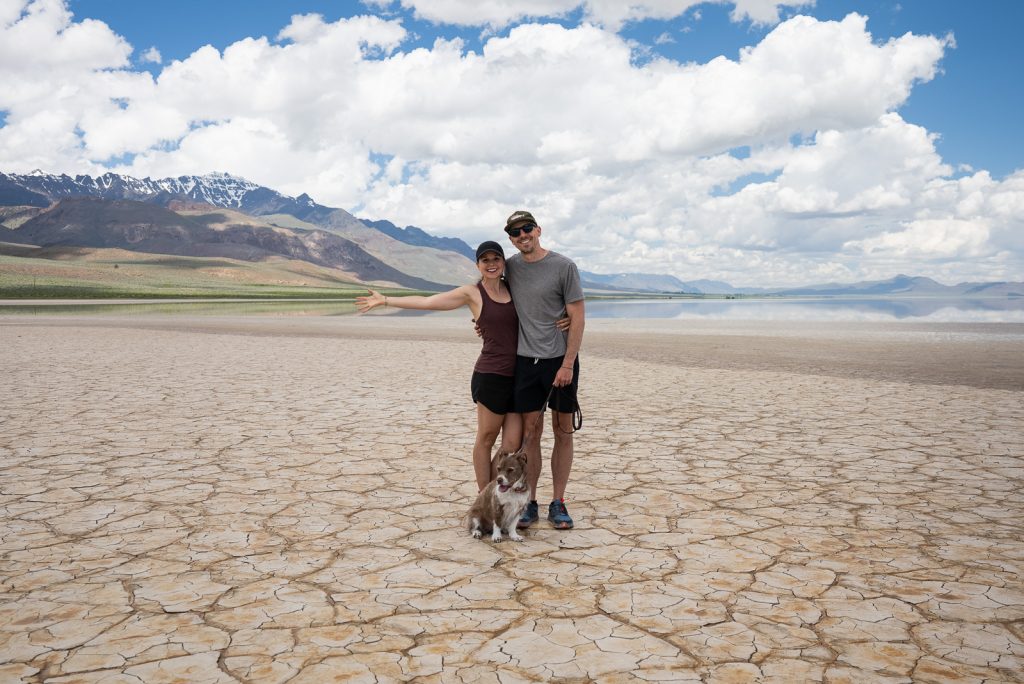
- Drive Across the Alvord Desert: Did you know that half of Oregon is actually desert? The Alvord Desert is a massive, 12-mile-long dry lakebed where you can literally drive or camp right out on the playa. Just make sure it’s 100% dry! On your way there, take a bumpy detour to soak in Willow Creek Hot Springs.
- Grab a Milkshake in Fields: Stop at the Fields Station General Store in the tiny town of Fields to grab one of their famous handspun milkshakes!
Painted Hills
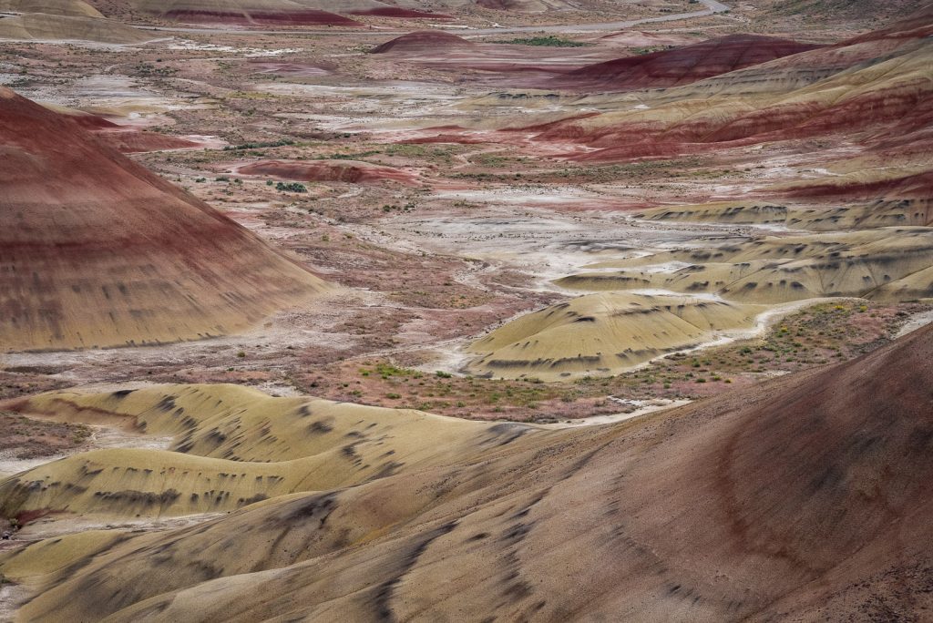
- See the Painted Hills: As one of the official “7 Wonders of Oregon,” the Painted Hills are famous for their vibrant bands of red, gold, and black volcanic ash. Walk the boardwalks on the Painted Cove Trail and check out the Painted Hills Overlook.
- Explore the Sheep Rock Unit: Also part of the John Day Fossil Beds National Monument, this area features blue-green rock formations. Stop by the Thomas Condon Visitor Center to see their collection of prehistoric fossils, and drive through Picture Gorge.
Joseph & Wallowa Lake
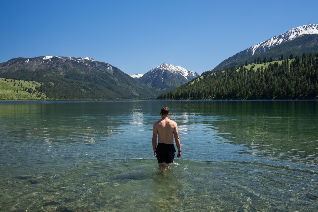
- Hang Out in Joseph & Wallowa Lake: Finish your trip at the base of the Wallowa Mountains in the charming town of Joseph. Relax on the south side of Wallowa Lake, browse the local shops, and grab truffles at Arrowhead Chocolates (they are to die for!).
- Pedal the Railriders: One of our absolute favorite activities of the whole trip was pedaling a custom railbike along old, unused railroad tracks with Joseph Branch Railriders.
- Tackle the Eagle Cap Wilderness: Take a day hike up the Chief Joseph Mountain Trail, or ride the Wallowa Lake Tramway up to the peak of Mt. Howard.
Our 8-Day Eastern Oregon Road Trip Itinerary shares all the best stops through Leslie Gulch, the Alvord Desert, the Painted Hills, and the Wallowa Mountains!
12. Washington National Parks Route
Washington is home to three of the most breathtaking national parks in the entire country, and visiting them all in one road trip is the ultimate Pacific Northwest adventure! This loop takes you from coastal beaches and mossy rainforests of Olympic, up into the rugged mountains of the North Cascades, and finishing at the grandest volcano of them all: Mount Rainier!
Days Needed: 10 days, driving between each park can take a half to full day!
Closest Airports: Seattle-Tacoma International Airport (SEA).
Where to Start & End: Seattle, WA
Best Time of Year: Summer (July-September), especially for Mount Rainier and North Cascades. Many areas are not accessible and have snow outside of that timeframe. Olympic can be visited year-round though!
Check out our 3 Days in Seattle Itinerary where we share our favorite local eateries, coffee shops, and hidden city gems before hitting the road.
Top Experiences Along the Route


Olympic National Park
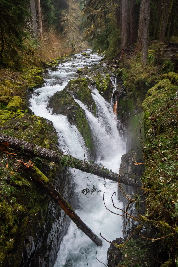
- Lake Crescent: Head over to the crystal-clear waters of Lake Crescent. And if you want a fun challenge, hike the steep switchbacks and use the rope sections to scramble to the top of Mount Storm King, one of our favorite hikes on the Olympic Peninsula!
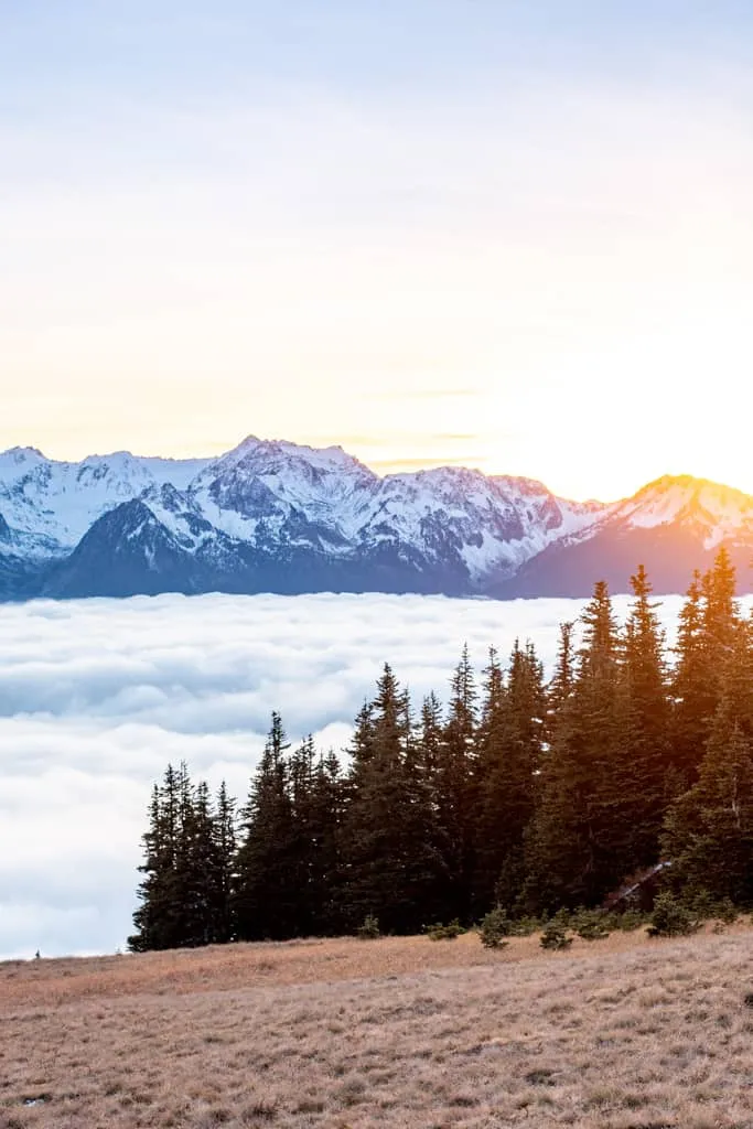
- Catch sunset at Hurricane Ridge: Drive up the winding road to stand at 5,200 feet and look out over the Olympic mountains!
- Wander the Hoh Rainforest: Walk under giant, moss-draped trees along the Hall of Mosses Trail.
- Explore Rialto Beach: Catch low tide at Rialto Beach to make the beach walk out to Hole-in-the-Wall, where you can see colorful starfish in the tidepools. We share even more coastal stops in our full Olympic National Park Guide!
Mount Rainier National Park
- Explore the Sunrise Corridor: At 6,400 feet, Sunrise is the highest point in the park you can drive to. Hike the Mount Fremont Lookout Trail at sunset to sit by a historic fire lookout for views of the mountain’s massive glaciers.
- Walk Through Paradise: Head over to the southern slopes of the volcano to hike the Skyline Trail. In the summer, the meadows here erupt into a sea of vibrant wildflowers, and you get to walk right alongside rushing glacial rivers and waterfalls like Myrtle Falls. Check out our list for even more things to do at Mount Rainier!
North Cascades National Park
- Admire Diablo Lake: Pull over at the scenic overlook to marvel at the lake’s intense turquoise color, which is caused by fine rock powder from surrounding glaciers.
- Hike the Cascade Pass Trail: Trek through incredible alpine scenery, pristine meadows, and rocky slopes that offer some of the most dramatic mountain views in the entire range.
- Drive the North Cascades Highway: Cruise along one of the most beautiful scenic drives in the country as it winds through deep valleys and under jagged, towering peaks.
Check out our detailed guides to Washington State National Parks! We also have itineraries for individual destinations along this route, including our 2 Day Olympic National Park Itinerary, our Weekend in the North Cascades Itinerary, plus a guide on How to Visit Mount Rainier from Seattle.
13. Alaska Highway or Cassiar Highway Road Trip
We spent an unforgettable summer driving to Alaska in our van, and while these route are technically in Canada, they are the only way to reach the Last Frontier. Along these routes you’ll go past wild rivers, massive glaciers, natural hot springs, and have endless opportunities to spot wildlife. These are the longest road trips on this list, but if you have a RV/campervan, can work remotely (with Starlink!), or have a lot of time off, it’s an epic adventure that covers anywhere from 1,400 to nearly 2,000 miles one way!
Days Needed: 5-7 days for the actual routes, plus a few extra days to drive to the starting point.
Closest Airports: Vancouver International Airport (YVR) if flying in to rent a rig.
Where to Start & End: British Columbia (Dawson Creek for the Alaska Highway or Kitwanga for the Cassiar). End your trip in Fairbanks or Anchorage, AK.
Best Time of Year: June through mid-August.
Option #1: Alaska Highway
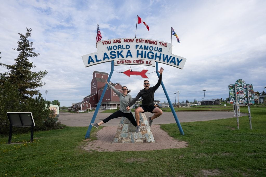

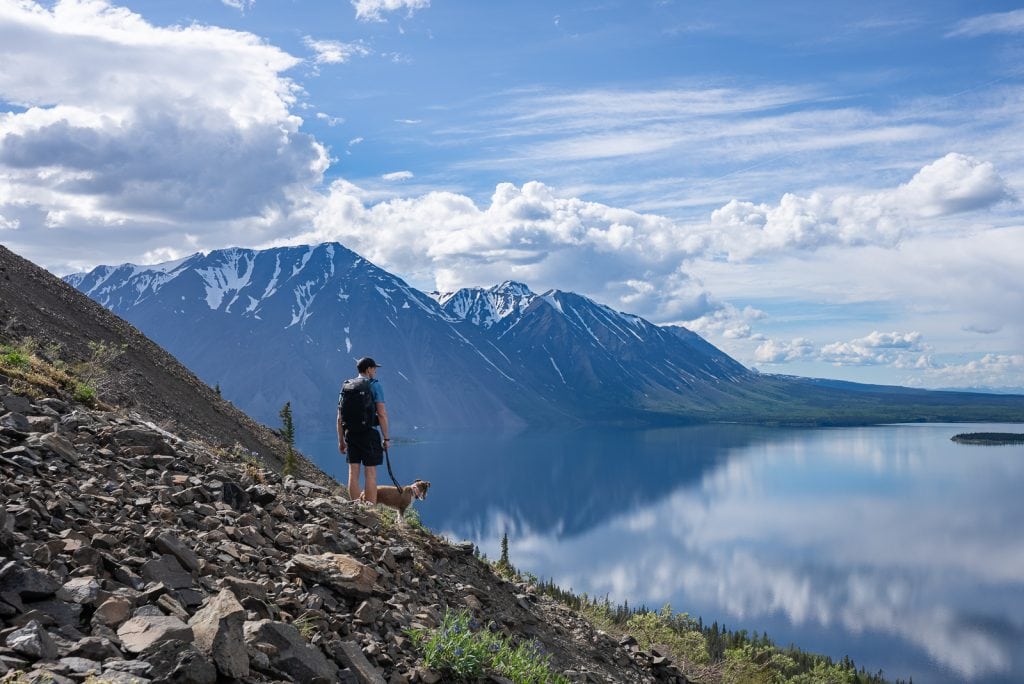

The Alaska Highway starts in Dawson Creek, BC and stretches over 1,390 miles to Delta Junction, Alaska. It’s generally wider, more developed, and has a bit more traffic, but it is packed with iconic stops!
- Take a Photo at Mile 0: You can’t leave Dawson Creek without snapping a classic photo in front of the historic “World Famous Alaska Highway” sign post!
- Snack on Legendary Cinnamon Rolls: Make a mandatory pit stop at Tetsa River Lodge to grab one of their giant, world-famous, fresh-baked cinnamon rolls. They are completely worth the hype!
- Camp at Muncho Lake: Spend a night camping on the shores of this spectacular lake, famous for its deep jade-green water.
- Soak in Liard River Hot Springs: Walk down a beautiful boardwalk through a boreal forest to relax in Canada’s second-largest natural hot springs. It’s one of the best stops on the entire highway!
- Visit the Sign Post Forest: Stop in Watson Lake to add your own hometown sign to a massive, sprawling collection of over 80,000 signs started by a homesick soldier in 1942!
Option #2: Stewart-Cassiar Highway
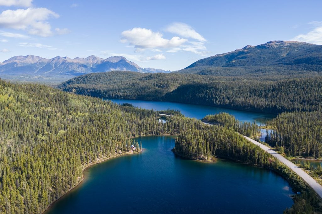

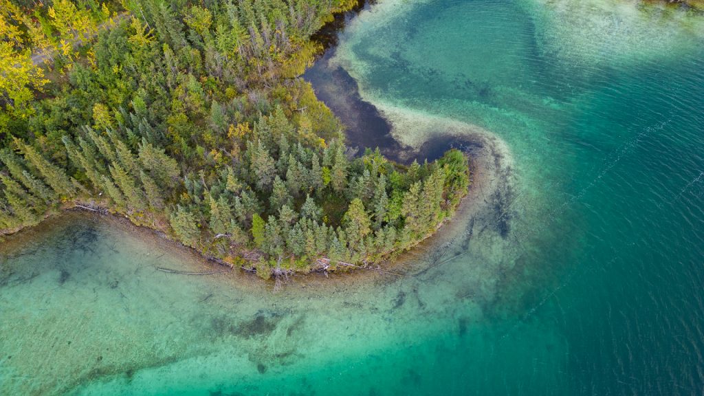
If you want fewer crowds, narrower roads, and an even more rugged, untamed wilderness, the Cassiar is your route. Stretching 450 miles from Kitwanga, BC, until it connects up with the Alaska Highway in the Yukon, it runs parallel to the main Alcan route but further west, closer to the coast.
- Paddle Boya Lake: Explore the crystal-clear blue waters of this unique northern lake, perfect for canoeing or lakeside camping.
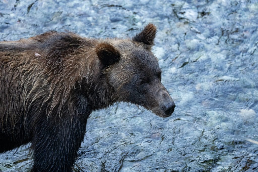
- Watch Bears in Hyder: Take a quick detour across the Alaska border to the tiny town of Hyder, where you can stand on Fish Creek Wildlife Observation Site boardwalk to watch grizzlies and black bears fishing for salmon in the river.
- See Salmon Glacier: Drive up a winding mountain road to an unbelievable overlook of the massive Salmon Glacier. It’s the world’s largest vehicle-accessible glacier!
Kluane National Park
No matter which route you choose, both the routes converge in the Yukon and take you right past Kluane National Park and Reserve. This area is home to Canada’s highest peak (Mount Logan) and the world’s largest non-polar icefield. Take a flightseeing tour to see the massive glaciers from above, or hike the King’s Throne Trail for gorgeous views of Kathleen Lake.
A+K Tip: This is a very remote road trip with limited services and spotty cell coverage. Having a reliable rig, monitoring your fuel closely, and traveling with a Starlink will make your journey way smoother!
Check out our detailed guides to map out your drive, including The Ultimate Guide to Driving the Alaska Highway and our guide to the Stewart-Cassiar Highway!
14. The Kenai Peninsula Loop
We spent over two months overlanding Alaska in our van, and the Kenai Peninsula was our absolute favorite region in the whole state! This route from Anchorage takes you to explore giant glaciers, breaching whales, and massive fjords, then down to the end of the road where the ocean meets the mountains.
Days Needed: 7-10 days.
Closest Airports: Anchorage Ted Stevens International Airport (ANC).
Where to Start & End: Anchorage, AK
Best Time of Year: Summer (June-August). Fall starts in Alaska at the end of August, so mid-summer is your best bet for great weather and fully running tours!
Top Experiences Along the Route


Whittier
- Drive Through a Mountain: To get into Whittier, you have to drive through the Anton Anderson Memorial Tunnel. It’s a 2.5-mile, single-lane tunnel shared by both cars and trains, meaning it only opens in one direction at a time on a strict hourly schedule!
- Take a Glacier Cruise: Whittier sits tucked into Prince William Sound, and we highly recommend a glacier cruise here! You’ll get to see tidewater glaciers calving chunks of ice into the ocean and spot sea otters floating in the water.
- Hike Portage Pass Trail: If you want a phenomenal day hike right after passing through the tunnel, tackle the 4-mile round-trip trail up Portage Pass Trail. It’s the only hike in the area that rewards you with an up-close view of Portage Glacier spilling down into the lake below without needing to pay for a commercial boat tour!
Seward & Kenai Fjords National Park
- Kenai Fjords National Park: We booked a 7.5-hour cruise with Major Marine Tours, and it was truly one of the single best experiences of our entire lives. We got to watch gigantic glaciers calve right into the ocean and saw hundreds of harbor seals, plus sea lions and puffins!
- Hike the Harding Icefield: This is one of the most epic hikes we have ever done. It climbs up alongside Exit Glacier until you are standing at the edge of the Harding Icefield, a 700-square-mile expanse of ice!
- Eat Dinner in Seward: Treat yourself to dinner in downtown Seward at The Cookery for some incredible, locally sourced wild oysters and salmon.
Homer & Kachemak Bay
- Drive the Homer Spit: Drive all the way to the literal end of the road on the Homer Spit, a 4.5-mile long needle of land jutting out into the deep blue waters of Kachemak Bay.
- Water Taxi to Grewingk Glacier: One of our favorite experiences in Homer was taking Alan’s Water Taxi across the bay to Kachemak Bay State Park for an incredible overnight backpacking trip. We hiked the Saddle Trail and pitched our tent on the edge of Grewingk Glacier Lake. It was pure magic!
Check out our detailed 10 Day Alaska Road Trip Itinerary to map out your daily stops! We also have guides for individual spots along this route, including our guide to the Best things to do in Kenai Fjords National Park and how to experience the Harding Icefield Trail!
15. Grand Teton to Yellowstone National Park Road Trip
Located just a couple hours apart, Grand Teton and Yellowstone National Parks are perfect to combine into one epic national park road trip loop! Between the two parks, you get to experience gorgeous mountain peaks, alpine lakes, and tons of wildlife, plus colorful thermal springs, erupting geysers, and bubbling mud pots.
Days Needed: 5-7 days. We have a 5 day itinerary to help you out!
Closest Airports: Jackson Hole Airport (JAC) is located inside Grand Teton National Park. You can also look at smaller regional airports in Cody or Bozeman.
Where to Start & End: You can easily fly into Jackson Hole, spend the first half of your week exploring Grand Teton, drive north into Yellowstone, and either loop back or fly out of Bozeman or Cody.
Best Time of Year: Summer through early Fall (June–September)
Top Experiences along the Route


Grand Teton National Park
- Catch Sunrise at Schwabacher Landing & Mormon Row: Schwabacher Landing offers a stunning reflection of the peaks over the Snake River. It’s a great spot to see moose! While Mormon Row features historic wooden barns backed by the Teton mountains.
- Explore Jenny Lake & Cascade Canyon: Take the shuttle boat across Jenny Lake, then hike up to Hidden Falls and Inspiration Point. You can continue into Cascade Canyon for one of the best hikes in the park!
- Grab food in Jackson: We love Picnic for coffee and breakfast. And for lunch or dinner, our favorite spot is Hand Fire Pizza, which is located inside an old movie theater.
Yellowstone National Park
- Watch Old Faithful Erupt: Watch Yellowstone’s most iconic geyser shoot water high into the air. We recommend checking the Geyser Times app on your phone to catch an early morning window and beat the crowds.
- Walk the Upper Geyser Basin to Morning Glory Pool: Take the flat, 1.5-mile boardwalk trail past countless bubbling, steaming thermal features to reach Morning Glory Pool, a deep hot spring famous for its unbelievably vivid layers of yellow, green, and blue.
- See Grand Prismatic Spring & Fairy Falls: Marvel at the largest hot spring in the United States! Walk the lakeside boardwalk to feel the steam, then take the Fairy Falls Trail to the overlook.
A+K Tip: Grand Teton and Yellowstone are home to both black and grizzly bears! Always carry bear spray and know how to use it.
Skip the planning stress and read our 5-Day Grand Teton and Yellowstone National Parks Itinerary, where we share the perfect daily route to see the best of both National Parks!
16. The Dakotas Road Trip (Black Hills & Badlands to North Dakota)
If you think a road trip through South and North Dakota is just flat prairies, think again! Between the colorful canyons of the Badlands, the underground world of rare cave formations at Wind Cave National Park, the towering granite spires of the Needles Highway, and landscapes where bison roam free in North Dakota, a road trip through the Dakotas is one of the most underrated adventures in the country!
Days Needed: 7–10 days.
Closest Airports: Fly into Rapid City Regional Airport (RAP), and fly home out of Bismarck Municipal Airport (BIS) if heading all the way north.
Where to Start & End: Start in Rapid City, SD, and head north through the Black Hills, ending your trip in western North Dakota.
Best Time of Year: Late Spring through Fall (May–October).
Top Experiences Along the Route


Custer State Park & The Black Hills
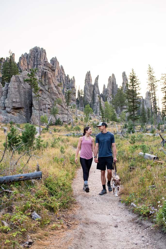
- Hike past Cathedral Spires to Black Elk Peak: Sitting at 7,242 feet, this is the highest peak east of the Rocky Mountains and west of the Pyrenees, and one of our absolute favorite hikes in the Black Hills.
- Drive the Needles Highway & Wildlife Loop: Navigate the pigtail bridges and incredibly tight granite openings of the Needles Highway! Afterward, hit the 18-mile Wildlife Loop Road. Custer has one of the nation’s largest free-roaming herds with 1,400 bison. We had literally 100 to 200 of them walk right past our van windows! Both drives are located inside Custer State Park.
- Cool Off in Spearfish Canyon: Start your morning early with a sunrise hike to Devil’s Bathtub, a smooth, narrow rock shoot.
- Go Underground at Wind Cave National Park: Visit the 7th U.S. National Park and the first cave system protected anywhere in the world. Book a ranger tour in advance to see the honeycomb-like calcite structures called boxwork. Wind Cave National Park is home to 95% of the world’s known boxwork formations!
Badlands National Park
- Sunrise in Badlands National Park: Head to Big Badlands Overlook at sunrise in Badlands National Park to see the colorful clay layers. Afterwards, drive the Badlands Loop Road to look for bighorn sheep and prairie dogs at Robert’s Prairie Dog Town.
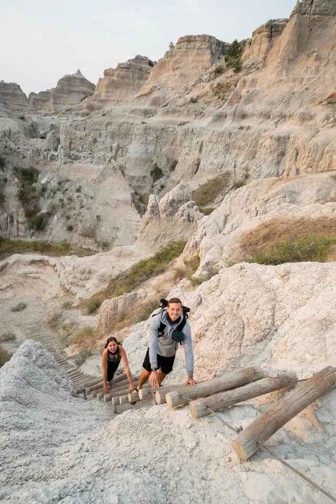
- Climb the Log Ladder on the Notch Trail: This 1.3-mile trail was our absolute favorite hike in the park. You wander through a canyon before climbing a wooden cable ladder up a cliffside.
- Grab a Donut at Wall Drug: You will see billboards for Wall Drug for hundreds of miles before you get here. Yes, it’s cheesy and touristy, but we LOVED it! Stop by to try one of their famous homemade maple cake donuts.
Theodore Roosevelt National Park
- Wander Through the Painted Canyon: Stop at the edge of the South Unit in Theodore Roosevelt National Park to see the badlands from above, or hike the Painted Canyon Trail to wander into the canyon.
- Drive the North Unit Scenic Drive: Head up to the park’s quieter North Unit for a 14-mile drive past cliffs, giant rock sphere concretions, and stop at Oxbow Overlook where you can see the Little Missouri River winding below.
Check out our detailed 7 Day South Dakota Road Trip Itinerary to see how we spent a week traveling through Spearfish Canyon, Custer State Park, Mount Rushmore, and the Badlands!
17. Minnesota’s North Shore Road Trip (Duluth to Grand Portage)
One of the absolute BEST surprises during our travels was Minnesota’s North Shore. While locals rave about it, it’s a region that doesn’t get talked about a ton outside of the Great Lakes. This route takes you up the 150-mile stretch of Highway 61 along the coast of Lake Superior, winding past a stunning concentration of waterfalls, state parks and historic lighthouses. All before ending at the Canadian border!
Days Needed: 5–7 days.
Closest Airports: You can fly directly into Duluth International Airport (DLH). Alternatively, you can fly into Minneapolis-Saint Paul International Airport (MSP), which is about a 2.5-hour drive south of Duluth but often offers more flight options.
Where to Start & End: Start in Duluth, MN, and wind your way north across the state to Grand Portage, before returning to Duluth at the end.
Best Time of Year: Summer through Fall (June–October)
Top Experiences Along the Route



- Explore Canal Park & Watch the Ships: Hang out in downtown Duluth’s waterfront district to cross the Aerial Lift Bridge, and climb the 80-foot Enger Tower for a gorgeous panoramic view of the harbor below. Make sure to grab an ice cream flight at Love Creamery and BBQ at OMC Smokehouse!
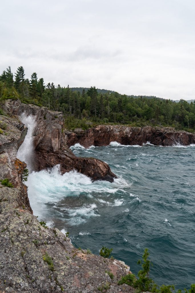
- Hike Through State Parks: Stop at Gooseberry Falls State Park to see the upper and lower drops tumbling over basalt rock, or head to Tettegouche State Park to take in the views from Palisade Head, a sheer 300-foot cliff plunging straight into the lake.
- Visit the Split Rock Lighthouse: Tour this historic 1910 lighthouse on a 130-foot cliffside, built to guide ships safely through Lake Superior’s notorious storms.
- Hang Out in America’s Coolest Small Town: We fell in love with Grand Marais! Walk out to the peninsula at Artists Point to explore the rocky shoreline, and check out the 1922 lighthouse! For food, grab a Maple Latte at Java Moose, pick up a giant fried “Skizzle” dough at World’s Best Donuts, and eat your weight in fry bread tacos and totchos (tater tot nachos) at Hungry Hippie Tacos.
- Chase the Mystery at Devil’s Kettle: Hike the 2-mile round-trip trail at Judge C.R. Magney State Park to see Devil’s Kettle Falls. Here, the river splits in half, where one side cascades normally, while the other side vanishes into a massive volcanic pothole. Scientists finally proved it just flows back into the main river from underground!
- Learn the area’s history. Visit the Grand Portage National Historic Monument to learn about the fur trade industry and voyageurs!
- Stand Over High Falls: Drive right up to the US/Canada border at Grand Portage State Park to view High Falls (also called Pigeon Falls). It drops 120 feet, making it the tallest waterfall in the state!
Check out our detailed 5-Day Minnesota’s North Shore Road Trip Itinerary to see how we spent a week driving along the rocky coastline of Lake Superior! Then, read our guide to the 8 Must-Visit Minnesota North Shore State Parks to help you learn more about each park.
18. Michigan’s Upper Peninsula
Another one of the most underrated USA road trips is Michigan’s Upper Peninsula. Bordering three Great Lakes, this area is filled with stunning shoreline hikes, plus small towns, interesting mining history, and waterfalls. It offers a fun mix of activities for everyone to enjoy!
Days Needed: 7-10 days, especially if adding on Isle Royale.
Closest Airports: This area is pretty remote, with no major airports super close by. The Marquette Sawyer Regional Airport (MQT) is centrally located on the peninsula, but does have limited flights. You could also combine this region with Minnesota’s North Shore and fly into Minneapolis- St. Paul (MSP) or Duluth (DLH).
Where to Start & End: We suggest starting at the Porcupine Mountains and ending at Tahquamenon Falls. Or vice versa!
Best Time of Year: Summer through Fall (June–October).
Top Experiences Along the Route


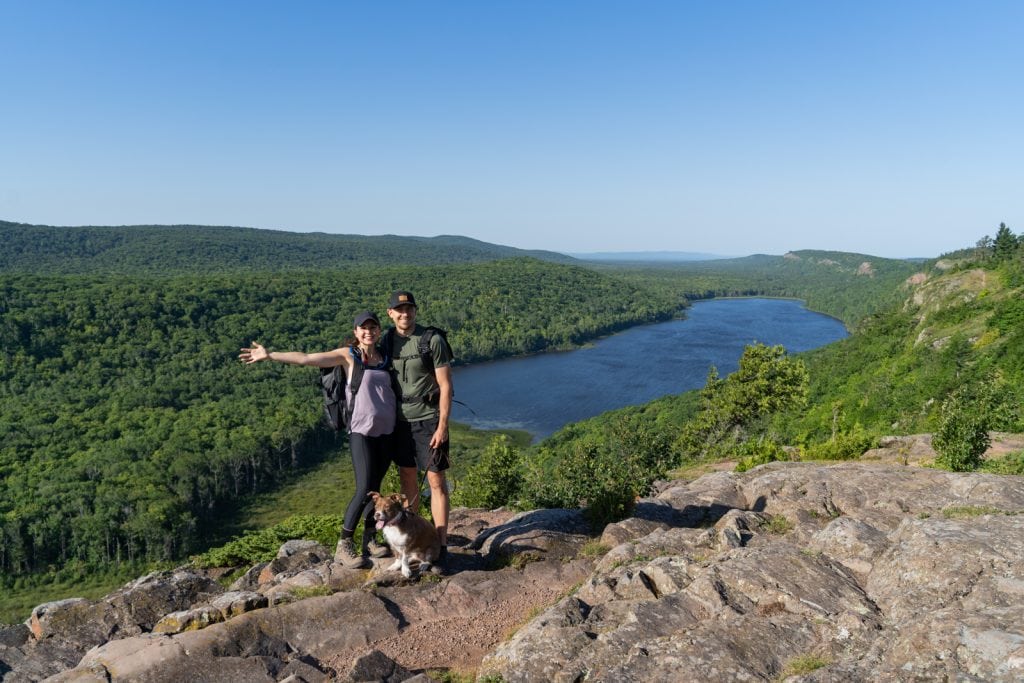
- Hike in the Porcupine Mountains. Nicknamed “The Porkies,” this is one of the best hiking areas in the state! We loved the Escarpment Trail, which has amazing views of Lake of the Clouds!
- Explore the Keweenaw Peninsula! Visit historic downtown Houghton, tour either the Quincy Mine or Delaware Mine, grab pastries from monks at The Jam Pot, and drive the scenic Brockway Mountain Drive.
- Camp at Isle Royale National Park. The Keweenaw Peninsula is one of the launching points to visit Isle Royale, the least visited national park in the lower 48. You can either take a seaplane (our top pick!) or ferry from here to either Windigo or Rock Harbor. Rock Harbor has more amenities and is a bit more scenic, in our opinion. Once here, you can camp at different backcountry campgrounds, go for day hikes, and look for wildlife. Since it is such a journey to get to, we suggest dedicating two days.
- Try a pasty. This handheld meat and vegetable pie was brought to the area by Cornish and Finnish miners. Today, it’s the region’s most iconic dish!
- See the crystal clear spring water at Kitch-iti-kipi. You can even drive a wooden raft over the water!
- Hike at Pictured Rocks. This is hands down one of the most beautiful spots in the Great Lakes! Along the Chapel Loop Trail you’ll see dramatic cliffs and vibrant, clear blue waters. (No dogs allowed)
- See Tahquamenon Falls. This is one of the largest waterfalls east of the Mississippi! They are known for their brown color (due to tannins) and foam, giving it the nickname “Root Beer Falls.”
For more information about this area, check out our detailed guides to the Porcupine Mountains and Pictured Rocks! We also share everything you need to know to get to Isle Royale, plus fun things to do once you’re on the island.
19. Upstate New York Road Trip (Niagara Falls to the Adirondacks)
If you think New York is just concrete streets and yellow cabs, think again! This route showcases an unbelievable variety of scenery. You’ll go from the industrial history and incredible food scene of Buffalo, through deep glacial gorges and lake basins, past the rolling vineyards of the Finger Lakes, and all the way up into the rugged wilderness of the Adirondack Mountains!
Days Needed: 7 days
Closest Airports: Fly into Buffalo Niagara International Airport (BUF) and fly home out of Albany International Airport (ALB).
Where to Start & End: Start in Buffalo, NY, and wind your way east across the state, ending in Albany.
Best Time of Year: Summer through Fall (June–October)
Top Experiences Along the Route

Buffalo & Niagara Falls
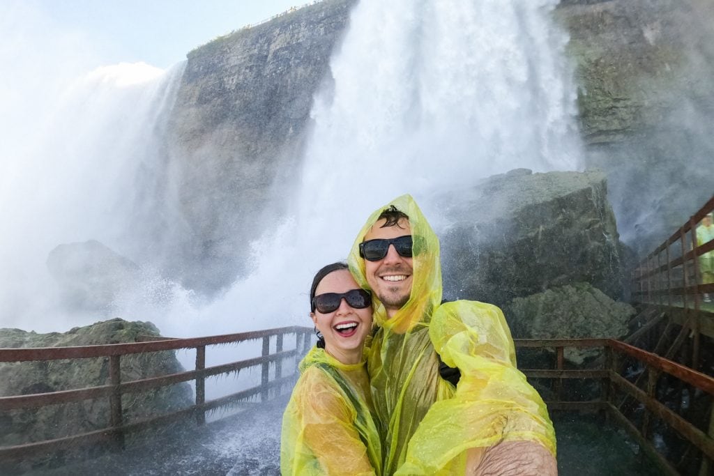
- Get Soaked at Niagara Falls (US Side): Spend a full day exploring America’s oldest state park! Ride the Maid of the Mist boat tour to get right into the heart of Horseshoe Falls, and walk the wooden decks at Cave of the Winds to stand on the Hurricane Deck right beneath Bridal Veil Falls.
- Go on a Buffalo Food Tour: Buffalo has one of the most unique food scenes we’ve ever tried! Head to Bar-Bill Tavern for the juiciest wings of your life and grab a massive slice of Buffalo-style pizza at Imperial Pizza. Plus you must try a classic Beef on Weck sandwich, which is tender roast beef on a salty caraway kaiser roll. And then satisfy your sweet tooth with a giant peanut stick donut from Paula’s Donuts or some local sponge candy from Watson’s!
Letchworth & Finger Lakes
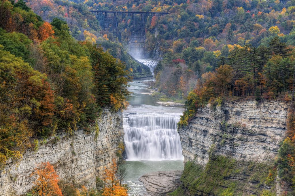
- Explore Letchworth State Park: Known as the “Grand Canyon of the East,” the Genesee River cuts through massive shale cliffs with three roaring waterfalls (Upper, Middle, and Lower Falls) tucked into the gorge.
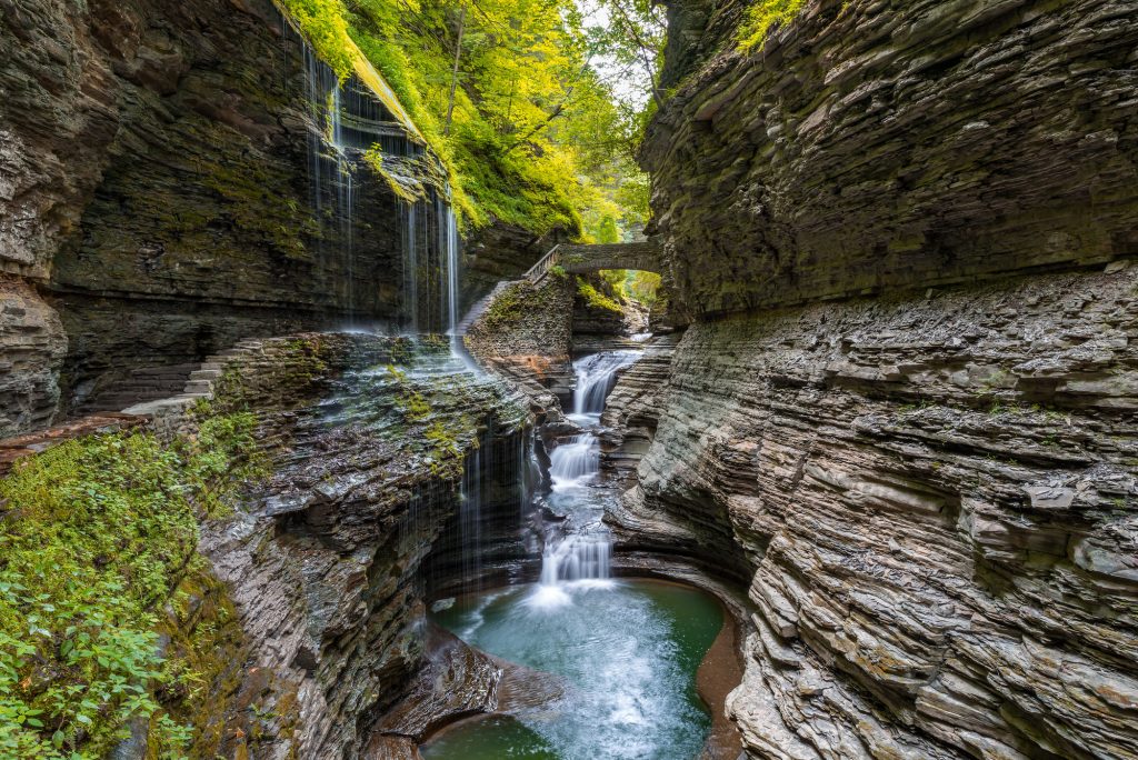
- Watkins Glen State Park: Hike the 2-mile Gorge Trail, which winds beneath, behind, and over 19 waterfalls!
- Taughannock Falls State Park: Take the flat, easy canyon trail to stand at the base of a 215-foot waterfall (it’s actually taller than Niagara Falls!).
The Adirondacks
- Summit Mount Marcy: Tackle Mount Marcy, the highest point in the entire state of New York at 5,344 feet!
- Ride the Rails: Head to Lake Placid or North Creek with Revolution Rail Co. for a unique excursion pedal-powering custom railbikes along old, unused railroad tracks!
We put together The Ultimate Guide to the US Side of Niagara Falls to help you plan your day! Then watch our Buffalo Food Tour video to see where we tracked down the absolute best wings, beef on weck, and sponge candy in town!
20. West Virginia Road Trip
West Virginia was barely even on our radar until our plans to visit New England fell through one year. And it turned out to be one of the absolute best surprises we’ve ever had since hitting the road!
This USA road trip is one of the best hidden gems in the country. Located entirely within the Appalachian Mountains, West Virginia offers so much of the scenery found in nearby states, but with a fraction of the crowds. Plus, all the state parks here are completely FREE!
Days Needed: 7–9 days
Closest Airports: Fly into Pittsburgh International Airport (PIT) and fly home out of West Virginia International Yeager Airport (CRW).
Where to Start & End: Start in Pittsburgh, PA, and wind your way south through the mountains, ending in Charleston, WV (or loop back to Pittsburgh).
Best Time of Year: Late Spring through Fall (May–October)
Top Experiences Along the Route
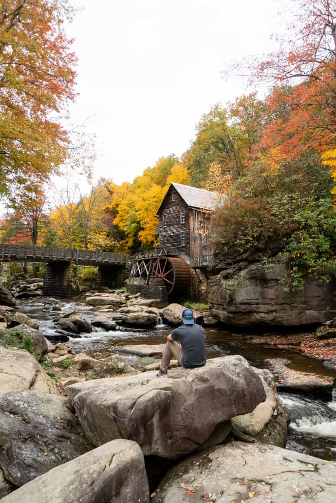
Morgantown & Fairmont
- Catch the Views at Coopers Rock: Located just outside Morgantown, Coopers Rock State Forest has gorgeous canyon views of the Cheat River. You can also hike the 2.5-mile Raven Rock Trail to stand on giant rock outcroppings overlooking the mountains!
- Stuff Your Face in Fairmont: Stop in the small town of Fairmont to try the state’s most iconic local foods! Grab a legendary pepperoni roll (the ultimate miner’s lunch) at the original Country Club Bakery. Afterward, head to Yann’s for a classic West Virginia hot dog topped with their famous spicy chili sauce, mustard, and onions. Just don’t ask for ketchup here, it’s strictly forbidden!
Canaan Valley, Davis, & Thomas
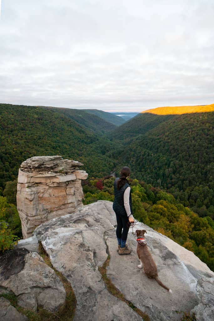
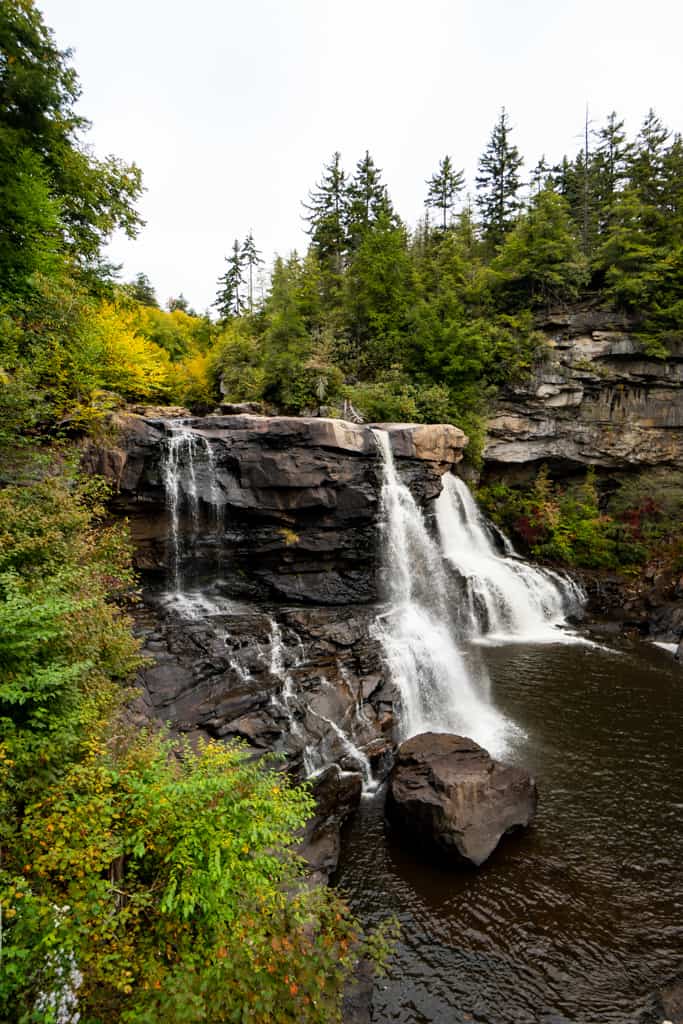
- Chase Waterfalls in Blackwater Falls State Park: Wake up early to catch a magical sunrise over the canyon at Lindy Point. Then hike to Elakala Falls to see the amber colored waters. Stop by the nearby Douglas Falls just outside the park, too!
- Hang Out in Thomas: Take an afternoon to stroll through the super artsy, historic coal-mining town of Thomas. Grab a coffee at TipTop!
Seneca Rocks & Spruce Knob
- Hike Seneca Rocks: Stand in awe of the massive, jagged stone crest of Seneca Rocks and hike up the steep 1.3-mile switchback trail to the upper observation platform. Then, watch the rock climbers tackle the sheer vertical walls of the quartzite fin rising 1,000 feet above the valley floor!
- Stand on the State’s Highest Peak at Spruce Knob: Drive the windy road up to 4,863 feet and walk the short loop to the stone tower for endless Appalachian ridge views.
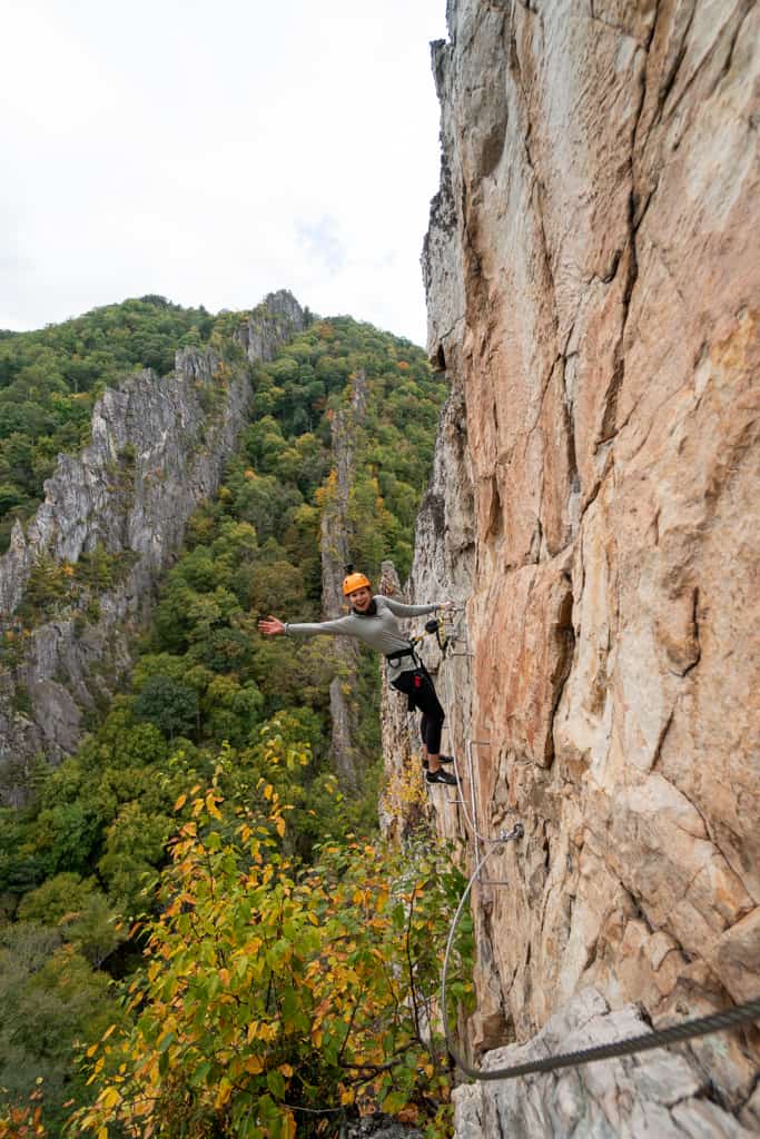
- Scale the Cliffs at NROCKS Via Ferrata: If you are brave, head down the road from Seneca to this privately owned outdoor park. Clip your harness into fixed steel cables to climb massive vertical rock faces and cross a suspension bridge hanging 150 feet in the air between two rock fins. It was one of the coolest things we have ever done!
The New River Gorge & Charleston
- Explore New River Gorge National Park: Visit America’s 63rd National Park! Go whitewater rafting, hike the Long Point Trail for the absolute best view of the bridge spanning the canyon, or test your fear of heights by tackling the bridge walk!
- Devour a Tudor’s Biscuit: We feel bad making you wait until the end of the trip for this, but stopping at Tudor’s Biscuit World is a total West Virginia rite of passage. Their massive, fluffy biscuit sandwiches are named after local sports teams. Adam still talks about a biscuit he had here to this day!
- Wander Downtown Charleston: Explore the indoor/outdoor Capitol Market (grab a coffee at Mea Cuppa!). Then, browse the shelves at Taylor Books and walk past the stunning state capitol building. It features a massive gold-leafed dome that is actually five feet taller than the U.S. Capitol in D.C.! Finish the day with a scoop of homemade seasonal Pawpaw ice cream at Ellen’s.
Check out our 7 Day West Virginia Road Trip Itinerary to see how we mapped out a week of chasing waterfalls at Blackwater Falls, hiking Seneca Rocks, and exploring the country’s newest national park, the New River Gorge. Or watch our experience on Youtube!
21. New England Fall Road Trip
New England is said to be the best USA road trip for fall foliage. And it’s easy to see why! Along this route you’ll experience the absolute best of Vermont, New Hampshire, and coastal Maine. You will see historic towns, epic coastal views, and more colorful trees than you can even imagine! This road trip is carefully timed to chase the absolute best fall foliage through all three states.
Days Needed: 12 days
Closest Airports: Boston Logan International Airport (BOS).
Where to Start & End: This route is a loop that starts and ends in Boston! You’ll grab your rental car at Boston Logan (BOS), drive 3.5 hours north to head into the mountains of Vermont, weave east through New Hampshire, hit the rugged coast of Maine, and then cruise back down to Boston to fly home.
Best Time of Year: Fall (late September through late October). Peak fall foliage changes from year to year and varies by region. We suggest checking the historical data for each location to determine when is best to visit. You may not hit up every spot during peak foliage, but you should be able to see lots of color.
Top Experiences Along the Route


Vermont’s Green Mountains & Northeast Kingdom
- Chow Down at Cold Hollow Cider Mill: Start your trip with insanely fresh, hot apple cider donuts and a glass of apple cider.
- Explore Waterbury & Stowe: Grab a scoop at the famous Ben & Jerry’s factory headquarters, visit the (supposedly haunted) Gold Brook Covered Bridge, and hike the short trail to the roaring Moss Glen Falls. If you want a fun autumn challenge, hand over $8 to get lost in the Percy Farm Corn Maze!
- Soak in the Views at Lake Willoughby: Drive north into Vermont’s rugged Northeast Kingdom to see this glacier-carved lake. It’s located between Mount Pisgah and Mount Hor, and the surrounding cliffs look absolutely unbelievable with autumn colors!
New Hampshire’s White Mountains
- Catch Sunrise at Artist Bluff: This short 1.5-mile trail offers an unforgettable overlook of Echo Lake. It gets incredibly busy, so arrive early! Afterward, call ahead to get your name on the list at Polly’s Pancake Parlor.
- Walk Through the Flume Gorge: We almost skipped this because the $18 online ticket felt steep for a walk in nature, but we are so glad we splurged! Walking the wooden boardwalks past the towering, mossy granite walls felt like walking through a fairytale.
- Drive the Kancamagus Highway & Hike Mount Willard: Cruise the famous 34-mile Kancamagus Highway. Then hike Mount Willard for a cliffside view straight down Crawford Notch. The colors here were probably the best we saw the entire trip!
Coastal Maine (Portland & Acadia National Park)
- Savor the Flavors of Portland: While in Portland, grab a famous Maine potato donut at The Holy Donut. The Maple Bacon and Pumpkin Head flavors are SO good! Then, explore historic Fort Williams Park, and snap a photo of the iconic Portland Head Light, the oldest lighthouse in Maine. Before leaving town, grab a fresh lobster roll from the Bite Into Maine truck!
- Visit Acadia National Park: Drive up to Mount Desert Island to experience Acadia. This is one of our absolute favorite national parks in the country! Hike the iron-rungs on the Precipice trail, scramble up the boulder path of South Bubble, and drive up to the summit of Cadillac Mountain to see the autumn colors.
Check out our 12 Day New England Fall Road Trip Itinerary to see how we mapped out the perfect route through Vermont, New Hampshire, and coastal Maine to chase peak fall foliage!
22. Blue Ridge Parkway (Shenandoah to the Smokies)
Winding along the crest of the Appalachian Mountains, the Blue Ridge Parkway is widely considered America’s favorite scenic drive. While we have yet to drive the entire 469-mile stretch of the parkway in one go, we have explored some absolutely stunning segments of it! Plus, the parkway can be broken up into smaller road trips if you are short on time.
Days Needed: 3–7 days, depending on how much ground you want to cover.
Closest Airports: For Segment 1 (North): Fly into Washington Dulles International Airport (IAD) or Ronald Reagan Washington National Airport (DCA). For Segments 2 & 3 (South): Fly into Asheville Regional Airport (AVL) or McGhee Tyson Airport in Knoxville (TYS).
Where to Start & End: Your exact starting and ending point will depend heavily on which route you choose.
Best Time of Year: Spring through fall. Expect the highest crowds during the height of summer vacation and the peak of autumn foliage.
Segments to Choose From


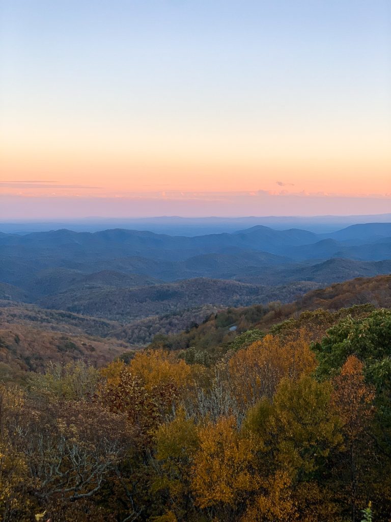
The Northern Gateway & Shenandoah National Park
- Conquer Old Rag: The Old Rag Trail is a tough 9.5-mile hike featuring a technical rock scramble to reach a bare granite summit with panoramic views of the Shenandoah Valley. We have done this one twice now and absolutely love it!
- Chase Cascading Waterfalls: Hike one of the beautiful trails to Dark Hollow Falls or complete the gorgeous loop to Rose River Falls.
Boone to Asheville
- Fuel Up in Boone: Grab a morning brew at Hatchet Coffee and load up on delicious baked goods and treats at Stick Boy Bread Company.
- Cross the Mile High Swinging Bridge: Brave the heights at Grandfather Mountain to walk across America’s highest suspension footbridge.
- Drive the Linn Cove Viaduct & Hike Crabtree Falls: Coast around the viaduct that hugs the face of Grandfather Mountain. Stop at Milepost 339.5 to hike down to the 70-foot stone wall of Crabtree Falls.
Asheville to the Great Smoky Mountains National Park
- Devour Asheville’s Food Scene: Explore the River Arts District and grab some legendary breakfast tacos at Taco Billy or indulge in the Indian street food at Chai Pani!
- Hike the Balds & Visit Orchard Coffee: Hike across the rolling meadows of Black Balsam Knob. Afterward, hop off the parkway into the cute town of Waynesville for a specialty drink at Orchard Coffee.
- Explore the Smokies: Check out the most visited national park in America: Great Smoky Mountains! Stand beneath the 120-foot drop of Mingo Falls, drive the historic loop through the valley of Cades Cove, and hike the Alum Cave Trail up to the summit of Mount LeConte. Then, drive up to Clingmans Dome, the highest point in Tennessee!
23. Everglades & Florida Keys Road Trip
This tropical road trip takes you through the marshlands of the Everglades down a gorgeous highway suspended over the ocean, all the way to the paradise of Key West. If you love gator adventures, snorkeling pristine coral reefs, and eating your weight in key lime pie, this is the perfect route!
Days Needed: 7–10 days
Closest Airports: Miami International Airport (MIA).
Where to Start & End: You’ll fly into Miami (MIA), and head into the wetlands. From there, you’ll drive south along the keys, ending in Key West before making the easy drive back up to Miami to fly home.
Best Time of Year: Fall–Spring (November to April)
Top Experiences Along the Route




The Everglades & Miami Outskirts
- Explore the Anhinga Trail: This flat 0.8-mile boardwalk winds over a beautiful sawgrass marsh. We did this trail at sunrise and the morning fog over the water was absolutely magical!
- Bike Shark Valley to the Observation Tower: This area has TONS of gators! We rented bikes to explore the flat, 15-mile paved tram road to the observation tower. We saw at least 50 alligators, including a family with baby gators!
- Grab a Shake at Robert Is Here: Stop at this legendary, family-owned fruit stand in Homestead. They blend up the freshest tropical fruit smoothies and milkshakes. We tried the Key Lime milkshake and it tasted exactly like a slice of pie in a glass!
- Eat Gator at Everglades Gator Grill: We stopped here and tried their grilled gator kabobs with peppers and pineapple. If you didn’t tell us it was gator, we would’ve thought it was just a tougher piece of chicken.
- Snorkel Biscayne National Park: This is one of the most unique national parks because it is 95% underwater! We snorkeled through the mangroves and coral reefs, plus saw the historic Boca Chita Lighthouse.
The Middle & Lower Keys
- Feed the Tarpon at Robbie’s: Pull off the highway in Islamorada to buy a bucket of bait fish, walk out on the docks, and dangle them over the edge to hand feed jumping tarpon!
- See sea turtles at the Turtle Hospital. This hospital rescues and rehabilitates sick and injured sea turtles.
- Explore Bahia Honda State Park: Stop for a swim at some of the best white-sand beaches in the Keys, and walk up the historic Old Bahia Honda Bridge for an incredible view of the island chain.
Key West & Beyond
- Stand at the Southernmost Point: You can’t leave Key West without snapping a photo in front of the famous, colorful concrete buoy marking the southernmost point in the continental United States, located just 90 miles from Cuba!
- Go on a Key West Food Crawl: Taste some amazing food in town by grabbing a strong morning Cuban coffee at Cuban Coffee Queen, show down on incredible Cuban burgers at Fritas Cuban Burgers, and sit down for an authentic traditional dinner at El Siboney Restaurant. And of course, make it a personal mission to sample a slice of key lime pie at every stop along the way!
- Visit Dry Tortugas National Park: Located 70 miles west of Key West and accessible only by boat or seaplane, this is one of the most remote and breathtaking national parks in the US. You can tour the massive 19th-century Fort Jefferson, snorkel right off the beaches, and camp directly under the darkest, starriest night skies imaginable!
In our guide to the 7 Fun Things to Do in the Everglades, we share how to make the most of one day in the park! Plus you can see us explore part of the Florida Keys in this video!
Tips for your USA road trip
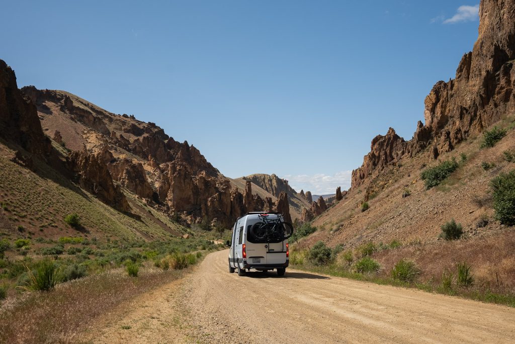
Renting a car
Any car works! You do not need a fancy vehicle to tackle most of these routes. However, for some of the western road trips, a campervan is an extra fun way to explore. The west has lots of gorgeous free camping on public lands! You can see our top van life rental companies here, plus a guide to how to find free camping.
However, some destinations, like the California Coast, the Midwest, and the East Coast are definitely tougher for van life. Unless you want to pay for a pricey campsite every single night or spend your trip parked in Walmart parking lots, we highly recommend a regular car and hotels for these areas!
Book lodging in advance
Many of these USA road trips are popular and things fill up fast! If you are planning to do any of the routes passing through national parks, you’ll want to book your campsites or hotel rooms months ahead of time.
Download offline maps
Make sure to download offline maps on both Google Maps (for driving navigation). Plus AllTrails (for hiking) before you leave home so you don’t end up lost!
Check dog friendliness
We love traveling with Kona, but not all of these USA road trips are super dog-friendly! While some routes are great for pets, places like National Parks have very strict rules about where dogs can go (usually only on paved roads and viewpoints, not trails). Always check the park rules ahead of time so you can plan the best trip for your pup!
Save this guide with the best USA road trips!
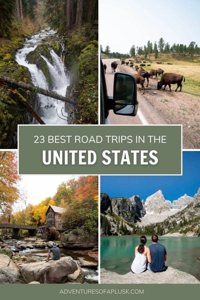

about the author
This blog post was written by our writer Nicoll. Learn a bit about her below!
After six years of full-time travel, Nicoll is now a mountain-loving mama living in Colorado with her husband Jake, their sweet baby girl Teagan, and their pup Gunner. She loves hiking, riding her dirt bike, and finding joy in the little things.