Last updated on August 21st, 2026
Want to drive to the Arctic Ocean? In this guide we’re sharing everything you need to know before driving the Dempster Highway, based on our experience!
Hands down one of the greatest adventures of our lives (and we have had many incredible experiences!) was driving the Dempster Highway in Canada’s Yukon and Northwest Territories.
Over the course of a week we experienced epic mountain peaks, complete solitude, wildlife, the northern lights, and small, authentic indigenous towns. And it all ended in Tuktoyaktuk, where we took a dip in the Arctic Ocean, something we NEVER thought we would experience in our lifetime. And what made it even cooler (literally) was that we DROVE ourselves there in our home on wheels.

Watch our experience driving the Dempster Highway, including stopping at different sights and towns, dipping into the Arctic Ocean, and getting stuck at a bridge closure for the night.
While driving the Dempster Highway is a memorable experience, it is also a bit daunting. With almost 900 kilometers (~560 miles) of remote, unpaved road, there are many horror stories. Like how you need to carry TWO spare tires, your windshield will get cracked, and how few and far between services are.
It took a bit of convincing to get Adam comfortable with the idea. And this photo below is a pretty accurate representation of how Adam felt going into the drive.

But thankfully the drive went super smoothly. Well, for the most part. And we would both agree that it was easily one of the best things we have ever done!
If you’re like us and want to drive the Dempster Highway to the Arctic Ocean, but are a bit uneasy about it, we’re here to help! In this guide we’re covering road conditions, places to stay, what to bring, important things to know, how to stay safe, and so much more for driving the Dempster Highway to Tuktoyaktuk!
Looking for more things to do in Canada and Alaska? Check out our guides and vlogs!
- 17 FUN things to do in Dawson City, Yukon Territory
- How to drive Canada’s EPIC Stewart-Cassiar Highway!
- How to have an EPIC 10 Day Vancouver Island Road Trip!
- 12+ FUN Things to do in Tofino on Vancouver Island (+ 3 day itinerary)
- The BEST things to do in Campbell River on Vancouver Island
- Sea to Sky Highway Road Trip: The Best Stops from Vancouver to Whistler (+Itineraries!)
- 3 Days in Vancouver
- Backpacking at Garibaldi Provincial Park
- Watch our Canada vlogs and Alaska vlogs!
- About the Dempster Highway
- How to get to the Dempster Highway
- What type of vehicle do you need for the Dempster Highway?
- How long does it take to drive the Dempster Highway?
- When to drive the Dempster Highway
- Important things to know before driving the Dempster Highway
- Tips for driving the Dempster Highway
- What to bring to drive Dempster Highway
- A complete breakdown of the Dempster Highway
- The start of the Dempster Highway (KM 0)
- Tombstone Territorial Park (KM 50.5 to 115)
- North Fork Pass Summit (KM 80)
- Two Moose Lake (KM 102.6)
- Blackstone River (KM 107.6)
- Sheep Lick (KM 178.4)
- Engineer Creek Campground and Sapper Hill (KM 193.8)
- Elephant Rock Pullout (KM 221.2)
- Ogilvie Ridge Viewpoint (KM 259)
- Eagle Plains, Yukon (KM 369)
- Arctic Circle Sign (KM 405.5)
- Rock River Campground (KM 445.8)
- Yukon Territory-Northwest Territories Border (KM 465)
- Peel River Ferry Crossing (NWT KM 74)
- Nataiinlaii Territorial Park and Campground (NWT KM 76)
- Fort McPherson (NWT KM 86)
- Mackenzie River Crossing (NWT KM 142)
- Gwich’in Territorial Park and Campground (NWT KM 234)
- Jak Territorial Park (NWT KM 266)
- Inuvik (NWT KM 272)
- Between Inuvik and Tuktoyaktuk
- Tuktoyaktuk
- Our Exact Dempster Highway Itinerary
About the Dempster Highway

The Dempster Highway is Canada’s most northern highway and is the only highway in Canada that crosses the Arctic Circle. It spans 900 kilometers (~560 miles) from the Klondike Highway near Dawson City to Tuktoyaktuk. And minus a small stretch in Inuvik, it’s unpaved, with varying road conditions.
History of the Dempster Highway
Construction on the Dempster Highway began in 1959 and the first 740 km (460 miles) were completed to Inuvik in 1979. It was built to accommodate oil and gas exploration and provide access to the Canadian Arctic. The road has a unique design, as it sits on top of a gravel berm to insulate the permafrost in the soil underneath. The thickness of the berm ranges from 1.2-2.4 meters (~4-8 feet) and without it, the permafrost would melt and the road would sink into the ground.
In 2017, they continued the road 152 km (94 miles) up to Tuktoyaktuk (Tuk for short), connecting the rest of Canada to the Arctic Ocean. Before that year there was no way to reach Tuktoyaktuk by car! While this stretch of the road technically is called the Inuvik–Tuktoyaktuk Highway, for the sake of this guide, we’re considering it part of the Dempster Highway.

Dempster Highway vs. the Dalton Highway
While the Dempster Highway is the only way to drive to the Arctic Ocean in Canada, it’s not the only way to drive to the Arctic Ocean! There is another road that can take you there, the Dalton Highway in Alaska.
You may be wondering why we chose the Dempster Highway over the Dalton Highway, since we spent the summer in Alaska. While both are scenic, unpaved roads that take you through mountains and wilderness, we decided on the Dempster in Canada for a couple reasons.
First, we wanted to visit Tombstone Territorial Park, which is at the start of the drive. And second, the Dalton Highway takes you mostly to oil fields in Prudhoe Bay, which isn’t overly scenic. Once here, you have to pay for a tour to get access to the ocean. The Dempster Highway, however, takes you to a small town, surrounded by pingos and you’re able to visit the ocean on your own.
Regardless of which highway you choose, getting to drive to the Arctic Ocean is a bucket list experience. But we highly recommend the Dempster Highway!
How to get to the Dempster Highway
The Dempster Highway is located 40 km (~25 miles) east of Dawson City in Canada’s Yukon Territory. This is the closest town to start your adventure, but you could also start from Whitehorse, which is 5.5 hours (493 km/306 miles) south of the Dempster Highway.
Flying to the Yukon Territory? Dawson City does have an airport (YDA), with flights from Whitehorse (YXY) via Air North, a Yukon airline. This is a tiny airport and there are no nonstop flights from other destinations besides Whitehorse.
If you want to see more of the Yukon Territory, we suggest flying into Whitehorse. Air Canada and WestJet offer flights to Whitehorse from May to September.
However, keep in mind that if you decide to fly to the Yukon Territory, you will have to rent a car. And not all car rental companies will allow you to drive the Dempster. We’ll share more about that next!
What type of vehicle do you need for the Dempster Highway?

Just about any vehicle (except electric) will work on the Dempster Highway. Having a high clearance vehicle is a plus, but not necessary. We saw all types of vehicles along the way.
However, in our opinion, the best vehicle would be a van, truck camper, or small RV. By having a home on wheels, you can be super flexible about where you drive everyday, since you’ll have more sleeping options. And you will also be able to have more comfort along the way! Besides the type of vehicle, here are some other things to consider before driving the Dempster Highway.
Have good tires
The gravel surface can be tough on tires and tires with thick tread is important. We have Falken A/T3W tires and we have been very happy with them! While driving slowly likely helped us avoid any flat tires, we also think the sturdiness of our tires played a role.
Do you need 4×4?
You do not need a 4×4 to drive the Dempster Highway. Our van is RWD and at no point did we feel we needed 4×4.
Make sure your vehicle is in good condition
The most important thing before tackling the Dempster Highway is to ensure your vehicle is ready for the challenge ahead. Make sure to have your fluids topped off, carry at least one extra spare tire, have good tires, and have any required services completed before you set off.
We met a guy on the road who bought an old SUV for the drive up and it broke down on him during his drive out, just outside of Tombstone Territorial Park. Despite a couple of us trying to help troubleshoot and get in contact with a tow truck in Dawson City, he had to stay the night in his SUV until help could arrive the next day.
Rental cars may not be allowed
If you do decide to fly to the Yukon Territory and need to rent a car for the Dempster Highway, keep in mind that many rental car companies will not allow you to drive on the Dempster Highway.
Some companies that we hear do allow it are Driving Force, Klondike Car Rental, and Overland Yukon.
In our opinion, driving a rental would be a bit risky, as you run the risk of damage or issues happening on a car you’re not familiar with. But it isn’t impossible! If you do rent, make sure you pay for windshield coverage, have a spare tire, and have tools to change a spare. You also may be charged additional fees to drive the road, due to how rough it can be on vehicles.

Wash your vehicle afterwards
Your vehicle will be a nice shade of brown by the time you finish the Dempster from all of the mud and dirt that you accumulate along the way. And while it may be obvious, when finishing the Dempster Highway, make sure to wash your vehicle. The road is treated with calcium chloride to keep dust down, so you’ll want to make sure you get that off your vehicle.
How long does it take to drive the Dempster Highway?
According to Google Maps, the drive, without any stops, takes between 13 to 14 hours one way. However, you will want to stop and depending on different factors, like road conditions, construction, and the ferry schedule, it will take longer.
We drove the entire Dempster Highway in 7 days. Our drive up to the Arctic Ocean took 5 days, which included a full day at Tombstone Territorial Park. While we did the drive back down in 2 days. So technically it’s doable in about 4 days, but we didn’t stop to do anything on those 2 days back down and drove ALL day.
We will share our exact itinerary at the very end of this guide!
When to drive the Dempster Highway

The Dempster Highway can technically be driven year round, but with a few caveats.
- Many of the businesses and campgrounds are only open seasonally.
- During certain periods in the spring and fall, the Mackenzie and Peel River crossings are either thawing or still freezing. Because of this, the ferry service won’t be running and the rivers won’t be frozen enough for vehicles to drive over. The road closes for 6-8 weeks in the fall to allow the rivers to freeze and 3-5 weeks in the spring for the rivers to thaw.
- In the winter, you will be driving on ice and snow, which should only be done by experienced winter drivers.

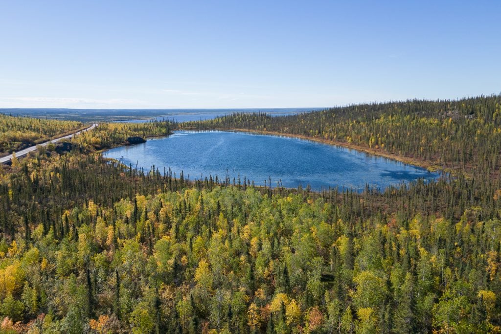
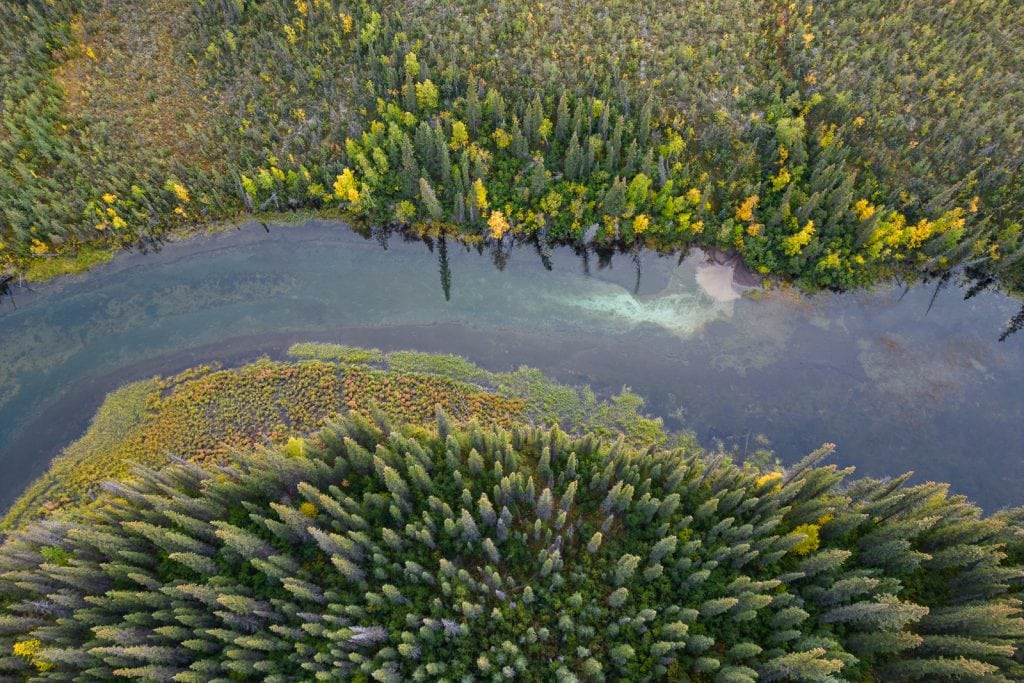
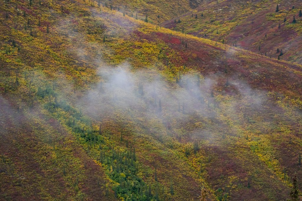
In our opinion, the best time to drive the Dempster Highway is from June to very early September. We drove the Dempster Highway from August 30, 2022-September 5, 2022.
While this timeframe was perfect for seeing the amazing fall foliage along the way, we’d suggest going about a week earlier. We ran into a couple issues where places were already closed for the season, including a spot that served fish and chips we were excited about. But had we gone a week earlier, we could’ve gone to that spot and still seen the fall foliage on the way back.
This guide is written based on our experience in the late summer. If you plan to make this journey outside of the summer you’ll need to do a lot more planning and preparation to ensure you’ll have enough food, fuel, water, and any other necessities along your route.
Important things to know before driving the Dempster Highway

Road surface
Except for the first 5 km and the portion in Inuvik, the Dempster Highway is all hard packed gravel. It is a decently maintained gravel road, but you will find washboarded sections, plus potholes. You also need to be mindful of soft shoulders, large rocks, muddy spots, and frost heaves, which are like natural speed bumps in the road.
Before driving the road, we were pretty nervous about how rough it would feel. Since we travel in our van, with cabinets and lots of things that can shake on unpaved roads, we were worried that it would be loud and annoying. However, we both agreed that the road was nowhere near as bad as we built it up to be in our heads.
During our drive, we found the portion of the road between the Klondike Highway (Highway 2) and Tombstone Territorial Park to be one of the roughest and worst sections. The section before Eagle Plains was also a bit rougher and since the Inuvik-Tuktoyaktuk Highway is still only a few years old, the surface isn’t as compact, so it can feel a bit bumpier. But if like us, you have lots of gravel road experience, you won’t find the road to be too bad.
Ferry crossings
Along the way you will cross two rivers via ferry, the Peel River and Mackenzie River. When traveling northbound, the Peel River will come first. This ferry operates on demand from roughly 9 AM to 1 AM and the Mackenzie River Ferry operates on the hour from roughly 9 AM to 11 PM.
You can learn more at the Northwest Territories website to see up to date hours of operation and opening and closing dates. Both ferries are FREE and are a neat experience!
Flat tires
As we have mentioned, flat tires are very common on the Dempster Highway. We met 4+ groups that encountered one and have heard countless stories of others. Make sure you have all of the tools to change a tire and know how to do so!
Windshield damage
It is very common to get a chip on your windshield. That is just a reality of driving hundreds of miles on gravel roads! Thankfully we did not get any chips (we already had a few though!). And our biggest tip for avoiding them is to slow down when passing oncoming vehicles.
Check road conditions
No matter the season you are driving, road conditions and weather can change rapidly. Keep an eye on the road conditions. Be sure to keep the Yukon 511 and Northwest Territories highway conditions websites saved and check them often for updates on road conditions and possible construction.
You can also pop into the Dempster Highway Visitor Center in Dawson City to read road reports by recent travelers and speak with someone who has driven it many times. They will be able to answer all of your questions about the road, culture, amenities, history…they know it all about the Dempster Highway!

Cell Service + Internet
Cell service was spotty to non-existent during much of the drive. In towns, you won’t have many options to find Wi-Fi, but you will have cell service.
Below is some information on our setup and experience with connectivity on the Dempster Highway.
Our internet set up
When we did the Dempster Highway in 2022, we relied solely on data plans through cell phone providers to have internet on the road.
We have Verizon Wireless for our phones and were able to connect to Canadian providers for free with our plan, utilizing the same text and talk allowances (unlimited) we have back in the United States.
But for data, Verizon Wireless only gave us 2 GB of high speed data per day, per device (we have two cell phones, plus a Verizon hotspot device), which runs out quickly, as we rely on data for work.
We also have an AT&T hotspot device, but unfortunately it was not eligible for any international data, so we couldn’t use it at all. In the past when we had AT&T phones, we were able to use our phones normally in Canada, unlimited data and all.
Starlink
Have Starlink? You’re in luck! As of 2023, Starlink now has coverage all the way up in the North Country, including the Yukon and Northwest Territories. During our visit in 2022, Starlink only covered about halfway up British Columbia, so it was not worth the investment for us.
We do have Starlink now and HIGHLY recommend it if you need to work from the road! If we ever do the Dempster Highway again, this would allow us to spend more time out there in the future. And acts as an additional safety feature if you need to contact someone for help!
Services along the Dempster Highway
The Dempster Highway is a very remote experience. There are limited services and only four towns that offer any amenities: Eagle Plains, Fort McPherson, Inuvik, and Tuktoyaktuk. Inuvik is the largest of them all, but all four towns offer fuel, lodging, and a restaurant or convenience store.

Fuel
The largest stretch without fuel on the Dempster Highway is from the start of the drive (there is a gas station right here) and Eagle Plains, which is 368 km (228 miles).
A general rule of thumb for fuel in this part of Canada is to never let your tank get below half full. It is recommended to fill up at every opportunity.
Just in case your vehicle has a small fuel tank, you lose track of your fuel level, or the gas station you were banking on is unexpectedly closed, it might be a good idea to carry extra fuel. We brought 2 two gallon Rotopax fuel canisters for our adventures, but never had to use them. Although, we do have a 24 gallon diesel tank and get about 20 MPG, so we can go for long distances without needing fuel.
Grocery stores
You won’t find any grocery stores along the Dempster Highway except in Inuvik, the largest town on the highway. Plus a very small store in Tuk. We recommend stocking up as best you can in Dawson City. Oddly enough, we found the grocery store in Inuvik to have more selection and inventory than the stores in Dawson City.
If you keep your expectations low and be flexible with your meals you’ll find enough to get you by in both towns. We tried to stock up on non-perishable food items, like pasta sauce and noodles, to not risk any food going bad over the drive.
Laundry
We didn’t personally do any laundry along the Dempster Highway, but Bob’s Gas does have a laundromat in both Inuvik and Tuktoyaktuk.

Where to sleep
Since this is a road trip, your lodging will change every night. It seems that most travelers on the Dempster Highway are RVers or van lifers, so you will stay in your home on wheels, but the location of your home will vary. There are lots of free, boondocking spots along the route! We won’t be sharing all boondocking spots in this guide, as we didn’t stay at too many, but iOverlander is a great resource to find more.
Curious how we find free campsites? Check out our detailed guide to free camping to learn which tools we use, rules to follow, and other tips!
If you prefer a formal, paid accommodation, you can find some lodges, developed campgrounds, and motels. The majority of these will be in Eagle Plains, Fort McPherson, Inuvik, and Tuktoyaktuk. For motels, we suggest booking ahead of time so that you can ensure you have a room. We will list these specific lodging options under our breakdown of the highway below!

Wildlife
If you’re lucky, you’ll see a lot of wildlife along the Dempster Highway! The area is home to caribou, sheep, eagles, and of course, bears (grizzly and black bears). So make sure to stay alert and slow down if you notice any near the road. Unfortunately for us, we only saw one black bear (which was still exciting!) and an eagle.
You may be thinking, “wait, don’t polar bears live in the arctic?!” And while they do, it’s pretty rare to see a polar bear along the Dempster Highway. They have been seen in Tuk, but there’s about a 99% chance you will not see one.
Bugs
One thing you may hear a lot about when heading north are mosquitoes. However, we didn’t find them to be too bad overall. We traveled later in the season so that probably helped. We hear they can be pretty ferocious at times, though! So make sure to be prepared to fight off the little bloodsuckers!
Tips for driving the Dempster Highway

Drive slow!
We experienced so many people driving fast and passing us. And several times we saw some of those same people an hour or two down the road, pulled over and changing a tire. We rarely drove the 90 km (55 mph) speed limit and had zero flat tires. Yes we traveled slowly, but we didn’t have any tire issues and got to enjoy the scenery even more. So we call that a win!
Slow down when passing a vehicle
When getting passed by a car or having a vehicle drive past from the other direction, we suggest slowing down a bit. Other vehicles kick up rocks and debris, which increases your chance of getting a chipped windshield or other damage.
Check on those pulled over
One thing we loved about the Dempster Highway is that people looked out for each other. Whenever someone was pulled over, multiple people would check to make sure they were okay or help them if needed. The sense of community with other travelers, even though we didn’t know each other, put us at ease a bit!
What to bring to drive Dempster Highway
We’ll cover everything you need to bring for this adventure below, but we can’t stress it enough: be prepared! Make sure you have good, quality equipment and enough supplies to keep yourself safe. There isn’t much traffic on the Dempster Highway and if you break down or need help, it might not come for a day or two.
We feel like we encountered a wide range of events that could happen on this road including car issues, breakdowns and flat tires (not ours thankfully), bridge closures, unavailable amenities, and more. It is very important to have the gear and knowledge to be self-sufficient.

Tire repair kit and a spare
Make sure you pack a tire repair kit and have at least one spare tire for your trip. While it’s recommended to have two spare tires, this is a bit tough for most vehicles to carry. We felt comfortable with just one and the repair kit.
Roadside emergency kit
We recommend bringing a roadside emergency kit, which will have jumper cables, first aid supplies, a roadside warning sign, emergency blanket, tow strap, and more!
Fluids for your vehicle
Make sure to carry any fluids you might need to keep your vehicle running smoothly, like DEF for the diesel folks out there. Or top off with everything you need beforehand!

More than enough food and water
There are very limited places and communities to eat and get groceries along the way, so you’ll likely be packing your own food and cooking your own meals. Make sure to bring plenty of water and food/snacks for the journey. With a long road trip with challenging road conditions like the Dempster Highway, you never know what may happen.
For example, on our journey back down the Dempster a semi truck misjudged the crossbar over a bridge and damaged the bridge. The bridge closed and we had to stay the night with about 20 others at the bridge, waiting for crews to come and assess the damage and open it up. Luckily, the bridge was reopened the day after we arrived and we had plenty of food and water on us. But some people had been stuck there for 24+ hours!
With that said, it’s a good idea to carry more food (and water!) than you think you need, especially non perishable items, just in case you break down, you decide to spend more time in one area, or a bridge gets damaged by a semi truck.
Download offline maps & documents
Since you may not have cell service for multiple days of the drive, we highly suggest downloading offline maps (both Google Maps and AllTrails maps), plus any documents you may need before you hit the road. We kept our itinerary on a Google Sheet, so we made sure to have that downloaded, plus the routes for any hikes we wanted to do.
Want to get 30% off an AllTrails Plus membership? Use our code aplusk30 (you must redeem this code on the website, not the app)!
We use AllTrails Plus on every single hike and it is the most helpful hiking tool out there! Some of the features we love are offline maps (so we can navigate even without cell service), wrong-turn alerts, and its 3D maps feature, so we can get a feel for trails before we hike.
Satellite Device
It’s a good idea to bring a satellite device, like a satellite phone or Garmin inReach Mini, just in case you need help and don’t have any service. If you don’t have your own, you can rent these from Up North Adventures and Yukon Wide Adventures, both in Whitehorse.
Our Garmin inReach Mini came in handy many times along the Dempster Highway, both to keep our families updated on our drive and also to troubleshoot issues.
When our check engine light came on in the middle of nowhere, we used the Garmin to message my dad to have him help us figure out what was wrong. We also used it to communicate with others we met at the bridge closure, who were also carrying satellite devices, as well as to have my dad help troubleshoot another person’s vehicle issues.
Hiking Gear
If you’re doing any hiking, make sure to bring the appropriate hiking gear with you (see what all we take here!). We also always recommend having the 10 essentials on you, which can come in handy both for hiking or for your road trip!
Binoculars
You may see lots of wildlife along the highway and having binoculars is a must! Adam got these Bushnell H20 Roof Prism binoculars for his birthday in 2021 and we love them!
Bear spray
There is plenty of wildlife to see when driving the Dempster Highway, especially bears. If you plan to hike or camp in a tent, make sure to bring bear spray and more importantly, know how to use it.

Bug repellant
Although we didn’t experience much of a problem with bugs and mosquitos compared to what we expected, they can be notoriously thick in the North Country. For our trip we bought a Thermacell and brought bug spray with DEET.
Swimsuit
You might not think to bring your swimsuit to the Arctic Ocean, but if you drive all the way to the Arctic Ocean and don’t take a dip – then what’s the point?!
Podcasts and music to listen to
No road trip is complete without some groovy tunes and fun podcasts. Make sure to download them for offline use!
Camera
You will definitely want to bring a camera with you on this adventure! Any camera will work great, but if you’re curious what cameras and gear we use, check out our gear list.
Cash
Many of the campgrounds and some businesses along the way only take cash, so make sure to have some Canadian currency on you!
Fishing license
If you plan on fishing along the way, make sure to purchase the appropriate fishing license before you go and read up on the regulations. You can find info at these websites for both Yukon and Northwest Territories.
A complete breakdown of the Dempster Highway
For the next part of this guide, we’re breaking down the Dempster Highway by major landmark. We’re including details on what to expect, any amenities and services, things to do, and places to stay.
We have also created this custom Google Map, which includes the majority of the stops we are listing below. You can download this map to your phone and be able to access it while on the road!
To see how we structured the drive, scroll down to the end of this guide for our itinerary!
Note: This information below is all based on our visit in 2022. While we have double checked information, we cannot guarantee that things will be the same for future years.
The start of the Dempster Highway (KM 0)

Get ready for the road trip of a lifetime! The Dempster Highway starts right about here, across from a gas station. Make sure to fuel up and take a photo with the Dempster Highway sign before hitting the road. Oh and enjoy the pavement for the first 5 km because it’s the last of it you’ll see until Inuvik!
Tombstone Territorial Park (KM 50.5 to 115)

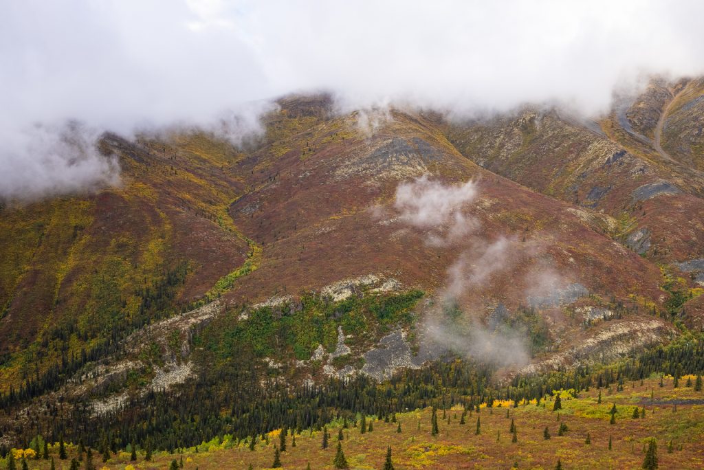
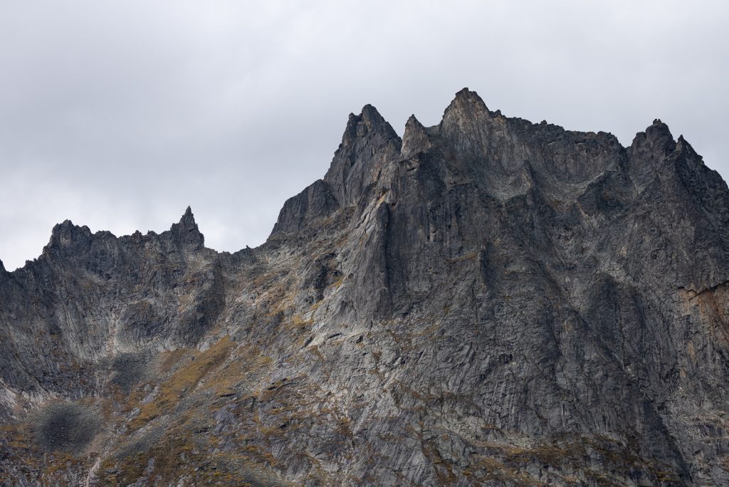
Tombstone Territorial Park is located along the Dempster Highway between kilometer 50.5 to 115. It is on the traditional territory of the Tr’ondëk Hwëch’in First Nation, who called the mountains “ragged mountain land” in the Han language. And it’s a very accurate description!
The park is known for its incredible scenery, including rugged peaks, permafrost landforms, and abundant wildlife. In fact, it’s sometimes referred to as Canada’s Patagonia.
In our opinion, this is a MUST visit stop on the Dempster Highway. It’s some of the most stunning scenery of the drive!
Things to do

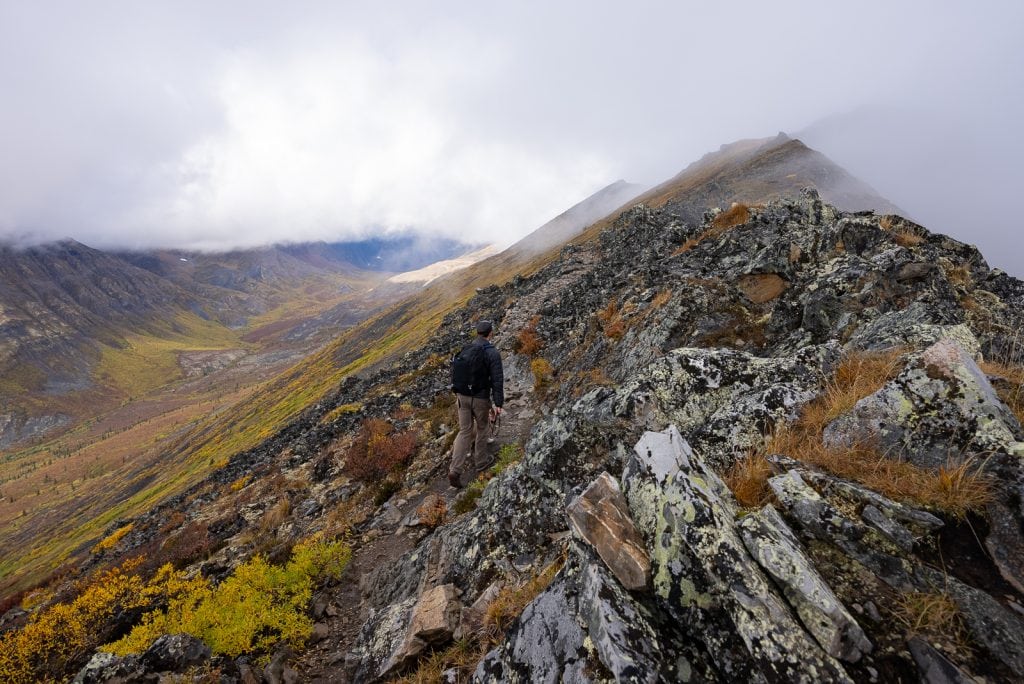
Hike to Grizzly Lake
The Grizzly Lake Trail is an epic 22 km (13.8 miles) roundtrip hike that is usually done as an overnight trip, but can be done in one day, which is what we did. It is a strenuous hike and will take the whole day, but if you start early it is doable and SO worth it!
You are above the treeline basically the entire hike and have nonstop views. But the best part is when you get close to Grizzly Lake and see the insanely jagged peaks that surround it. It’s unreal! And it didn’t hurt that we did this hike at the very end of August, which is the start of fall in the Yukon Territory. The terrain was full of golden, orange, and red hues.
Watch us hike the Grizzly Lake Trail in Tombstone Territorial Park
Goldensides Mountain Trail
If you don’t have the time or ability to hike to Grizzly Lake, Goldensides Mountain is a popular day hike. It’s 3.7 km (2.3 miles) round trip and gains 203 meters (666 feet), making it doable for most visitors!
Backpack to Grizzly Lake, Divide Lake, and Talus Lake
Next time we visit we’d love to hike the Grizzly Lake, Divide Lake, and Talus Lake Trail. This is a multi-night trip that continues beyond Grizzly Lake, to other gorgeous lakes higher up in the mountains.
Note: Backcountry camping in Tombstone Territorial Park requires a permit and advance reservation of a campsite. There are limited backcountry campsites and they do go fast. The silver lining to this is that oftentimes campsites come available a couple nights before. So be sure to check often to see if any come available for the dates you’re interested in.
Visit the Tombstone Interpretive Center
To learn more about the area and the local First Nations, visit the Tombstone Interpretive Center. They have different exhibits, plus rangers that can give you suggestions of things to do in the park. It is open mid-May to mid-September.

Tombstone Range viewpoint
The Tombstone Range viewpoint is a great, quick roadside stop to get a view of the mountains.
Where to stay
Campgrounds
This is the only campground in the park and is first-come, first-served. Despite us going later in the season, it was extremely busy when we visited. We arrived later in the day and couldn’t get a spot. But if you arrive earlier, you will likely have a good chance at getting one of the 51 spots. However, if you don’t get a campsite they do offer overflow parking, which is what we had to do. The overflow parking does still cost the same as a spot, so we’d suggest boondocking nearby instead.
Dispersed camping
Open Gravel Area KM 88 (we stayed here for one night with a handful of others after hiking Grizzly Lake)
Spot by the river
Small spot by the Blackstone River



North Fork Pass Summit (KM 80)
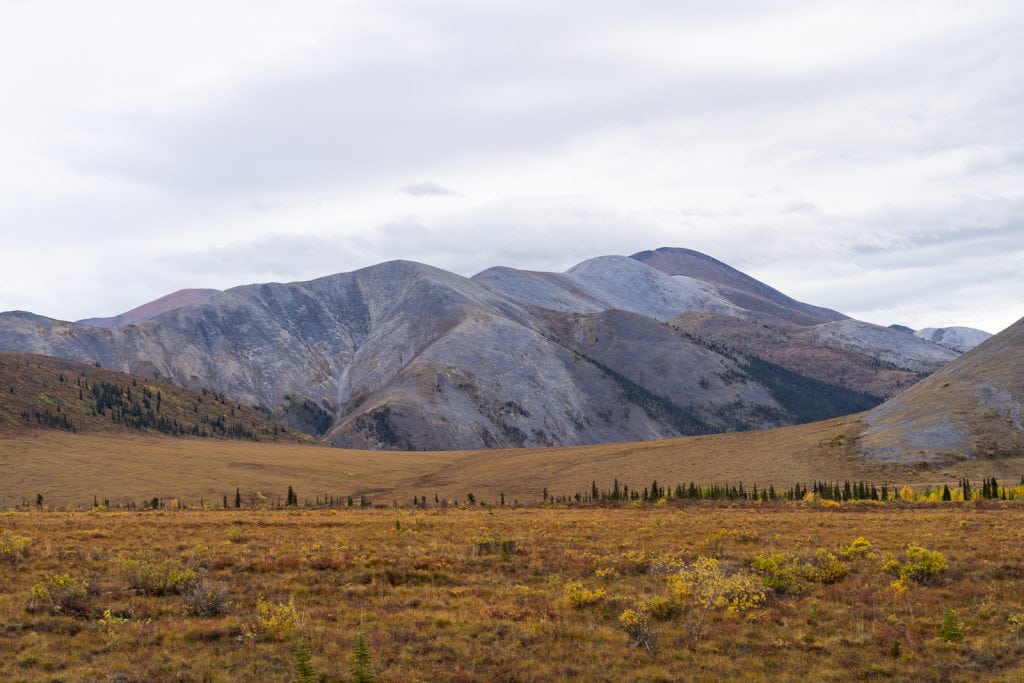
The North Fork Pass Summit is the highest point on the Dempster at 1,400 meters (4,593 feet). This is also a continental divide, where rivers to the north flow to the Beaufort Sea via the Mackenzie River and rivers to the south flow into the Bering Sea to the west via the Yukon River.
From here on you are traveling through mostly permafrost! Wherever you see tundra, the soil underneath is likely frozen.
Two Moose Lake (KM 102.6)
While there aren’t many moose in this area, if you are to see some, it will likely be here around Two Moose Lake. There is lots of shrubbery around the lake and moose are sometimes seen here feeding on it.

Blackstone River (KM 107.6)
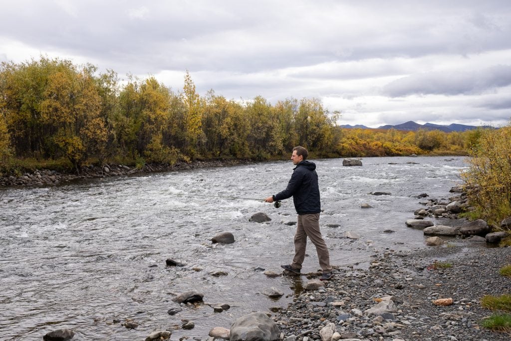
The Blackstone River is one of the many rivers you’ll encounter along the Dempster Highway. And around 107 km into the drive you can find a rest area along the river, which has two pit toilets and some trash cans.
This is also a great spot to fish! Adam spent a few hours fishing here for Arctic Grayling. He hooked one, but unfortunately it swam away…womp womp!

Sheep Lick (KM 178.4)
As you’re passing through this area keep an eye on the hillsides across the water and look for little trails leading to the water. Engineer Creek is rich in calcium and magnesium and the resident Dall Sheep come down to drink the water to add these minerals to their diet. You can see them by the water or sunning on the hill sides!
Engineer Creek Campground and Sapper Hill (KM 193.8)
Here you’ll find a Yukon government campground with about 12 sites. It’s a first-come, first-served campground that costs $20 (in cash) at the campground or $18 if you get your camping pass in advance.
The campground sits just below towering dolomite cliffs that you can actually hike up to via the Sapper Hill Trail. This short, but steep, hike will take you among tors, which are towers and spikes of rocks that are the result of frost shattering.
It looks like an amazing hike and we intended to hike it, but unfortunately ran out of time…next time for sure!

Elephant Rock Pullout (KM 221.2)
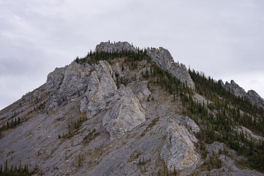
For a quick stop, check out the Elephant Rock Pullout! If you look southeast across the river, you can see a rock formation on the rock that resembles an elephant.
Believe it or not, elephants once roamed the Yukon! Wooly mammoth bones have been found in the territory and the animals are believed to have lived here only 8,000 years ago.
We will say that binoculars will help quite a bit with looking at the rock, so make sure to have them handy!

Ogilvie Ridge Viewpoint (KM 259)
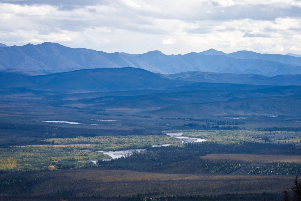
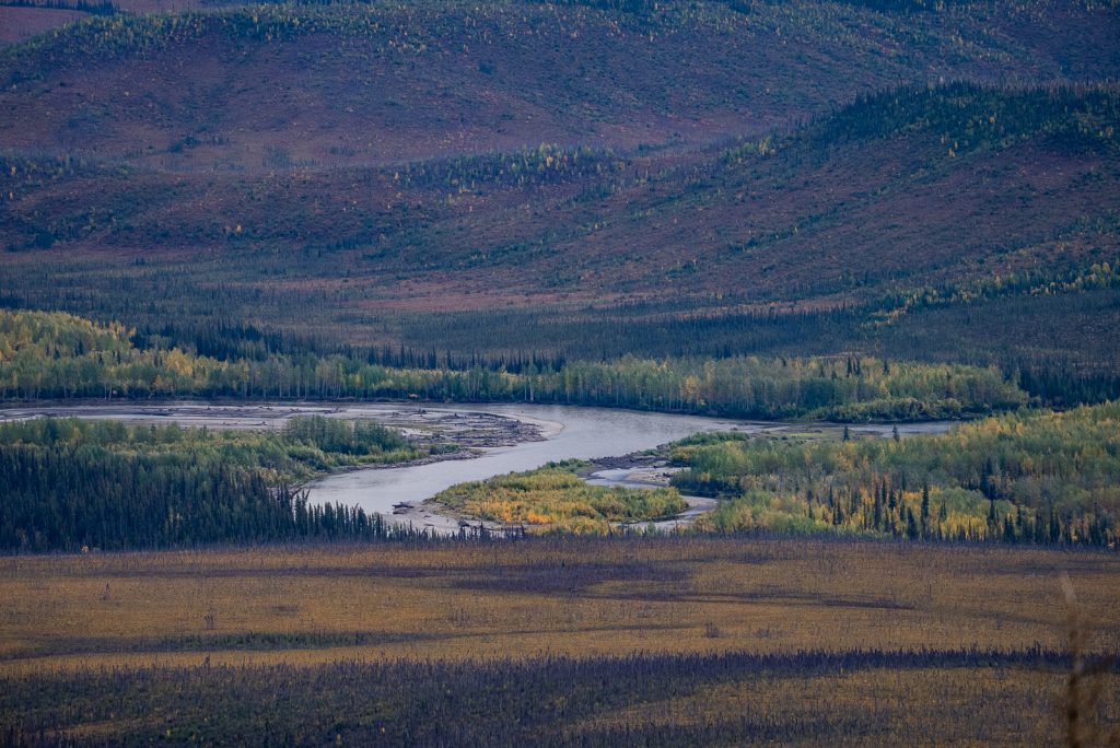
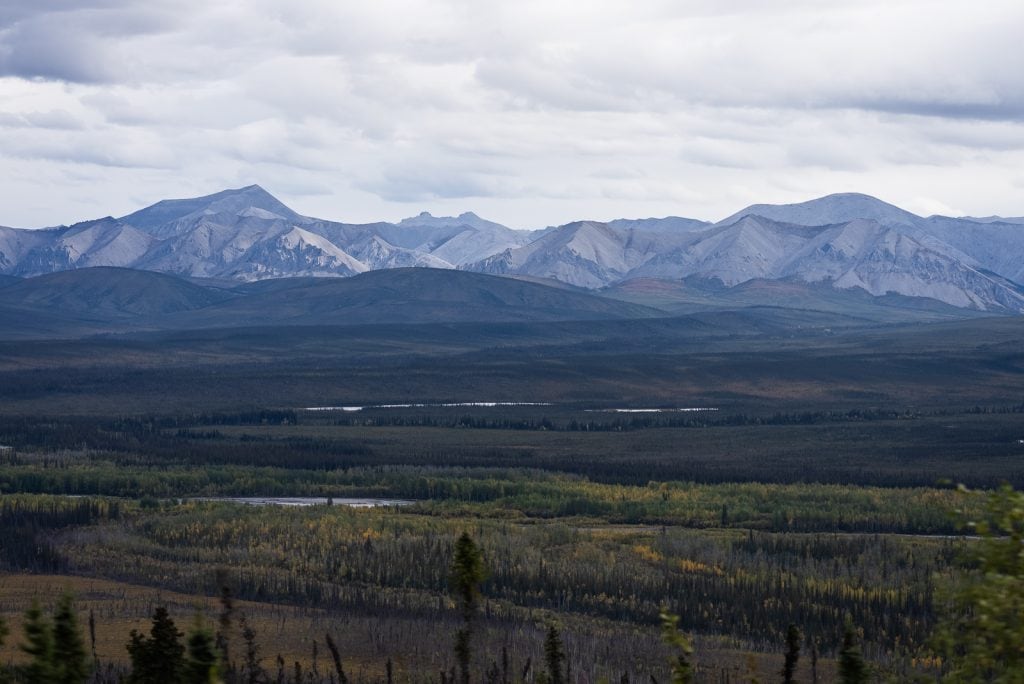
One stop that we loved along the drive was the Ogilvie Ridge Viewpoint. From this viewpoint you have sweeping views of the Ogilvie Mountains and Eagle Plains, which were filled with golden trees.

Eagle Plains, Yukon (KM 369)
You have made it to the mighty metropolis of Eagle Plains! When we passed through they boasted a bustling population of 9!
Eagle Plains is your first fuel stop, so make sure you stop and fill up! This gas station was a neat experience in itself. It’s much more old school than modern day gas stations. The diesel pump was unlike anything we had seen!
Besides the gas station, there is a tire shop here, plus a restaurant. And if you need a place to stay, you can stay at the Eagle Plains Hotel or the Eagle Plains Campground & RV Park.

Arctic Circle Sign (KM 405.5)
Welcome to the Arctic Circle!
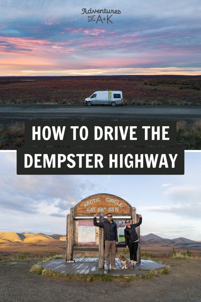
For us, this was the first of many extremely exciting moments along the drive. The ARCTIC CIRCLE! We just drove to the ARCTIC CIRCLE!
You’ll find a large pullout off the side of the Dempster Highway, where you can stop and snap a photo with the Arctic Circle sign. And a bonus is that the scenery in this area is gorgeous! We were treated to golden and red rolling mountains, as the sun was beginning to set. But if you happen to visit here on the Summer Solstice, the sun will never set!

Rock River Campground (KM 445.8)
If you need a place to stop and sleep, you can find the Rock River Campground shortly after reaching the Arctic Circle. It’s a Yukon government campground with 17 sites. And similar to the Engineer Creek Campground, it costs $20 (in cash) at the campground of $18 if you get your camping pass in advance.

Yukon Territory-Northwest Territories Border (KM 465)
Less than 60 km from the Arctic Circle sign is another big accomplishment…getting to the Northwest Territories!
This entire road trip was something we never thought we’d do in our lifetime. But crossing into the Northwest Territories was extra special because growing up in Texas, it’s not a place you ever hear about. Knowing we were getting to experience this remote part of Canada was such a cool feeling.
Make sure to stop at the sign for a photo! And don’t forget to move the clock ahead 1 hour because you are now on Mountain Standard Time. You’ll also notice that the kilometer markers will reset to 0.

Where to stay
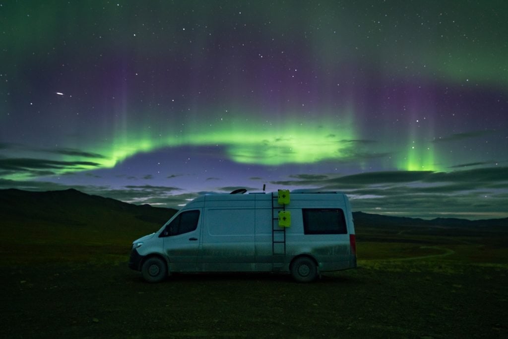
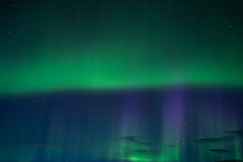
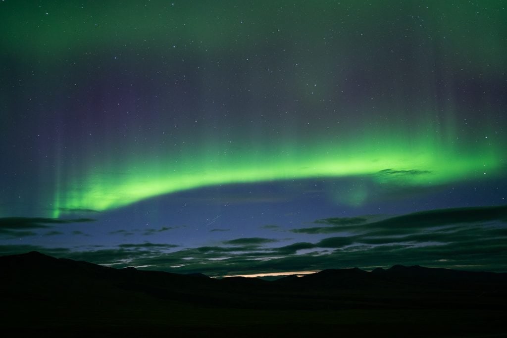
We arrived in the Northwest Territories very late at night, just after the sun had set. So our goal was to find a spot to sleep right away. We headed to this spot a few minutes down the road from the border. It’s an open space up on a hill, with amazing views and no civilization in sight. And at around 2 AM, we woke up to peek outside and were treated to one of the most magical moments of our lives…we saw the Northern Lights!
Peel River Ferry Crossing (NWT KM 74)
We left our boondocking spot around sunrise and got to experience gorgeous glowing light as we made our way to the Peel River Ferry. This part of the drive experiences a variety of scenery. You start with bare mountains and end with more green, forested terrain, plus water around.
The Peel River Ferry will be your first of two ferries on the Dempster Highway. This ferry is a cable ferry, which means the ferry is pulled across the river by a cable! It’s pretty neat to ride and it only takes a few minutes!
The ferry operates from early June to mid October and is free to ride. Make sure to check the NWT website for current operating times! We got there early for the first ferry of the day and had no issue getting on.

Nataiinlaii Territorial Park and Campground (NWT KM 76)
Meaning “water flowing out in all directions,” Nataiinlaii Territorial Park was for many years a hunting and fishing ground and an important transportation route.
The park offers a campground with 23 first-come, first-served, non-powered sites with picnic tables, firepit, firewood, and water fillup. We believe the sites are around $23 CAD and since there is no internet, you will need to pay with cash.
There is also a visitor center with an interpretive center, showers, and a kitchen shelter. You can enjoy a trail with views of the Peel River too!

Fort McPherson (NWT KM 86)
Just a quick drive from the river is the hamlet of Fort McPherson! This hamlet is home to the Tetlit Gwich’in First Nation, who call the hamlet “head of the waters-town” in their language of Gwich’in. It was also the principal Hudson’s Bay Company trading post in the Mackenzie Delta for over 50 years.
We also stopped to refuel here. Remember to fuel up every chance you get! There is also a small grocery store here if you’re looking for a snack.

Things to do
There aren’t a ton of things to do in this area, but one thing to check out is the Lost Patrol Gravesite.
Between 1904 and 1921 the Royal Northwest Mounted Police would make a trip between Dawson City and Fort McPherson to deliver mail and other dispatches. In December of 1910, a group of four police left Fort McPherson with supplies for 30 days, but never made it to Dawson City. The patrol headed south, dismissed their guide a few days into the trip, and soon got lost.
In Dawson City, the patrol was more than a month late so a search party led by Corporal William John Dempster sought out to find them. They found the lost patrol in February of 1911 frozen in the snow. The bodies were recovered and buried in Fort McPherson and a memorial was created in 1938. And in 1963, the highway was named after Dempster, years before it was even completed.
Where to stay
The Peel River Inn is located right by the gas station in town.
Mackenzie River Crossing (NWT KM 142)
After a bit more driving, you’ll make it to your next ferry to get across the Mackenzie River, the longest river in Canada and second longest in North America, after the Mississippi!
Like the Peel River crossing, you’ll take a ferry to get across the Mackenzie and this one is free and operated seasonally. Make sure to check the times!
This ferry took longer than the Peel River crossing. It has two total stops, so depending on where people need to go, you may make another stop first.

Gwich’in Territorial Park and Campground (NWT KM 234)
The Gwich’in Territorial Park and Campground has beautiful scenery and opportunities for recreation like fishing and canoeing/kayaking. At the campground you can find 15 non-powered sites and 4 tent sites with firepits. There is also potable water, kitchen shelter, and toilets.
We can’t find any information on pricing, so make sure to have enough cash handy if you decide to stay.

Jak Territorial Park (NWT KM 266)
Just a few kilometers south of Inuvik is Jak Territorial Park, a small park with a nice campground. We stayed here one night after exploring Inuvik and would recommend it!
The campground includes 11 powered sites and 25 non-powered sites. During our visit, we paid $24 for the campsite, which included showers.
But our favorite part of the park was the 10 meter high lookout tower that has impressive views of the Mackenzie Delta and Richardson Mountains!
Inuvik (NWT KM 272)
You’ve made it to the largest town on the Dempster Highway…Inuvik! This is the largest Canadian community north of the Arctic Circle and offers just about anything you’ll need on your Dempster Highway journey. It’s worth spending a few hours here or staying for the night, like we did!

Things to do
Get a photo at the Inuvik Sign
As you enter town, it’s hard to not notice the beautiful Inuvik sign. It’s designed to resemble the Northern Lights and makes for a great, quick photo opp!
Check out the Igloo Church
One of the most photographed buildings in Inuvik is the Our Lady of Victory Church, also known as the Igloo Church. It is a Catholic Church that was built to imitate the Inuvialuit igloo-style snow houses and it’s very unique on the outside.

Western Arctic Regional Visitor Center
Make sure to visit the Western Arctic Regional Visitor Center to get your “I crossed the Arctic Circle” certificate! They also have a nice exhibit inside that showcases some indigenous history and culture of the area, plus information about wildlife. It’s well worth the visit!
Inuvik Community Greenhouse
The people of Inuvik have transformed an old hockey rink into a community greenhouse, which is a neat way to take advantage of all that sunlight! Tours of the greenhouse are offered in the summer months and you can check out their Facebook page to learn more.

Take a walk around Boot Lake Trail
If you’re looking for somewhere to stretch your legs, the Boot Lake Trail is a good option! You’ll hike around the little lake and also get views of the east channel of the Mackenzie River. It is a well maintained gravel trail that’s easy to access from town. We really enjoyed our walk here!
Great Northern Arts Festival
If you time your visit in July, check out The Great Northern Arts Festival. This is a 10 day fine arts and performing arts festival with workshops, galleries, and evenings of song, dance, and stories. It showcases artists from the Northwest Territories, Yukon, Nunavut, and other areas.
Places to eat
We really wanted to eat at Alestine’s, which we hear has amazing fish and chips, tacos, and a dessert called a piece of tail. Unfortunately they were closed for the season when we rolled through town. So if you go earlier than us, you may be in luck!
Services
Grocery store: NorthMart had a decent selection of the staples. They also sell other items, like clothes and snowmobiles, plus have fast food inside.
Fuel: There are a handful of gas stations in Inuvik, like Northwind Gas Station and Bob’s Gas Station. Be sure to fill up! We also got a discount for Bob’s Gas Station from the Inuvik Visitor Center, which I am not sure if they still do, but it’s worth trying to get!
Laundry: Bob’s Gas Station has a laundromat.
Cell service: We had full bars of service in Inuvik!
Water fill up and dump station: Happy Valley Campground. According to iOverlander, you can use their dump station and fill up on water even if not staying here.
Where to stay
Hotels
Campgrounds
Happy Valley Territorial Park
Jak Territorial Park (mentioned above)
Boondocking
There aren’t many boondocking options around Inuvik, which is why we opted to camp at Jak Territorial Park.
Between Inuvik and Tuktoyaktuk

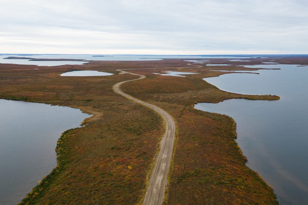
The stretch of road between Inuvik and Tuktoyaktuk was completed in 2017 and the road surface is a bit different. The road surface seemed to be a bit chunkier and not as worn down, which made for what seemed like a rougher ride. There isn’t much to stop and do on this stretch so drive safely, take your time, and enjoy the unique scenery. You will be surrounded by tundra, passing ice hills, thousands of lakes, and solitude!
If you leave Inuvik early like us, you may be treated to an EPIC sunrise! What a way to start an exciting day!

Tuktoyaktuk
And now for the BEST part of the drive…you have made it to Tuk and the ARCTIC OCEAN! What an accomplishment! There are no words to describe the feeling we had when we pulled up to the end of town and saw the Arctic Ocean sign. It was unreal!
Beyond the Arctic Ocean, Tuk is an interesting place to visit in itself.
It’s a very small Inuvialuit community and was inhabited by the Inuvialuit for centuries, before being established in 1936 as a Hudson’s Bay Company trading post and transport depot. It originally was named Port Brabant, but was renamed in 1950 and was the first place in Canada to revert to its traditional Indigenous name.
Despite becoming more popular to visit, it has an extremely authentic feel to it. Minus the campers you’ll see parked by the Arctic Ocean, you’ll mostly be surrounded by locals and their homes. You won’t find many shops or restaurants or amenities, but you will get a glimpse into what life by the Arctic Ocean looks like.
Things to do

Take a photo with the Arctic Ocean sign
You’ve driven all this way…you gotta get a photo with the Arctic Ocean Sign to prove it!
Take a dip in the Arctic Ocean
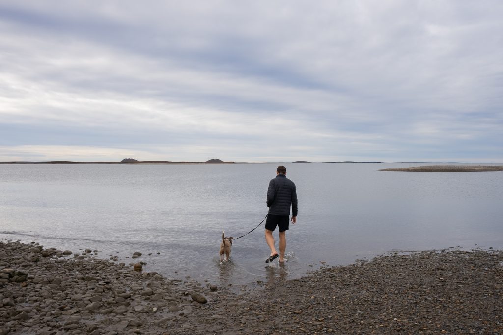
A must do on our trip was to take a swim in the Arctic Ocean! Even if you don’t go full body, at least dip your feet in! We went to a beach-like area near Grandma’s Kitchen to get into the water. It was definitely cold, but as someone who hates cold water, I was able to dunk my whole body.

Visit the Visitor Center
Make sure to pop into the Visitor Center to get any questions you have answered. They’ll have the scoop on any restaurant hours and other activities. You can also get another certificate for making it to the end of the road!
You can see their hours on their Facebook page. Also, if you plan to camp by the ocean, this is where you’ll pay for your site.

Pingo National Landmark
Our favorite thing we did in Tuk, minus getting into the ocean, was visiting Pingo National Landmark.
Pingo is the Inuvialuit word for “small hill.” They are a kind of “periglacial” landform, meaning they are created through processes of freezing and thawing. Pingos are covered with tundra on the outside and the core is ice. They are basically ice dome hills and they grow in much the same way that a can of soda expands as it freezes. They have been used by the Inuvialuit for centuries as navigational aids, as well as to spot caribou and whales.
The area around Tuk is home to over 1,350 pingos, which is the highest concentration in the world. Pingo National Landmark protects eight of these pingos including the tallest in Canada and second tallest in the world, Ibyuk Pingo. The Ibyuk Pingo is 49 meters (161 feet) tall by 300 meters (984 feet) wide.

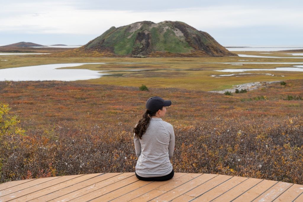
The only way to get close to a pingo is to paddle out to the viewing boardwalk. If you have your own kayak, SUP, or canoe you can park and launch from the day use area. If you need to rent you can give Arctic Ocean Canoe & Qayak a call and they can help you!
It was an easy paddle out to the viewing boardwalk and we highly recommend it. We had the whole place to ourselves!
If you don’t have time to paddle out to them, you can stop by the Pingo National Landmark Lookout to get a good look at them as well.

Check out a Traditional Sod House
Years ago the Inuvialuit built traditional sod houses, which are built out of driftwood and sod is used for insulation. It was designed so that the warm air stayed in and the cooler air would be trapped in the tunnel that leads into the dwelling.
We were able to check out the outside of the sod houses on our own. But we believe there are some tours that can take you inside. Finding information on the tours was a bit tough for us though.

Wander around town
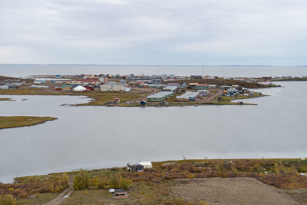
While there isn’t a ton to see and do in town, there are a couple cool churches and the Our Lady of Lourdes Ship. Plus it’s just interesting to see a different way of life. As you explore, you may even meet a kind local! We ran into the deputy mayor, who took us out to a random area of town to see some beluga whales from afar. Which was SO cool and a really memorable experience!
Places to eat
There are only two restaurants in Tuk and we highly recommend Grandma’s Kitchen! This is a stand run by the sweetest local woman, who during our visit was both taking the orders and making the food!
One item that you should try here is muktuk, which is the beluga whale blubber and skin that is boiled. As you can imagine, being this far north, getting food can be a bit difficult. And like many indigenous cultures, the population in Tuk has historically relied on hunting and fishing for most of their food. And beluga whales are a big staple in their diet. This is something we never thought we’d try, but we think it’s super important to try local foods when traveling, especially the foods of other cultures. It was a valuable cultural experience and we’re so thankful we got to try it!
They also have muskox, burgers, fish and chips, and bake their own bread. We enjoyed a burger as well and it was super solid!

Services
Grocery store: Northern Store and Stanton Tuk
Fuel: Bob’s Gas Tuktoyaktuk, Gruben’s Gas Bar
Laundry: Bob’s Gas Tuktoyaktuk
Cell service: We had cell service while in Tuk.
Water fill up and dump station: We couldn’t find any options for water or a dump station. Your best bet is in Inuvik.

Where to stay
Hotels/B&Bs
End of the Road Ltd.
Smitty’s Bed and Breakfast
Hunter’s B&B
Tuktu B&B
Campgrounds
Tuktoyaktuk Sandspit Campground
This is one of two campgrounds in Tuk and costs $63 CAD. The cost may be hard to swallow, but you get an oceanside spot and you get to help support the community. Before 2017, this tiny hamlet didn’t receive many tourists and this fee goes towards helping the community build more infrastructure for tourism. Please only camp in the designated and allowed areas, as locals like to use this area as well.
This camping area does have some outlets (but not to charge your RV) and portapotties.
Tuktoyaktuk Souvenir Shop
This is a souvenir shop with a few spots for RVs, which costs $25 per night. You can also buy some local art here.
Our Exact Dempster Highway Itinerary

Below is our exact Dempster Highway itinerary, with the kilometers driven each day noted. This itinerary allowed us to enjoy some sights along the way without feeling too rushed and we’d recommend structuring your trip this way! In the future, we’d probably spend another night or two out on the highway, boondocking in an epic nature spot and working via our Starlink.
August 30 (58 km): We began the Dempster Highway mid-day from Dawson City and drove to Tombstone Territorial Park for the night.
August 31 (0 km): We spent the day hiking to Grizzly Lake at Tombstone Territorial Park and boondocked just outside the park boundary.
September 1 (398 km): We left Tombstone Territorial Park in the morning, stopped to fish at the Blackstone River, and ended the day just past the Northwest Territories border.
September 2 (265 km): We drove from the NWT border to Inuvik, with two ferry crossings. Originally we planned to make it to Tuk, but after a long first day, we decided to take it easy and just explore Inuvik and go to bed early.
September 3 (152 km): We drove the final stretch from Invuik to Tuk and the Arctic Ocean! We spent the day exploring town, getting in the ocean, checking out the pingos, and eating at Grandma’s Kitchen.
September 4 (518 km): We made the drive from Tuk to Eagle Plains, where we got stuck at a bridge closure for the night.
September 5 (369 km): After the bridge reopened, we drove from Eagle Plains back to the start of the Dempster Highway.
Ready to tackle the Dempster Highway to Tuktoyaktuk?
Pin this guide to driving the Dempster Highway to help you plan!