
Last updated on June 7th, 2026
Sedona is one of the best places to visit in Arizona! Here you’ll find delicious local restaurants, tons of boutique shops, interesting history and culture, jaw dropping views, and fun hikes.
And while we definitely love a long day hike or backpacking adventure, sometimes easy hikes are a nice change of pace. And thankfully there are lots of different easy hikes in Sedona to explore!
We have explored many of the beautiful, easy hikes in Sedona ourselves, and have recruited some other travel bloggers to tell you about their favorite easy hiking trails in Sedona too. Together we have come up with the ultimate list of hikes for you to complete during your next visit to Sedona!

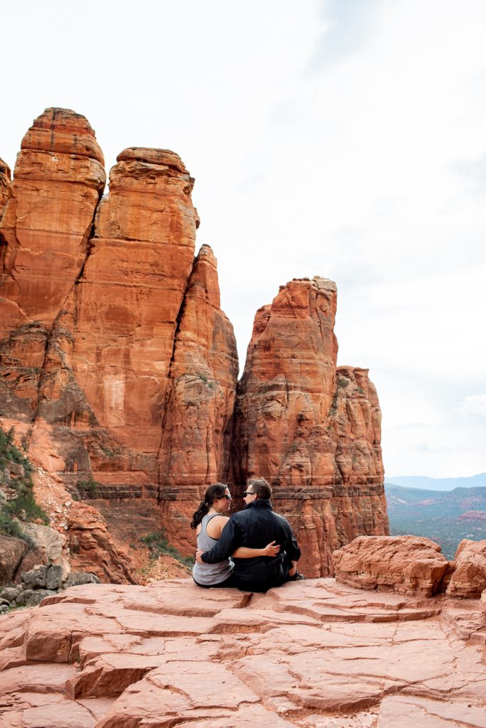
Easy Hikes in Sedona Disclaimer
We chose these hikes because they are almost all under 5 miles and have relatively low elevation gain. And we believe that they can be accomplished by most hikers! However, what one person may consider easy, another may find challenging. We always recommend reading recent trail reviews from other hikers to gauge if the hike is within your abilities, as well as learn of any current hazards or concerns along the trail.
Passes Required for the Easy Hikes in Sedona
Many of these easy hikes in Sedona are located in the Coconino National Forest and require a pass to park at the trailheads. We will note below the trails that require a pass!
The Red Rock Pass and The America the Beautiful pass will both work when parking at these trailheads, minus a couple exceptions, like the West Fork Trail. There are several options to choose from depending on your situation.
Daily Red Rock Pass: This pass is $5 and is good for one day, at as many trailheads as you would like.
Weekly Red Rock Pass: This pass will cost you $15 and is good for seven consecutive days.
Annual Red Rock Pass: This pass is $20 and is good for twelve consecutive months.
America the Beautiful Pass: This is our favorite option! It will cost $80 and is good for one year. With this you can access all National Park Service managed sites and federal lands for free, including many of these hikes!
Want to Learn More as you explore?
We highly suggest downloading the Guide Along – Sedona (totally worth the cost!!) audio tours to navigate you on the road. Even when you don’t have service it knows where you are and provides commentary and history about the area. As well as alerts you when to stop for specific sights. These guides are fun to listen to and the narrator feels like a fun friend in the car with you!
Map of the Easy Hikes in Sedona
The Best Easy Hikes in Sedona, AZ

Devil’s Bridge
Length: 3.9 Miles
Elevation Gain: 528 Feet
Type of Trail: Out and Back
Pass Required: None
Reviews & Current Conditions: Devil’s Bridge
Recommended by Us!
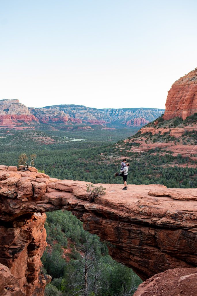
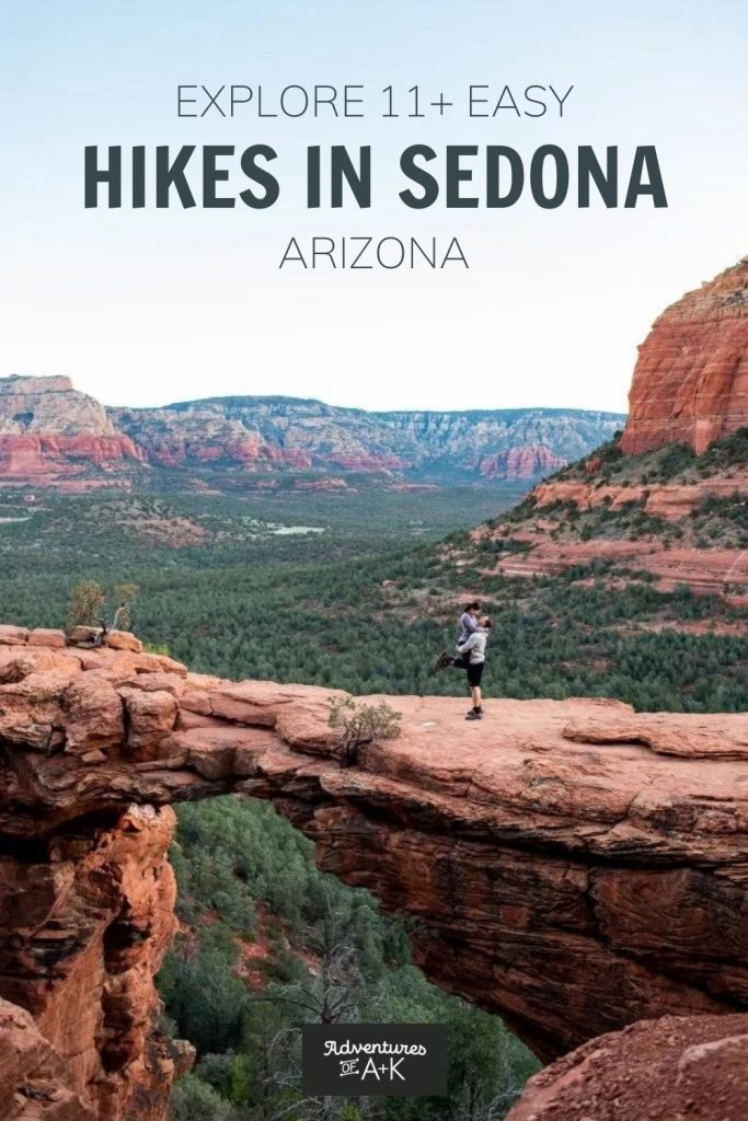
Start off your trip to Sedona with a stunning sunrise hike to Devil’s Bridge. This 3.9 mile hike has 528 feet of elevation gain, and is doable for any activity level! And the payoff at the end is epic. Just look at that natural sandstone arch with the red rocks glowing in the background!
We recommend you do this hike at sunrise since it is a crazy popular hike in Sedona. During the day, you can expect to wait in a line to go onto the bridge. Even at sunrise you should expect some others (we lucked out and had it to ourselves!), but it will be way less busy. Just be sure to pack your headlamp!
The parking lots for this trail are limited and are usually full during the middle of the day. So, Sedona offers a free shuttle to the trailhead, which you should definitely consider if you can’t make it for sunrise.
Soldier Pass Trail
Length: 4.5 Miles
Elevation Gain: 856 Feet
Type of Trail: Out and Back
Pass Required: None
Reviews & Current Conditions: Soldier Pass Trail
Recommended by Us!
One of the most popular easy hikes in Sedona is the Soldier Pass Trail. It can get very busy, especially on the weekends and during major tourist seasons. But Soldier Pass is busy for good reason, the trail is awesome! There are so many unique spots along the way and beautiful sights to see.
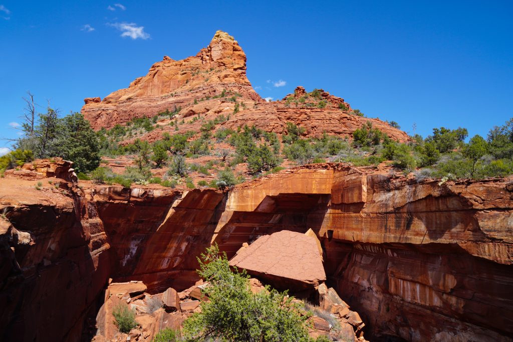
Early into the hike you’ll see Devil’s Kitchen, a unique sinkhole. Then, after that, the Seven Sacred Pools. Depending on the time of year, it may just be puddles. But even still, the view from them is beautiful!
Eventually you will come to a trail on the right, about 0.9 miles from the pools. This takes you to a secret cave, more on that below!! After the side trip to the cave, keep going on Soldier Pass Trail to a 360 degree lookout before turning around. Or, if you’d rather, you can make this hike a loop by hiking the Brins Mesa Trail to the Cibola Pass Trail to the Jordan Trail for an additional 1.5 miles.
Since this trail is so popular, parking can be very difficult. The parking lot gate is open from 8 AM to 6 PM Monday through Wednesday only and can fit about a dozen cars. If the lot is full, you’ll have to park down the road from the trailhead. Please pay close attention to signs to ensure you do not get towed. Between Thursday and Sunday you are required to take the free Sedona shuttle to the trailhead.


Soldier Pass Cave Trail Add-on
Length: 1 mile (from the Soldier Pass Trail)
Elevation Gain: Unknown
Type of Trail: Out and Back
Pass Required: None
Reviews & Current Conditions: Soldier Pass Trail
Recommended by Us!
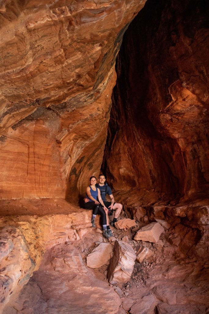
A side trail that is connected to the Soldier Pass trail above is the beautiful Soldier Pass Cave Trail, a “secret” cave that requires a 1 mile out-and-back hike from Soldier Pass Trail.
To find this cave, you’ll want to follow the first right turnoff on this AllTrails map, about 1.2 miles in. This detour may be super short, but the cave does require some scrambling on loose rocks to get up to it, so only attempt this if you are comfortable. But once you make it to the top, you’ll be rewarded with cool caves and beautiful views!
It might not be its own stand-alone trail, but since it’s so short and unique, we thought it deserved a list on the best easy hikes in Sedona!
Cathedral Rock Trail
Length: 1.2 Miles
Elevation Gain: 741
Type of Trail: Out and Back
Pass Required: Red Rock Pass or America the Beautiful Pass Required (only if you park at the parking lot)
Reviews & Current Conditions: Cathedral Rock Trail
Recommended by Us!
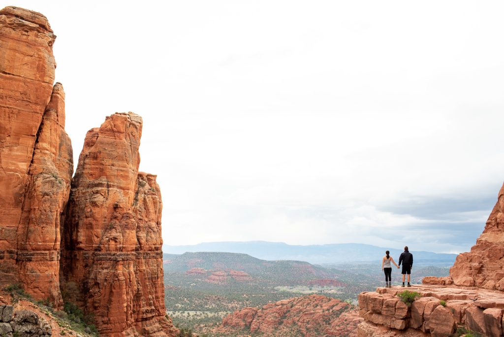
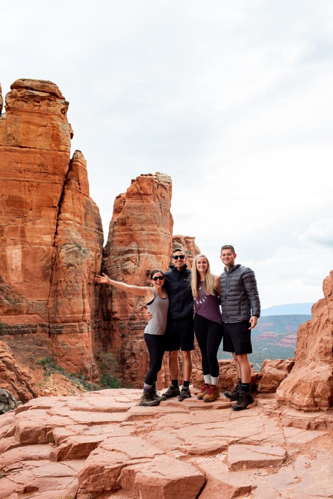
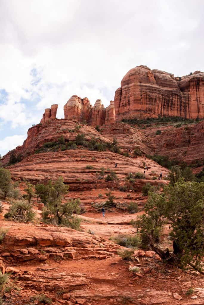
This super short trail requires a lot of elevation gain, but the rewarding views of the red rocks makes it all worth it! This is possibly our favorite hike of all the easy hikes in Sedona that we have completed!
We did the Cathedral Rock Trail for sunset and highly recommend you do the same. It’s stunning to watch the golden glow over the orange rocks around you! It would also be amazing at sunrise. Just make sure to bring some headlamps!
Important Note: From Thursday-Sunday, the FREE Sedona Shuttle is required to get to the trail, starting at 7 AM. However, you can park at the trailhead parking lot if you arrive by 6:30 AM. After that, they close it and you must take the shuttle. Or you can hike in via the Baldwin Trail!
Little Sugarloaf
Length: 1.1 Miles
Elevation Gain: 301 Feet
Type of Trail: Out and Back
Pass Required: None
Reviews & Current Conditions: Little Sugarloaf via Thunder Mountain
Recommended by Joren of Lor & Jor Explore
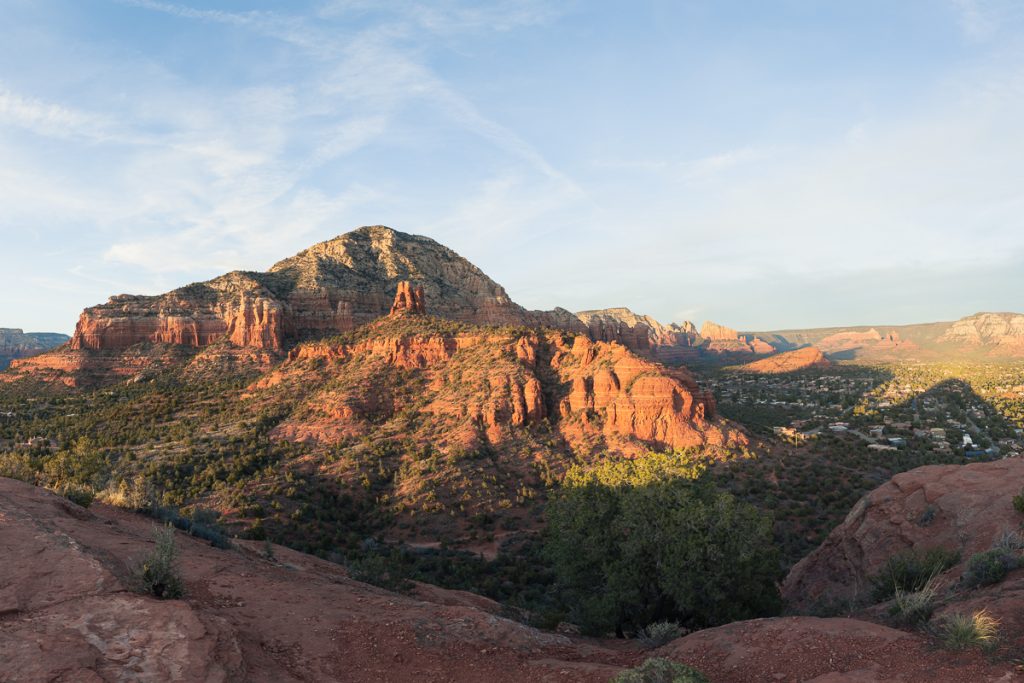
The Little Sugarloaf hike in west Sedona is a quick 1.1 mile out-and-back with a big pay off at the top. It’s right on the edge of town and requires just a few minutes of driving up Thunder Mountain Road to reach the trailhead.
Parking here is limited, with only about 15 spaces. There’s also no restroom at the trailhead, so be sure to make a stop beforehand.
The good news is this hike is often overlooked for more popular easy hiking trails in Sedona, so it’s easier to find a parking spot and you won’t need to pay any fees.
What makes Little Sugarloaf such an underrated gem is the panoramic view that you get from the summit. Once you’ve made it up to the flat slickrock at the top you can settle in to enjoy a beautiful sunset, looking across town toward the Airport Mesa and the layered red rock cliffs in the distance.
The last bit of the uphill climb is short but steep, with some loose soil along the route. Make sure you’re wearing sturdy hiking boots with good traction and, if you’ll be heading down after sunset, bring along a headlamp.
Secret Slick Rock Trail
Length: 0.8 Miles
Elevation gain: 80 Feet
Type of trail: Out and Back
Pass Required: None
Reviews & Current Conditions: Secret Slick Rock Trail
Recommended by Taryn of Chasing Trail
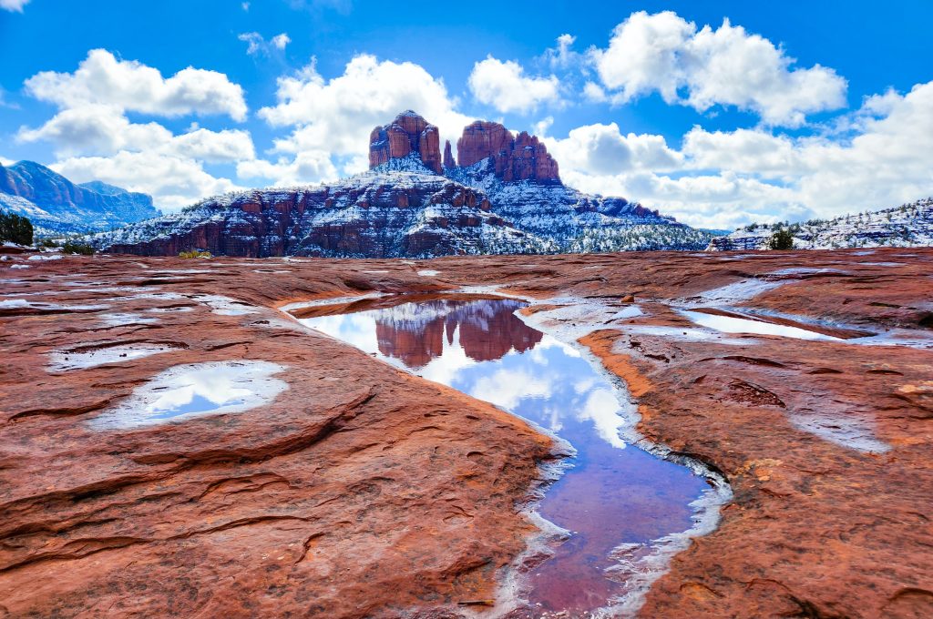
At not even one mile round-trip, epic scenery, and the option to connect to several other, longer trails, Secret Slick Rock is easily one of the best easy hikes in Sedona.
Despite its name, Secret Slick Rock isn’t a secret at all. However, the ‘secret’ is to hike it right after rain. If you time it right, you can photograph a stunning reflection of Cathedral Rock in pools of water that form in the red rocks.
You’ll find the trailhead right off of the paved Chavez Crossing Road, close to Crescent Moon Ranch. Like most Sedona trails, parking becomes a challenge if you don’t arrive early or late. Unlike many other trails, parking here is FREE and doesn’t require a permit!
Early morning is best, particularly if you want to capture that coveted reflection photo. Once you park, look for the small trail marker directly across from the overlook (which is worth a quick stop before or after your hike!).
Best of all, the trailhead is in West Sedona, tucked away from the perpetually busy trails in Uptown. So even if you’re on a tight time crunch, you can easily check this one off your Arizona bucket list.
If you’re up for a longer but still easy-going hike (and one that’s FAR less crowded than many others in town!), you can connect to the Ridge Trail and/or Ramshead Trail from Secret Slick Rock.
Doe Mountain Trail
Length: 1.5 Miles
Elevation Gain: 511 Feet
Type of Trail: Out and Back
Pass Required: Red Rock Pass or America the Beautiful Pass Required
Reviews & Current Conditions: Doe Mountain Trail
Recommended by Alec of Explore with Alec
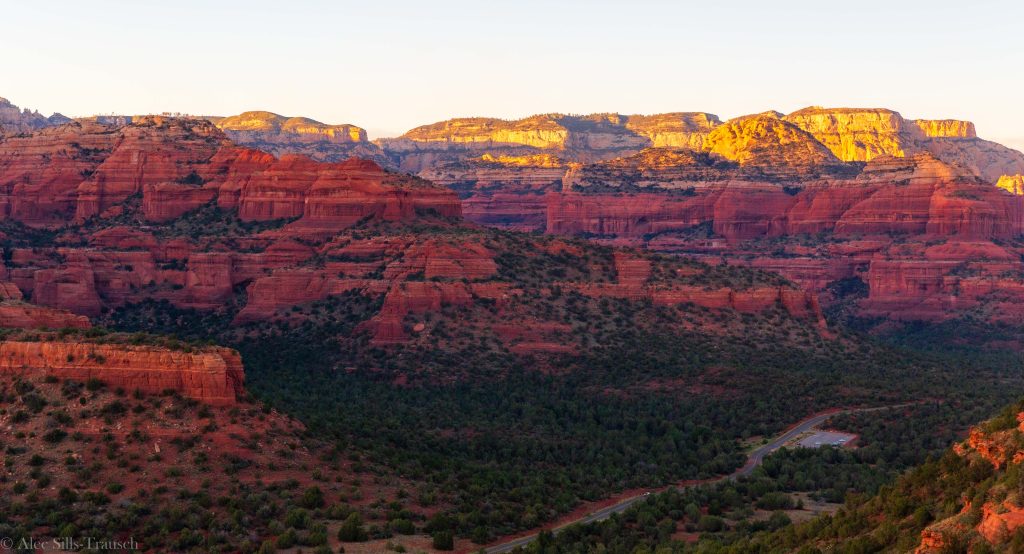
Doe Mountain is a perfect trail for those looking to ditch the crowds and get some lovely views of the Sedona backcountry. Even better, it’s an ideal spot to watch the sunset and still make it down to the car with some light in the sky. If you plan to watch the sunset, you’ll want to stick to the ledge where you can see the parking lot as the sun goes down over the distant mountains.
Overall, this is a two-mile hike with some elevation gain, but it’ll be over before you even notice it. You can probably make this long if you explore the mesa, but we were keeping it easy and just wanted a pretty view.
Doe Mountain sits opposite the popular Bear Mountain trail on Boynton Pass Road, about 5 minutes past Fay Canyon Trailhead. From West Sedona, it’s under a 15-minute drive (unless there’s a road jam at Devil’s Bridge).
As for passes, make sure you have your Red Rock Pass or America the Beautiful Pass for this hike. This helps fund the area and is vital for keeping Sedona looking so great, for this trail and many of the other easy hiking trails in Sedona.
Margs Draw Trail
Length: 4 Miles
Elevation Gain: 393 Feet
Type of Trail: Out and Back
Pass Required: Red Rock Pass or America the Beautiful Pass Required
Reviews & Current Conditions: Margs Draw Trail
Recommended by Riana of Teaspoon of Adventure
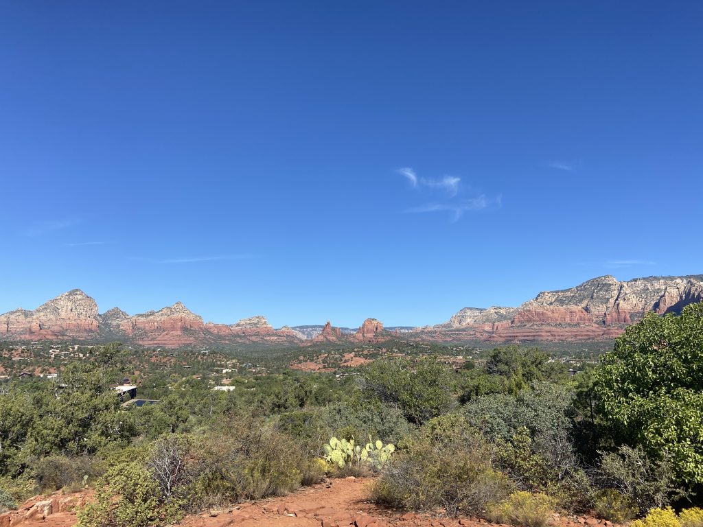
Margs Draw Trail is a great choice for easy hikes in Sedona if you have a few days in Sedona. This trail is scenic, with views of the iconic Snoopy Rock on the way out and Bell Rock and Cathedral Rock on the way back. After a few minutes of uphill trekking from the parking lot, the trail levels out and is relatively flat on a clearly marked, minimally rocky path. There are also some nice patches of shade along the route so you can get out of the Arizona sun.
One of the best things about Margs Draw Trail is that it’s much less crowded than some of the more popular hikes in Sedona. When we hiked it in October 2023, we only saw four other people along the entire route.
The Margs Draw Trailhead is just a five minute drive from downtown Sedona and there is a small parking lot at the trailhead. As the trail is part of the Coconino National Forest, you’ll need to have a Red Rock Pass or America the Beautiful pass to access it.
Birthing Cave Trail
Length: 1.9 Miles
Elevation Gain: 242 Feet
Type of Trail: Out and Back
Pass Required: None
Reviews & Current Conditions: Birthing Cave Trail
Recommended by Jess of Uprooted Traveler
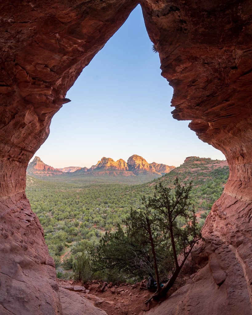
If you want to see one of Sedona’s many unique caves, the Birthing Cave Trail is one of the easiest options.
The trailhead is located along Long Canyon Road and actually shares its trailhead with the aptly named Long Canyon Trail. There’s a handful of parking spots near the trailhead itself, as well as on the west side of Long Canyon Road, just north of the trailhead. If you’re coming during Sedona’s busy season or on a weekend, you might want to get here early to make sure that you can snag a spot. Luckily, parking here is free!
The trail weaves through the desert, along a mostly flat trail. Towards the end of the hike, you’ll approach a red sandstone mesa, with what appears to be a heart-shaped cavern—the Birthing Cave. To get into the cave, you’ll need to climb up a steep, rocky hill that’s a bit challenging. So please only attempt if you feel comfortable and able. But once you’re in the enormous cavern, the hard work will be worth it. You’ll be rewarded with stunning views over the surrounding Ponderosa pines and the red rock cliffs.
Before heading out on this hike, download an offline trail map on AllTrails—while it is one of the most easy hikes in Sedona, there are tons of social trails, branching off the main pathway and it’s easy to get turned around.
Airport View Trail (Airport Mesa)
Length: 1.4 Miles
Elevation Gain: 216 Feet
Type of Trail: Out and Back
Pass Required: Free or $3 depending where you park
Reviews & Current Conditions: Airport View Trail
Recommended by Layla of Layla Lens
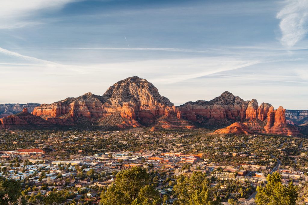
The Airport View Trail is one of the best easy hikes to watch the sunset in Sedona. This trail leads to the Airport Mesa Vortex, a scenic overlook with panoramic views of the red mountains. With Airport Mesa being one of Sedona’s four energy vortexes, this hike is especially popular for tourists, and a unique thing to do in Sedona.
There’s two main ways to hike up the Airport Mesa vortex, or overlook. There’s a free parking lot at the main trailhead, but there’s only 10 parking spots, so it’s likely to be full. If you can’t find parking, the next best option is to park at the top (right by the airport) for $3.
If you park at the paid parking lot by the airport, you can hike the Airport View Trail to get to the Airport Mesa Vortex. The Airport View trail is a rocky 1.4 mile trail that descends down to the vortex, so you’ll want to wear comfortable hiking shoes. This trail runs parallel to the Airport road, so it has amazing views of the city, especially during sunset.
Bell Rock and Courthouse Butte Loop
Length: 3.6 Miles
Elevation Gain: 341 Feet
Type of Trail: Loop
Pass Required: Red Rock Pass or America the Beautiful Pass Required
Reviews & Current Conditions: Bell Rock and Courthouse Butte Loop Trail
Recommended by Samantha of PA on Pause
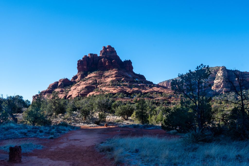
The Bell Rock and Courthouse Butte loop trail is an excellent choice for scenic, easy hikes in Sedona. This trail is well-maintained and fairly flat, making it suitable for hikers of most skill levels, including beginners and families. Head south on SR-179 from the center of Sedona, and you’ll be at the trailhead in about 10 minutes.
Parking is available at the trailhead for a few dozen cars, but the lot does tend to fill up quickly, especially on weekends and holidays. There are, however, two additional parking lots that can be used to access this hike. This will make your hike about one mile longer.
Hikers need to have a Red Rock Pass or for parking, which can be purchased from the pay station at the trailhead. A daily pass costs $5. Alternatively, an America the Beautiful pass works as well!
The hike itself is filled with stunning views of Bell Rock, Courthouse Butte, and more of the iconic red rock formations that Sedona is known for.
If the loop ends up being too long for your abilities or circumstances, there is a connector trail between the two formations that can be used to shorten the loop.
Make sure you have the AllTrails map open to navigate the trail intersections. Some can be a little confusing if you are unfamiliar with the trail. Because this trail is fairly open with little cover from vegetation or trees, bring sunscreen, a hat, and plenty of water.
West Fork Trail
Length: 6.5 Miles
Elevation Gain: 564 Feet
Type of Trail: Out and Back
Pass Required: Grand Annual Red Rock Pass (or $12 fee at the trailhead)
Reviews & Current Conditions: West Fork Trail
Recommended by Claire of The Detour Effect
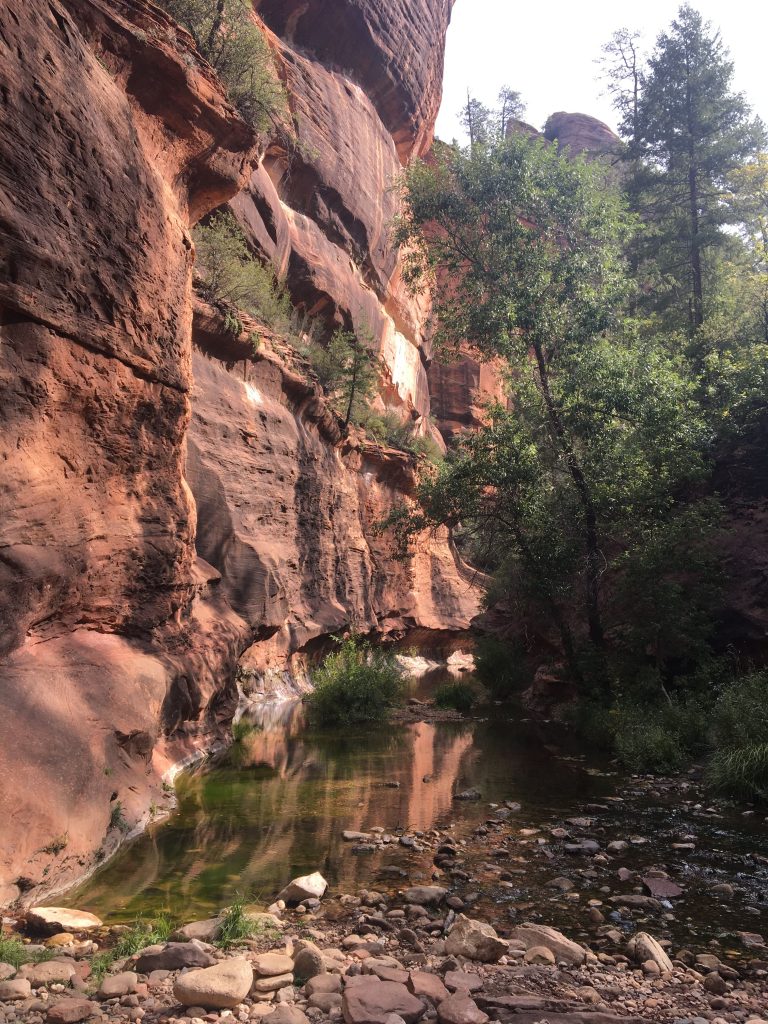
West Fork Trail is one of the most popular easy day hikes in Sedona because it showcases northern Arizona’s unique blend of lush foliage and desert canyon scenery. Hikers of all ability levels enjoy the shady tree cover down in Oak Creek Canyon, where colorful leaves impress in autumn and the rushing creek cools the grateful ecosystem during summer’s heat waves.
A slot canyon feature locally referred to as the “narrows” is 3.25 miles from the trailhead, or 6.5 miles out-and-back. This is where many day hikers turn around, but those who turn back earlier can still admire the trail’s famous rock walls, jump some of its 13 creek crossings (wear quick-drying or water shoes!), and investigate Sedona’s history. The ruins of a homestead built by Jesse Jefferson “Bear” Howard, of Wild West legend, can be seen quite early on in the trail.
There is a large parking lot off scenic 89A for West Fork Trail, but it still fills up, causing many cars to spill out precariously onto the side of the road. It’s best to arrive early. You can buy a Grand Annual Red Rock Pass or pay a $12 day use fee at the manned payment station at the trailhead.
It’s best to hike West Fork between spring and autumn, avoiding winter when the melting snow and rising creek levels render the stream impassable.
Fay Canyon Trail
Length: 2.4 Miles
Elevation Gain: 298 Feet
Type of Trail: Out and Back
Pass Required: None
Reviews & Current Conditions: Fay Canyon Trail
Recommended by Iphi of Travel Choreography
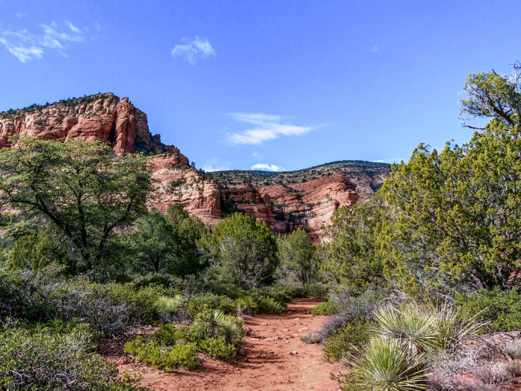
Fay Canyon, about 8 miles northwest of Sedona, is a great and easy trail in Sedona for even the most casual hiker. The hike itself is a mix of flat areas and some short climbs leading to two beautiful viewpoints.
The Fay Canyon Arch is a highlight of the hike, though it’s easy to miss if you’re not paying attention; the path veers off about halfway, follow it to find the arch. More importantly, there’s no fee to hike this part of the Coconino National Forest, and you don’t need the Red Rocks Pass. The trailhead has a big parking lot with bathrooms, but it fills up fast, so come early to avoid parking issues.
It’s suggested to wear hiking boots, but sneakers can work too. Depending on the time of year, the trail might be a bit muddy and slippery. Overall, it’s a simple and enjoyable hike with lovely red rock views.
When to Visit Sedona


Sedona, and all of Arizona, experiences very hot summers. Our first trip to Sedona was in April and the weather was perfect!
The spring and fall are the best times to explore these easy hikes in Sedona if you don’t want to get extra sweaty. During the day it will be warm and at night it will be cooler. But with beautiful weather comes crowds! These seasons are popular tourist times for this very reason so you might be hiking with more people on the trails and the cost of hotels and other activities might be higher.
We have also been to Sedona in December. This trip we got super lucky since it snowed a few days before we got there. We got to see a little of the beautiful snow left behind but didn’t have any icy roads or trails to deal with.
It doesn’t snow all throughout the winter in Sedona, but it does on occasion. If you’re okay with the chance of snow, then winter can be a great time to visit Sedona!
When to Hike the Trails in Sedona
Quite possibly more important than what time of year to visit is what time of day to hike! We highly recommend hiking at sunrise and sunset to beat some of the crowds and to get the most beautiful photos.
Sunrise is typically our favorite because there will be the least amount of people on the trails, it is easy to find parking, the lighting is perfect, and you get an early start to your busy day.
However, sunset can be just as beautiful and will usually mean less crowds than you’ll encounter in the middle of the day.
Packing List for Sedona Hikes
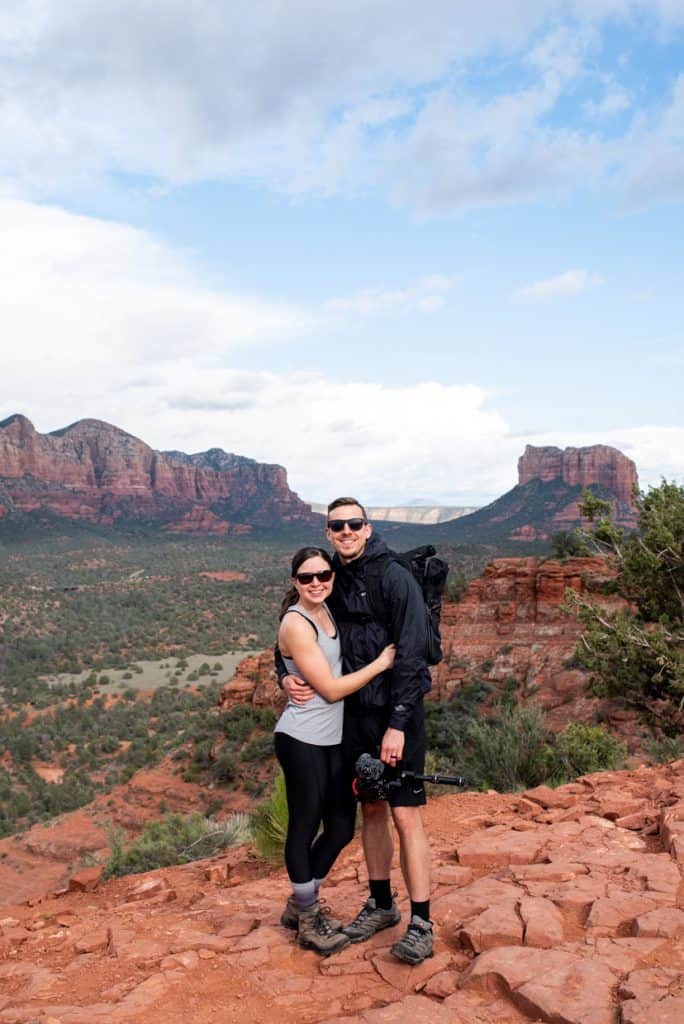
A question we often get when sharing our adventures is what items we pack. Our gear is listed here. But here are some items we especially recommend bringing on your easy hikes in Sedona!
Ten Essentials
As always, we recommend having the 10 essentials on you when doing any hike. While most of these easy trails in Sedona are very maintained and easy to follow, accidents can happen anywhere and it’s good to be prepared!
Hiking Shoes
You’ll want to wear proper hiking shoes. We almost always wear our Lowa Renegades (Kathryn) and Altra Superiors (Adam), but also love our Chacos. These are great hiking sandals for the warmer months and for sandy and smooth rock terrain.
Headlamp
If you plan to do any of these easy hikes in Sedona for sunrise or sunset (you should) then you’ll need a headlamp since it will be dark for half of the hike. We use these headlamps and they workout great!
Layers
No matter the time of year you visit Sedona, temperatures can swing up to 40 degrees in one day! We visited in April and typically started our days in the spring with jackets or pullovers on. Then ended in t-shirts or tank tops.
Sun Protection
Almost all of the easy hikes in Sedona are very exposed. We’d suggest bringing sunscreen, sunglasses, and a hat to stay protected. We have been using Bare Republic, which is a “better for you” sunscreen. Although it may give you a nice white, vampire-esque sheen.
Water
Water is a must in the desert! We love our Camelbak bladder for hikes because it stores a ton of water. And it’s easy to drink from while moving.
Snacks
Make sure to bring along some snacks for your hikes! We love the meals and bars from Wild Zora (if you use our link you’ll get 15% off your purchase). Some of our other favorite snacks are trail mix, lunch meat, carrots and hummus, apples, chicharones, and pistachios.
AllTrails Map
We’d highly recommend downloading the AllTrails maps for all hikes you plan to do before you go. While the trails are mostly easy to follow, we like to use the map to track our progress along the trail. You will need an AllTrails+ membership to download maps, which is $35.99 a year and so worth it!
Want to get 30% off an AllTrails Plus membership? Use our code aplusk30 (you must redeem this code on the website, not the app)!
We use AllTrails Plus on every single hike and it is the most helpful hiking tool out there! Some of the features we love are offline maps (so we can navigate even without cell service), wrong-turn alerts, and its 3D maps feature, so we can get a feel for trails before we hike.
Where to Stay in Sedona

If you’re not from Sedona, you’ll probably need a place to stay after a long day of hiking. Here are some of our best recommendations for places to stay in Sedona.
Vacation Rentals
We stayed at a vacation rental in Sedona and loved having a bigger space to come back to after hiking, plus a kitchen to cook some meals. It also was definitely cheaper for us to stay there too.
However, Sedona is also home to some really nice resorts and hotels if you want to pamper yourself a bit. 🙂 Here is a list of suggestions for both vacation rentals and hotels/resorts!
- Option #1: This 1 bedroom, 1 bathroom guest house is where we stayed and we loved it! It was close to trails, close to a Whole Foods, and has a sky deck with views of the mountains. The beds (even the pull out couch) were also SO comfy!
- Option #2: This 1 bedroom, 1 bathroom cottage is in the coveted Solider’s Pass area, which is home to one of the best hiking trails in Sedona! The perk of walking to this trail (instead of trying to drive and park) makes this spot awesome on its own, but it also looks super cute and has a hot tub!
- Option #3: A 1 bedroom, 1 bathroom house with gorgeous views! (It seems that views are standard in Sedona 😉 )
- Option #4: A 1 bedroom, 1 bathroom apartment in uptown Sedona.
- Option #5: A large 3 bedroom, 2 bathroom house, perfect for the family!
Hotels + Resorts
- Amara Resort & Spa: Just one look at the infinity pool view and we are SOLD on this place! Definitely one of the priciest options, but wow what a gorgeous resort!
- Sedona Rouge Hotel & Spa: Another nice, but pricier, option in Sedona.
- Courtyard Marriott Sedona: This hotel has a pool (score!), a really nicely decorated interior, and is close to town!
- Holiday Inn Express Oak Creek: A little bit out of the main part of town, but still in a beautiful area and cheaper than the resorts right in town.
- Southwest Inn: As the name implies, this spot has Southwest vibes. It is also quite a bit cheaper than the first two options!
Looking for more things to do in Arizona?
- 20+ Best Places to Visit in Arizona
2 Days in Sedona Itinerary - How to Hike the Bear Canyon to Seven Falls Trail in Tucson, Arizona
- 1 Day at the Grand Canyon South Rim Itinerary
- 2 Days in Scottsdale, Arizona Itinerary
- The Best Things to Do in Saguaro National Park West
- Hiking Wasson Peak at Saguaro National Park in Tucson, Arizona
- 1 Day in Page, Arizona
Save this list of easy hikes in Sedona


About the Author
This article was written by Tori, one of our Adventures of A+K team members. Learn a bit about her below!
Hi, I’m Tori! I live in Nashville, TN with my husband and two daughters. We travel as much as possible throughout the year, around a 9-5 schedule and with babies in tow! My travel blog, Tori Pines Travels, aims to help people plan action-packed and culture-rich vacations around their busy jobs, fitting in as much exploring as possible. When I’m not working for Adam and Kathryn or entertaining my little ones, I’m writing, cooking, crafting or exploring Music City!