
Last updated on March 15th, 2024
Europe is filled to the brim with incredible hiking destinations. People always talk about the major sites. They tell you to visit the Roman Colosseum, the Parthenon, or Big Ben. But why don’t you instead plan your European vacation around the epic hikes in Europe? Below we’ve listed some of the absolute best hiking trails you should visit across the continent.
We have personally hiked some of these and they are out of this world. Especially if you are used to hiking in the US, then you are in for a treat! The scenery in Europe is so different with a wide variety of backdrops. From coastal views to the Swiss alps, hot springs and countryside. There’s something for everyone! Add these to your bucket list and start planning your trips to the best hikes in Europe!

- Things You Need for the Best Hikes in Europe
- Map of the best hikes in Europe
- The Best Hikes in Southern Europe
- The Best Hikes in Western Europe
- The Best Hikes in the British Isles
- The Best Hikes in Eastern Europe
- The Best Hikes in Northern Europe
- Looking for More European Adventures?
- Ready to Start Exploring the Best Hikes in Europe?
Things You Need for the Best Hikes in Europe
There are a few items that we think are absolutely necessary before you head out to explore the best hikes in Europe. Here are our top tips!
AllTrails+
We use AllTrails+ on every single hike and it is the most helpful hiking tool out there! Some of the features we love are offline maps (so we can navigate even without cell service), wrong-turn alerts, and its 3D maps feature, so we can get a feel for trails before we hike.
Want to get 30% off an AllTrails+ membership? Click this link or use our code aplusk30 (you must redeem this code on the website, not the app)!
Hiking Shoes
Hiking shoes can make or break a hiking trip. That’s why it is so important to have high quality, comfortable hiking shoes when exploring the best hikes in Europe. We recommend both these women’s hiking shoes and men’s hiking shoes! These are the shoes we wear and love them. Just make sure to break them in before you hit the trails!
Water Bladder
When you’re hiking rigorous trails, the last thing you’ll want to do is hold a water bottle. We swear by our Camelbak water bladder! It goes right into your backpack with a straw that clips right on your shoulder. Drinking is hands-free, making it easier to stay super hydrated!
When we hiked in Italy we didn’t pack enough water and ran out, which was not fun! This camelbak would’ve helped us big time. This is a must when exploring the best hikes in Europe.
Map of the best hikes in Europe
The Best Hikes in Southern Europe

Tre Cime (Italy)
Recommended by Us!
We have hiked hundreds of trails around the world and Tre Cime di Lavaredo is not only one of the best hikes in Europe, but easily one of the most beautiful trails we have ever experienced.
From the second you leave the parking lot, you will have jaw dropping views of the area’s both impressive and jagged dolomite peaks, including the hike’s three namesake spires, Tre Cime.
And while the views alone make Tre Cime one of the best hikes in Europe, the cherry on top are the multiple mountain huts, called rifugios, along the way. Here you can grab both coffee and pastries, and other food items. Nothing beats having a cappuccino and sweet treat while overlooking the mountains!
The best time of the year to hike Tre Cime is in the summer, when the trails are clear of snow. However, one important thing to know is that there are no forests along the trail. This means you’ll have expansive views the entire time (the best!), but it also means you’ll be exposed to the elements throughout the hike. Make sure to pack both sun protection and layers, including a rain jacket (the weather can change quickly!). And don’t forget cash to pay for both food and drinks along the way!
You will also want to start this hike as early as possible to ensure you can get parking. The parking lot, which costs €30 per car, usually fills up by 9 AM! If you do not want to deal with the hassle of parking (and save some money) you can take a bus instead! There are a handful of bus options depending on where you’re coming from.
Length: 10.1 kilometers (6.3 miles)
Elevation Gain: 467 meters (1,532 feet)
Type of Trail: Loop
Difficulty: Moderate
Time: 3-4 hours, depending on if you stop at a rifugio
Fee or permit required: €30 fee to park
AllTrails Link: Tre Cime di Lavaredo
Lago di Sorapis (Italy)

Recommended by Us!
The Dolomites not only get one, but two features on this best hikes in Europe list. And for good reason…they are magical! Besides the sweeping views at Tre Cime, another must do hike in this region is Lago di Sorapis. This Gatorade blue lake, surrounded by the rugged peaks of the Dolomites, makes for one gorgeous day hike. It looks like something out of a postcard!
There are multiple routes to take up to the lake, but we suggest hiking Trail 215, which is one of the easier routes. Along the way, you’ll have views of the Dolomites, but the real treat is when you make it to the end and get to see the bright blue waters of Lago di Sorapis. If you’re not already short of breath from the hike, the view at the end will surely take your breath away!
Similar to Tre Cime, you can also enjoy a drink and snack at Rifugio Vandelli, which is just steps from the lakeshore. It’s the perfect spot to refuel before your hike back down!
Because of its higher elevation, this hike is best to complete in the summertime, when the trail is snow free, the rifugio is open, and the lake’s water levels are higher. However, due to its beauty, it gets very popular in the summertime, so you’ll want to start your hike early!
To get to the trailhead for Lago di Sorapis you have a couple options. You can take bus 30 or 31 from Cortina d’Ampezzo, the closest town to the hike, and get off at Passo Tre Corci. Or you can drive! There is some parking along the road, as well as a parking lot.
Length: 12.2 kilometers (7.6 miles)
Elevation Gain: 584 meters (1,916 feet)
Type of Trail: Loop
Difficulty: Moderate
Time: 4 hours
Fee or permit required: None
AllTrails Link: Lago di Sorapis

Path of the Gods (Italy)
Recommended by Us!
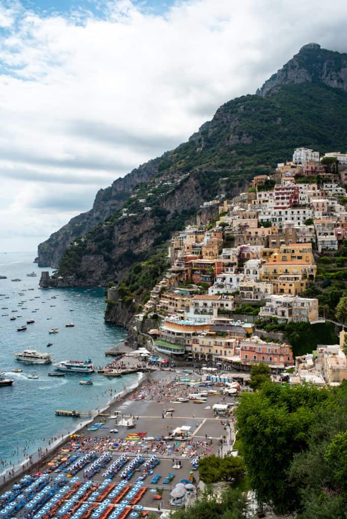
Italy’s Amalfi Coast is renowned for both its dramatic oceanside cliffs and charming small towns. And while you can experience this area by strolling the streets and laying out at the beach, in our opinion, the best way to see its beauty is by hiking the Path of the Gods trail. This trail takes you high up above the action as you skirt along the cliffs, overlook the ocean, and get glimpses of the coastline’s iconic towns.
This hike both starts and ends in two different locations, Bomerano and Positano, which makes getting to and from the hike a bit complex. But thankfully, there is a great bus system along the Amalfi Coast! For the easiest experience, we highly suggest buying your bus tickets in advance. Your lodging will be able to tell you the closest place to buy them.
During our hike we started in Positano and took the Sita Bus to Amalfi. Once in Amalfi, you will want to get on the Agerola bus. You will ride this bus for about 40 minutes, before getting off in Bomerano (Sentiero degli Dei). From here, the trailhead is just a few minutes away!
Along the hike you’ll have sweeping views of the Amalfi Coast, with many different spots to stop and enjoy a picnic lunch. This trail is pretty exposed, so make sure to bring sun protection and lots of water!
Towards the end of the hike, you will pass through the small town of Nocelle. We highly recommend stopping at the Lemon Point (cash only) for a fresh lemonade!
After Nocelle, you will have around 1,700 steps to get back down to Positano. These steps will end right on the main road. From here, you can either take a bus back to wherever you’re staying or walk the rest of the way to Positano.
Because of the logistics to get to and from this hike, we suggest giving yourself a full day to experience it. And while you can do this hike year round, we’d suggest hiking in the late spring or early fall, when the summer crowds have dispersed.
Length: 9.3 kilometers (5.8 miles)
Elevation Gain: 360 meters (1,181 feet)
Type of Trail: Point-to-Point
Difficulty: Moderate
Time: 3-5 Hours, not including the bus ride to the start.
Fee or permit required: Bus Ticket (About €10 )
AllTrails Link: Path of the Gods
Cinque Terre Blue Trail (Italy)
Recommended by Jenoa of The Travel Folk
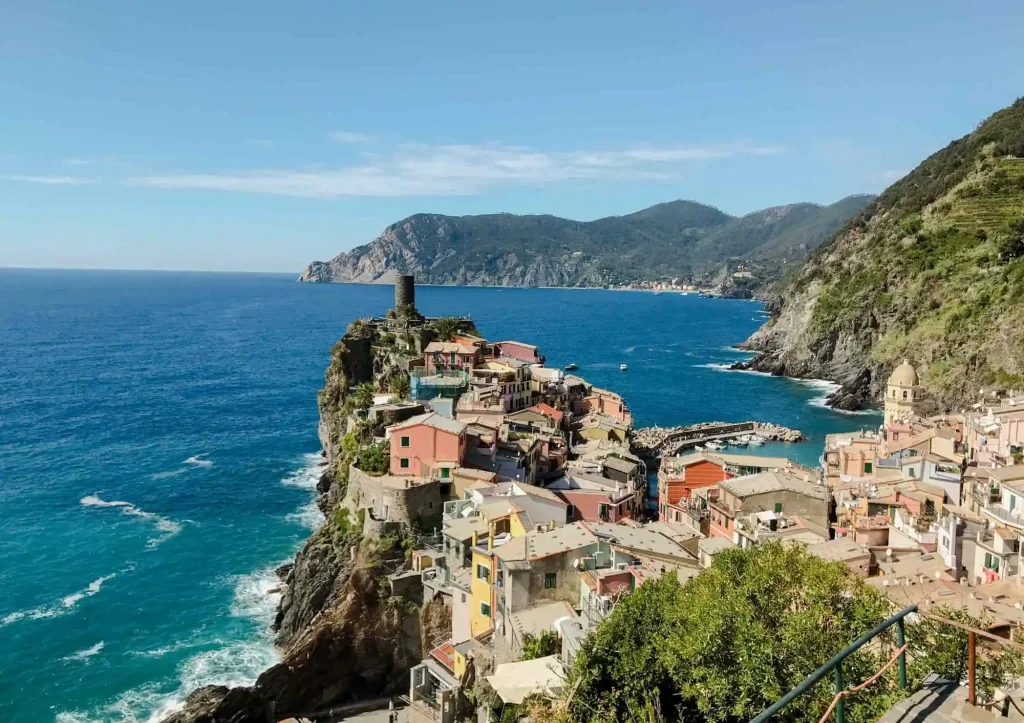
The trail from Vernazza to Corniglia is an incredible hike that takes you between two of the five coastal towns in Cinque Terre. It’s one of the best hikes in Europe because of the spectacular panoramic Mediterranean views the entire route, and it’s accessible for all hiking levels.
The easiest way to access the hike is by taking the train from La Spezia to Vernazza. It makes a great side trip from Florence. Do not drive a car here, as this is a recommended one-way route, plus it’s very difficult to find parking in Cinque Terre.
The best time of year to hike the Cinque Terre is in both late spring (May) and early fall (late September to October). This time of the year often has the nicest weather and fewer crowds than during the summer months.
Comfortable walking shoes are recommended, although a sturdy pair of hiking sandals will also do. The trail is made of dirt and some loose rock but does not require any technical hiking gear. Make sure to also bring a water bottle, which can be filled up in the public fountain in Vernazza before heading on the hike.
A permit is required to use the trails in Cinque Terre National Park, and there is a checkpoint at the start of the hike. The permit can be purchased at any of the train stations in Cinque Terre or online in advance.
Along the way, make sure to stop to take in the amazing views and don’t forget to pick up a lemon and orange granita at Bar Il Gabbiano. A particularly refreshing drink on a hot day!
Length: 4 kilometers (2.5 miles)
Elevation Gain: 204 meters (669 feet)
Type of Trail: Point-to-Point
Difficulty: Moderate
Time: 1.5 hours
Fee or permit required: Yes, a permit is required to hike these trails, you can purchase online here.
AllTrails Link: Blue Trail: Vernazza – Corniglia
Pico Ruivo (Portugal)
Recommended by Marga of Discover Portugal
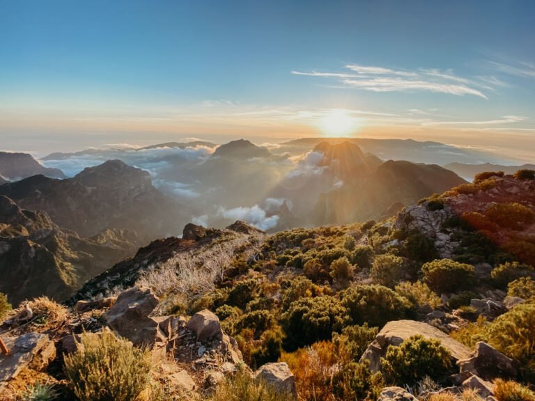
Madeira is a hiker’s paradise, and the island provides routes, or the so-called levadas, for any hiker. One of the more challenging hikes brings you to the peak of the Portuguese island, the Pico Ruivo. The mountain is 1.862 meters (6,109 feet) tall, and there are two main hiking routes to the top: both the PR 1 Vereda do Arieiro to Pico Ruivo and the PR 1.2 Vereda do Pico Ruivo. From Funchal, it takes about an hour by car to reach both starting points.
The easiest route is the PR 1.2. You can drive up towards the car park Achada do Teixeira. From here, the one-way journey to the top is 2.8 kilometers (1.74 miles). There are some shelters along the way and even a cafe! Although the path is upward, it’s doable for most fitness levels.
If you prefer a more challenging route, then the PR 1 Vereda do Arieiro is lovely. There is a car park at coordinates 32°44’05.6 “N – 16°55’43.2” W; from there, it’s a 7.5 kilometer (4.7 miles) hike to the top. You’ll pass several tunnels, so bringing a flashlight is a good idea. Once you reach the summit, you have two options: walk to the car park Achada do Teixeira or follow the same path back. The way back is strenuous, but thankfully, transfers are available between the two car parks if you decide to hike a one-way route.
The routes are very well marked, but to be extra sure, the WalkMe Madeira App will help you with all hikes on the island. Good hiking shoes are a must, and as the weather in Madeira sometimes changes rapidly, good clothes are advisable. And even though there are restaurants in both car parks, bringing plenty of water and something to eat is a good idea. You can also join a group excursion and hike the route for sunrise! It’s pure magic! And remember to discover the many other hikes on the island while you are here. Portugal is home to many of the best hikes in Europe!
PR 1
Length: 10.8 kilometers (6.7 miles)
Elevation Gain: 1,114 meters (3,654 feet)
Type of Trail: Out and Back
Difficulty: Hard
Time: 5-6 hours
Fee or permit required: None
AllTrails Link: Pico Ruivo 1
PR 1.2
Length: 5.9 kilometers (3.7 miles)
Elevation Gain: 472 meters (1,551 feet)
Type of Trail: Out and Back
Difficulty: Hard
Time: 3 hours
Fee or permit required: None
AllTrails Link: Pico Ruivo 1.2
Seven Hanging Valleys (Portugal)
Recommended by Linn Haglund of Brainy Backpackers
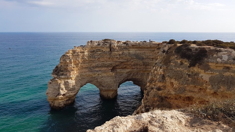
Hiking Seven Hanging Valleys Trail in southern Portugal gives you a unique chance to explore the rugged coastline all year round, and is one of the most beautiful hikes in Europe. Stretching from Algar Seco in Carvoeiro to Marinha Beach, the hike is fairly easy, but you need good hiking shoes or trainers, as the terrain is uneven in some places.
The trail passes spectacular beaches like Benagil Beach, where you can take a boat tour to see the famous caves of the same name. But also sinkholes, natural arches, a lighthouse, and natural rock formations jutting out of the water, some of them found at the end or starting point, depending on the direction you choose to walk, Marinha Beach.
There is no public transportation to Marinha Beach, but an ample parking lot. However, buses go to Carvoeiro from Lagoa and you can walk directly from there, adding about half an hour to the hike. You can easily walk it back and forth so you don’t have to worry about transportation back to the starting point. Ensure you bring enough water and cover your head as there isn’t much shade along the trail.
Length: 12.8 kilometers (8 miles)
Elevation Gain: 330 meters (1,085 feet)
Type of Trail: Point-to-Point
Difficulty: Moderate
Time: 3 Hours
Fee or permit required: None
AllTrails Link: Seven Hanging Valleys
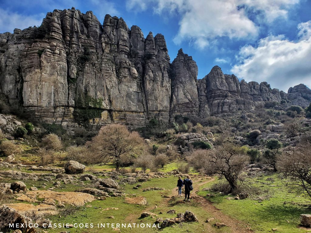
Torcal de Antequera (Spain)
Recommended by Cassie of Mexico Cassie (Goes International)
Who could turn down the opportunity to hike in one of the most beautiful karst landscapes in all of Europe? Walking over an ancient limestone seabed that now stands 1200m above sea level must be experienced.
The Torcal de Antequera is a 16 km drive along winding mountain roads from the town of Antequera with some of the best hikes in Europe to explore along the way.
If you’re visiting in a car, then there is parking at the visitors’ center or down below if the car park is full (a bus is available from the lower car park). There is no public transport available.
The park and the visitors’ center are open all year round but it’s advisable to pay attention to the weather. It can be both extremely windy and cloudy over this isolated park. In the summer it can be extremely hot with very little shade so do not forget to bring enough water for your hike. The best times to hike the Torcal de Antequera are both March – May and September – October.
If you’re hiking outside of summer, then it is recommended to wear hiking shoes and bring a raincoat.
If you don’t want to eat in the visitors’ center, then head into Antequera to find a restaurant. There are plenty of very good options, like Restaurante A Mi Manera!
Although the hikes in this area are not full day hikes (unless you take it slowly and stop for the views, which you will), the scenery makes this one of the best places to hike in Europe.
There are three marked trails visitors may follow without reservation: green, yellow and red.
Green Trail:
Length: 1.8 kilometers (1.1 miles)
Elevation Gain: 37 meters (121 feet)
Type of Trail: Loop
Difficulty: Easy
Time: Less than an hour
Fee or permit required: None
AllTrails Link: Green Trail
Yellow Trail:
Length: 2.7 kilometers (1.7 miles)
Elevation Gain: 61 meters (200 feet)
Type of Trail: Loop
Difficulty: Moderate
Time: 1 Hour
Fee or permit required: None
AllTrails Link: Yellow Trail
Red Trail:
Length: 5.1 kilometers (3.2 miles)
Elevation Gain: 164 meters (538 feet)
Type of Trail: Loop
Difficulty: Moderate
Time: 2 Hours
Fee or permit required: None
AllTrails Link: Red Trail
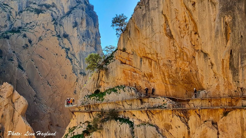
El Caminito del Rey (Spain)
Recommended by Linn Haglund of Andalucia Hiking
One of the absolute best hikes you can do in Europe is El Caminito del Rey hike in southern Spain. Once considered the world’s most dangerous hike, it has now been restored and regulated, making it a safe, and incredibly stunning hike for the entire family.
However, if you are suffering from vertigo, you might reconsider it. The path is pinned 100 meters above the bottom of the dramatic Gaitanes Gorge in the province of Malaga.
It is easy to reach by train to El Chorro. A shuttle bus will take you to the beginning of the trail. If you drive, then you can park at El Kiosko, where you start the trail and take the shuttle bus back from El Chorro where the trail ends.
You must book a time slot in advance as there are limited entries and it is recommended to book early as tickets sell out fast. When you reach the checkpoint, you show your ticket and will receive a mandatory helmet and a security brief. There are also guided tours if you want to learn more about the history and geography of this amazing hike in Europe.
Length: 6.7 kilometers (4.2 miles)
Elevation Gain: 279 meters (918 feet)
Type of Trail: Point to Point
Difficulty: Easy
Time: 2.5 hours
Fee or permit required: Must book a time slot in advance
AllTrails Link: El Caminito del Rey
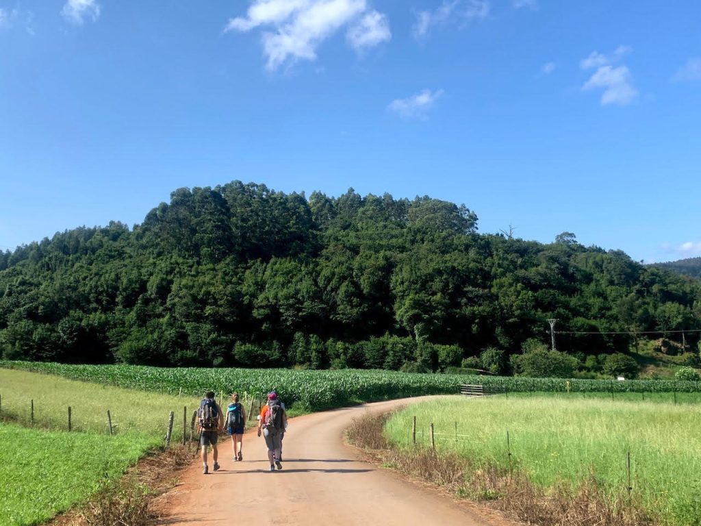
Camino del Norte (Spain)
Recommended by Milijana of World Travel Connector
Camino del Norte is the most beautiful route of the famous Camino de Santiago hiking trail in Spain and one of the best hikes in Europe that you can experience. The Northern Way, or Camino del Norte in Spanish, is among the most beautiful European hiking trails. It goes along the coast of northern Spain.
The trail starts in Irun on the Spanish-French border in the Basque Country and ends in Santiago de Compostela in Galicia. San Sebastian International Airport is the nearest airport to Irun. Biarritz Airport is not far from Irun either. Depending on the flight, some hikers fly to San Sebastian and some to Biarritz. Both towns are well-connected by buses with Irun.
The Camino del Norte is a 529 mi (852 km) long trail that takes about one month to finish. The route goes through four Spanish regions: the Basque Country, Cantabria, Asturias, and Galicia. The hike is moderate. But, it seeks high endurance as it lasts one month. Thus, one of the biggest mistakes is to overpack. A small 24 lb hiking backpack with only hiking essentials is enough. The route goes through both towns and villages where hikers can get their supplies.
The Camino del Norte trail route goes along the green coast of rainy northern Spain. So, the best time to hike Camino del Norte is in July and August. If you want to visit during the less rainy months, then visit in the summer.
Length: 852.5 kilometers (529.7 miles)
Elevation Gain: 121,114 meters (69,274 feet)
Type of Trail: Point-to-Point
Difficulty: Hard
Time: 30 Days
Fee or permit required: None
AllTrails Link: Camino del Norte
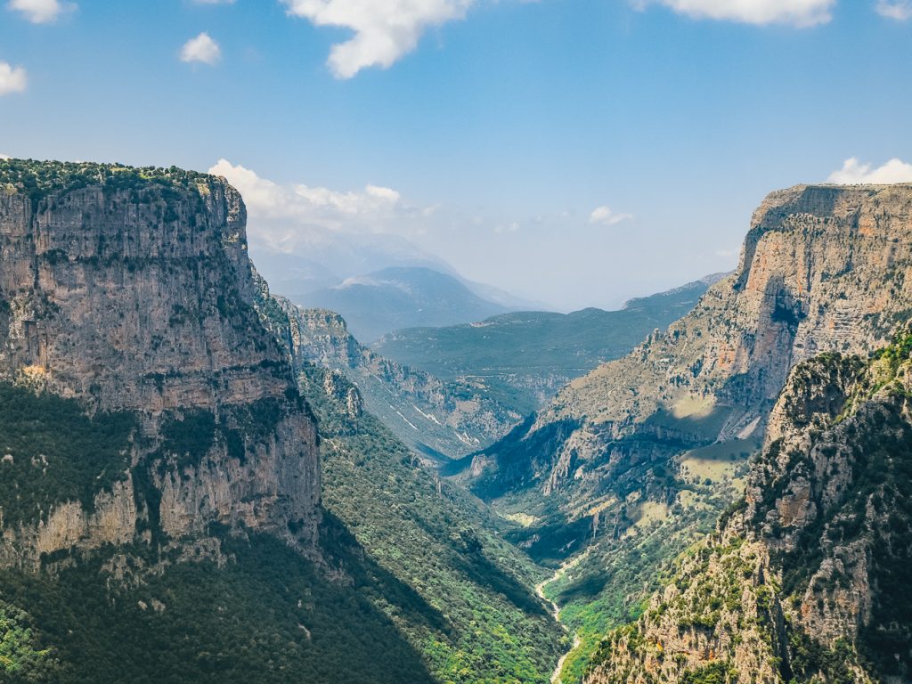
Vikos Gorge (Greece)
Recommended by Marjut of The Smooth Escape
Vikos Gorge is a fantastic off-the-beaten-path destination in northwestern Greece. It has a depth of 1000 meters and is often referred to as the Grand Canyon of Greece. The hiking trail along the bottom of the gorge is considered both one of the best hikes in Greece and in all of Europe. The hike offers breathtaking views of the limestone cliffs towering above the trail.
The hike starts in the village of Monodendri and ends in Vikos. The best way to get there is to rent a car and drive because public transportation is limited in the region. Parking is available along the streets of Monodendri. Since this is a point-to-point hike, you have to take a taxi back to Monodendri at the end of the hike.
The best time to do the Vikos Gorge hike is between May and October when there’s no snow on the trail. Good hiking shoes are required for this hike as the terrain is both very rocky and steep.
Length: 13.4 kilometers (8.3 miles)
Elevation Gain: 692 meters (2,273 feet)
Type of Trail: Point to Point
Difficulty: Hard
Time: 5.5 Hours
Fee or permit required: None
AllTrails Link: Vikos Gorge
The Best Hikes in Western Europe
Seebensee and Drachensee (Austria)
Recommended by Adri of Traveltipzone
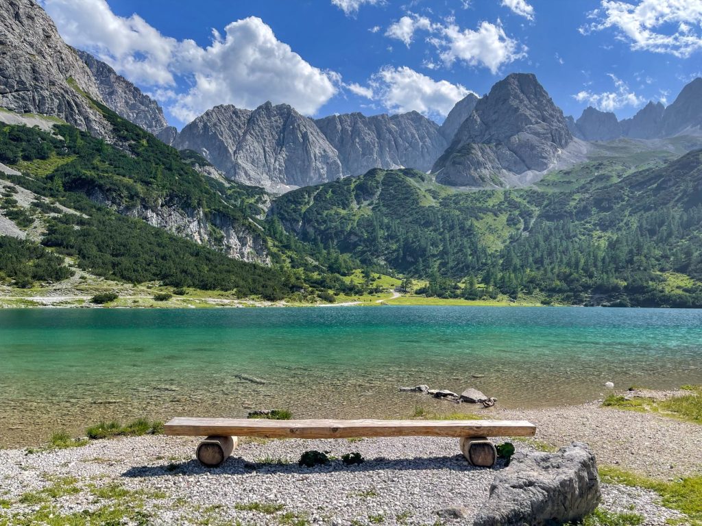
The Austrian Tyrol is full of wonderful hiking trails, but one of the most outstanding among them is the hike to two lakes near Ehrwald, Seebensee and Drachensee.The epic views make this one of the best hikes in Europe.
To get to Ehrwald, as it is a quite remote village, the easiest way is by car. If you prefer public transportation, then you can take a bus from Innsbruck with a transfer.
Seebensee and Drachensee are two natural alpine lakes surrounded by beautiful crystal-clear green water and breathtaking mountains. It’s no wonder that during the summer months, this is one of the most popular hiking routes in Tyrol.
The hike to the lakes is challenging but absolutely worth it. The round trip from Ehrwald is over 18 kilometers. Fortunately, with the mountain lift from Ehrwald’s parking lot, you can take a cable car for a significant part of the way, making the hike from the mountain station much easier.
You can choose to walk or cycle to Seebensee, as there is a good-quality gravel road leading to it. Drachensee, on the other hand, is a real challenge, as a steep, rocky path leads up to it on the mountainside, where basic hiking equipment is recommended.
If you want to take a break along the way, there are several places to stop, such as one of the restaurants like Tirolerhaus, Seebenalm, and Coburger Hut. Nearby, there are plenty of other trails. For more challenging hikes, the peaks of the Alps also await.
All in all, don’t miss the hike to Seebensee and Drachensee if you’re in Tyrol or the nearby Bavarian Alps – it’s an unforgettable experience guaranteed.
Length: 24 kilometers (15 miles)
Elevation Gain: 1,179 meters (3,871 feet)
Type of Trail: Out and Back
Difficulty: Hard
Time: 6 Hours
Fee or permit required: 14 Euros to ride the cable car
AllTrails Link: Seebensee and Drachensee
Tour du Mont Blanc (France, Italy and Switzerland)
Recommended by Steff of JustTravelous
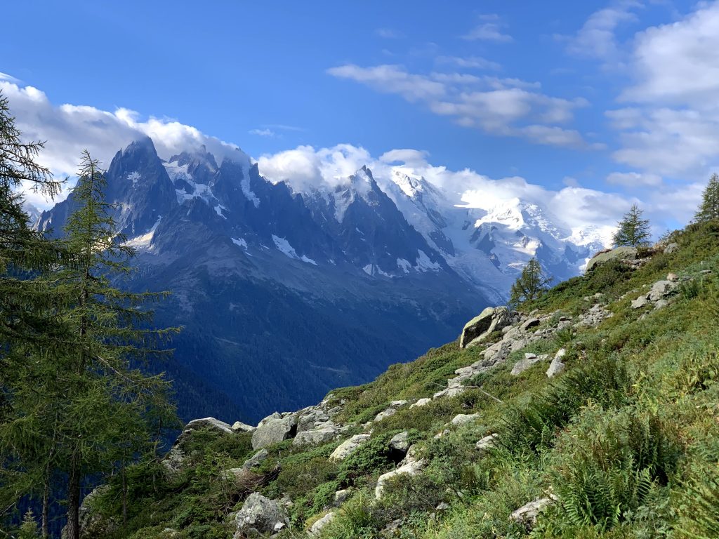
Tour du Mont Blanc is easily one of the best multi-day hikes in Europe. You hike through three countries (France, Italy, and Switzerland) on an 11-day hike through the Alps. Every day is a new wonder across this 164 km (102 mi) trail with 10,427 m (34,212.4 ft) in altitude.
The trail has great refuges along the way for both a hot meal and a bed at the end of each long day of hiking. Book the refuges in advance via the official TMB website. You can also camp if you prefer to rough it (and save money)!
If you are trying to start via public transit, then it is recommended to start from Chamonix, France. Otherwise, parking along the trail is easy and possible to start from any stage along the trail.
Hiking poles are a must with the elevation gain on this trail. At some points in the trail, you will walk through adorable mountain towns, so it is easy to stock up on groceries throughout the hike. Fresh alpine water is readily available throughout the trail as well!
Length: 164 kilometers (102 mi)
Elevation Gain: 10,427m (34,212.4 ft)
Type of Trail: Loop
Difficulty: Hard
Time: 11 Days
Fee or permit required: No permit or fee but book the Refuges in advance
AllTrails Link: Tour du Mont Blanc
Ebenalp Mountain (Switzerland)
Recommended by Angie of We’re Not in Kansas Anymore!
Ebenalp Mountain hike near Wasserauen in northern Switzerland is one of the best bang for your buck hikes in Europe. At the top is where you’ll find Berggasthaus Aescher-Wildkirchli, a cliff hugging rustic Inn and restaurant. Before you head down the mountain stop in for some tasty Rösti, a potato dish similar to hash browns smothered in creamy melted Appenzeller cheese and a hot drink to start your day.
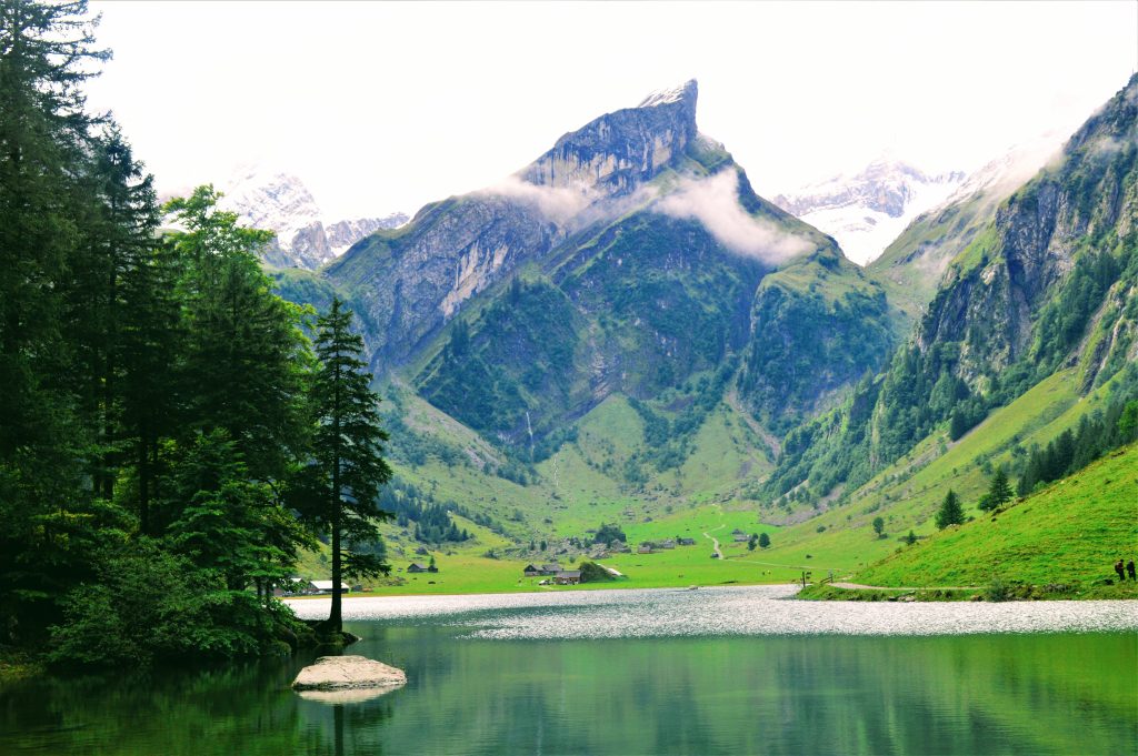
If you find yourself on Ebenalp on a Sunday then you’re in for a very special treat. Locals flock to the mountaintop to attend church services in the Wildkirchli Cave Church. The choir belts out angelic hymns in a most unique and beautiful form of singing called natural yodeling, a cross between both singing and yodeling and it is divine! The views down the mountain are stunning, as is Seealpsee, the emerald green alpine lake near the end of this amazing hike!
You can reach the summit of Ebenalp by taking a cable car from the base, which you can either drive to or take the train to the Wasseraun station. Near the train station is where you will find both the cable car station and ample parking. Since snow makes the steep downhill hike treacherous, the hike is best done late spring/early summer through early fall. Recommended equipment: you will need both rain gear and hiking poles, which are beneficial for the steep descents.
The trail does include dangerous drop-offs, so caution is paramount.
Length: 9.3 kilometers (5.8 miles)
Elevation Loss: 349 meters (1,145 feet)
Type of Trail: Point-to-Point
Difficulty: Moderate
Time: 4 hours
Fee or permit required: None
AllTrails Link: Ebenalp Ascher
Seealpsee (Switzerland)
Recommended by Callie of Counting Our Footsteps
The hike to Seealpsee Lake is a beautiful hike that can be enjoyed all year round. However, the months of May – September will be the best to do this hike. We visited in May and it was perfect! It was both not crowded at all and it was just the right temperature.
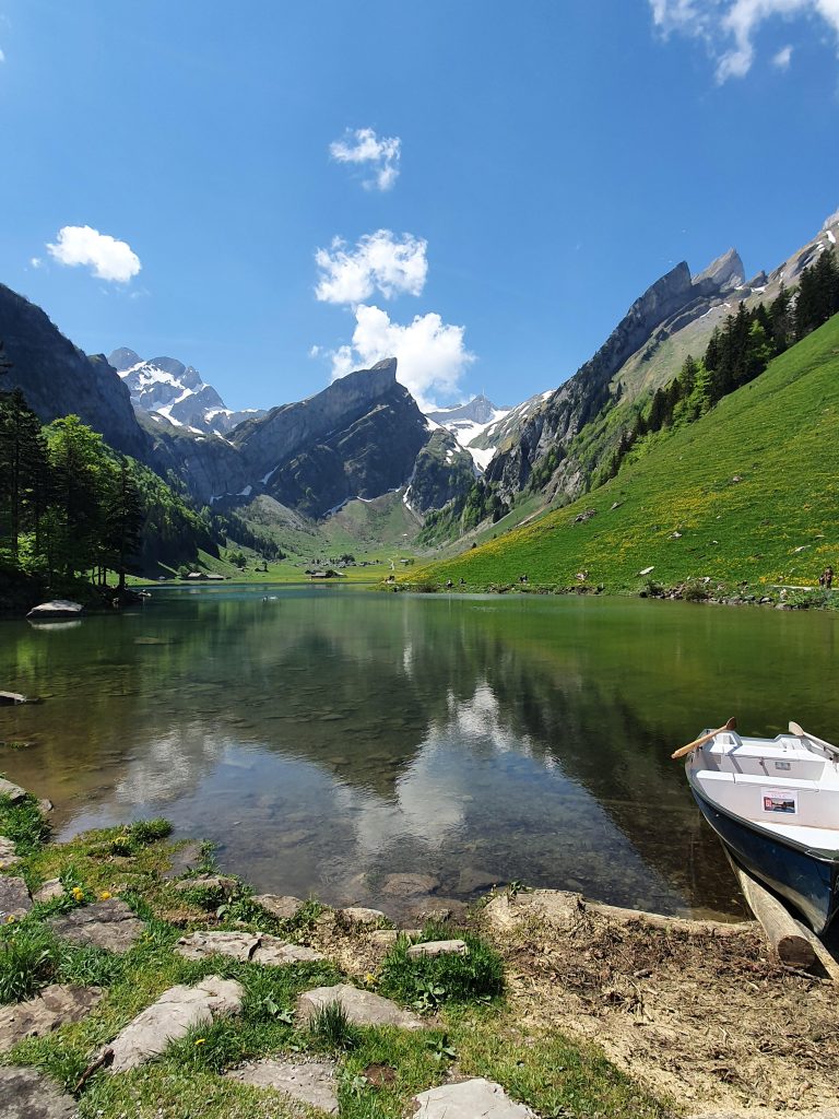
What makes this hike so great is that it is suitable for all abilities and once you reach Seealpsee Lake at the top of the hike, you will be met by the most stunning views. There is even a restaurant at the lake. This is one of the reasons that Seealpsee is one of the best hikes in Europe!
The hike is entirely on a paved or gravel path so it is possible for families to take small children in strollers.
You can easily access the start of this hike by car, train or bus. There are both regular buses and trains from the nearby town of Appenzelland even trains from Zurich. There is also a large parking lot at the start of the hike in Wasserauen.
Length: 7.56 kilometers (4.7 miles)
Elevation Gain: 363 meters (1,194 feet)
Type of Trail: Out and Back
Difficulty: Moderate
Time: 2.5 hours
Fee or permit required: None
AllTrails Link: Wasserauen – Lake Trail
Calanque d’En Vau (France)
Recommended by Sarah of CosmopoliClan
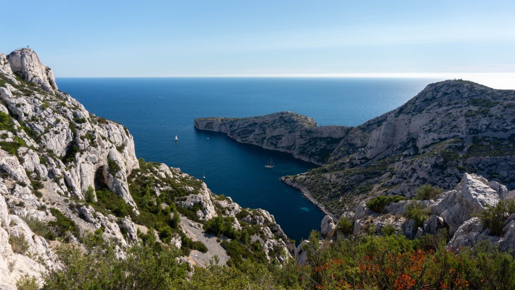
In the South of France, between both metropolitan Marseille and coastal Cassis, lies the Calanques National Park. This landscape of limestone cliffs boasts nine steep-walled coastal inlets or calanques, the Calanque d’En Vau being the most scenic. Both the aquamarine waters and green pine trees contrast beautifully with the pale gray cliffs. The views along this trail make this one of the best hikes in Europe!
This beautiful inlet is located closest to Cassis, which is where the trailhead is situated. You can park at the parking lot next to the entrance. It has limited capacity, especially in summer, so it’s important to arrive early. Calanque d’En Vau is the third inlet in row, so you’ll first pass Calanque de Port Miou and Calanque de Port Pin. The red/white striped trail is well signposted.
Spring and early fall are the best times of the year to take the Calanque d’En Vau hike. During the summer months, the trail is very crowded and there’s a risk of closure due to wildfires. The terrain is very rugged and the rocks are very slippery. The trail also includes a steep rocky descent (and ascent when returning).
Wear sturdy shoes, plus bring plenty of water and sun protection. Once you arrive at the Calanque d’En Vau, you can enjoy a well-earned refreshing dip. Just be aware of the jellyfish that might hide in the water, they have a nasty sting. At the rocky beach, you might encounter kayakers and SUP-ers too.
Length: 6.6 kilometers (4.1 miles)
Elevation Gain: 331 meters (1,086 feet)
Type of Trail: Out and Back
Difficulty: Moderate
Time: 4 hours
Fee or permit required: None
AllTrails Link: Calanque d’En Vau
La Tournette (France)
Recommended by Kev of Kevmrc
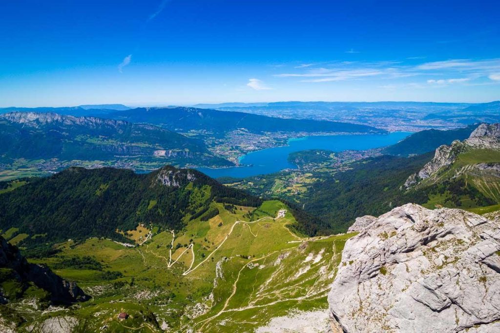
Nestled between the mountains and Lake Annecy in the French Alps, Annecy is a charming town that will delight all hikers. Among Annecy’s best hikes is the Tournette trail. This iconic 11-kilometer ascent treats you to breathtaking views of both the lake and the towering peaks. The trail is almost entirely unobstructed, offering a series of viewpoints along the way, and if you’re lucky, then you might even encounter some wildlife! Do you need any other reasons for why this is the best hike in Europe?
The route starts at Chalet de l’Aulp, accessible only by car, about 1 hour from the center of Annecy. Parking is limited, so it’s best to arrive early to secure a spot. Otherwise, you’ll need to backtrack to the Refuge du Pré Vérel parking lot, a 30-minute walk from the starting point.
This hike is best enjoyed between June and September. Due to important elevation gain, there’s a lot of snow and ice the rest of the year, making the hike dangerous and even impossible without alpine equipment. In any case, be sure to wear good walking shoes, pack a meal and snacks, and sun protection, as there’s almost no shade.
It should be said that this is quite a hard trail, not suitable for everyone, but incredibly gratifying! Once back down, I recommend having a cool drink among the cows at Chalet de l’Aulp.
Length: 11.3 kilometers (7 miles)
Elevation Gain: 1,270 meters (4,166 feet)
Type of Trail: Out and Back
Difficulty: Hard
Time: 6-7 Hours
Fee or permit required: None
AllTrails Link: La Tournette
Schliersee to Tegernsee via Prinzenweg (Germany)
Recommended by Anna of Big World Short Stories
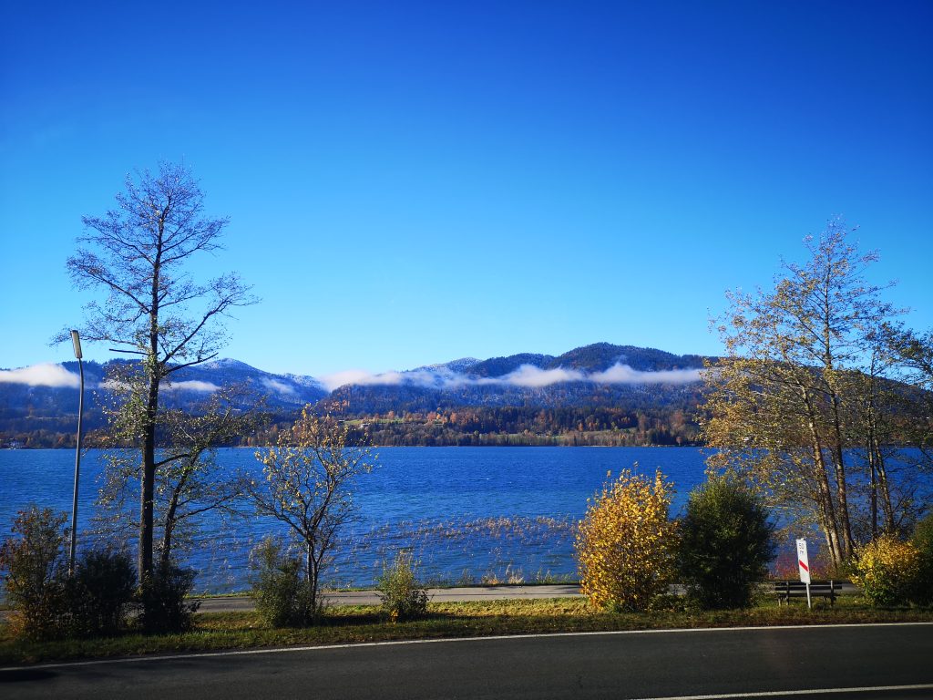
Munich in Bavaria is the gateway to the Alps in Germany. One of the most panoramic and easily accessible trails for hiking near Munich is Schliersee to Tegernsee Hike via Prinzenweg. This is a panoramic day hike between the two most beautiful lakes in Bavaria – Tegernsee and Schliersee. You will have spectacular views once you hike up to the highest point at Gindelalm Schneid.
To get to the trailhead via public transportation, take a train from Munich Main Train Station to Schliersee Station. You will finish the hike in Tegernsee. To go back to Munich, take a train from Tegernsee train station. There are regular trains once an hour connecting Tegernsee and Schliersee to Munich.
If you are traveling in a group of 2 or more, then the cheapest option is to get Bayernticket. This is a day ticket valid for all types of public transportation within Bavaria.
This route is very popular among locals, especially on weekends when the weather is nice, since it is one of the best hikes in Europe. If you want to avoid the crowds go during the week and start the hike very early in the morning. The trail is well-marked and open year-round. There are many beer gardens and restaurants on the way, serving typical Bavarian beer and traditional food.
Length: 11.9 kilometers (7.4 miles)
Elevation Gain: 556 meters (1,824 feet)
Type of Trail: Point-to-Point
Difficulty: Moderate
Time: 4 Hours
Fee or permit required: None
AllTrails Link: Schliersee to Tegernsee

The Best Hikes in the British Isles
The Old Man of Storr (Scotland)
Recommended by Us!
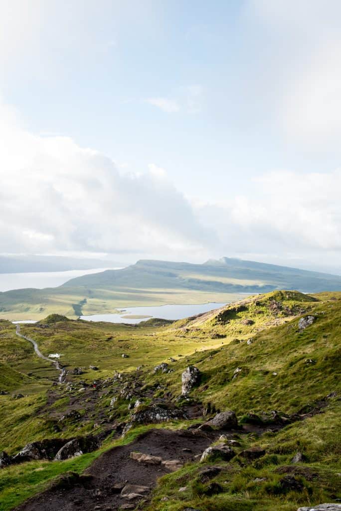
With charming small towns, dramatic cliffs, mountains and rolling hills, plus adorable roaming sheep, Scotland’s Isle of Skye is straight out of a fairytale. And one of the most epic hikes in the Scottish Highlands region is the Old Man of Storr!
The Old Man of Storr is a group of sharp looking basalt rock columns that jut out of the ground, which are the remains of a volcanic plug from millions and millions of years ago. It truly looks and feels like another planet!
You can see the Old Man of Storr from far away, but the best way to experience it is on The Old Man of Storr Circular route. As you climb up you’ll have sweeping views of green hills and the coast. And at the end, you’ll make it to an insane viewpoint of the Old Man of Storr. It is guaranteed to take your breath away!
Can’t make it to the end? You can still see some amazing views by just going part of the way!
Length: 5.4 kilometers (3.4 miles)
Elevation Gain: 357 meters (1,171 feet)
Type of Trail: Loop
Difficulty: Hard
Time: 1.5-2 hours
Fee or permit required: £6 per car fee for up to 6 hours or £7 fee for up to 12 hours. The machine takes either coins or card!
AllTrails Link: The Old Man of Storr Circular

The Quiraing Circuit (Scotland)
Recommended by Us!
The magical Isle of Skye is home to another one of the best hikes in Europe: the Quiraing Circuit.
While there may not be one iconic viewpoint like The Old Man of Storr, the entire hike will provide breathtaking scenery. Along the way you’ll encounter uniquely shaped rocks and cliffaces, waterfalls, coastal views, and lush green landscapes. It combines a lot of what makes the Isle of Skye a special place!
Since the hike is a loop, you can go either direction. But we recommend hiking counterclockwise, as it’s easier to hike up the steeper part than to go down it. We also found some areas to be confusing, so make sure to download the offline AllTrails map in advance!
The best way to access this hike is by car, which we highly recommend having while exploring the Isle of Skye–it’s a road trippers paradise! Plan to drive here from Edinburgh. Before or after your hike, make sure to stop at this charming coffee stand, which is in a unique building and has phenomenal views!
Length: 6.9 kilometers (4.3 miles)
Elevation Gain: 382 meters (1,253 feet)
Type of Trail: Loop
Difficulty: Hard
Time: 2 hours
Fee or permit required: There is a fee to park at the trailhead, which is either £3 for 3 hours or £5 for 6 hours. The machine takes coins or card!
AllTrails Link: The Quiraing Circuit
Croughaun Loop (Ireland)
Recommended by Laura of Live Adventure Travel
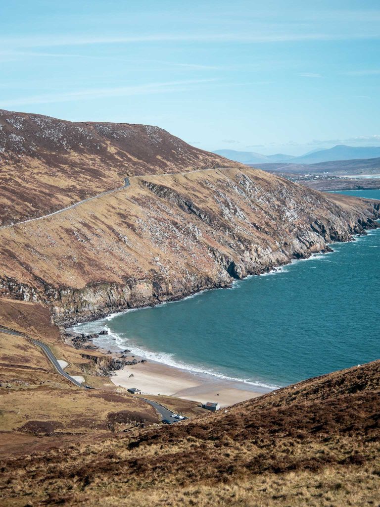
Ireland is known for its outstanding coastal scenery, with famous landscapes such as the Cliffs of Moher, the Ring of Kerry and the Giants Causeway. However, one part of the country tourists often miss is the stunning Achill Island in County Mayo. Not only is Achill one of the most beautiful spots in the country. It is also home to Ireland’s highest sea cliffs, Croaghaun, and the best hikes in Europe.
Hiking along the edge of these cliffs is sure to take your breath away, be prepared to meet an array of wildlife along the way from the soaring eagles to playful dolphins. If you visit in the early summer months then you may even get lucky and spot some basking sharks swimming below.
Getting to Croaghaun Cliffs is a little bit difficult, so it is best to rent a car. And, don’t worry, the island is attached to the mainland via a bridge. I’d advise parking at Keem Bay (my favourite beach in Ireland) and starting your hike via the iconic watch tower. AllTrails has a great summary of this route. Alternatively, you can park at Loch Acorrymore as in the summer Keem Bay is quite popular among locals looking to go for a swim.
I’d advise taking on Croaghaun in the Spring/Summer months as it is not a marked trail and the train can get extremely wet/boggy in the winter. After the hike, I recommend grabbing a bite to eat on the island. I really enjoy the food in the Beehive. Or, if you are looking for something quick and easy, then Blásta does some tasty fast food.
It is important to note that Achill is very much a seasonable island. This means a lot of places will be closed in the Autumn/Winter months. However, the hike is accessible all year round.
Length: 8.5 kilometers (5.3 miles)
Elevation Gain: 548 meters (1,797 feet)
Type of Trail: Loop
Difficulty: Hard
Time: 3-4 hours
Fee or permit required: None
AllTrails Link: Croughaun Loop
The Dingle Way (Ireland)
Recommended by Kelie of Vacations Planned
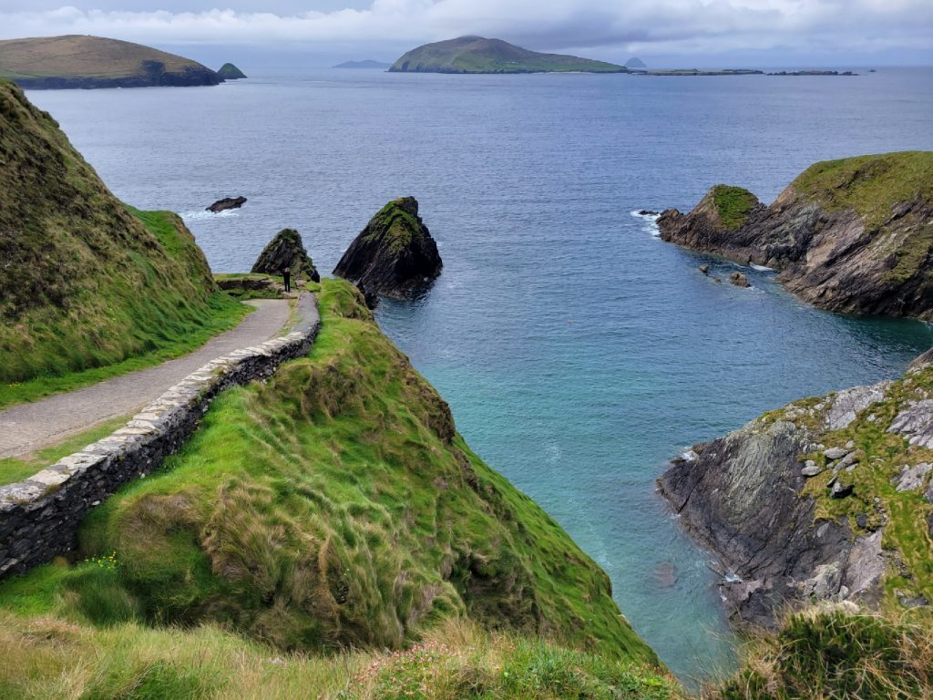
The Dingle Way trail is a challenging trek that will take you around the entire Dingle Peninsula in Ireland. It’s an absolutely gorgeous hike in Europe that winds through mountains, small villages and towns, and along dramatic cliffs.
It will push the most active of travelers and the views are 100% worth it! The trail starts and ends in the town of Tralee; the whole trail takes about 8 or 9 days to complete.
Along the way, there will be wonderful lodging to rest and enjoy the local culture and food. And depending on how much time you have, you don’t have to walk the whole trail.
If you just want to attempt certain sections, then there are many parts you can start at in Dingle. To get to Tralee, you can drive or take a train or bus from Dublin or Shannon (depending on which airport you fly into).
The weather in Ireland can be tricky because it rains regularly throughout the year. But the best and likely driest season to attempt this trek would be May through August. You’ll need good walking shoes, a rain jacket with a hood, rain resistant backpack, and walking sticks are optional (though many find them helpful).
Length: 182.6 kilometers (113.5 miles)
Elevation Gain: 3,895 meters (12,782 feet)
Type of Trail: Loop
Difficulty: Hard
Time: 8-9 Days
Fee or permit required: None
AllTrails Link: The Dingle Way
Gap of Dunloe (Ireland)
Recommended by Janelle of Make the Trip Matter
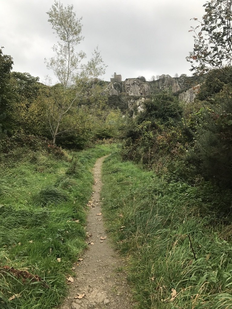
The Ring of Kerry is one of the most popular natural attractions in Ireland and is made up of many excellent hikes. Arguably one of the very best is the Gap of Dunloe which has stunning views, lakes, waterfalls, stone bridges, and unique ruins. It’s an epic hike in Europe that you should add to your bucket list.
To reach this hike, you can drive or consider hiring a local tour from Killarney. Parking is available near Kate Kearney’s Cottage, the starting point of the trek. The best time to explore this region is during the late spring to early fall (though the summer can get quite busy), avoiding potentially harsh winter conditions.
While the trail doesn’t demand specialized gear, comfortable hiking boots and weather-appropriate clothing are advisable, especially because it can get muddy. The trail is very accessible for all types of travelers whether you wish to walk, bike, boat, or even take a horse and carriage through the Gap.
You can stop for refreshments in the cafe at the trailhead, or continue your exploration with the other nearby Ring of Kerry sites such as the Torc Waterfall, Muckross House, and Ross Castle.
Length: 7 kilometers (4.4 miles)
Elevation Gain: 376 meters (1,236 feet)
Type of Trail: Out and Back
Difficulty: Moderate
Time: 2.5 hours
Fee or permit required: None
AllTrails Link: Gap of Dunloe
Scafell Pike (England)
Recommended by Paulina of the UK Every Day
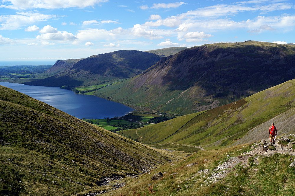
Scafell Pike, located in the Lake District is undoubtedly one of the most remarkable hiking destinations in Europe. This majestic mountain offers an unparalleled experience for outdoor enthusiasts and nature lovers alike. Rising to an impressive height of 978 meters, it stands as the highest peak in England, attracting adventurers from all over the world.
The best time of year to embark on the Scafell Pike hike largely depends on both personal preferences and weather conditions. The summer months, particularly from June to September, are generally considered the most popular time to undertake this adventure.
During this period, the weather is relatively mild, and the days are longer, providing ample daylight for the hike.
For those relying on public transportation, there are several options available. One can take a train to the nearby town of Penrith or Windermere, and from there catch a bus. However, the most convenient option is to drive by car to Wasdale – Lake Head Car Park from where you can start your hike.
Length: 9.3 kilometers (5.7 miles)
Elevation Gain: 913 meters (3,208 feet)
Type of Trail: Out and Back
Difficulty: Hard
Time: 4 hours
Fee or permit required: None
AllTrails Link: Scafell Pike
The Best Hikes in Eastern Europe
Seven Rila Lakes (Bulgaria)
Recommended by Emma of Journey of a Nomadic Family
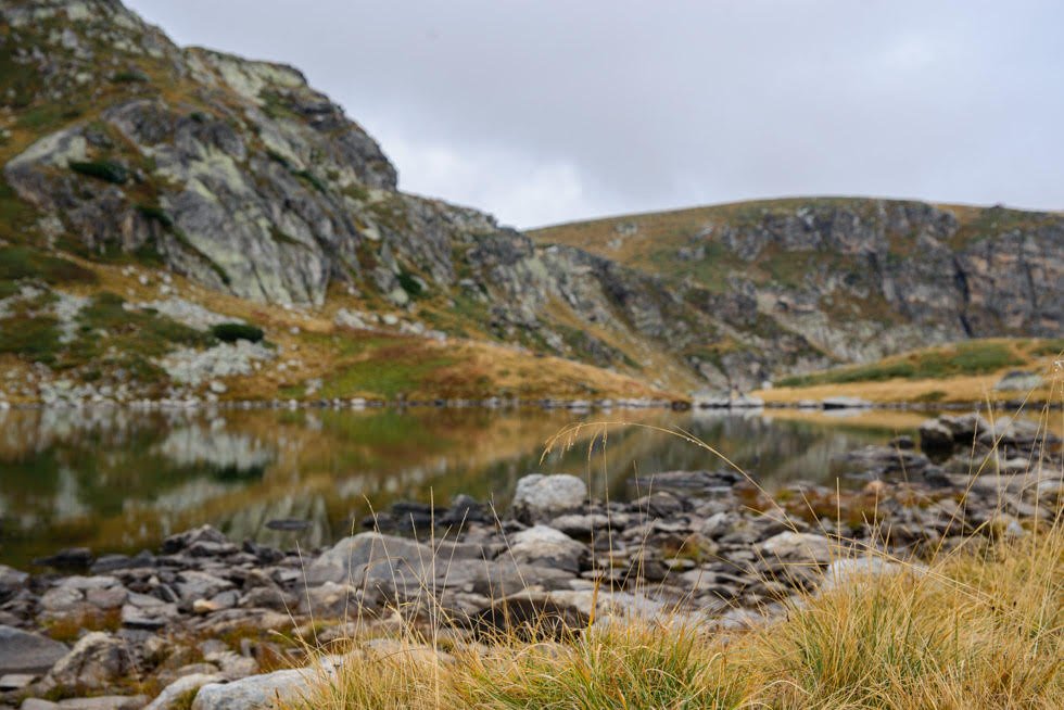
The Seven Rila Lakes hike in Bulgaria stands out as one of Europe’s premier hiking experiences, captivating adventurers with its breathtaking scenery but relatively easy-to-manage trails. Nestled in the Rila Mountains, this trail takes hikers on a mesmerizing journey through seven glacial lakes, each with its own unique name, charm and beauty.
What makes the Seven Rila Lakes hike exceptional is the panoramic views that unfold along the way. The pristine lakes are surrounded by both rugged peaks and lush alpine meadows, creating a picturesque landscape. The crystal-clear waters of the lakes reflect the azure sky, making the trek a visual feast.
To embark on this adventure, travelers typically arrive in Sofia, the capital of Bulgaria. From there, a two-hour drive takes them to the trailhead or there are plenty of organized tours. The hike itself is approximately 15 kilometers long and can be done either as a loop or out and back.
For seasoned hikers it’s an easy hike, but if you want to make it more challenging, do not catch the ski lift chairs (roughly 18 Leva or 9 Euros return) on the way up and instead start your hike underneath the chairs.
The best time to hike the Seven Rila Lakes hike is during the summer months, from mid-May to September when the weather is milder and the trail is free of snow. If you hike in the early autumn months, then you’ll be rewarded with inverted clouds, icicles hanging from bushes and maybe a drizzle of snow. Wrap up warm with plenty of layers! This area is prone to avalanches in the winter, so if you’re not familiar with winter hiking, definitely take a guide.
Length: 10 kilometers (6.2 miles)
Elevation Gain: 532 meters (1,748 feet)
Type of Trail: Loop
Difficulty: Moderate
Time: 3 hours, 30 minutes
Fee or permit required: None, but you can book a guide for this hike
AllTrails Link: Seven Rila Lakes
Vintgar Gorge (Slovenia)
Recommended by Melissa of Parenthood and Passports
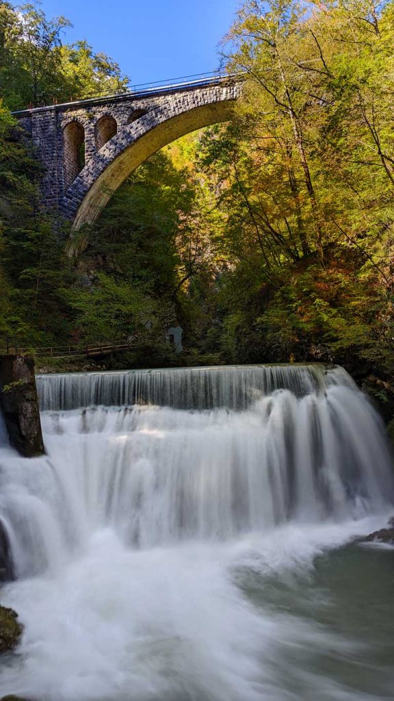
Vintgar Gorge in Slovenia stands out as one of Europe’s most breathtaking hikes, offering an enjoyable experience without a lot of effort. In fact, this trail is easy enough for families with young children.
The hike starts with a 1.6 kilometer trail that guides you through a remarkable ravine carved by the Radovna River. The path through the ravine takes place mostly on a suspended wooden boardwalk along the gorge’s wall, as well as across a series of bridges over the Radovna River.
Both children and adults will delight in traversing the bridges over the river, taking in the sights of rushing water and cascading waterfalls. After hiking through the gorge, you have the option to either take a cab back to the trail parking lot or embark on the return trail loop called St. Catherine Loop.
Although the return trail adds an additional 2-2.5 miles, it leads you through a grove of tall trees, by the quaint Church of St. Catherine and through picturesque pastures where sheep and cows graze all around you.
Located just a few kilometers outside Lake Bled, Slovenia, you can take a shuttle bus to the gorge, drive, rent bikes, or even walk from the town. If you plan to drive, then there is a small parking fee in one of the two available lots at the trailhead.
Despite its popularity, the trail remains comfortably uncrowded, thanks to timed admission tickets required by the operators for gorge hikes.
It’s important to note if planning to hike Vintgar Gorge, the trail closes in mid-October and remains closed until early May.
Length: 5.5 kilometers (3.4 miles)
Elevation Gain: 205 meters (675 feet)
Type of Trail: Loop
Difficulty: Easy
Time: 2 Hours
Fee or permit required: 10 € + 2 € for parking
AllTrails Link: Vintgar Gorge
Lake Krn (Slovenia)
Recommended by Stephanie of The Unknown Enthusiast
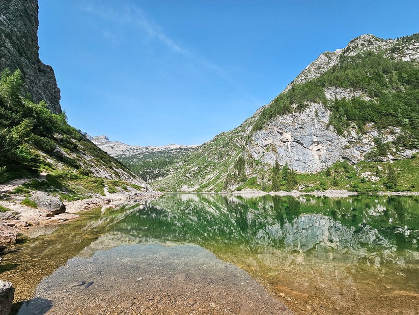
You may not think of Slovenia when you think of the best hikes in Europe, but you will be surprised to hear that the country is home to some gorgeous scenery and fun hikes! Lake Krn is one of the beautiful alpine lakes in Slovenia, and offers a beautiful trail to a stunning destination. You’ll hike up the mountain on a forested trail, and then the last hour of the hike is through an alpine pass and valley, where you’re surrounded by evergreens and mountain peaks.
The lake itself is a beautiful green-blue color, and when the wind is low, the reflection of the mountains on the water is lovely. You can also continue to hike to the top of Mount Krn after the lake, if you want a longer hike.
There is no public transportation, so you’ll need to drive yourself to the trailhead, where there is parking near the Lepena Valley hut. This hike is best done in summer or early fall, when the snow is melted. About 20 minutes before you arrive at the lake, you’ll pass a small farm that makes their own cheese to sell to hikers – definitely stop and try some!
When you’re done with the hike, I’d definitely recommend stopping at the hut by the trailhead for a bowl of jota soup.
Length: 12.5 kilometers (8 miles)
Elevation Gain: 944 meters (3,100 feet)
Type of Trail: Out and Back
Difficulty: Hard
Time: 4.5 Hours
Fee or permit required: None
AllTrails Link: Lake Krn
Morskie Oko (Poland)
Recommended by Tom of Trekking The Dream
The Polish Tatra Mountains are some of the most stunning in Europe and offer plenty of opportunities for hikers of every ability. While hiking in Poland may not be on many travelers’ radars, some of the best hikes in Europe are right here in these mountains.
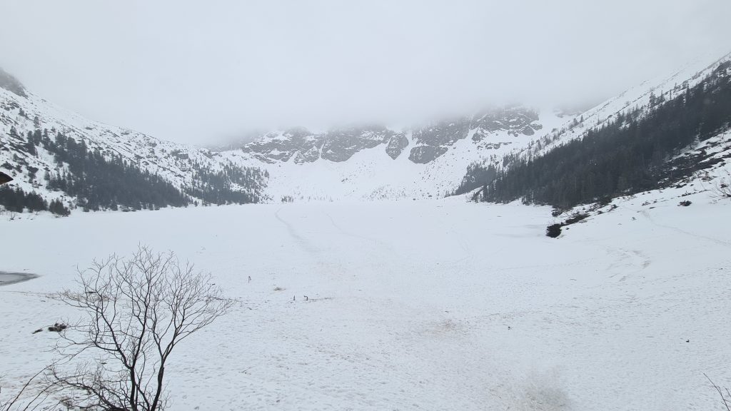
The Morskie Oko Lake is the largest in the spectacularly beautiful Tatra National Park and the hike to it is particularly suitable for families. Walkers can follow the winding access road or take the more direct route through the mature pine forest that covers most of the park. Wildlife abounds and, depending on the time of year, you may see wild boar, marmots, Tatra chamois and even wolves and bears!
Public transport is available from the nearby town of Zakopane and will take you directly to the car park at the trailhead. If you are driving, then a small charge can be paid in advance or on-site.
The views are amazing at any time of year, but be aware that in winter, the temperatures drop well below zero, as is evidenced by the frozen lake!
No specialist kit is required for this hike, but remember to wear decent footwear, suitable clothing, and take plenty of water. The hike is worth it for the beautiful views. You can reward yourself with something to eat in the restaurant at the lake.
Length: 17.2 kilometers (10.7 miles)
Elevation Gain: 565 meters (1,856 feet)
Type of Trail: Out and Back
Difficulty: Hard
Time: 4-5 hours
Fee or permit required: 5 PLN for the hike / 25 – 45 PLN for the car park
AllTrails Link: Morskie Oko Hike
Upper and Lower Lakes at Plitvice Lakes National Park (Croatia)
Recommended by Anne of Packing Light Travel
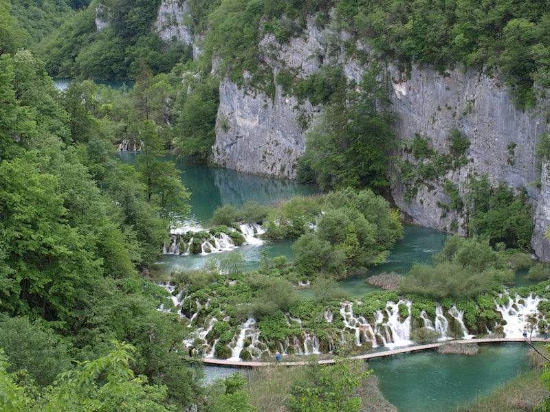
Plitvice Lakes is one of the best hikes in Europe! The connecting lakes, streams, and waterfalls of the stunningly beautiful Plitvice Lakes National Park are its greatest assets, earning it UNESCO-listed status for its natural and ecological significance.
Public bus services operate from Zagreb, Split, and Zadar, and many operators offer day tours. Environmentally friendly electric boats and road trains within the park, and plenty of easy walking trails and boardwalks make Plitvice a popular destination for day trippers.
However, the national park is best appreciated on a two-day visit by private vehicle. A two-day pass permits hiking the more popular boardwalks and trails before and after day trippers arrive and depart, and exploration of the higher, more challenging trails with their spectacular views during the busy periods. It also means entering when the park opens and staying until it closes, with opportunities to appreciate and photograph the scenery in various shades of light.
Having a vehicle makes it easier to enjoy the local hospitality and home-cooked meals offered by the many private accommodation providers located outside the park. There are four hotels within the park, so this is another option. For additional insights, see tips for visiting Plitvice Lakes National Park, Croatia.
Length: 15.1 kilometers (9.4 miles)
Elevation Gain: 401 meters (1,315 feet)
Type of Trail: Loop
Difficulty: Moderate
Time: 4 Hours
Fee or permit required: Yes, varies by season.
AllTrails Link: Upper and Lower Lakes
The Best Hikes in Northern Europe
Asbyrgi Canyon (Iceland)
Recommended by Shweta of Zest In A Tote
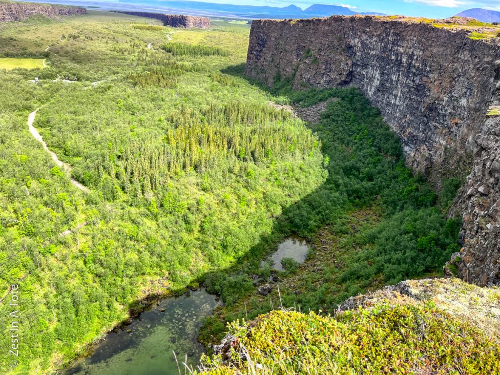
Asbyrgi Canyon lies in a remote part of North Iceland and home to some of the best hikes in all of Europe. The closest city to Asbyrgi is Husavik. Asbyrgi is a breathtaking glacier canyon that is about 3.5 km in length and about 1.1 km in width. Geologists expect Asbyrgi Canyon to have been formed about 10 million years ago due to the flooding of the Jokulsa river. But the more fun explanations in Icelandic folklore. It is believed that Odin’s horse laid one of its feet on the earth creating a horseshoe imprint!
The best way to appreciate this dramatic canyon is to hike the rim of Asbyrgi Canyon. Public transportation to this part of North Iceland doesn’t exist. So you either have to drive or take a Diamond Circle tour that covers this canyon. The visitors center in Asbyrgi has ample parking. The canyon floor also has a free campground.
Spring and summer months, April to September would be the best time to visit this canyon. Being in a remote location, you don’t have to deal with crowds while hiking the rim. The staff at the visitors center would tell you all possible hiking options: from easy 1 km routes to the moderate 8-12 km routes. There is no gear required for this hike.
Length: 13.2 kilometers (8.2 miles)
Elevation Gain: 283 meters (931 feet)
Type of Trail: Loop
Difficulty: Moderate
Time: 3 Hours
Fee or permit required: None
AllTrails Link: Asbyrgi Canyon Loop.
Reykjadalur Hot Springs (Iceland)
Recommended by Jess of Uprooted Traveler
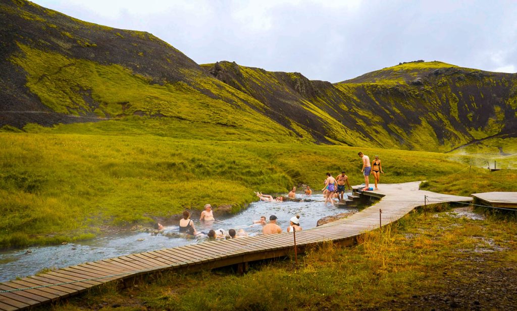
On this incredible Reykjadalur Hot Springs trail, you’ll hike up into the impossibly green mountains of Iceland to a thermal river, perfect for relaxing in and soaking in the epic surrounding scenery. Along the way, you’ll pass massive waterfalls, bubbling hot pots, and adorably weathered Icelandic sheep. Walking this trail must be added to your bucket list of the best hikes in Europe!
The trailhead is conveniently located just 40 minutes south of Reykjavik, along the Ring Road, making it the perfect pit stop on the way to Vik and other popular destinations in southern Iceland.
There’s plenty of parking by the trailhead and actually a coffee shop right next to it called the Reykjadalur Cafe. It’s the perfect spot to grab a hot drink to warm up before your hike.
While the trail is generally accessible year round, the best time to hike to the hot spring is in the summertime, when the temperature is pleasant, the trail is snow- and ice-free, and you have the best chance of getting clear skies. Come November, the trail usually is covered with snow, so you should come prepared with microspikes and trekking poles to help you get up the steep and icy hills.
Length: 6 kilometers (5 miles)
Elevation Gain: 346 meters (1,138 feet)
Type of Trail: Out and Back
Difficulty: Moderate
Time: 2.5 hours
Fee or permit required: None
AllTrails Link: Reykjadalur Hot Springs
Reinebringen (Norway)
Recommended by Hannah of That Adventurer
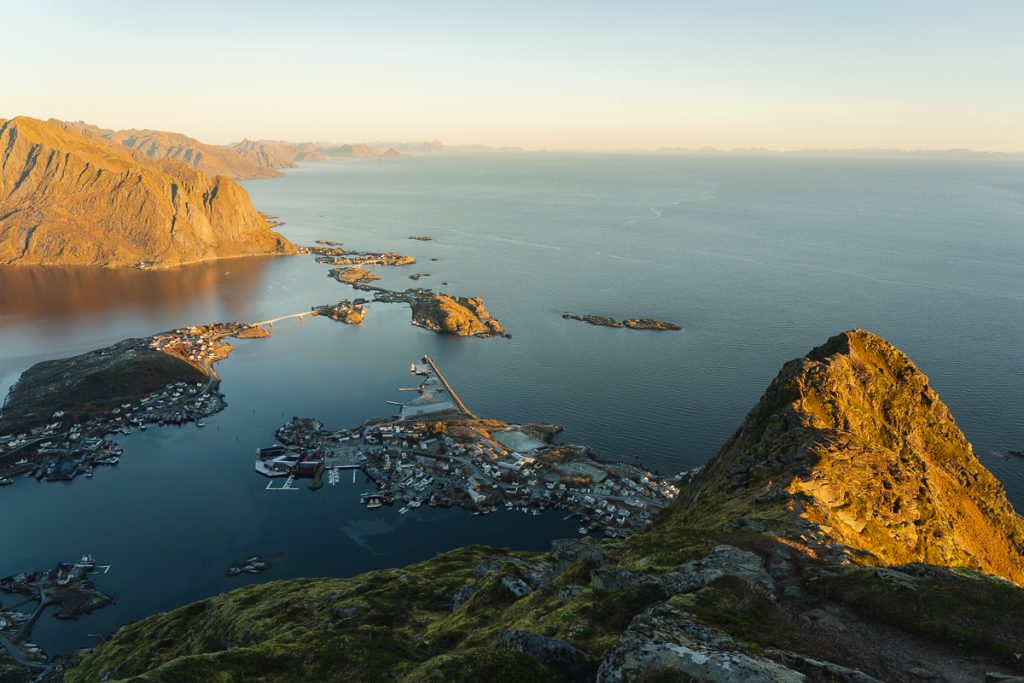
The Reinebringen Hike in the Lofoten Islands in Norway is one of the most popular and beautiful hikes in Europe. From the top, you’ll get incredible views of the Lofoten archipelago with its fjords, cute fishing villages, and mountains that seem to spring up from nowhere.
The hike is not to be taken lightly as it involves hiking up 1,500 steep stone steps until you reach the top. This hike should not be attempted in winter, or wet and rainy conditions as the steps can get super slippery, and dangerous. There are a few places along the way where you can move off the main staircase to the side and catch your breath while looking out to the sea behind you.
There is no direct public transportation to the start of the hike and you should park in the pay parking in Reine, or the very limited free parking just off the main road before you descend into the village. A signposted path running parallel to the road will take you to the trailhead.
The best time to do the Reinebringen hike is during summer when the weather is better, and the days are long. However, this is also the busiest period, so early morning starts are recommended to avoid crowds. Or, since there’s midnight sun in Lofoten in summer you could do a late night/early morning hike too.
No special gear is required, but wear good hiking boots or trail running shoes and bring water and food as there are no facilities along the way. In winter, always pack microspikes as a precaution in case the steps are slippery.
After the hike, enjoy Fika in Bringen cafe in Reine, or head to Anita’s Sjømat for one of their famous fish sandwiches and lunch!
Length: 3.4 kilometers from the free parking in Reine (2.1 miles)
Elevation Gain: 470 meters (1,542 feet)
Type of Trail: Out and Back
Difficulty: Hard
Time: 2-3 hours
Fee or permit required: None
AllTrails Link: Reinebringen (Note: This trail takes you to the ‘true peak’ of Reinebringen which is not the viewpoint that the majority of people go to. The true peak is not recommended as it involves scrambling and light rock climbing on very narrow, eroded sections of the trail. Stop when you get to the top of the stairs.)
Preikestolen or Pulpit Rock (Norway)
Recommended by Alice of Adventures of Alice
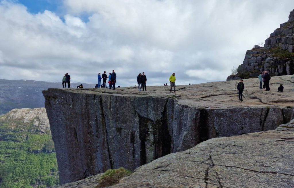
Preikestolen is by far one of the best hikes in Europe and one of the most popular hikes in the beautiful country of Norway. Located near the beautiful city of Stavanger, the views along the whole hike are spectacular and once you reach the top, it’s simply breathtaking. Plus, it’s relatively easy to climb.
There are two places you can park to get to the hike. If you take road 523 until you reach Preikestolvegen, then you can follow the route to one of the parking lots (listed as upper parking and lower parking on Google Maps). Lower parking is where the campsite is located and also where you’ll find the official start of the trail.
To park for the day costs 250 NOK or around £18. This is useful if you have a car but if you don’t have a car, it would be best to get a guided tour there. You can also get a bus from Stavanger which takes around an hour.
The best time to go would be during the main season, which is June to August, however, this is also when it is the busiest. Going even a week before or after this peak time may improve the experience. We went in late May and, while it was still fairly busy, it wasn’t peak summer busy.
You don’t need any special gear to hike this trail. Just some comfortable hiking boots, a bag with snacks and water, and some waterproofs in case it rains!
Length: 8 kilometers (5 miles)
Elevation Gain: 398 meters (1,305 feet)
Type of Trail: Out and Back (with options to make it a loop)
Difficulty: Moderate
Time: 3 hours
Fee or permit required: None
AllTrails Link: Preikestolen
Looking for More European Adventures?
Ready to Start Exploring the Best Hikes in Europe?
Pin this Europe hiking guide to help plan your adventure!
This article was written by Tori, one of our Adventures of A+K team members. Learn a bit about her below!
Hi, I’m Tori! I live in Nashville, TN with my husband and two daughters. We travel as much as possible throughout the year, around a 9-5 schedule and with babies in tow! My travel blog, Tori Pines Travels, aims to help people plan action-packed and culture-rich vacations around their busy jobs, fitting in as much exploring as possible. When I’m not working for Adam and Kathryn or entertaining my little ones, I’m writing, cooking, crafting or exploring Music City!