Last updated on December 4th, 2023
Looking to drive the McCarthy Road to Wrangell-St. Elias National Park? In this guide we’re sharing everything you need to know to safely drive the road including what vehicle to drive, how long it takes, all the hazards to be aware of, and so much more!
Wrangell-St. Elias National Park is one of the few national parks in Alaska that is accessible by car. However, that doesn’t necessarily mean it’s easy to get to. The most popular road into the park, McCarthy Road, is an unpaved adventure that requires a bit of a time commitment. But for those willing to put in a bit of effort, it’s worth it to visit the park!
Before visiting Wrangell-St. Elias National Park we were a bit nervous to take our home on wheels down McCarthy Road. We had heard some horror stories and didn’t want to get into a pickle in the middle of remote Alaska.
But we are so glad that we went for it! It was nowhere near as bad as we anticipated and Wrangell-St. Elias National Park is a beautiful, unique, and fun park to explore.
Watch us spend three days in Wrangell-St. Elias National Park, including hiking the Bonanza Mine Trail, walking on the Root Glacier, and camping with one of our best views yet!
Feeling a bit unsure like we were? In this guide we’re sharing our experience and tips from driving the McCarthy Road. We hope it helps answer any questions you have or ease any concerns, so that you can experience the largest national park in the United States!
- About McCarthy Road
- Where is McCarthy Road?
- Road conditions on McCarthy Road
- Things to know before driving McCarthy Road
- What to bring to drive the McCarthy Road
- The best stops along the McCarthy Road
- At the end of McCarthy Road
- Don’t want to make the drive afterall?
- Things to do in Wrangell-St. Elias National Park
- Ready to drive to Wrangell-St. Elias National Park?

Looking for more things to do in Alaska?
- Things to do in Wrangell-St. Elias National Park (LARGEST national park in the US!)
- How to hike the Root Glacier trail in Wrangell-St. Elias National Park
- Hiking the Bonanza Mine trail in Wrangell-St. Elias National Park
- RVing Alaska: Our top tips & things to know!
- 12+ FUN things to do in Valdez, Alaska
- 8+ EPIC things to do in Hatcher Pass in Alaska
- The ULTIMATE guide to visiting Denali National Park (Mile 0-43)
- 8 things to do in Kenai Fjords National Park
- The ULTIMATE guide to driving the Alaska Highway
- Summer Alaska Packing List
- How to spend 7 days in Alaska (4 itinerary options!)
- All of our Alaska vlogs
- All of our Alaska guides
About McCarthy Road
The McCarthy Road is a mostly gravel, 59 mile road that starts in Chitina, AK (pronounced CHIT-na), at mile 33 of the Edgerton Highway. And it dead ends at the Kennicott River across from the small town of McCarthy, Alaska.
The McCarthy Road follows the route of the old Copper River & Northwestern Railway. This railway began operation in 1907 and would carry copper ore from the Kennecott Mines to Cordova. When large-scale mining ended in 1938, most of the rails were salvaged for scrap iron. And in 1971, the rail bed was covered with gravel, which created today’s road.
If you’re curious to learn more about the railway and mining operations, plus see artifacts and photos, you can visit the McCarthy-Kennicott Historical Museum in McCarthy or tour the Kennecott Mill.
Where is McCarthy Road?
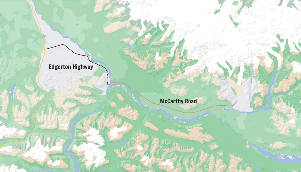
The McCarthy Road is located in southcentral Alaska, with the start of the road being about 4.5 hours east of Anchorage, 3.5 hours south of Tok, and under 5.5 hours south of Fairbanks.
It is one of only two roads into Wrangell-St. Elias National Park, with the other being Nabesna Road. Nabesna Road is more about the journey, with sights along the way and no major attraction at the end. While McCarthy Road is more about the destination. There are things to see along McCarthy Road, but the real prize is getting to the Kennecott area of Wrangell-St. Elias National Park at the end.
Road conditions on McCarthy Road

Since McCarthy Road is built on top of old train tracks, old railroad ties and spikes used to become exposed and cause flat tires. However, thankfully over the last few years the state has spent a lot of money to improve the road and it is now well maintained in the summer months.
When we drove the McCarthy Road in August 2022, the road had both chip seal pavement and gravel, with potholes, sharp rocks, and washboards in some spots.
But in all honesty, it was MUCH better than we expected. We have driven many unpaved roads all around North America and it was definitely not the worst we have ever been on. In fact, in some spots we were shocked by how decent the conditions were! And we even drove it on a rainier day.
To get up to date road conditions and other information about the park and road, you can visit or call the Chitina Ranger Station. We also suggest checking out the Alaska 511 website.
Things to know before driving McCarthy Road

When to drive McCarthy Road
The best time to drive McCarthy Road is in the summer and early fall when the road is maintained and driving conditions are best. We’d suggest between June through early September, which is when the park will be the most accessible and tours are offered.
What vehicles can drive McCarthy Road?
Although doable, large RVs and trailers are not recommended. This road is best driven in a car, truck, van, and class B or C RV. You do not need 4×4 or AWD. We drove McCarthy Road in our 170 WB Sprinter van and it worked out great!
If renting a car, make sure to check with the rental company before driving this road. Some may prohibit driving unpaved roads.
Go slow
It is recommended to drive 5-10 mph in the rough spots of the road and no more than the posted 35 mph speed limit in other areas. In our experience, the faster you drive on these gravel roads, the higher your chance of something going wrong, like a flat tire.
We have driven a handful of unpaved roads in Alaska and Canada, including the Dempster Highway, which is notorious for flat tires. And throughout them all we have had zero issues. We think driving slow has had a lot to do with that!
How long does it take to drive McCarthy Road?
The National Park Service suggests giving yourself two hours each way to drive McCarthy Road. This timeframe is just for the actual McCarthy Road, not including the 33 miles on the Edgerton Highway. All together, you will need at least 3 hours each way.
If you plan to make a lot of stops, make sure to plan for even more time!
Fuel up beforehand
There is gas and diesel at the Kenny Lake Mercantile and you can find gas at Wrangell View Store in Chitina. Once you get east of Chitina you won’t find any fuel.
Before heading on the Edgerton Highway and McCarthy Road you can also find fuel in Glennallen and Copper Center.
Where to stay before and after driving the McCarthy Road
If you are looking for a place to stay before making the drive down McCarthy Road, or need somewhere to leave your RV or trailer while you drive down McCarthy road, there are a few options near Chitina.
Kenny Lake Mercantile
This is an RV park at mile 7.2 of the Richardson Highway. It has 9 pull through sites, 10 electric sites, a dump station with fresh water, laundry room, and showers.
Wrangell View RV Park
This RV park has full hookups, but no other amenities (including no restrooms or showers). We hear that they only take cash or check, so come prepared!
Liberty Falls State Recreation Site
This campsite is close to Chitina and has 10 campsites, which cost $25 per night. It’s also home to Liberty Falls, which is stunning!
Free public campground
This campground can be found right after you cross the Copper River Bridge on McCarthy Road.
Tazlina River Access
We stayed here the night before we made the drive down McCarthy Road. It is just a parking lot, but has nice scenery around and was a convenient place to stay, especially since we wanted to visit the Visitor Center before heading down the road!
Leave no trace
There are no garbage cans along McCarthy Road, so please make sure to pack out any trash and follow all other Leave No Trace principles, to ensure you leave the road better than you found it.
Cell service
We had Verizon cell service in Chitina, Kennecott, and McCarthy, but there was little to no Verizon service along McCarthy Road. We hear that AT&T does not work as well within these areas. Make sure to download offline Google Maps and AllTrails maps in advance!
Want to get 30% off an AllTrails Plus membership? Use our code aplusk30 (you must redeem this code on the website, not the app)!
We use AllTrails Plus on every single hike and it is the most helpful hiking tool out there! Some of the features we love are offline maps (so we can navigate even without cell service), wrong-turn alerts, and its 3D maps feature, so we can get a feel for trails before we hike.
What to bring to drive the McCarthy Road
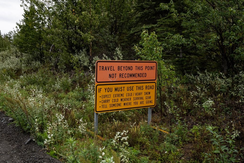
Spare tire and a jack
Although the McCarthy Road at one point was notorious for flat tires, it has been cleaned up and is actively managed throughout the year. Flat tires and other similar incidents are much less frequent, but they can and do still occur. They are more likely to happen after the road has been recently graded and old debris is kicked up.
Be sure to bring a fully inflated spare tire (not a doughnut tire) and a jack. We also carried a tire patch kit while in Alaska!
Thankfully we had zero issues, which besides just driving slow, we attribute partially to having good tires. Our van has Falken Wildpeak AT3W tires and they handled the unpaved McCarthy Road, Denali Highway, Top of the World Highway, and Dempster Highways like a champ!
If you do have tire trouble, you can find tire repair services in Chitina, but depending on where you have trouble, this may or may not help you.
Extra food and water
Since there are no services once you leave Chitina, and limited services to begin with in Chitina, make sure to pack enough food and water. There aren’t a ton of picnic spots along the way, but you can easily pull over in many different areas to have a car picnic. We’d suggest bringing more food and water than you think you need, just in case you do have car troubles.
Satellite communication device
Since this is a more remote adventure, we suggest carrying a satellite communication device, like a Garmin inReach Mini. We take this with us everywhere and it has come in handy several times on our adventures, mostly to text family (not for SOS reasons thankfully)!
Binoculars
We loved having our Bushnell H20 Roof Prism binoculars with us in Alaska! They helped us spot some wildlife from afar many times. While we unfortunately didn’t see any wildlife on McCarthy Road, you might!
Audio guide
While we are pointing out some spots of interest below, the National Park Service also has an audio guide you can listen to as you drive! Make sure to download this to your phone in advance.
Podcasts and music
Speaking of downloading things to your phone, we suggest downloading some podcasts and music to listen to along the drive!
The best stops along the McCarthy Road
While the McCarthy Road is a scenic drive and has wilderness surrounding you the entire way, it doesn’t offer a ton of major sights to see along the way. But there are some landmarks and stops that we want to point out so you can make a quick stop or admire them from the car window.

Liberty Falls
While technically not on McCarthy Road, Liberty Falls is a must stop when driving the Edgerton Highway to McCarthy Road. This recreation site is home to a gorgeous multi-tier waterfall tucked into a rocky gorge. It’s just a few seconds walk from the parking area to view the falls from the bridge, with the option to take a short trail to get closer to them.
And as we mentioned above, it does have some campsites too! The campground was very empty when we drove the road at the end of August.

State wayside
The state wayside in Chitina is where you’ll leave the pavement behind and begin your big adventure! At this paved wayside you’ll find informational boards and most importantly, restrooms.
Right after you leave the wayside you’ll drive through the “railroad cut”, which was originally a railroad tunnel. It’s one of the coolest features of the road!
Copper River Bridge (Mile 1.4)
Shortly after the railroad cut you’ll drive across the Copper River Bridge. From here you can see the confluence of the Copper and Chitina Rivers. There are a few pullouts to view the rivers and you can camp right around here too. Once you get off the bridge, the road will turn to gravel.
The large snow covered mountain you may or may not be able to see to the north, depending on weather, is Mount Drum, which sits at 12,010 feet.

Kuskulana River Canyon and Bridge (Mile 17.2)
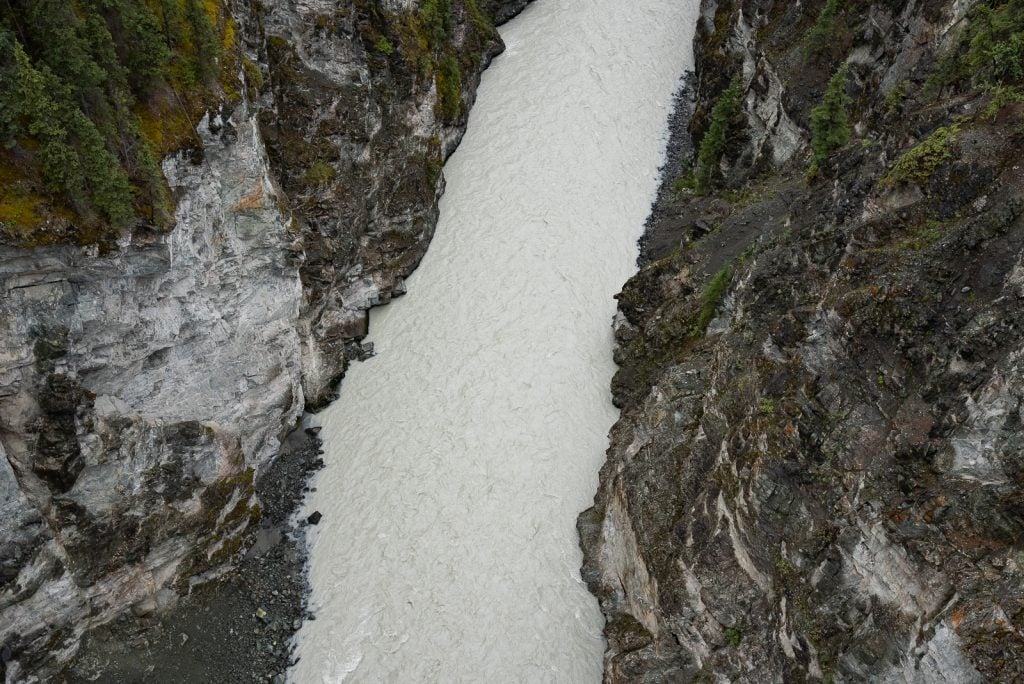
A major highlight along McCarthy Road is the Kuskulana River Canyon and Bridge. This bridge was built during the winter of 1910, which is no small feat, and sits 238 feet above the canyon below.
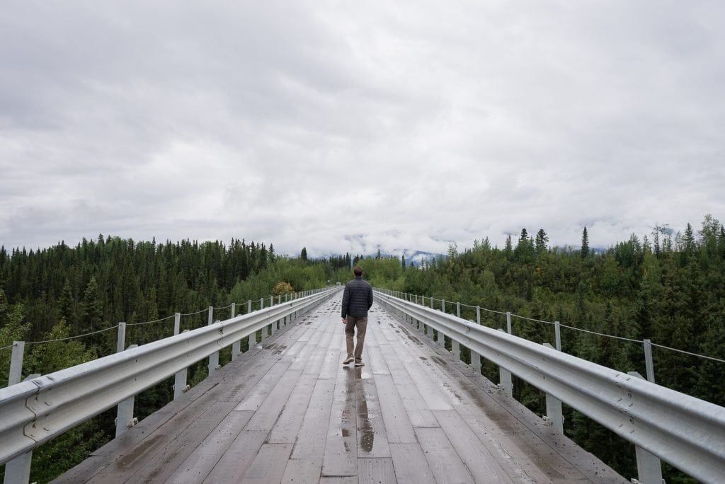
The bridge is a one lane bridge, so watch out for oncoming traffic and don’t stop on the bridge. There are pull outs on either side where you can park and walk out onto the bridge to admire the views.
And the views are amazing! The river below is beautiful, as is the canyon it rushes through, and there is plenty of mountain scenery around. You can also take some short trails down towards the base of the bridge. We loved this stop!

Gilahina River & Gilahina Trestle Wayside (Mile 29)
About half way down McCarthy Road, this rest area has toilets and a half mile trail to stretch your legs. You’ll see the Gilahina Trestle Bridge which was originally 890 feet long and built in 8 days (WOW!) in the winter of 1911. It cost a total of $25 million to build, but thankfully profited $100 million. Between this bridge and the Kuskulana Bridge, we are mind blown by the efficiency of Alaskans in the winter!
Crystalline Hills (Mile 34.8)
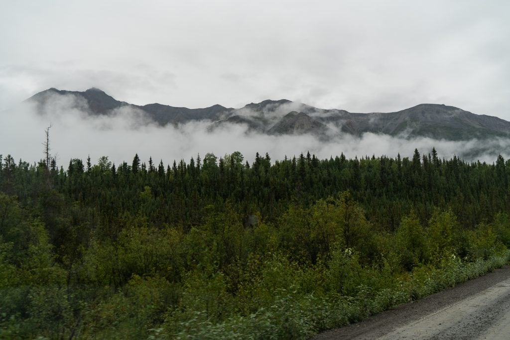
As you make your way through the Crystalline Hills, keep an eye on the hillsides on the north side of the road (left side). The lower slopes are made of light colored marble and is a great spot to see Dall Sheep. Pull over and whip out your binoculars to see if you can spot any!?
At the end of McCarthy Road

Congratulations! You have made it to the end of McCarthy Road!
The road ends right at a footbridge that takes you across the Kennicott River, about 5 miles from Kennecott. Fun fact: the real spelling is Kennicott with an “i,” but the mining town spelled it with an “e,” hence the different spellings.
You cannot take a private vehicle past this point and to get to the Kennecott area of Wrangell-St. Elias National Park you will need to either take a shuttle, bike, or walk, which is what we did!


If taking a shuttle, you’ll find signage at the footbridge with different companies that can take you to Kennecott. There is also a phone you can use to call them and get a ride. Some of these companies do allow dogs on the shuttle.

For walking, you can either walk the road or take the Wagon Road trail. We took the Wagon Road trail both ways, which follows the road at some points, but also ducks more into the forest. This is where we saw our one and only grizzly bear in Alaska, so be bear aware!

As for where to leave your vehicle while you explore the park, Base Camp Kennicott has a large lot where you can park your car for a day (or multiple days) to explore the park. It costs $10 per day to park ($5 for only 4 hours). You can also camp overnight here, right on the river, for $35 per night. We camped for one night and then moved to a parking spot for two nights while we tent camped in the park!
Don’t want to make the drive afterall?
If after reading this guide you’re still unsure you want to make the drive yourself, you do have another option! Kennicott Shuttle can take you from Glennallen and other nearby destinations down the McCarthy Road. You can also take a flight from Chitina on Wrangell Mountain Air.
Things to do in Wrangell-St. Elias National Park

Now that you’ve made it to the park, it’s time to explore! To find out things to do in Wrangell-St. Elias National Park, where to stay, what to eat, and specific hike details, check out these guides:
- Things to do in Wrangell-St. Elias National Park (LARGEST national park in the US!)
- How to hike the Root Glacier trail in Wrangell-St. Elias National Park
- Hiking the Bonanza Mine trail in Wrangell-St. Elias National Park
Ready to drive to Wrangell-St. Elias National Park?
Pin this guide to the McCarthy Road to help plan your trip!