
Last updated on February 10th, 2026
Heading to the Big Island soon? We’re sharing the 10 best hikes on the Big Island, from short scenic trails to challenging treks with epic payoffs. Plus, we’ll cover what you need to know about each one!
Hiking on the Big Island feels completely different from anywhere else in Hawaii. Since the Big Island is so massive and geologically diverse, the landscapes change dramatically depending on where you are. You’ll find lush rainforests and waterfalls, craters and lava fields, plus cliffs and beaches with bright blue ocean views!

If you’re eager to hit the trails on the Big Island, we’re sharing 10 hikes on the Big Island that we loved, plus a couple high up on our list for next time. Each one offers something special and there is something for all ability levels. So whether you’re after a quick and easy stroll, or a challenging climb, these hikes on the Big Island will help you see the most during your time here!
- Map of the best hikes on the Big Island
- The Top 10 Best Hikes on the Big Island
- 1. Thurston Lava Tube Trail (Nāhuku Trail)
- 2. Akaka Falls Trail
- 3. Pololū Trail
- 4. Crater Rim Drive to Keanakakoi Crater
- 5. Kīlauea Iki & Crater Rim Trail
- 6. Captain Cook Monument Trail
- 7. Kiholo Bay and Wainanalii Lagoon
- 8. Papakolea Green Sand Beach
- 9. Fisherman’s Trail
- 10. Mauna Kea Summit (Humuʻula Trail)
- Save this Guide to the Best Hikes on the Big Island
- About the Author
Map of the best hikes on the Big Island
There are 6 regions on the Big Island. We will refer to them often in this blog so you have a better understanding of where the hikes are located. These regions are: Kona, Kohala, Hamakua Coast, Hilo, Puna, and Kau.
There are trails in every region on this blog, from the popular places to stay on the big island like Kona and Hilo, to the smaller areas on the north and south sides of the island. Plus there’s a few located in Hawaii Volcanoes National Park as well. Below is a map of where each hike on this blog post is located so you can plan your big island adventures easier and visit all of the best hikes on the Big Island!
Want to Learn More as you explore?
We highly suggest downloading the Guide Along – Big Island (totally worth the cost!!) audio tours to navigate you on the road. Even when you don’t have service it knows where you are and provides commentary and history about the area. As well as alerts you when to stop for specific sights. These guides are fun to listen to and the narrator feels like a fun friend in the car with you! They also offer a larger Hawaii Bundle which is great if you’re visiting multiple islands!
The Top 10 Best Hikes on the Big Island
Our list of the best hikes on the Big Island is listed by length, from shortest to longest. And we have also included the AllTrails link for each trail, so that you can read current conditions before you head out.
Be sure to get AllTrails Plus so that you can download the map and ensure you never get lost! (Use our code aplusk30 for 30% off!) And while we’ve included many of these hikes in our 7 Day Big Island Itinerary, there’s several other fun things to do in that post too. So be sure to read both guides before heading to the island!
1. Thurston Lava Tube Trail (Nāhuku Trail)
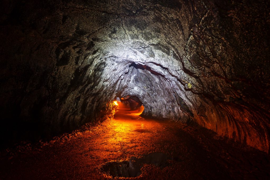
Miles: 0.4 miles
Elevation Gain: 49 feet
Difficulty: Easy
Trail Map & Current Conditions
The easiest option of the hikes on the Big Island is the Nāhuku Trail to the Thurston Lava Tube. Located in Hawaii Volcanoes National Park, you’ll walk just a few minutes through the super lush, green foliage on a paved trail. This makes it a great option for strollers and wheelchairs!
The lava tube is cool to see, is massive and was formed hundreds of years ago. Since it’s quick and easy, this trail is great for all ages and pairs well with other things to do in Hawaii Volcanoes National Park.
2. Akaka Falls Trail
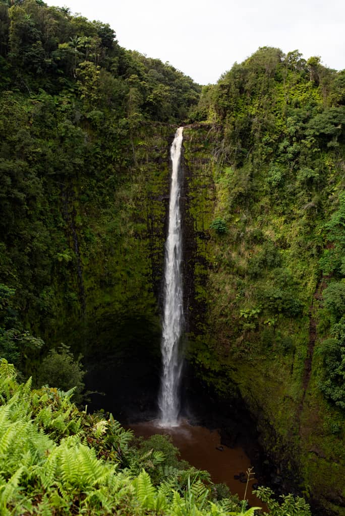

Miles: 0.5 miles
Elevation Gain: 108 feet
Difficulty: Easy
Trail Map & Current Conditions
A must-see on the Big Island, the Akaka Falls Trail at Akaka Falls State Park offers an easy, scenic walk to the island’s iconic 442-foot waterfall. This short, lush trail is perfect for all levels, and the view of the powerful falls surrounded by tropical greenery at the end is absolutely beautiful. The park charges a $10 parking fee, plus a $5 entrance fee per person, though some claim there’s free parking just outside the park, but we can’t confirm that. Be sure to follow all posted rules and signage to help preserve the beauty of this amazing spot!
3. Pololū Trail


Miles: 0.9 miles
Elevation Gain: 344 feet
Difficulty: Moderate
Trail Map & Current Conditions
Pololū Valley is worth more than just a quick stop at the lookout. The Pololū trail down is short, about 0.9 miles, but it’s fairly steep, dropping 344 feet in just over half a mile. At the bottom, you’ll find a striking black sand beach that usually feels quieter than many others on the island, since you have to work to get to it. The hike back up can be hot and tiring, so bring water, but the views and the peaceful beach make the effort worthwhile.
4. Crater Rim Drive to Keanakakoi Crater
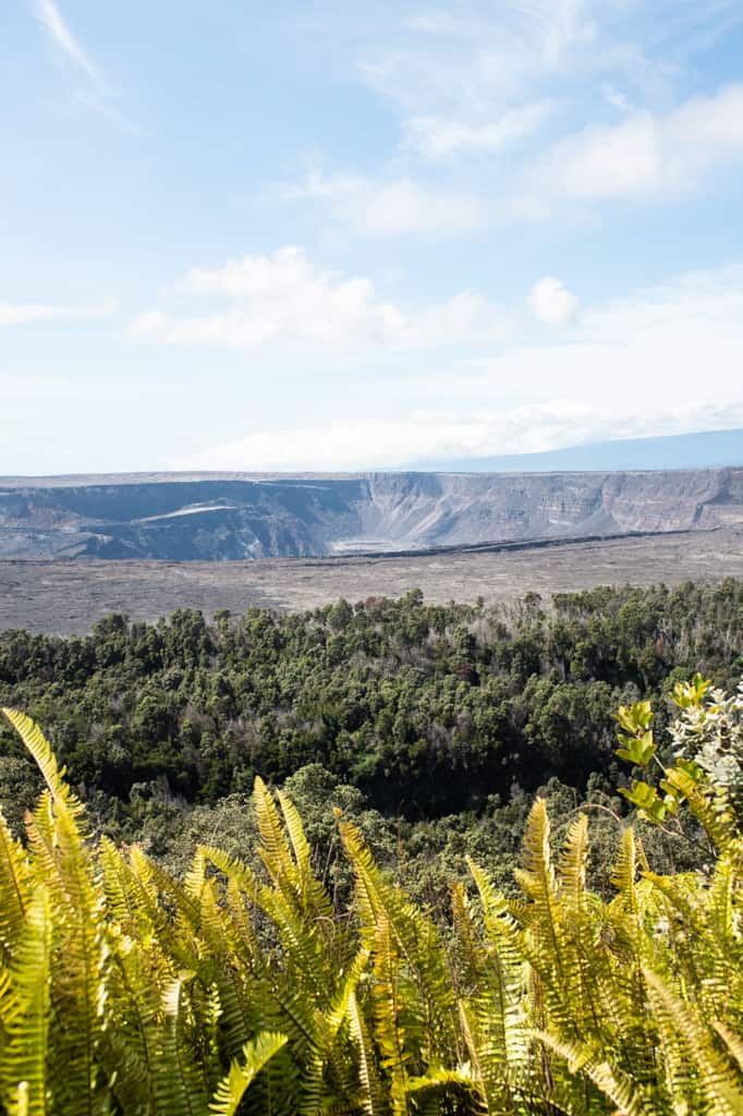
Miles: 2.1 miles
Elevation Gain: 190 feet
Difficulty: Easy
Trail Map & Current Conditions
For a unique hike inside Hawaiʻi Volcanoes National Park, head to the section of Crater Rim Drive near the Devastation Trail. Since the 2018 earthquakes, this stretch of road has been closed to vehicles, but you can walk or bike it to reach Keanakako‘i Crater. Along the way, you’ll pass viewpoints overlooking Kīlauea Crater and get an up-close look at sections of road cracked and shifted by the earthquakes.
This hike on the Big Island is more like a walk on the road, but the endpoint is great, especially if the volcano is showing activity. It’s an easy, fascinating walk that gives you a real sense of the island’s volcanic power.
5. Kīlauea Iki & Crater Rim Trail

Miles: 3.2 miles
Elevation Gain: 741 feet
Difficulty: Moderate
Trail Map & Current Conditions
The Kīlauea Iki Trail is one of the most memorable hikes on the Big Island and is located in Hawaiʻi Volcanoes National Park. About 3 miles round trip with more than a 700-foot elevation change, the trail takes you from the lush crater rim down to the hardened lava floor and then back up the other side. Walking across the crater feels surreal, like stepping onto another planet.
Keep in mind there’s no shade on the crater floor. The parking lot is fairly large, but this trail gets busy as the day goes on, so it’s best to start early to avoid both the crowds and the heat.
6. Captain Cook Monument Trail
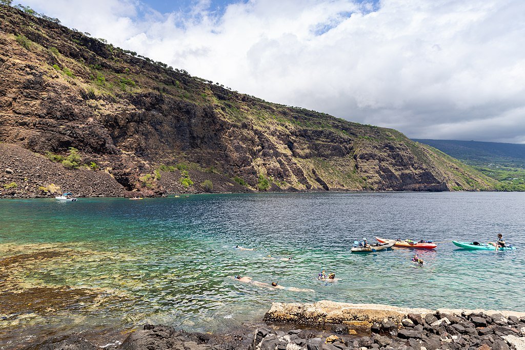
Miles: 3.7 miles
Elevation Gain: 1,269 feet
Difficulty: Hard
Trail Map & Current Conditions
The Captain Cook Monument Trail is a challenging, but rewarding hike on the Kona side of the island. This monument sits right along the water at the bottom of the trail and is only accessible by boat or foot. With the hike being 3.7 miles round trip and nearly 1,300 feet of elevation gain and loss, with the hike to the monument being downhill and the climb back up being a serious workout.
At the bottom, you’ll reach Kealakekua Bay, one of the best snorkeling spots on the Big Island, with clear water and tons of marine life. If you’re up for the effort, this trail combines a great hike with an unbeatable chance to snorkel.
A few things to note, there’s no beach here, just a drop off into the water. So if you plan to go snorkeling, be aware that it’s a bit of work to get in and out of the water. People also report pretty aggressive mongoose live here, so if you bring any food, be sure to secure it super well.
7. Kiholo Bay and Wainanalii Lagoon
Miles: 5.1 miles
Elevation Gain: 328 feet
Difficulty: Easy
Trail Map & Current Conditions
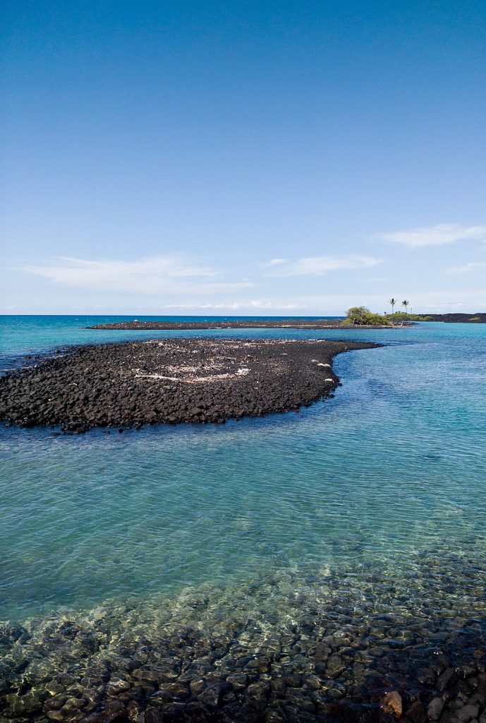
The trail to Kīholo Bay and Wainanaliʻi Lagoon is a scenic coastal walk that combines lava fields, turquoise water, and the chance to spot sea turtles and wild goats. This hike is about 2.5 miles each way over rocky terrain, so sturdy shoes are a must. At the end, you’ll find a beautiful lagoon where turtles often rest and a stunning bay perfect for relaxing by the water. It’s a relatively easy walk, but the exposed lava field can get very hot, so go early and bring plenty of water.
8. Papakolea Green Sand Beach


Miles: 5.5 miles
Elevation Gain: 347 feet
Difficulty: Moderate
Trail Map & Current Conditions
Papakōlea, also known as Green Sand Beach, is one of the most unique spots on the Big Island. Reaching the beach requires a 2–3 mile walk each way across sandy, dirt paths with constant ocean views. The hike isn’t difficult, just a little repetitive, so go early to avoid the midday heat and crowds. The payoff is worth it to be standing on one of only a few green sand beaches in the world!
We went around 7:30 AM and were back by 10:00, but you could easily stay longer if the wind isn’t too strong. For more details on parking, how the sand gets its green color, and tips for visiting, check out our guide to the best beaches on the Big Island.
9. Fisherman’s Trail
Miles: 10.2 miles
Elevation Gain: 547 feet
Difficulty: Moderate
Trail Map & Current Conditions
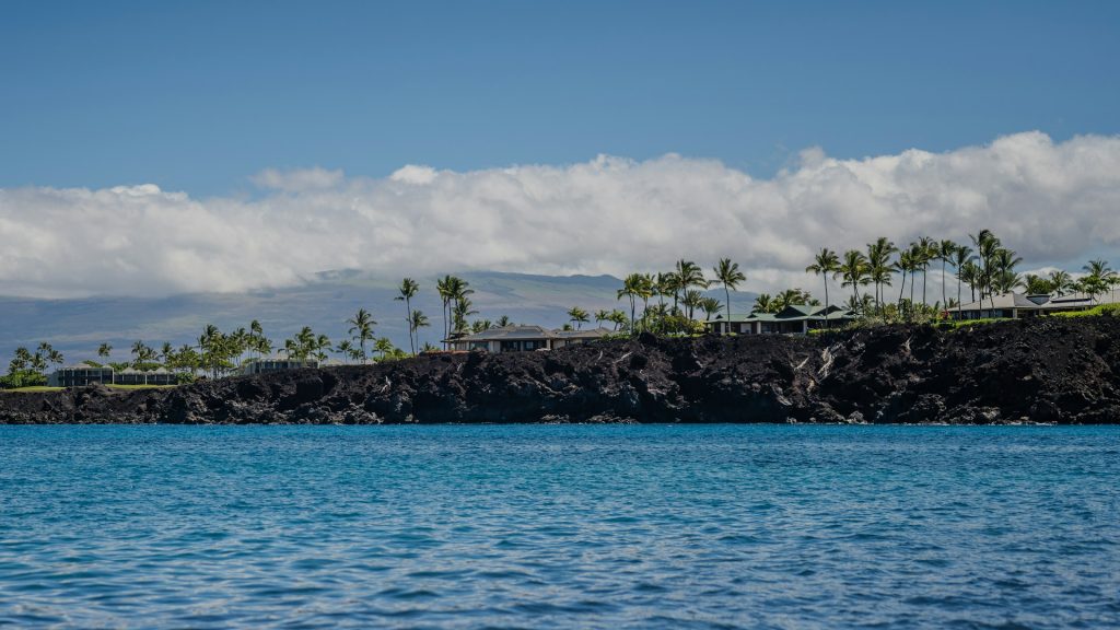
The Fisherman’s Trail runs along the rugged coastline at Anaehoʻomalu Bay (often called A-Bay) in Waikoloa. This hike is a relatively flat walk but with lots of loose rock, so hiking shoes are a must. You’ll follow a lava rock path right along the ocean, with tidepools, petroglyphs, and chances to spot turtles or even dolphins offshore. The views over the water are stunning!
It’s easy to lose the trail at some points, so we recommend having AllTrails Plus so that you can follow along the trail the entire time even without service. The trail can feel hot and exposed, so it’s best done in the morning or late afternoon, but it’s a beautiful way to experience the Big Island’s coastline up close.
10. Mauna Kea Summit (Humuʻula Trail)
Miles: 12.8 miles
Elevation Gain: 4,914
Difficulty: Hard
Trail Map & Current Conditions
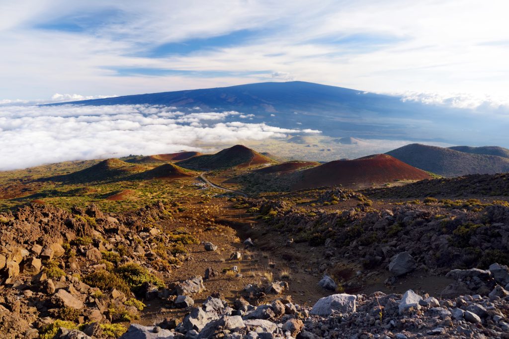
The Humuʻula Trail to the summit of Mauna Kea is the most challenging of the hikes on the Big Island, and one of the toughest in all of Hawaii. Starting at the Visitor Information Station at 9,200 feet, the trail climbs nearly 5,000 feet over about 6 miles to the 13,803-foot summit. Once you reach the Visitor Information Station (VIS) at 9,200 feet, you need to stay there and acclimate to the elevation for at least 30 minutes to avoid altitude sickness.
The elevation, thin air, and cold temperatures make this hike demanding, but on a clear day, the views from the top are incredible, stretching across the island and even to nearby peaks. This trek is best for experienced hikers prepared for altitude and changing weather conditions. According to the VIS, pregnant women, persons in poor health, and children under 13 should NOT venture above the VIS.
Need more ideas for your Hawaii trip?
- 7 Days on the Big Island
- One Day at Hawaii Volcanoes National Park
- 8 Best beaches on the Big Island
- 11 Things you Must Eat on the Big Island
- 5 Days on Oahu
- Hiking up the Koko Head Stairs on Oahu
- Hiking to the Lanikai Pillboxes on Oahu
- 5 Days on Maui
- 14 Must-visit Beaches on Maui
- The Ultimate Road to Hana Guide
- 7 Days on Kauai
- 12 Best Beaches on Kauai
- All Hawaii blogs + guides
Save this Guide to the Best Hikes on the Big Island
Pin this guide on the best hikes on the big island so that you can find it again later!
About the Author
This article was written by Tori, one of our Adventures of A+K team members. Learn a bit about her below!
Hi, I’m Tori! I live in Nashville, TN with my husband and two daughters. We travel as much as possible throughout the year, around a 9-5 schedule and with babies in tow! My travel blog, Tori Pines Travels, aims to help people plan action-packed and culture-rich vacations around their busy jobs, fitting in as much exploring as possible. When I’m not working for Adam and Kathryn or entertaining my little ones, I’m writing, cooking, crafting or exploring Music City!