
Last updated on February 24th, 2026
Are you visiting Capitol Reef National Park sometime soon? Then you must make sure to plan an itinerary full of the best hikes in Capitol Reef National Park so that you can experience all of the best views and scenery that the park has to offer!
We have spent a lot of time in the Utah National Parks over the years and Capitol Reef is, in our opinion, the most underrated of them all. The park offers so many things to do, like beautiful overlooks, delicious food (like PIE!), interesting history, and of course, great hikes.

According to AllTrails, Capitol Reef National Park has 55 trail options. If you only have a day or two in the park, that could make narrowing down those options very difficult! So we’re here to help, by narrowing down this extensive list of what we think are the 11 best hikes in Capitol Reef National Park. We’ve included stats, difficulty, and important tips for each hike, so that you’re totally prepared before hitting the trail!
After the list of best hikes in Capitol Reef National Park, we also include some tips for visiting, including how to get there, when to visit, and where to stay. And for even more ideas of things to do in Capitol Reef, plus the surrounding parks, be sure to check out all of our detailed Utah National Park guides!
- Map of the Best Hikes in Capitol Reef National Park
- The Best Hikes in Capitol Reef National Park
- 1. Petroglyph Panel
- 2. Gooseneck and Sunset Point
- 3. Hickman Bridge
- 4. Cohab Canyon
- 5. Cassidy Arch
- 6. Chimney Rock Loop
- 7. Rim Overlook
- 8. Capitol Gorge (Currently closed)
- 9. Grand Wash
- 10. Sulphur Creek
- 11. Navajo Knobs
- Things You Need to Know Before Hiking in Capitol Reef
- When to visit Capitol Reef National Park
- Getting to and around Capitol Reef National Park
- Cost to visit Capitol Reef
- America the Beautiful Pass
- Where to stay in Capitol Reef National Park
- How long to visit Capitol Reef National Park
- What to bring to Capitol Reef National Park
- Save this guide with the best hikes in Capitol Reef National Park

Map of the Best Hikes in Capitol Reef National Park
Want to Learn More as you explore?
We highly suggest downloading the Guide Along – Capitol Reef or the Utah Bundle (totally worth the cost!!) audio tours to navigate you on the road. Even when you don’t have service it knows where you are and provides commentary and history about the area. As well as alerts you when to stop for specific sights. These guides are fun to listen to and the narrator feels like a fun friend in the car with you!
The Best Hikes in Capitol Reef National Park
While there are so many hikes to choose from in Capitol Reef National Park, we think these 11 trails offer a great mix of sights, accessibility, and views. Fill your Capitol Reef itinerary with as many of these as you can fit and you will have an incredible time and see the best scenery!
1. Petroglyph Panel
Miles: 0.3 miles
Elevation Gain: 49 feet
Difficulty: Easy
Trail Map & Current Conditions
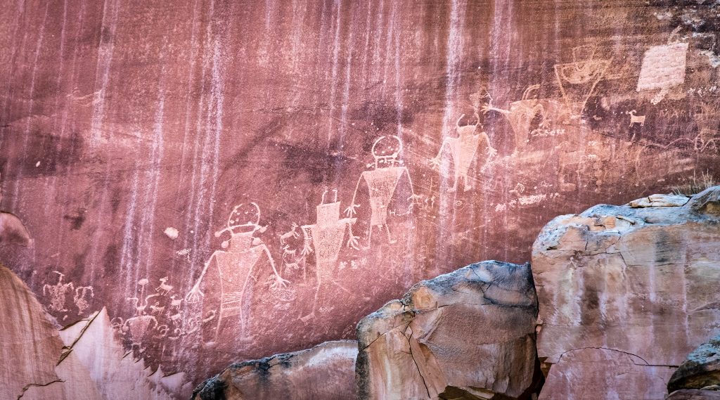
For a really short and easy stop to add to your Capitol Reef itinerary, check out the Petroglyph Panel! This hike is just 1.5 miles from the Visitor Center, on Highway 24. The boardwalk trail takes you to see a panel of petroglyphs left by the Fremont and ancient Puebloan peoples.
2. Gooseneck and Sunset Point
Miles: 1.7 miles (if you park in the closer lot)
Elevation Gain: ~75 feet
Difficulty: Easy
Trail Map & Current Conditions
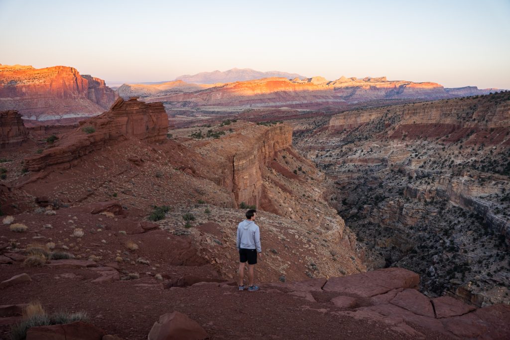
The Gooseneck and Sunset Point Trail is one of the best sunset spots in Capitol Reef National Park! While the linked trail is longer, you can drive a gravel road (suitacle in any vehicle) to Goosenecks Overlook. And then you just have to walk less than half a mile (one way) to get to Sunset Point. From here you can see Capitol Reef’s domes and unique orange formations, plus Sulphur Creek and the mountains off in the distance. It is breathtaking!
3. Hickman Bridge

Miles: 1.7 miles
Elevation Gain: 416 feet
Difficulty: Moderate
Trail Map & Current Conditions
Easily one of the most well-known of the best hikes in Capitol Reef National Park is Hickman Bridge Trail. This short and relatively easy hike leads you to the Hickman Bridge, a large sandstone natural bridge that you can walk under! The bridge is 130 feet and is 125 feet high. And is much more impressive in person than we expected!
There is a fair bit of elevation gain to get there, but you’ll be treated with beautiful views of Capitol Reef National Park all along the way. The hike starts off of Highway 24 and has a parking lot, but it’s usually packed. When we visited on a Friday afternoon it was full. So we had to park along the highway, along with many others.
4. Cohab Canyon
Miles: 3.0 miles
Elevation Gain: 793 feet
Difficulty: Moderate
Trail Map & Current Conditions
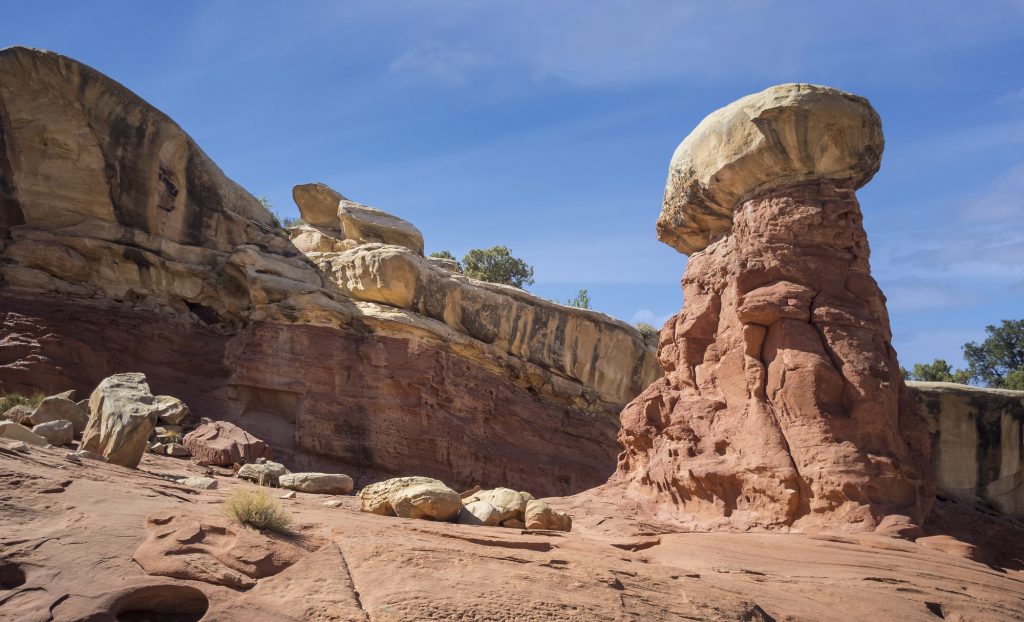
For stunning views of the Fruita District, and less daunting than the Rim Overlook Trail (mentioned below), then you must hike the Cohab Canyon Trail! While the trail might be pretty steep at the beginning, it’s a much shorter hike in mileage. Along the way you’ll get to venture through a canyon and explore some fun slot canyons. There are also several viewpoints of the Fruita area to admire as well!
While this trail is an out and back trail, one end is right across the highway from the Hickman Bridge, so that would be a good addition you could add on right after, before hiking back to Fruita.
5. Cassidy Arch

Miles: 3.1 miles
Elevation Gain: 685 feet
Difficulty: Moderate
Trail Map & Current Conditions
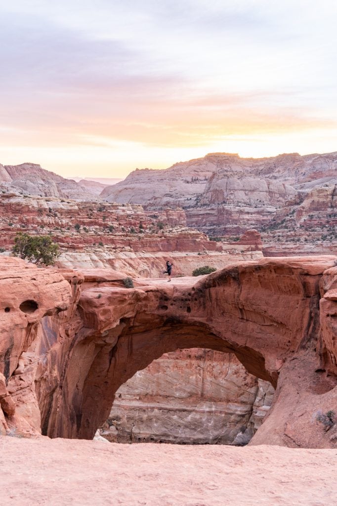
Our second favorite hike in Capitol Reef National Park (stay tuned to see #1!) was the relatively short Cassidy Arch Trail! For being fairly easy, you’re treated with absolutely incredible views of the park, plus a stunning arch that you can walk on! Yes, you can walk on top of the arch!
While there are many arches in Utah, it’s very rare you can walk on one. And although it may look sketchy from afar to walk on top, it’s actually very wide and feels totally safe!
We did this hike for sunrise and while we had to hike there in the dark, it was very easy to find our way. Especially since we use AllTrails+ and had the map downloaded! The best part was that we had the entire arch to ourselves, plus a stunning sunrise with deep pink and orange colors filling the sky.
6. Chimney Rock Loop
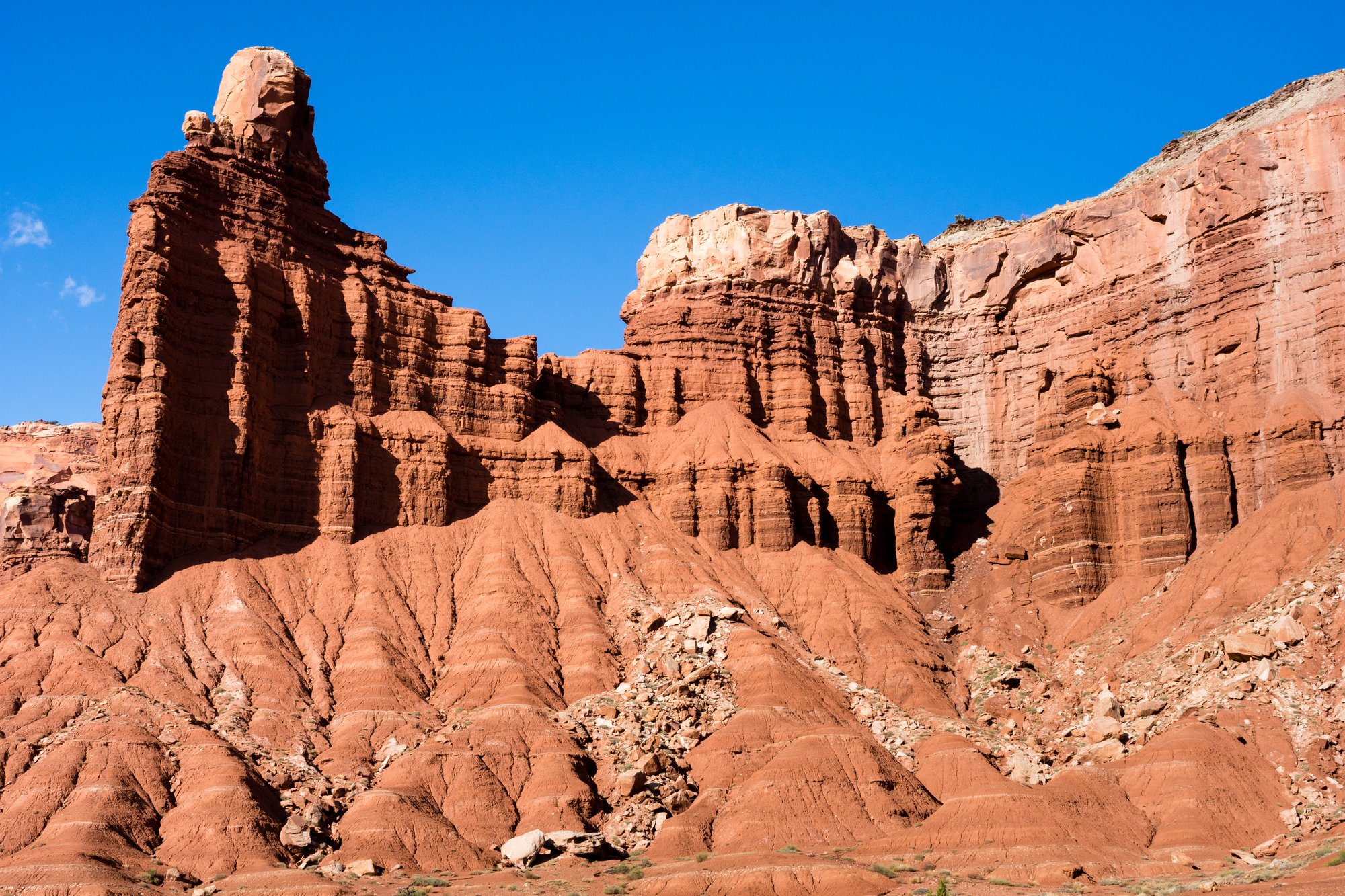
Miles: 3.3 miles
Elevation Gain: 793 feet
Difficulty: Moderate
Trail Map & Current Conditions
The Chimney Rock Loop Trail begins off of Highway 24, which is free to access. This trail begins with a steep climb up some switchbacks, but after that it’s a gradual decline for most of the way. There are some amazing views of the Waterpocket Fold surrounding you along the way.
It’s a loop trail, and the best way to do this hike is counter-clockwise to get most of the elevation out of the way at the beginning.
7. Rim Overlook
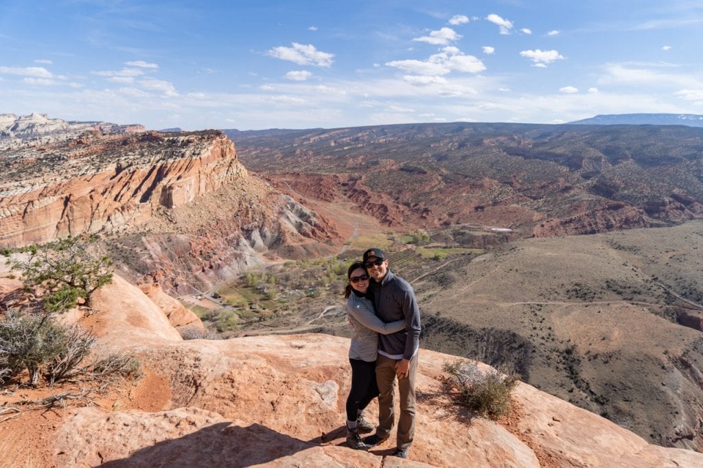
Miles: 4.3 miles
Elevation Gain: 1,066 feet
Difficulty: Moderate
Trail Map & Current Conditions
The Rim Overlook Trail is another great option for hikes in Capitol Reef National Park (with much smaller crowds)! This stunning trail takes you high above Highway 24 and you’ll be treated to views of the surrounding rocks, and the Fruita area below. The trail begins from the Hickman Bridge Trail and we think it is worth the extra mileage and elevation gain if you have the physical ability and extra time.
8. Capitol Gorge
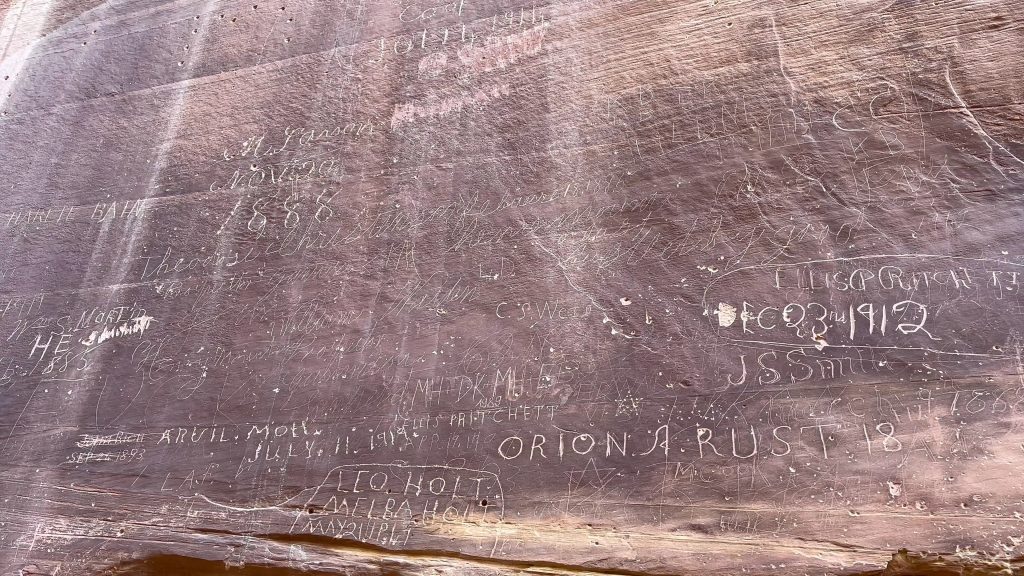
Miles: 4.5 miles
Elevation Gain: 374 feet
Difficulty: Easy
Trail Map & Current Conditions
The Capitol Gorge Trail is similar to the Grand Wash (mentioned below), just not quite as grand. But, there are a few unique elements to this trail that the other doesn’t have. Capitol Gorge has petroglyphs and the Pioneer Register, a wall where pioneers wrote their name and date when passing through the area many years ago.
Drive down the Capitol Reef Scenic Drive (this is the paid portion of the park) and then drive down a dirt road for the last 2 miles or so to get to the trailhead. This dirt road is in good condition, plus as you drive, the views and huge canyon walls surrounding you are awesome. It was worth it just to drive out here, even if you don’t want to do the hike.
We tried to do a portion of Capitol Gorge Trail, but the parking lot was so full by the time we made it there in the early afternoon, so sadly we didn’t stay for the hike.
NOTE: This trail is sometimes impacted by road closures due to the Scenic Drive Rehabilitation Project. You can see its current status here!
9. Grand Wash

Miles: 4.7 miles
Elevation Gain: 341 feet
Difficulty: Easy
Trail Map & Current Conditions
The Grand Wash is a gorge that cuts through the upper part of the Waterpocket Fold. This trail is mostly flat throughout the 4.7 miles through the canyon, in between the huge canyon walls. You can either start the trail at the Cassidy Arch Trailhead or there’s a parking lot on Highway 24.
This trail is most popular for having a half a mile portion that is narrower than the rest of the canyon which is called the Narrows. And yes, if you’ve been to or know anything about Zion National Park, it’s a much smaller version of the Zion Narrows, without the water.
Since we had been in a lot of epic slot canyons earlier in our Southern Utah National Park road trip, and were short on time, we just went in about 1 mile from the Cassidy Arch trailhead. Although we didn’t get to see it all, we loved what we saw. We felt tiny among the walls!
10. Sulphur Creek
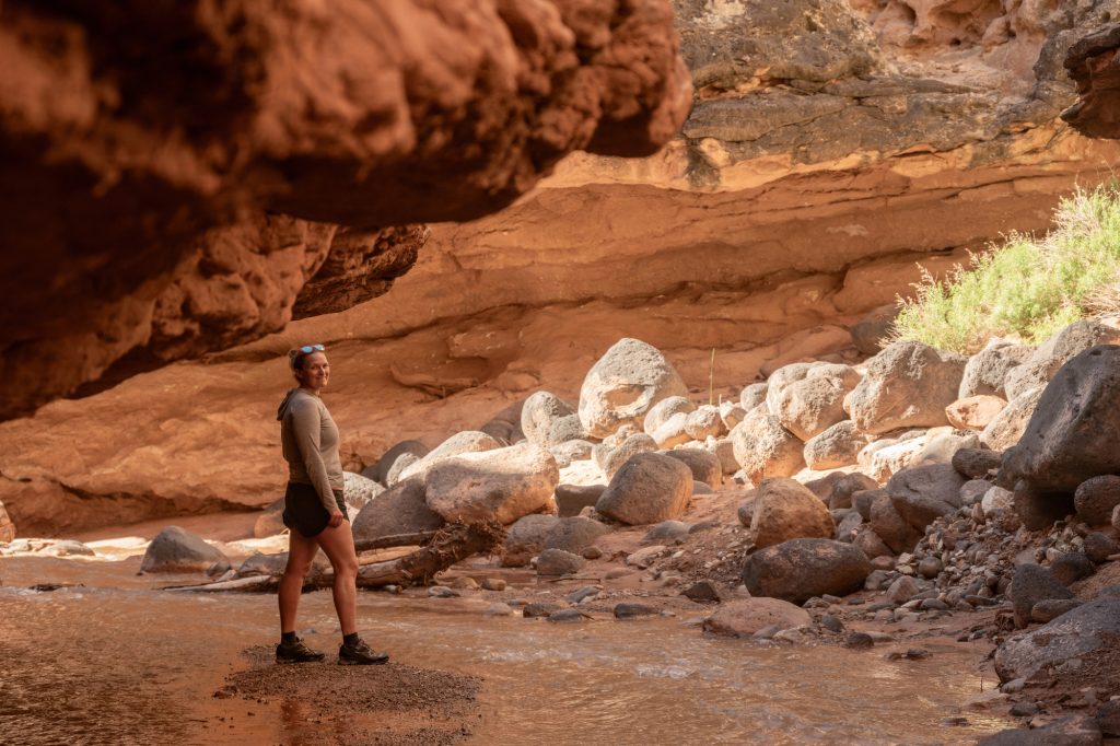
Miles: 5.9 miles
Elevation Gain: 416 feet
Difficulty: Moderate
Trail Map & Current Conditions
Of the best hikes in Capitol Reef National Park, Sulphur Creek trail just might be the one with the most adventure! This hike takes you through a canyon, with waterfalls to check out, plus streams to walk through. Which depending on the weather and time of year, can sometimes be CHEST high! So prepare to get wet and protect your things so they don’t get ruined.
This hike is at the top of our list for our next visit to Capitol Reef, as it’s said to be like a Zion Narrows experience at Capitol Reef, which we loved! But, similar to all slot canyons, please do not do this hike if the weather looks rainy or stormy, as flash floods can happen quickly. Be sure to read the NPS website about this hike to ensure you feel prepared to tackle this unique “trail.”
Another important thing to note about this hike is that the 5.8 miles is ONE WAY. You will need to have a car parked at either end OR you will have to walk 3.3 miles along Highway 24. They do not advise hiking both directions.
A+K Tip: The trailhead parking for this hike is 0.3 miles west of the Chimney Rock Trailhead along Highway 24. Capitol Reef’s website says to NOT park at Chimney Rock. And be prepared with a way to get back to your car after the hike since this is typically completed as a point-to-point trail.
11. Navajo Knobs


Miles: 9.1 miles
Elevation Gain: 2,139 feet
Difficulty: Hard
Trail Map & Current Conditions
Easily our favorite of the best hikes in Capitol Reef National Park is Navajo Knobs. It is definitely a difficult hike, but if you’re looking for a trail with the most epic views in the park, Navajo Knobs is the hike for you!
If you take the Rim Overlook offshoot trail on the Hickman Bridge Trail, it will lead you to Navajo Knobs. The Rim Overlook is an amazing place to stop, but if you can continue on to Navajo Knobs, you’re in for a treat!
The views on this hike were amazing the entire way as you climb high up, skirting the canyon rim and getting views of the Fruita area, crazy rock domes, and really unique rock formations, like the Castle.
At the top you’ll be rewarded with 360º views that you wouldn’t have gotten on the other lower trails. We really loved the views from the top! Plus, there was no one else there to share the experience with, and we barely saw anyone on that portion of the hike.
But, the hike is definitely very hard and requires some scrambling to get to the very top. Make sure you have the time and energy to complete this trail. We recommend devoting an entire day to this one!
A+K Tip: Part of Navajo Knobs is on the Hickman Bridge trail and the Rim Overlook trail. So for about 11 miles total, you’ll complete the Hickman Bridge Trail, Rim Overlook Trail and the Navajo Knobs Trail.
Things You Need to Know Before Hiking in Capitol Reef

When to visit Capitol Reef National Park
Along with the rest of the Southern Utah National Parks, the best time to visit are the shoulder seasons. This means April–May or September–October. This is when the park will be less busy, and offer gorgeous weather. But Capitol Reef National Park has one other important thing to consider when deciding when to go.
Capitol Reef National Park and its campgrounds are open 365 days a year, but the Gifford Homestead Store and Museum, which has delicious pies, is only open from March 14 (Pi Day) to October 31. We recommend visiting during this time frame so you can get the full park experience!
One perk of visiting in the summer and fall is that not only will you be able to eat pie, you’ll also be able to pick your own fruit! We think this would be such a fun and unique National Park experience! You can see the different fruit harvesting times here to plan your trip around your favorite.
Getting to and around Capitol Reef National Park
Capitol Reef National Park is in the town of Torrey, Utah, in the southern part of the state. It will take 3 hours and 45 minutes to get here from Salt Lake City if you plan on flying in. It’s located halfway between Bryce Canyon and the town of Moab. Although this park is a little more remote and further away than the other Utah parks, it is perfect to combine with the others for the ultimate Mighty Five road trip.
Getting around Capitol Reef is also not super easy, so you will need a car. Which you needed to get here anyways so that probably won’t be a problem. There is not a park shuttle at Capitol Reef. Fruita itself is pretty compact and walkable. It has a campground, the Gifford Homestead, and a handful of trails easily accessible in a small area. You could camp in the park and walk or bike to a few activities, but to get to many of the popular spots, you will need to drive.
Cost to visit Capitol Reef

It costs $20 per vehicle to enter Capitol Reef National Park. Unlike most national parks, there is not an official entrance station with a ranger that takes the fee. There is just a stand where you pay, but you can also get a digital pass in advance or buy a pass in the Visitor Center.
Plan to visit all of the Utah National Parks? We highly recommend buying the America the Beautiful pass! This pass gets you free entry to all national parks for one year. So use it as much as you can and explore multiple national parks!
Where to stay in Capitol Reef National Park
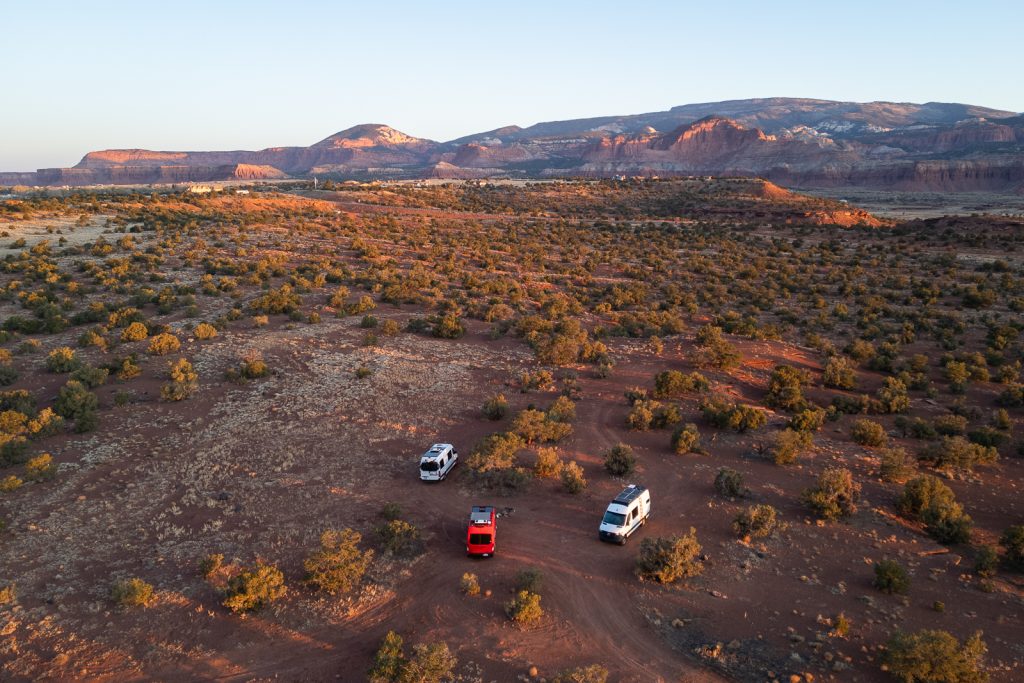
Capitol Reef National Park is home to one developed campground and two primitive campgrounds, with an option in each area of the park. Plus lots of free camping nearby!
While there is not a park lodge, the town of Torrey is just minutes from the park. It’s a small town and not as developed as the areas around Zion, Canyonlands, and Arches, it still has a variety of lodging options for any preference. It’s a great home base to explore all areas of the park!
For more information about where to stay including hotel options, vacation rentals, dispersed camping, be sure to read our detailed guide about visiting Capitol Reef.
How long to visit Capitol Reef National Park
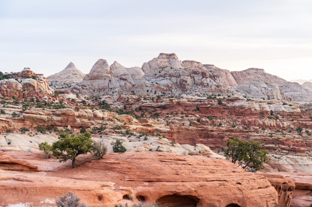
We recommend at least two days to explore the best hikes in Capitol Reef National Park along with seeing some of the other best sights!
If you only have one day, then you can definitely do a couple short hikes and eat pie. But in order to see all of the major highlights, we’d suggest two full days. In those two days, you’d likely want to stick to the Fruita district, as it offers a ton of options close to each other.
If you have three days and the right vehicle, we’d suggest spending a day at Cathedral Valley or the Waterpocket District. And with four days to explore, then you could do both!
We have created different Capitol Reef National Park itinerary options for different timeframes, as well as for different hiking abilities in our full guide to the park!
What to bring to Capitol Reef National Park

First and foremost, we always recommend that you pack the 10 essentials. You can see all of our hiking gear here, but a few key items that are important to have on the best hikes in Capitol Reef National Park are hiking shoes, layers, sunscreen, plenty of water, snacks, and AllTrails maps!
We highly recommend the AllTrails+ membership so you can download the map. There’s not usually great service on the trails! Want to get 30% off an AllTrails+ membership? Use our code aplusk30 (you must redeem this code on the website, not the app)!
Looking for more things to do in Utah?
- The Best Things to do in Capitol Reef National Park
- 10 Day Utah National Park Road Trip Itinerary
- The BEST Things to do in Moab
- Things to do in Arches National Park (+Itineraries)
- The Best Things to do in the Needles District at Canyonlands National Park
- Visiting Island in the Sky at Canyonlands National Park
- Hiking to Lower Calf Creek Falls
- Exploring the Peek-A-Boo and Spooky Slot Canyons
- All of our Utah Vlogs
- All of our Utah Guides
Save this guide with the best hikes in Capitol Reef National Park


This article was written by Tori, one of our Adventures of A+K team members. Learn a bit about her below!
Hi, I’m Tori! I live in Nashville, TN with my husband and two daughters. We travel as much as possible throughout the year, around a 9-5 schedule and with babies in tow! My travel blog, Tori Pines Travels, aims to help people plan action-packed and culture-rich vacations around their busy jobs, fitting in as much exploring as possible. When I’m not working for Adam and Kathryn or entertaining my little ones, I’m writing, cooking, crafting or exploring Music City!