Last updated on May 29th, 2025
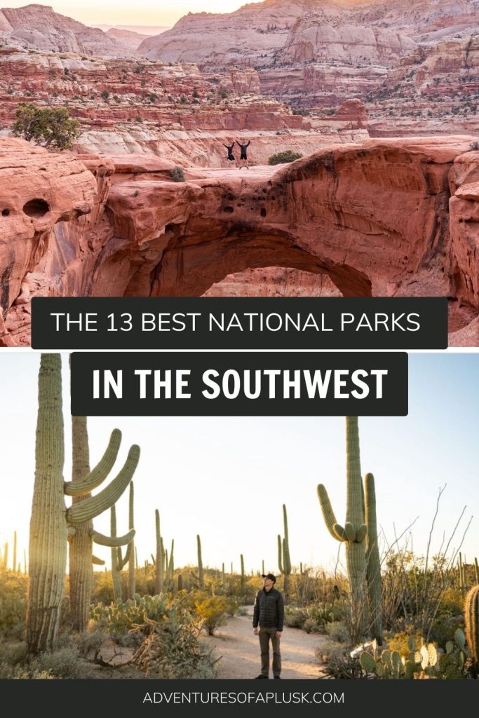
Heading to the American Southwest? We’re sharing the 13 best Southwest National Parks to explore in the area!
The American Southwest, which includes Arizona, Utah, Nevada, New Mexico, and parts of Texas, is home to some of the most unique national parks in the country! Here, you’ll find sprawling mountains, deserts, dramatic rock formations, towering cacti, breathtaking canyons, caves, and so much more.


Since we hit the road in our van full-time five years ago, we’ve explored 52 of the 63 national parks across the U.S., and let’s just say the parks in the Southwest have stolen our hearts.
In this guide, we’re excited to share the 13 best American Southwest National Parks that are a must-visit. We’ll share our favorite spots for hiking, the cost of each park, and helpful tips on permits and reservations. Plus, we’ll give our advice on the best camping spots, how to navigate each park, and other useful tips to help make your visit truly unforgettable.
- Defining Southwest National Parks
- 1. Arches National Park
- 2. Canyonlands National Park
- 3. Capitol Reef National Park
- 4. Bryce Canyon National Park
- 5. Zion National Park
- 6. Grand Canyon National Park
- 7. Petrified Forest National Park
- 8. Saguaro National Park
- 9. Carlsbad Caverns National Park
- 10. White Sands National Park
- 11. Big Bend National Park
- 12. Guadalupe Mountains National Park
Defining Southwest National Parks

Before we begin, we wanted to start by sharing what we mean by the “Southwest National Parks.” For the purposes of this guide, we’re focusing on parks in states like Arizona, Utah, Nevada, New Mexico, and parts of Texas. These states are known for their desert landscapes, dramatic rock formations, and rich cultural histories, all of which define the classic Southwest experience.
Heading to other regions of the US as well? Check out our guide to the best West Coast and East Coast National Parks!
13 BEST American Southwest National Parks
1. Arches National Park

Arches National Park, located in Utah, is famous for its stunning natural sandstone arches—over 2,000 of them! Here, you’ll find not only the famous arches but also striking formations like spires, balanced rocks, and desert varnish.
Topping the list of must-dos is definitely exploring the park’s namesake features, the arches! Double Arch is one of our favorite short hikes that takes you to one of the most impressive and unique rock formations in the park. It’s a giant arch formed by two massive sandstone spans that rise 112 feet above the ground and stretch 144 feet across (it’s one of the largest arches in the park!)
For those who love a good hike, the Devil’s Garden Trail is a must. It’s a challenging hike that takes you past eight arches, towering spires, and dramatic rock formations.
Another unforgettable experience is the Fiery Furnace Trail (requires a permit or to be led by a park ranger). It’s a bit of a scramble at times, with dead ends, but you’ll get to hike through a maze of narrow sandstone canyons that’s just so much fun!


Arches National Park at a glance
State: Utah
Cost: $30 per vehicle entrance fee (7-day pass) From April 1 through October 31, visitors entering the park in a vehicle between 7 am and 4 pm will need to have a $2 Timed Entry Ticket.
How to Get There: The park is easily accessible by car and is located just 5 miles north of Moab, Utah. The closest major airport is Salt Lake City International Airport (SLC), about 230 miles away.
Getting Around: There is no public transportation inside the park. But you can drive yourself, ride a bike, or take a commercial tour to get around inside the park.
Pet friendly: Pets are not permitted on hiking trails, off-trail (even in carriers), at overlooks, or inside the visitor center and any buildings. Leashed pets are welcome on established roads, in parking areas, and in designated campgrounds and picnic spots.
Campgrounds: Devils Garden is the only campground in Arches National Park. You can book your stay from March to October, but it usually gets packed every night. From November to February, campsites operate on a first-come, first-served basis.
Permits/Reservations: You can reserve campsites six months in advance for peak season. Grab tickets for the ranger-guided Fiery Furnace hike a week early. If you’re planning on backpacking, canyoneering, or rock climbing, you’ll need a permit, which you can pick up at a self-service station outside the visitor center.
Learn more about Arches National Park
Blog post
The BEST things to do in Arches National Park (+ itineraries)
YouTube videos
Hiking the Devil’s Garden Trail (with 8 arches!) at Arches National Park
Our first time at Arches National Park! (Delicate Arch, Park Avenue, Double Arch, & MORE!)
2. Canyonlands National Park

Canyonlands National Park, with its dramatic desert landscape carved by the Colorado River, is home to endless canyons, towering mesas, and colorful buttes. The park is divided into four districts: Island in the Sky, The Needles, The Maze, and the rivers themselves.
Mesa Arch is one of, if not the most, iconic spots within the Island in the Sky district of the park. This 90-foot-long arch’s opening frames the canyon below perfectly. The views are GORGEOUS.
In the Needle’s District, the Druid Arch to Chesler Park Loop lets you experience two of the district’s highlights. Druid Arch features a unique shape with two narrow openings, with incredible views both along the way and at the arch. Chesler Park is an open area packed with the district’s namesake sandstone spires.
Cave Springs was another one of our favorite spots in the Needles District. This is a super short and easy loop hike to explore an old cowboy camp and see petroglyphs and markings left behind by Native Americans.

Canyonlands National Park at a glance
State: Utah
Cost: $30 per vehicle entrance fee (7-day pass).
How to Get There: Each district of the park is accessed separately, as there are no connecting roads or bridges within the park. Both Island in the Sky and The Needles are accessible from Moab, with the closest airport being Salt Lake City (SLC). Driving to The Maze requires high-clearance, 4WD on unpaved roads, which may be impassable after rain.
Getting Around: To explore Canyonlands, you’ll need a car. Island in the Sky is the most visitor-friendly. All other destinations require some boating, hiking, or four-wheel driving to see the area’s attractions. You can also hire a tour to show you the top sites. If you want to do any of the 4×4 trails, then we recommend renting a Jeep. Twisted Jeep Rentals in Moab is a good option!
Pet friendly: Pets are not allowed on trails, off-trail, overlooks, buildings, backcountry, or river trips, but are permitted on leashes in front-country roads, parking areas, campgrounds, picnic areas, and in vehicles on specific roads.
Campgrounds: Island in the Sky Campground offers 12 first-come, first-served sites open year-round. The Needles Campground features 26 sites, with reservations available in spring-fall and first-come, first-served during other seasons.
Permits/Reservations: Day-use permits are needed for many of the four-wheel drive routes in the park. Overnight backcountry trips and all river trips need respective permits, which are highly competitive. Permits are also mandatory for pack and saddle-stock use.
Learn more about Canyonlands National Park
Blog post
The Best Things to do in the Needles District at Canyonlands National Park
YouTube videos
Hiking to Druid Arch and Chesler Park at Canyonlands National Park (Needles District)
One day at Canyonlands National Park (Island in the Sky) | Mesa Arch, Upheaval Dome, & overlooks!
3. Capitol Reef National Park

Located in south-central Utah’s red rock country, Capitol Reef National Park is a lesser-known gem boasting cliffs, canyons, domes, and bridges along the Waterpocket Fold—a 100-mile-long geologic wrinkle in the Earth’s crust! Home to epic canyons and stunning formations, its highlight, the Capitol Reef, showcases dome-like sandstone structures that look just like capitol buildings!
Our favorite must-see in the Fruita area of Capitol Reef has to be Hickman Bridge. It’s a short, iconic hike that takes you to an impressive sandstone natural bridge, stretching 130 feet across and towering at 125 feet tall. Plus, you can walk right under it!
We also loved visiting the Fruita Schoolhouse, constructed by locals in 1896. And the orchards! Picking fruit straight from the tree during peak season, from mid-June to October’s end, is an experience you can’t miss.
And you absolutely have to stop by the Gifford Homestead for their locally made pies and homemade ice cream. Choosing from the many delicious pie flavors was a real challenge, but the strawberry rhubarb was beyond tasty!


Capitol Reef National Park at a glance
State: Utah
Cost: $20 per vehicle entrance fee (7-day pass). In this park, instead of the usual staffed entrance, there’s just a pay station. But you can also grab a digital pass ahead of time.
How to Get There: Capitol Reef National Park is located in Torrey, Utah. It’s about halfway between Bryce Canyon and the Moab area. By car is the easiest way to reach the park. The nearest major airport is Salt Lake City International Airport (SLC), about 220 miles away.
Getting Around: Capitol Reef doesn’t have a park shuttle, so you’ll need a car both to reach the park and to explore it, especially for venturing beyond the Fruita area.
Pet friendly: Pets are allowed on the trail from the visitor center to Fruita Campground, the Fremont River Trail up to Hattie’s Field gate, in open orchards, Chestnut and Doc Inglesby picnic areas, campgrounds, and in parking areas. They are not allowed on other hiking trails, in public buildings, or in the backcountry.
Campgrounds: Capitol Reef features the Fruita Campground, a developed campground with facilities. Reservations are open from March to October. Additionally, it offers Cathedral Valley and Cedar Mesa campgrounds, which are primitive, free, and operate on a first-come, first-served basis.
Permits/Reservations: Backcountry backpacking and all canyoneering or climbing groups require a free permit, obtainable at the visitor center or online.
Learn more about Bryce Canyon National Park
Blog posts
Hiking the Fairyland Loop Trail at Bryce Canyon National Park
3 Days at Zion and Bryce Canyon National Parks Itinerary
YouTube video
One Day at Bryce Canyon National Park | Queens Garden + Navajo Loop, Fairyland Loop, & more!
4. Bryce Canyon National Park

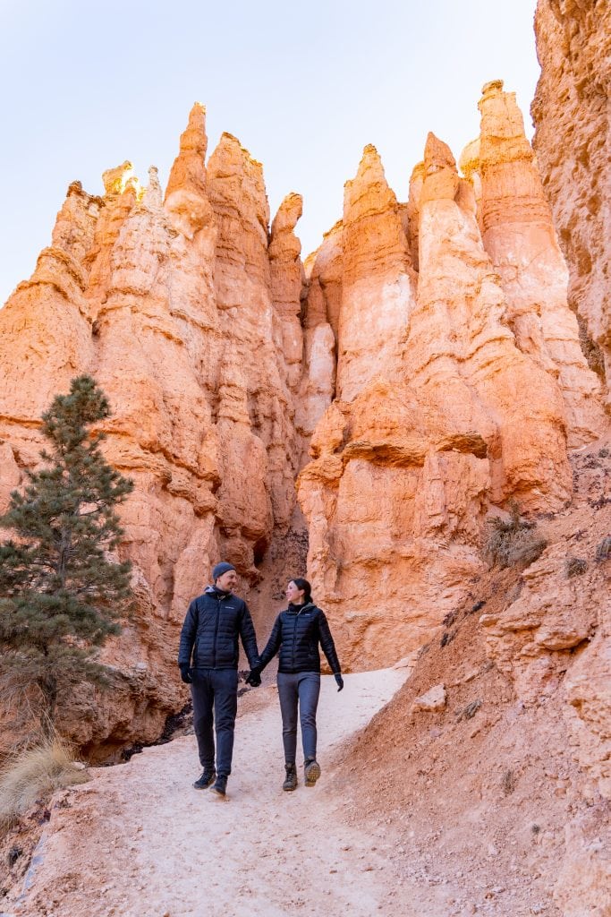
Bryce Canyon National Park in southern Utah isn’t actually a canyon, but a series of massive natural amphitheaters on the edge of the Paunsaugunt plateau. It’s famous for having the world’s largest collection of hoodoos, which are vibrant red rock spires that rise up from the ground in tons of unique shapes and sizes!
One of our absolute favorite hikes in Bryce Canyon has to be the Fairyland Loop Trail. This 8-mile hike gives you the opportunity to walk through and among many of the park’s hoodoos. As well as the chance to see iconic features like Tower Bridge, Chinese Wall, and the Sinking Ship!
And you’ve got to catch a sunrise at Sunset Point. Despite its name, the early morning light there is magical. But honestly, sunrise from anywhere along the rim, between Sunset and Sunrise Points, is breathtaking.
Don’t skip the Navajo and Queens Garden Loop either! This roughly 3-mile hike takes you from the rim’s edge down into the heart of the amphitheater. Walking among the hoodoos, you’re treated to up-close views of the park’s intricate formations, including the famous Thor’s Hammer!

Bryce Canyon National Park at a glance
State: Utah
Cost: $35 per vehicle entrance fee (7-day pass).
How to Get There: Bryce Canyon is located in Bryce, Utah, which is about 1 hour 45 minutes northeast of Zion National Park. It’s not close to any major cities in Utah, so you’ll want to make sure you’re stocked up on supplies beforehand. Public transportation to the park is not available. The closest major airport is McCarran International Airport (LAS) in Las Vegas, Nevada, about 270 miles away.
Getting Around: The Bryce Canyon Shuttle offers free rides to key overlooks, amenities, and trails within the Bryce Amphitheater area from April to mid-October. However, during these months, any vehicle over 20 ft long cannot drive in the main amphitheater area during shuttle hours.
Pet friendly: Pets are allowed on the park’s paved surfaces, including campgrounds, parking lots, roads, most viewpoints (excluding Piracy Point), the Rim Trail from Sunset to Sunrise Point, and the path from the entrance to Inspiration Point. They are not allowed on unpaved trails or viewpoints, inside buildings, or on the shuttle bus, even if carried.
Campgrounds: The park features two campgrounds: Sunset Campground, with reservable sites available up to six months ahead and open year-round. This is also the North Campground, which provides sites on a first-come, first-served basis and closes for the winter.
A+K Tip: Make sure to pack layers! Bryce Canyon is located at a higher elevation and can be a lot cooler than nearby Zion. We learned this the hard way!
Learn more about Bryce Canyon National Park
Blog posts
Hiking the Fairyland Loop Trail at Bryce Canyon National Park
3 Days at Zion and Bryce Canyon National Parks Itinerary
YouTube video
One Day at Bryce Canyon National Park | Queens Garden + Navajo Loop, Fairyland Loop, & more!
5. Zion National Park

Zion National Park, located in southwestern Utah, is one of the most striking and popular national parks in the United States. Known for its incredible canyon views, red cliffs, slot canyons, and the Virgin River, which winds through the park, Zion offers a diverse range of landscapes and experiences that attract millions of visitors each year.
Our go-to hike in Zion National Park has to be Observation Point via the East Mesa Trail. It’s a 6.7-mile hike with a 695-foot climb. It’s quieter, less daunting, and offers views even more epic than those from Angel’s Landing.
Then there’s the Watchman Trail. This 3.1-mile hike really impressed us with the incredible views from the top. It’s a bit of a climb, but reaching the summit to soak in those landscapes is totally rewarding.
And you can’t miss out on hiking the Narrows. This hike, one of the park’s most famous, takes you into the narrowest section of Zion Canyon, where, at points, the 1,000-foot tall walls are just 20 to 30 feet apart! Hiking The Narrows involves wading and sometimes swimming through the Virgin River. It’s as awesome as it sounds!


Zion National Park at a glance
State: Utah
Cost: $35 per vehicle entrance fee (7-day pass).
Getting There: The main area of Zion, called Zion Canyon, is located in Springdale, Utah. The closest major airport is McCarran International Airport (LAS) in Las Vegas, about a 170-mile drive to the park.
Getting Around: Zion National Park has a shuttle service, and you don’t need a ticket or reservation to use it. Just remember, personal vehicles are off-limits on Zion Canyon Scenic Drive during shuttle season. The Springdale Line shuttle arrives roughly every 15 minutes outside the park, while the Zion Canyon Line inside the park sees shuttles every 5-10 minutes.
Pet friendly: In Zion, pets are only allowed on the Pa’rus Trail. They’re not allowed on other trails, in wilderness areas, on shuttle buses, or inside public buildings.
Campgrounds: There are three campgrounds inside the park: Watchman (open year-round, reservations available six months in advance), South (closed for rehabilitation), and Lava Point (1-hour drive from Zion Canyon, closed in winter).
Permits/Reservations: In Zion, permits are required for the off-trail hike to The Subway, day hikes on Angels Landing, day and overnight hikes in the Virgin River Narrows, overnight climbs, backpacking, float trips on the Virgin River, and bringing horses or stock animals on designated Wilderness trails.
Learn more about Zion National Park
Blog posts
Hiking the Narrows at Zion National Park (Everything you need to know!)
How to hike to Observation Point at Zion National Park
3 Days at Zion and Bryce Canyon National Parks Itinerary
YouTube videos
Hiking to the AMAZING Kanarra Falls + Kolob Canyons at Zion National Park (Timber Creek Overlook)
The BEST VIEW at Zion National Park: Observation Point (via the East Mesa Trail)
Zion National Park WITHOUT the shuttle | Canyon Overlook, Northgate Peaks, & the Watchman Trail

6. Grand Canyon National Park

Grand Canyon National Park, famous for its massive size and stunning landscape, is a top destination in the U.S. It’s so big it’s visible from space (we’re not kidding!). The park covers the North and South Rims, with the South Rim being the more accessible and favored by visitors. Stretching as far as the eye can see, the Grand Canyon is over 277 miles long, 18 miles wide, more than a mile deep, and is over two billion years old!
The South Kaibab Trail to Ooh Aah Point is a must-do at the Grand Canyon. This hike provides one of the quickest ways to reach a panoramic viewpoint below the rim. The hike to Ooh Aah Point is about a 1.8-mile round trip and gives you a taste of the canyon’s massive depth.
South Rim Trail is another must-do. This hike starts right by the Bright Angel Trailhead, so no need to shuttle! This trail goes a total of 13 miles, but you can go as little or as long as you’d like! We suggest going to at least Yavapai to see as much of the rim as possible.
If hiking isn’t your thing, there are plenty of scenic drives in the park that offer stunning views of the canyon. The most popular drives include Desert View Drive and Hermit Road. You can also drive to the lesser-known point on the North Rim of the Grand Canyon called Toroweap Point.


Grand Canyon National Park at a glance
State: Arizona
Cost: The entry fee is $35 (7-day pass) and includes access to both the South and North Rims (season permitting). The park’s three entrance stations only take credit or debit cards, so no cash.
How to Get There: The park is easily accessible by car and is located near Tusayan (South Rim) and Fredonia (North Rim), Arizona. The closest major airport is McCarran International Airport (LAS) in Las Vegas, Nevada, about 270 miles from the South Rim.
Getting Around: The free shuttle bus, with its four routes (red, orange, blue, and purple), is the best way to explore the park without the hassle of parking. While there are day-use parking lots, they fill up quickly, so we recommend parking early and using the shuttle for the day. Renting a bike or joining a tour is also a great option.
Pet friendly: Pets can’t go below the canyon rim, ride shuttle buses, or stay in most lodging, except at Yavapai Lodge’s pet-friendly rooms. They’re allowed on leashes on the bridle trail between the North Kaibab and Arizona Trails, above-rim trails, and in campgrounds and developed areas. The Grand Canyon Kennel offers pet boarding.
Campgrounds: Developed campgrounds are available on both the South and North Rims. On the South Rim, Mather Campground offers amenities and shuttle services year-round. Trailer Village provides RV hookups and shuttle service. Desert View and Ten-X are seasonal, without hookups. On the North Rim, North Rim Campground and DeMotte Campground are seasonal and offer no hookups. All campsites, except for some North Rim options, require reservations 6 months in advance.
Permits/Reservations: If you’re planning on hiking or backpacking below the rim, you’ll need to obtain a backcountry use permit.
A+K Tip: If you prefer a less crowded experience, consider visiting the Grand Canyon during the shoulder seasons (spring and fall) or during weekdays.
Learn more about Grand Canyon National Park
Blog post
1 Day at the Grand Canyon South Rim Itinerary
YouTube video
24 Hours at the Grand Canyon | Arizona Day 3
7. Petrified Forest National Park
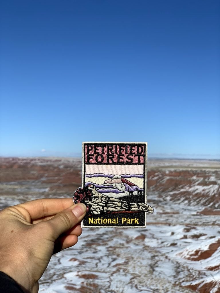
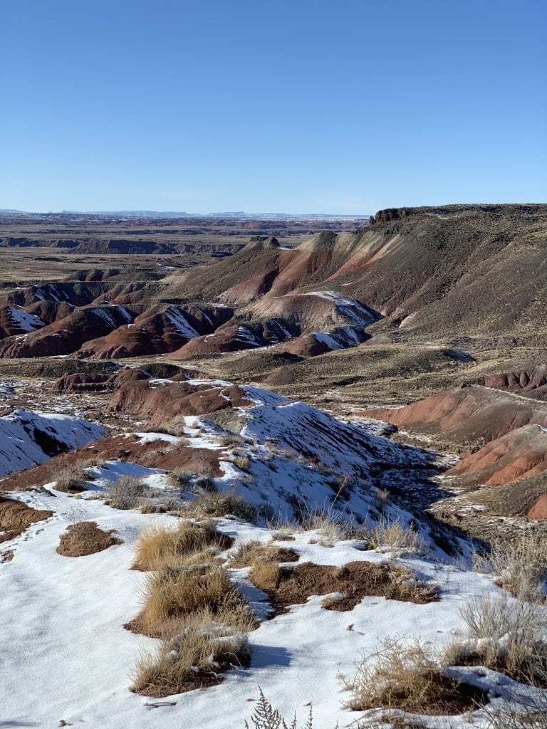
From its colorful badlands to the over 200-year-old rainbow-hued petrified logs scattered across the park, Petrified Forest National Park is a place best known for its vast deposits of petrified wood, stunning desert landscapes, archeological sites, and a section of the historic Route 66.
One of our absolute favorite hikes in Petrified Forest National Park has to be the 0.75-mile Crystal Forest Trail. It’s an easy walk that leads you through landscapes dotted with some of the largest and most beautiful petrified wood remains in the world!
The Blue Mesa Trail is another stunning hike! This one-mile loop trail takes you down from the mesa, where you get to wander among striking badland hills made of bluish bentonite clay dotted with chunks of petrified wood.
Don’t skip the Puerco Pueblo, either. It’s incredible to wander through these ancient ruins and imagine the lives of the people who lived here long ago. Plus, the nearby petroglyphs are cool to see, too!


Petrified Forest National Park at a glance
State: Arizona
Cost: $25 per vehicle (7-day pass).
How to Get There: Petrified Forest National Park stretches north and south between Interstate 40 and Highway 180. There are two entrances to the park. The closest major airport is Phoenix Sky Harbor International Airport (PHX), about 180 miles away.
Getting Around: Driving is the best way to explore Petrified Forest National Park, with the 28-mile Park Road linking all the major sights. Biking on Park Road or the park’s unpaved paths is another great option. There’s no public transportation or shuttles here.
Pet friendly: Pets are welcome on all paved roads and trails, plus every designated wilderness area in the park.
Campgrounds: The only overnight option for camping in the park is backpacking into the designated wilderness area, at least half a mile from any vehicle. No RV, car, or primitive camping allowed.
Permits/Reservations: You can grab a free backpacking wilderness permit in person from any visitor center on the day you want to backpack.
Petrified Forest National Park
We spent an afternoon here, but didn’t create any content. We hiked the Giant Logs trail and Blue Mesa trail, plus checked out different overlooks. Our dog Kona was able to hike with us too!
8. Saguaro National Park

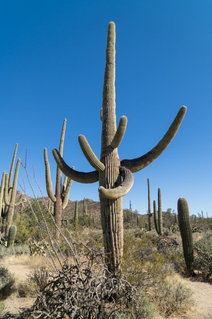
Tucson, Arizona, is where you’ll find the biggest cacti in the U.S. (2 million of them!) These towering plants are unique to just a tiny part of the country and are protected in Saguaro National Park, which wraps around Tucson’s east and west sides. It’s here that you can get up close with these massive cacti, hike mountains, see petroglyphs, and more!
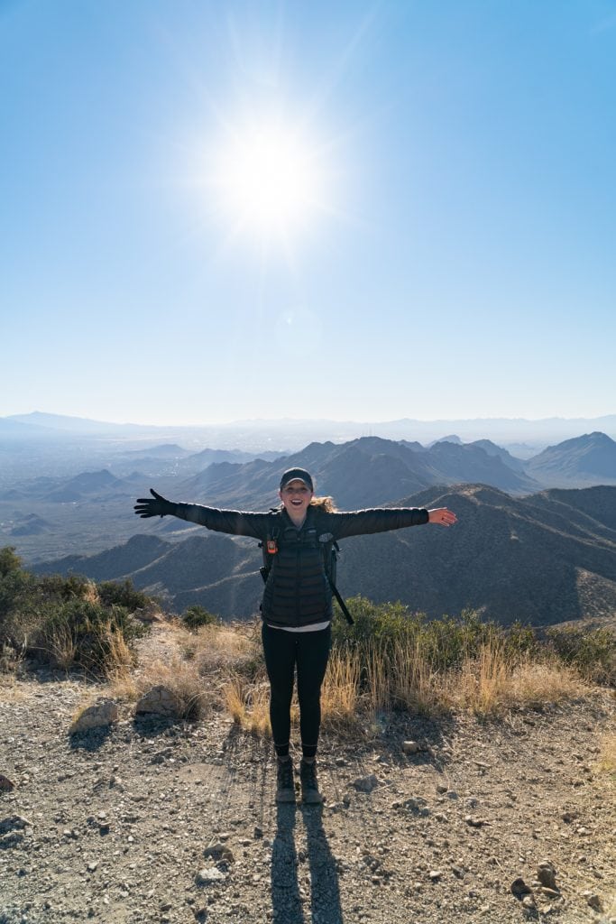
Hiking up to Wasson Peak, the tallest point on the west side of Saguaro National Park at 4,688 feet, was hands down our favorite adventure in the park! The views from up there are incredible, giving you a panoramic look at the area’s sprawling saguaros and distant mountain peaks.
After Wasson Peak, our second favorite thing we did in Saguaro National Park West was hike the Valley View Overlook Trail. This flat, 0.8-mile hike takes you through a dense area of saguaros before ending at a viewpoint that overlooks the valley.
Another must-do is the 0.4-mile Desert Discovery Trail. It’s an easy, flat, and paved path that weaves through towering saguaros and other desert plants, complete with informative signs about the local flora and fauna. Plus, it’s one of the only trails where you can bring your dogs along in the western part of Saguaro National Park.
Saguaro National Park at a glance
State: Arizona
Cost: $25 per vehicle (7-day pass). There are a few ways to pay, including self-pay stations, online, and at the Visitor Center.
Getting There: Saguaro National Park is split into two districts by Tucson: the Rincon Mountain District, known as Saguaro East, and the Tucson Mountain District, called Saguaro West. Despite how close they look on a map, they are an hour apart. If you’re flying to Tucson, you can fly into Tucson International Airport (TUS), which is located south of town and is only about a 30-minute drive from Saguaro National Park West.
Getting Around: There is no public transportation within Saguaro National Park, so you’ll need a car or bike to explore.
Pet friendly: Beyond the Desert Discovery Trail, there are a handful of other roads and trails that your pet can join you on, which you can view here.
Campgrounds: There are no campgrounds in Saguaro National Park, but just to the south of the park is the Gilbert Ray Campground, which has RV sites and a few tent sites. There are also a few dispersed camping areas nearby (Snyder Hill BLM, and Pipeline Road Dispersed Camping).
Permits/Reservations: If you’re planning to spend the night in the backcountry, hiking, camping solo, or horseback riding alone or with a group, you’ll need to grab a permit first.
Learn more about Saguaro National Park
Blog posts
Hiking Wasson Peak at Saguaro National Park in Tucson, Arizona
The BEST Things to do in Saguaro National Park West
YouTube video
One Day at Saguaro National Park (West) 🌵 | Hiking Wasson Peak, Valley View Overlook, & more!
9. Carlsbad Caverns National Park
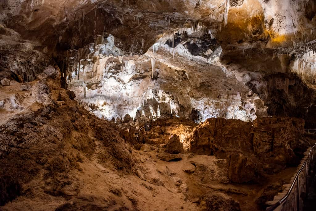
Beneath New Mexico’s Chihuahuan Desert lies Carlsbad Caverns National Park, famous for its vast network of over 119 caves. The highlight here is the Big Room, an enormous underground space that’s nearly 4,000 feet long and 255 feet high! As you explore, you’ll get to see stalactites, stalagmites, and some seriously intricate cave formations.
If you’re heading to Carlsbad Caverns National Park and can only do one thing, make it the Big Room. This massive underground chamber is not only one of the largest accessible cave rooms in the world but also it’s full of incredible rock formations!
Don’t miss the Bat Flight Program in the summer. You can watch hundreds of thousands of bats spiral out of the cave’s natural entrance at dusk. It’s a crazy experience!


Carlsbad Caverns National Park at a glance
State: New Mexico
Cost: $15 per person entrance fee (ages 16 and up). $1 fee for the Caverns timed entry reservation.
How to Get There: Carlsbad Caverns is easily accessible by car and is located near Carlsbad, New Mexico. The closest major airport is El Paso International Airport (ELP) in El Paso, Texas, about 145 miles away.
Getting Around: Walking is the best way to see the park since all the main attractions are focused around the cave system. There’s also an elevator available if you need easy access to the Big Room. The trails inside can get wet and slippery, so it’s a good idea to wear sturdy, rubber-soled shoes.
Pet friendly: Leashed pets are not allowed in the caves or on the trails due to safety concerns for both pets and wildlife. There is a dog kennel on-site, but you must bring all your vaccination records to use the facilities.
Permits/Reservations: Timed entry tickets are required for entering the main cave (Jan 1–Dec 31). Be sure to book in advance!
A+K Tip: The temperature inside the caverns is a constant 56°F (13°C), so bring a light jacket or sweater (even in summer).
Learn more about Carlsbad Caverns National Park
Blog post
One Day at Carlsbad Caverns National Park
YouTube video
Weekend in New Mexico: White Sands, Las Cruces, & Carlsbad Caverns National Park
10. White Sands National Park
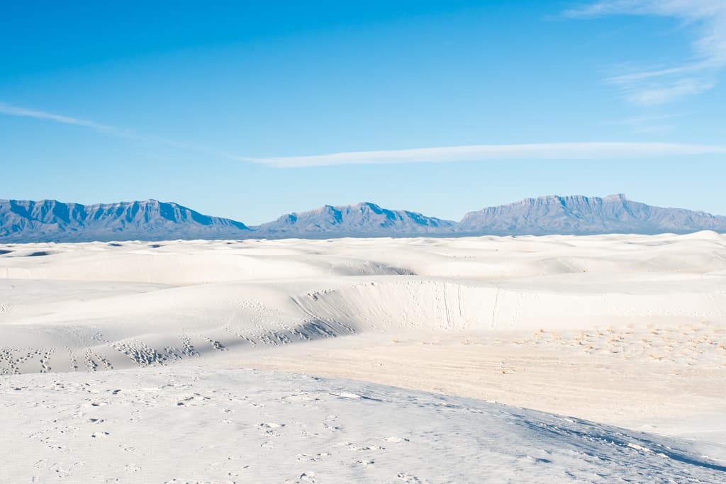
White Sands National Park is the world’s largest gypsum dune field, located in the heart of New Mexico’s Tularosa Basin! Here, you can explore its wave-like dunes, discover unique plant and animal life, and soak in the breathtaking scenery that changes with every shift of the wind.
One of the most fun activities at White Sands is sledding down the soft sand dunes. It’s a hit with both kids and adults! Just grab a sled from the visitor center or bring your own, and enjoy the ride.
While it’s a blast to roam freely across the open dune area at White Sands National Park, don’t miss out on the marked trails like the Dune Life Nature Trail. This trail takes you into the heart of the dunes, where you can learn about all the critters that call this landscape home, from lizards to foxes and more!
Finally, don’t miss the chance to visit the White Sands Missile Range Museum. This free museum showcases an extensive collection of missiles and rockets, with an outdoor missile park, exhibits, and displays.
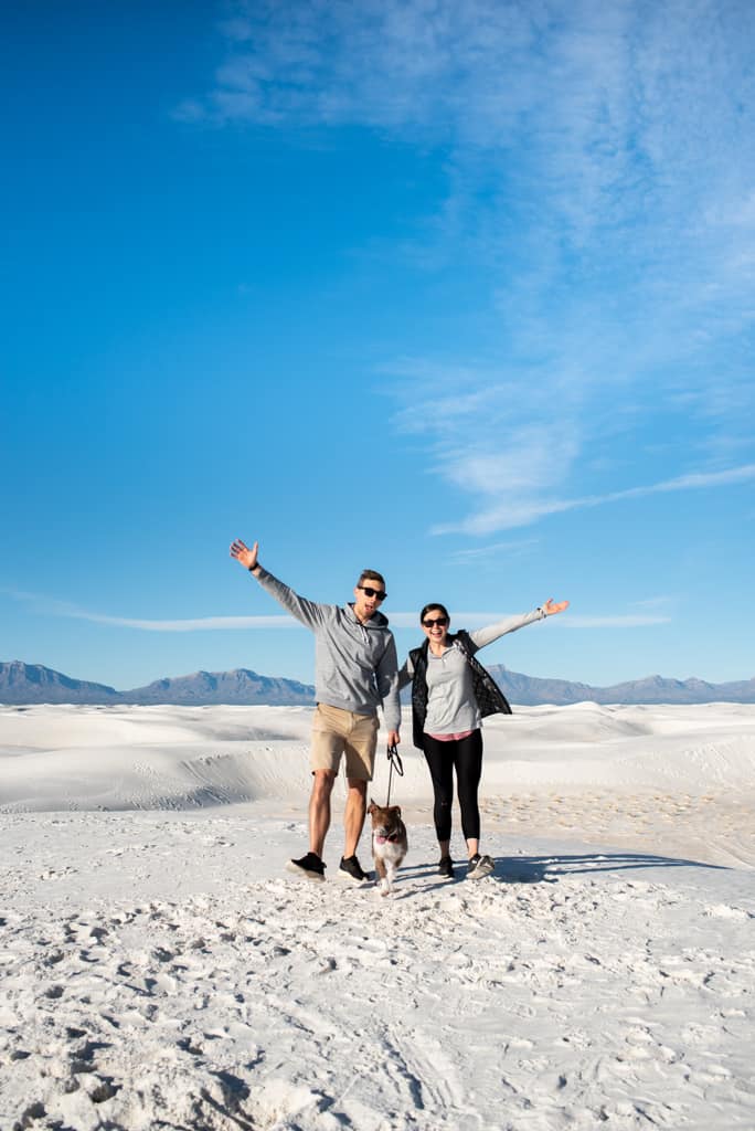

White Sands National Park at a glance
State: New Mexico
Cost: $25 per vehicle entrance fee (7-day pass).
Getting There: White Sands is easily accessible by car and is located 15 miles from Alamogordo, New Mexico. The closest major airport is El Paso International Airport (ELP) in El Paso, Texas, about 85 miles away.
Getting Around: The primary mode of transportation within White Sands National Park is by car. The park features a scenic drive called Dunes Drive, an eight-mile road that leads from the park entrance to the heart of the sand dunes. There is no public transportation that currently serves the park.
Pet friendly: Leashed pets are allowed on paved surfaces within the park on the dunes and hiking trails.
Campgrounds: White Sands National Park does not have developed campgrounds for overnight stays within the park boundaries. However, backcountry camping is an option.
Permits/Reservations: Backcountry camping is currently closed due to the rehabilitation of camping sites.
A+K Tip: While we normally love visiting parks at sunrise, White Sands has set operating hours (include hours). To visit the park before or after hours, you can apply for a special use permit.
Learn more about White Sands National Park
Blog post
5 Things to do at White Sands National Park
YouTube video
Weekend in New Mexico: White Sands, Las Cruces, & Carlsbad Caverns National Park
11. Big Bend National Park

Big Bend National Park in Texas is an incredible place where the desert meets the mountains, and the Rio Grande curves a path along the border. The park’s landscapes are just epic, filled with rugged mountains, desert expanses, and stunning river vistas.
The Lost Mine Trail is an absolute must. This 4.8-mile round-trip hike, with about 1,100 feet of elevation gain, offers some of the most amazing views we’ve ever seen in Texas. The Chisos Mountains are just unreal!
We also highly recommend hiking the Window Trail. It’s a slightly longer hike at 5.6 miles round-trip and about 1,000 feet of elevation gain. The trail leads to an iconic vantage point framed by steep canyon walls, creating a natural window that perfectly frames the desert landscape.
And you can’t visit Big Bend without driving the Ross Maxwell Scenic Drive. It’s the best way to see some of the park’s most stunning spots without having to lace up your hiking boots. The drive takes you past historic ranches and incredible rock formations and ends at the Santa Elena Canyon overlook!


Big Bend National Park at a glance
State: Texas
Cost: $30 per vehicle entrance fee (7-day pass). Only credit or debit cards are accepted, no cash.
How to Get there: Big Bend National Park is located in Southwest Texas, with the closest large city being El Paso, which is 290 miles (4.5 hours) from Big Bend National Park. There is no public transportation to or within Big Bend National Park.
Getting Around: Getting around Big Bend National Park mainly involves driving, as the park spans over 800,000 acres with significant distances between points of interest. Be sure you have plenty of gas, oil, food, and water for your trip.
Pet Friendly: Your pet can go anywhere your car can, but they’re not allowed on trails, off roads, or on the river.
Campgrounds: There are four campgrounds in Big Bend National Park. The National Park Service (NPS) operates three developed frontcountry campgrounds that provide drinking water and restroom facilities. In addition, a full hookup RV camping area is operated by the park concessioner, Aramark.
Permits/Reservations: A backcountry permit is required for all backcountry camping and river trips.
Learn more about Big Bend National Park
Blog post
The ULTIMATE West Texas Road Trip: Marfa and Big Bend
YouTube video
Big Bend National Park + Marfa, TX | US Road Trip Days 4-7
12. Guadalupe Mountains National Park

Guadalupe Mountains National Park is famous for its incredible mountain peaks and gorgeous desert landscapes. It also protects the largest Permian fossil reef in the world and boasts the four highest peaks in Texas!
If you only have time for one thing at Guadalupe Mountains National Park, you MUST hike to the top of Guadalupe Peak, the highest point in Texas at 8,751 feet. The trail is tough but so rewarding, especially when you reach the summit.
We also love the McKittrick Canyon Trail. Known for its vibrant fall colors, this trail takes you through one of the most scenic canyons in the park, with vibrant leaves and flowing streams. There are also lots of fossils in the canyon, as part of the canyon is a fossil reef that formed 260-270 million years ago!
And you can’t miss the Devil’s Hall Trail, a 3.8-mile hike that is known for its stunning natural rock hallway formed by massive cliffs!

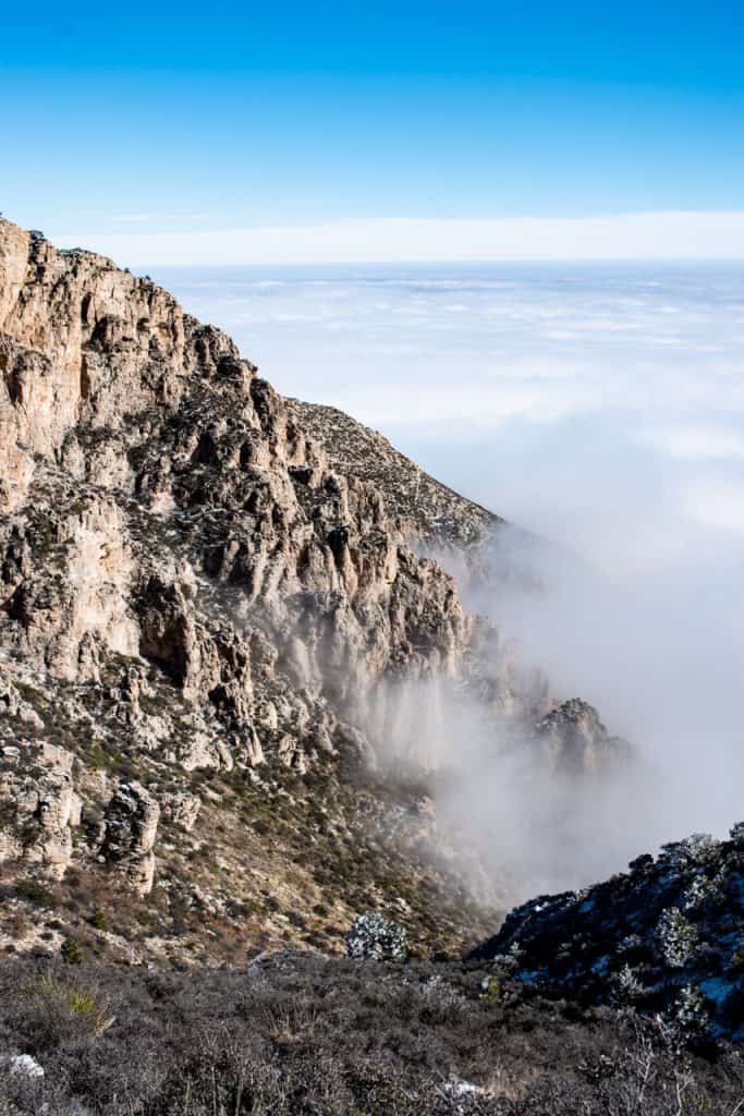
Guadalupe Mountains National Park at a glance
State: Texas
Cost: Entrance costs $10 per person. You can pay with a card at the Pine Springs Visitor Center or use cash or a card at self-pay stations by all the trailheads.
How to Get There: Located in West Texas, Guadalupe Mountains National Park is roughly 110 miles east of El Paso and 56 miles southwest of Carlsbad, New Mexico. If you’re flying in, the closest airport offering commercial flights is in El Paso, Texas (ELP).
Getting Around: Just a heads up, there’s no public transport, shuttles, or gas within the park. For necessities, head to Van Horn or El Paso in Texas or Whites City in New Mexico. The nearest gas station is a 35-mile drive from the visitor center, so plan your trip wisely!
Pet friendly: Pets on leashes under six feet are allowed only in vehicle-accessible areas, such as roadsides, parking, picnic areas, and campgrounds, including the Pine Springs Campground connector and Pinery Trail to the Butterfield Stage Station.
Campgrounds: Guadalupe Mountains has three developed campgrounds, open all year, for tents and RVs.
Permits/Reservations: You can book your camping spot and horse corral campsites in advance. If you’re planning to backpack overnight or ride horses on the trails, you’ll need to pick up a free permit for each activity.
Learn more about Guadalupe Mountains National Park
Blog post
5 Things to Do at Guadalupe Mountains National Park
YouTube videos
El Paso + Guadalupe Mountains National Park | US Road Trip Days 7-9
Guadalupe Peak + Saguaro National Park | US Road Trip Days 9 & 10
13. Great Basin National Park
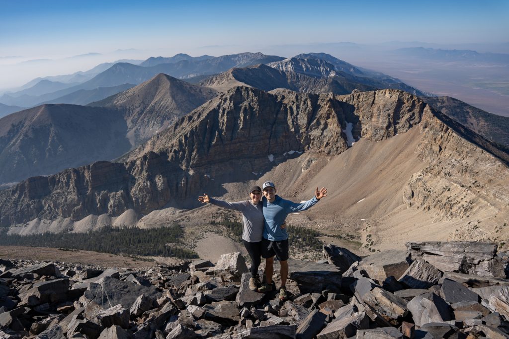
Quite possibly one of the most underrated National Parks in the United States is Great Basin. In fact, it’s one of the 10 least visited in the United States!
The park gets its name for the region it is located in: the Great Basin. This is a 200,000 square mile region that encompasses most of Nevada, plus parts of the neighboring states and is an area where no water drains to an ocean, but rather evaporates, sinks underground, or flows into mostly saline lakes. It is known for having long, flat valleys that span between numerous mountain ranges.
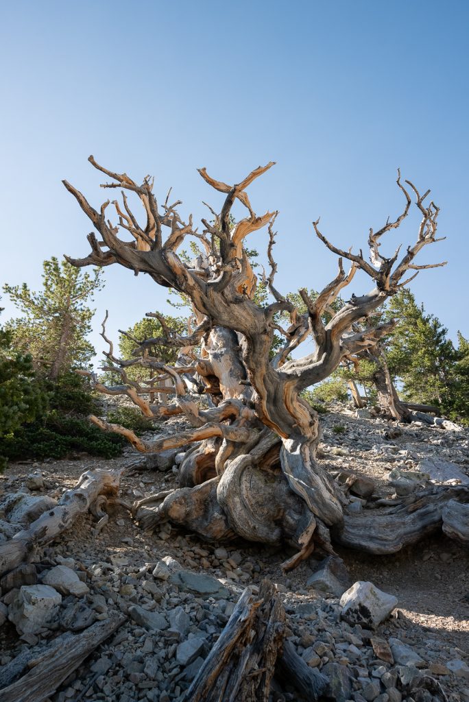
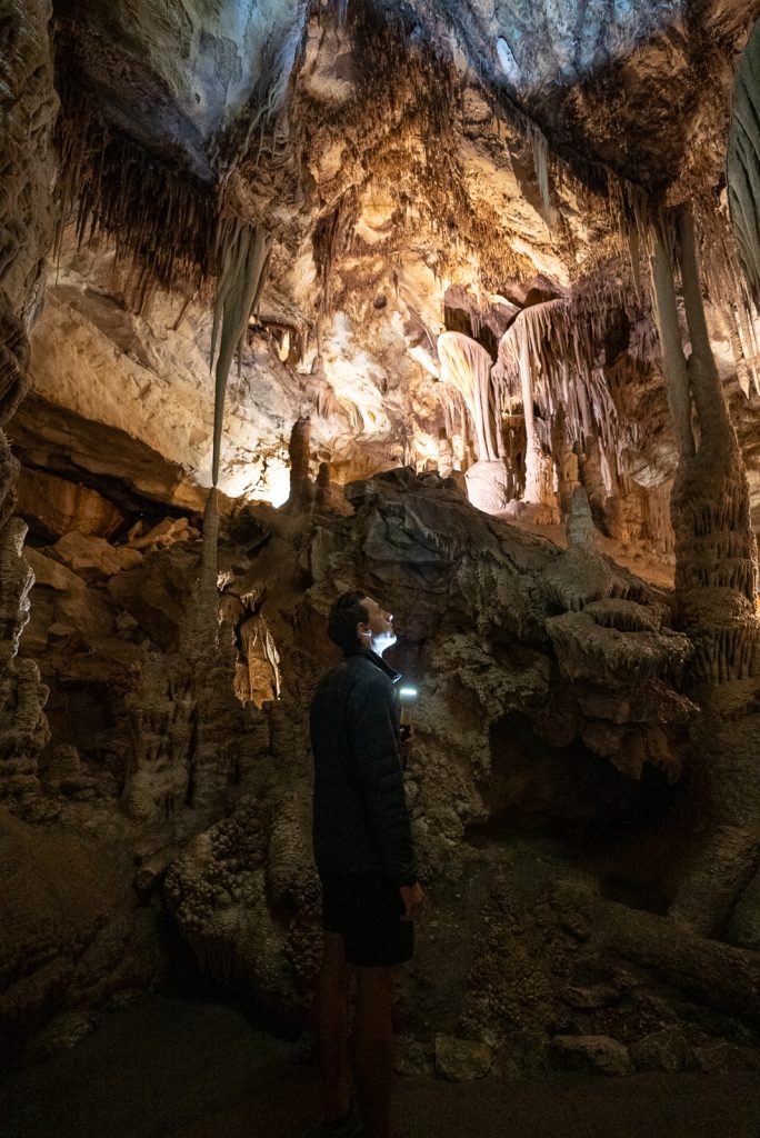
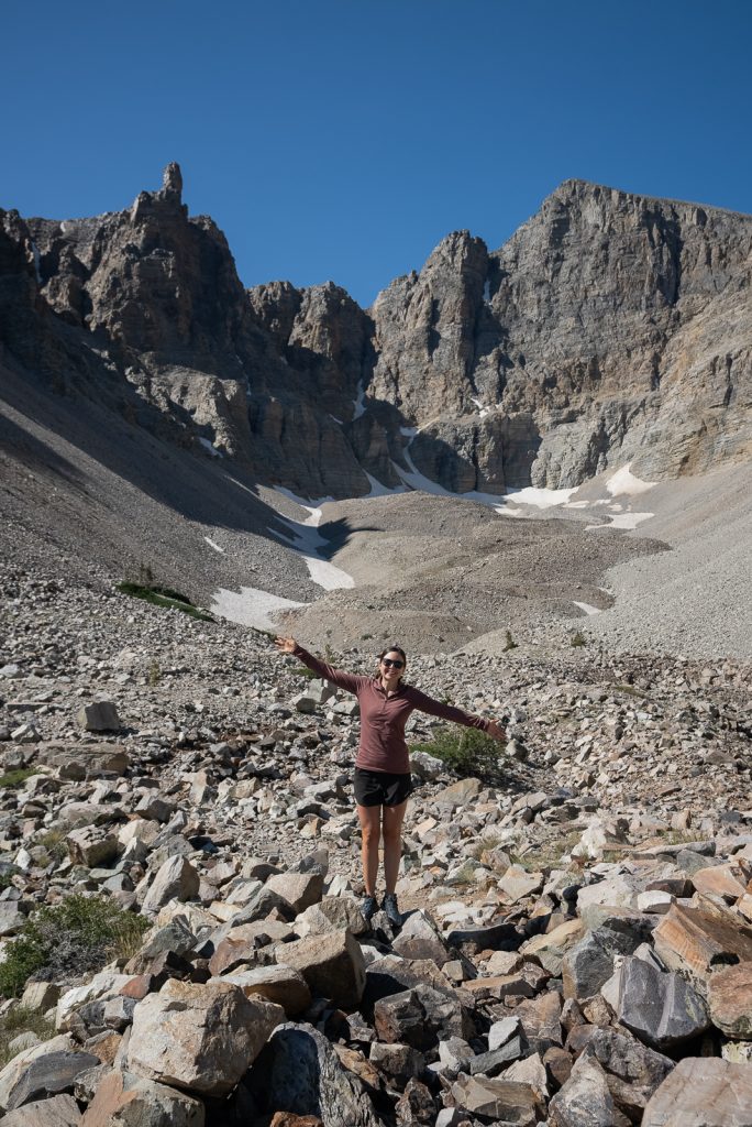
While the surrounding area is very desert-like, within the park you can find a whole range of scenery. Like rugged mountains, lakes, Bristlecone Pines, and a cave.
To experience the best of this park, we recommend hiking the 6 mile Bristlecone and Alpine Lakes Loop, summiting Wheeler Peak, the second highest point in Nevada, and going on a Lehman Cave tour.
And don’t forget to look outside at night to see tons of stars and possibly even the Milky Way!
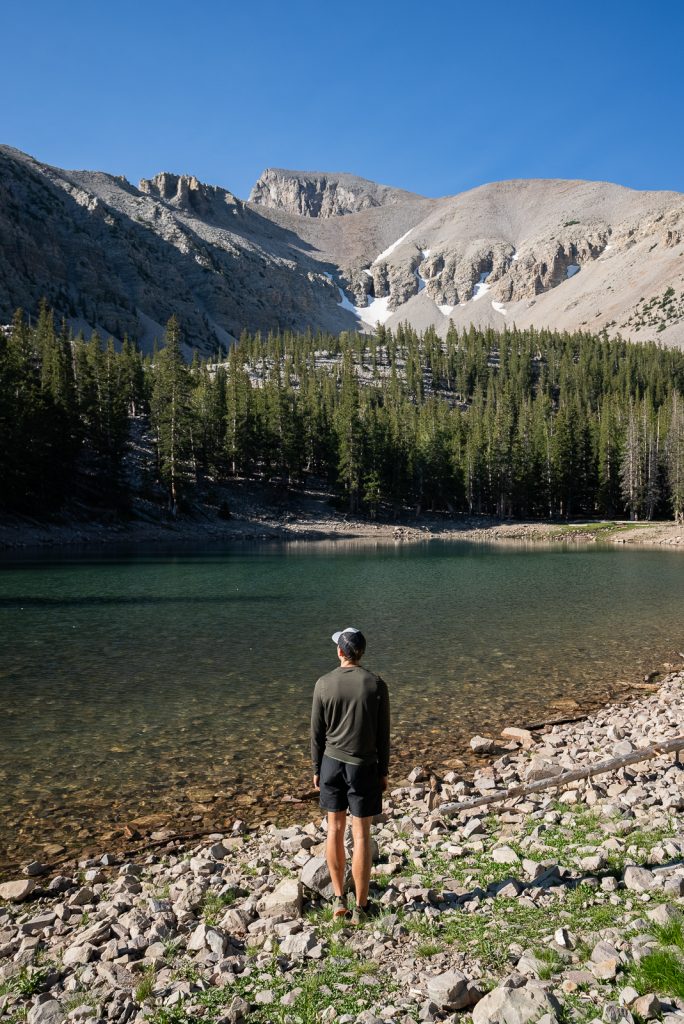
Great Basin National Park at a glance
State: Nevada
Cost: FREE!
How to Get There: Great Basin National Park is located near Baker, Nevada, a very small town near the border of Utah. The closest major cities are Salt Lake City (3.5 hour drive) and Las Vegas (4.5 hour drive). If you’re road tripping from near Lake Tahoe, you can get to the park on a fun road trip along the Loneliest Road in America!
Getting Around: There’s no public transport or shuttles within the park. You will need your own vehicle and any type will work fine!
Pet friendly: Pets on leashes under six feet are allowed only in vehicle-accessible areas, such as roadsides, parking, picnic areas, and campgrounds.
Campgrounds: Great Basin has five campgrounds, plus free primitive camping and backcountry camping.
Permits/Reservations: You do not need a reservation to enter the park, but some backcountry trails require permits. And you should reserve the Lehman Cave tour in advance. While they have walk up tours, there is no guarantee you’ll get one.
A+K Tip: Make sure to stock up on groceries and fuel before entering the park! While the nearby town of Baker does have a few restaurants, a gas station, and a small general store, you will find a larger grocery store and more fuel options in Ely, one hour to the west.
Learn more about Great Basin National Park
Blog post
10 Fun Things to Do in Great Basin National Park
YouTube video
THIS is Nevada?! 😍 Exploring Great Basin National Park!
Tips for Visiting National Parks in the American Southwest

Plan Ahead: National Parks are incredible, but research is key! Check park websites for reservation requirements, closures, and any special events happening during your visit.
Bring LOTS of water and sun protection: The National Parks in the American Southwest are sunny, hot, and exposed. Make sure you bring proper protection from the sun and also plenty of water on trails. We love our Camelbak bladder for hikes because it stores a ton of water and it’s easy to drink from while moving.
Download Maps in Advance: Don’t count on a reliable 5G signal deep in the wilderness. Many national parks have limited or no cell coverage. To stay on the right path, consider downloading offline maps before your trip. Apps like AllTrails+ (a personal favorite of ours) are a lifesaver for navigating trails even without an internet connection.
Want to get 30% off an AllTrails Plus membership? Use our code aplusk30 (you must redeem this code on the website, not the app)!
We use AllTrails Plus on every single hike and it is the most helpful hiking tool out there! Some of the features we love are offline maps (so we can navigate even without cell service), wrong-turn alerts, and its 3D maps feature, so we can get a feel for trails before we hike.
America the Beautiful Pass: For frequent park visitors, grab an America the Beautiful Pass ($80 annually). It grants access to over 2,000 federal recreation sites, including National Parks!
Pet-Friendly Planning: National Parks have varying pet regulations. Check pet restrictions beforehand. Some areas may not be pup-friendly to protect wildlife and the environment. If your furry friend can join, bring waste bags and keep them on a leash.
Be Weather Ready: Pack for all conditions! Mountain weather can change quickly, so bring layers, rain gear, and sunscreen no matter the forecast.
Leave No Trace: Be a responsible park visitor! Pack out all trash, stick to designated trails, and minimize your impact to keep these natural wonders pristine for everyone to enjoy.
About the author
This blog post was written by our writer Nicoll. Learn a bit about her below!
After six years of full-time travel, Nicoll is now a mountain-loving mama living in Colorado with her husband Jake, their sweet baby girl Teagan, and their pup Gunner. She loves hiking, riding her dirt bike, and finding joy in the little things.
Heading to the Southwest?
Pin this guide with the 13 best American Southwest National Parks to help plan your adventure!