Last updated on October 3rd, 2026
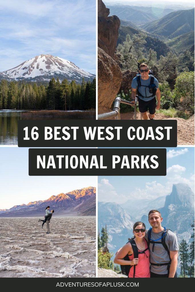
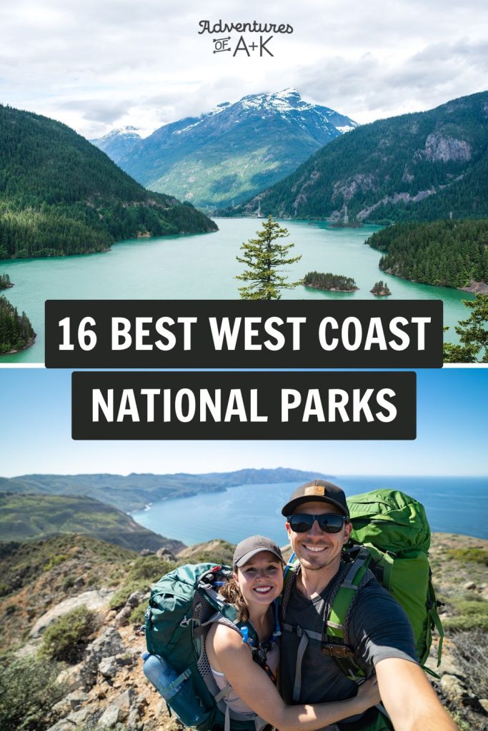
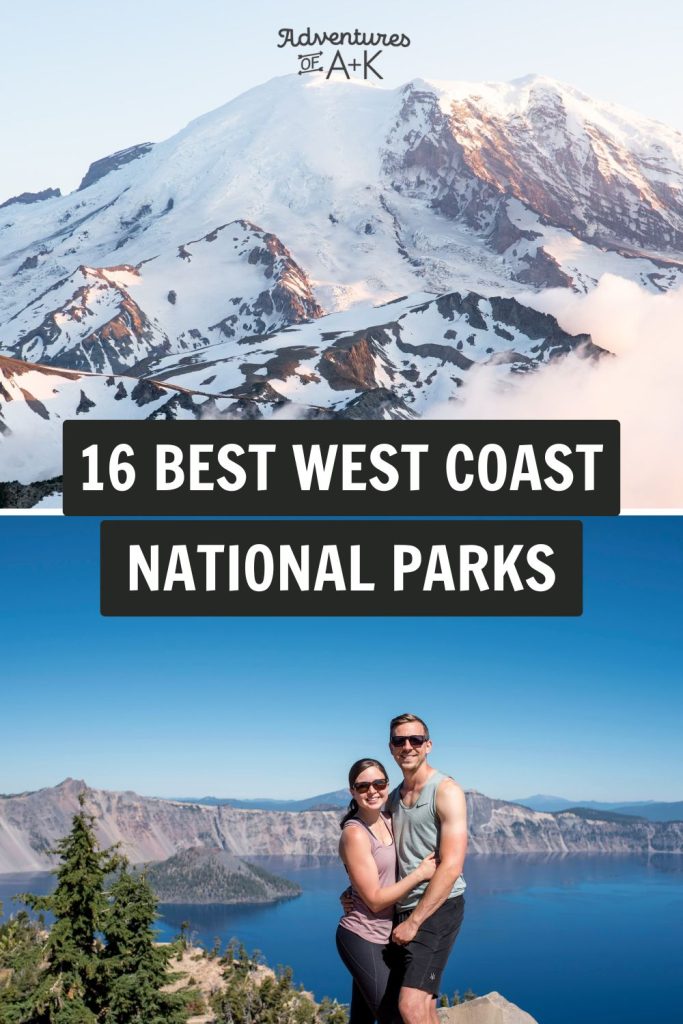
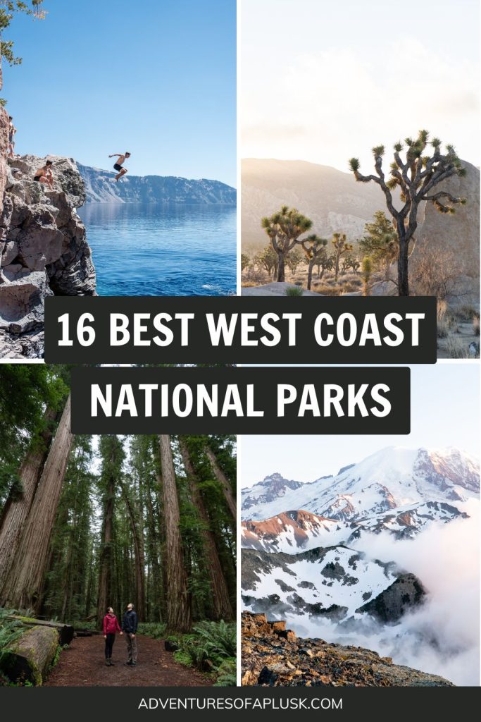
Planning a trip to the West Coast? In this guide, we’re sharing the best West Coast national parks you absolutely need to visit and why they’re a must-see.
The West Coast, which includes Washington, Oregon, and California, boasts more than a dozen national parks. You’ll find towering trees, massive mountains, and stunning coastal views here.


After setting out in our van full-time 5 years ago, we’ve had the amazing opportunity to visit 51 of the 65 national parks across the U.S. And the West Coast national parks are our personal favorite!
In this guide, we’re sharing the best national parks on the West Coast (based on our experience) that promise big adventures and even bigger memories. We’ll cover our favorite activities, how much things cost, and what permits and reservations you need. Plus, we’re throwing in some advice on where to camp, how to navigate each park, and a bunch more to make your adventure unforgettable!
- Defining West Coast National Parks
- 1. Olympic National Park
- 2. Mount Rainier National Park
- 3. North Cascades National Park
- 4. Crater Lake National Park
- 5. Channel Islands National Park
- 6. Yosemite National Park
- 7. Redwood National and State Parks
- 8. Pinnacles National Park
- 9. Death Valley National Park
- 10. Joshua Tree National Park
- 11. Lassen Volcanic National Park
- 12. Glacier National Park
- 13. Grand Teton National Park
- 14. Yellowstone National Park
- Tips for Visiting West Coast National Parks
Defining the West Coast National Parks

Before we begin, let’s clarify what we mean by “West Coast.” While definitions may vary, for the purpose of this article, we’ll consider the West Coast to include national parks in the states farthest west in the U.S., such as Washington, Oregon, and California.
And we’re also adding Wyoming and Montana. These states, though not coastal, have features similar to what you would find on the west coast.
Looking for National Parks in the neighboring states, like Utah and Arizona? Check out our guide to the best Southwest National Parks! Or maybe the East Coast is more your speed. Don’t worry, we have a guide about the East Coast National Parks too!
The 16 BEST West Coast National Parks in the USA
1. Olympic National Park
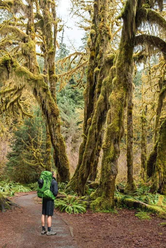
First on the list is Olympic National Park, Adam’s absolute favorite, and it’s easy to see why! This place is massive, with nearly a million acres of diverse landscapes to explore, including glacier-capped mountains, old-growth temperate rainforests, and over 70 miles of wild coastline! Plus, with over 600 miles of trails that crisscross the park, there are so many hikes to explore.
For starters, the Hoh Rainforest is a must-visit and is at the top of our list of things to do in Olympic National Park. It’s one of the only temperate rainforests in the continental U.S., and walking through its moss-covered trees on the Hall of Mosses trail is totally unique.
Exploring the park’s rugged coastline is another highlight. Rialto Beach, with its sea stacks and tide pools, is a place where we can spend hours discovering tiny marine life among the rocks. (don’t forget to check out Hole-in-the-Wall at low tide—it’s super cool).
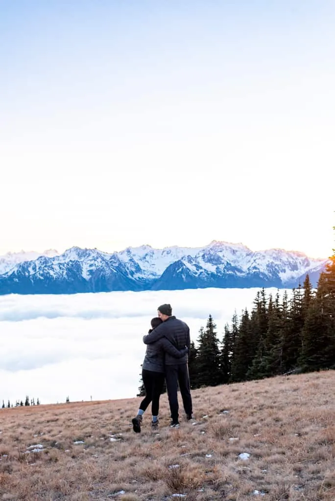
And, of course, no visit to Olympic National Park would be complete without mentioning the gorgeous views from the top of Hurricane Ridge. It is the most easily accessible mountainous area on the peninsula, with a steep, paved road from sea level to 5,242 feet!

Olympic National Park at a Glance
State: Washington State
Cost: $30 for a private vehicle, $25 for a motorcycle, and $15 for each person walking or biking in (7-day pass).
How to Get There: You can reach the park by car via US-101, which circles around the Olympic Peninsula and has several entrance points. The closest major airport is Seattle-Tacoma International Airport (SEA), about 100 miles from some park entrances.
Getting Around: Given the park’s massive size, driving is the most practical way to navigate Olympic National Park. As for reaching the park, the Dungeness Bus Line connects the Greater Puget Sound area from Seattle airport to Port Angeles. The Clallam Transit System covers Clallam County, including Port Angeles, Sequim, and Forks, with stops at select Olympic National Park destinations along Highway 101.
Pet friendly: Pets are allowed in campgrounds, some trails, and on some beaches (double-check the park’s website before bringing your pet). A few areas pets where pets allowed are: all beaches in the Kalaloch area, including Ruby Beach and South Beach, and Madison Falls Trail.
Campgrounds: 14 developed campgrounds are available within the park, offering various amenities and locations. Reservations are highly recommended, especially during peak season (summer and fall).
Permits and Reservations: Permits are mandatory for overnight camping outside of designated campgrounds. Climbing Mount Olympus or other major peaks may require a climbing permit, depending on the route.
Learn more about Olympic National Park
Blog post
The ULTIMATE Olympic Peninsula Road Trip Itinerary
27+ Fun Things to do on the Olympic Peninsula
20+ Best Things to Do in Olympic National Park (A Locals Guide!)
YouTube videos
Exploring the Olympic Peninsula | Cape Flattery, Hurricane Ridge, Mount Ellinor, & Murhut Falls
Conquering Mount Storm King + visiting a lavender farm and hobbit house! (Olympic Peninsula)
5 days on Washington’s MAGICAL Northern Olympic Peninsula
2. Mount Rainier National Park
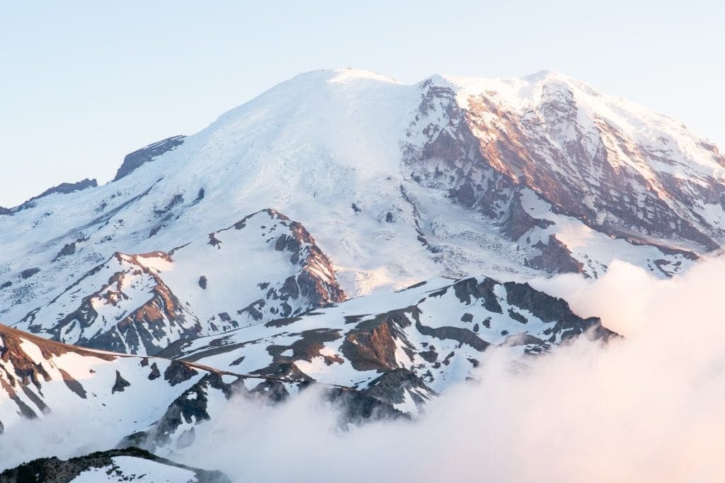
Mount Rainier National Park, located in the heart of Washington State, is, without a doubt, one of the most breathtaking destinations on the West Coast. This park centers around the towering Mount Rainier, an iconic active volcano that stands at 14,410 feet tall and is visible for miles. It’s huge, icy, and covered in the most extensive glaciers in the contiguous U.S.
One of our favorite hikes ever is the hike to the Mount Fremont Lookout. You get to see some of the most epic, up-close views of Mount Rainier, as well as the surrounding mountain ranges. We always suggest timing this hike so you’re there at sunset!
We also love visiting the Paradise area on the south side of the park. It’s named Paradise for a good reason—it’s one of the most beautiful spots you’ll ever see, especially when the wildflowers are in full bloom.
You can also explore the Sunrise area, the highest point in the park accessible by car. It offers some seriously cool (and slightly less crowded) trails, with panoramic views that are just as stunning as those from Paradise.


Mount Rainier National Park at a Glance
State: Washington State
Cost: $30 per vehicle entrance fee (7-day pass). As of 2024, from late May to September, timed entry reservations are required to access certain areas. Reservations are $2 and can be made up to 3 months in advance.
How to Get There: The park has several entrances. The most popular is the Nisqually Entrance on State Route 706. The closest major airport is Seattle-Tacoma International Airport (SEA), about 80 miles away.
Getting Around: Mount Rainier National Park covers a vast area, so the best way to get around is by car since the park does not provide shuttle buses.
Pet friendly: Leashed pets are allowed on most paved surfaces, but are not permitted on trails or in wilderness areas. Check the park’s website for details before bringing your furry friend.
Campgrounds: Mount Rainier National Park has 4 campgrounds, each located in a different section of the park: Cougar Rock in the southwest, Ohanapecosh in the southeast, White River in the northeast, and Mowich Lake in the northwest.
Permits/Reservations: Generally, you won’t need permits for most activities. Backcountry camping and climbing Mount Rainier itself do require permits, so plan accordingly.
Learn more about Mount Rainier National Park
Blog posts
Hiking the Mount Fremont Lookout Trail at Mount Rainier
The Best Things to do at Mount Rainier (+ where to stay & park tips!)
YouTube videos
24 Hours at Mount Rainier: Mount Fremont Lookout, Grove of the Patriarchs, waterfalls, & snow!
3. North Cascades National Park
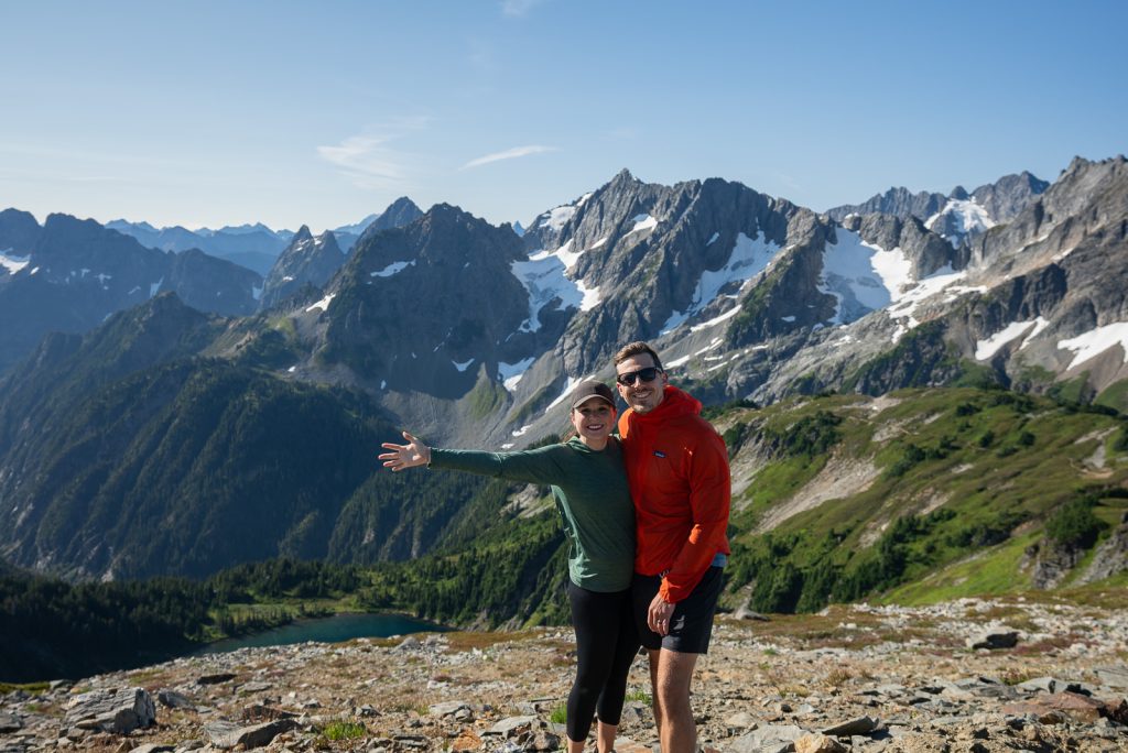
Nicknamed the “American Alps” for a reason, North Cascades National Park is home to stunning jagged peaks, over 300 glaciers (yes, you read that right—more than any other U.S. park outside of Alaska!), and some of the most pristine alpine lakes you’ll ever lay eyes on, the resemblance to the famed European mountain range is seriously uncanny.
With miles upon miles of scenic trails, hiking here is top of the list. For the best views of the park’s glaciers and jagged peaks, hike the Cascade Pass to Sahale Arm trail. Meanwhile, Diablo Lake’s striking turquoise waters, a result of glacial silt, provide a beautiful spot for kayaking or canoeing.
Plus, don’t miss the chance to drive the North Cascades Highway (State Route 20). It’s one of the most scenic drives in America!
But what really sets North Cascades apart are the lesser-known spots. Stehekin, a remote community accessible only by boat, plane, or a long hike, offers cozy cabins, a quaint bakery, and unbeatable scenery.


North Cascades National Park at a Glance
State: Washington State
Cost: There’s no entrance fee. However, some developed campgrounds within the park boundaries charge day-use fees.
How to Get There: Easily accessible by car, the park is located near the town of Marblemount, Washington. The closest major airport is Seattle-Tacoma International Airport (SEA), about 150 miles away.
Getting Around: The easiest way to get around North Cascades is by car. There are only a few buses connecting nearby towns like Bellingham and Winthrop to the park entrance. You can also take a passenger ferry to Stehekin.
Pet Friendly: Leashed pets are welcome on paved roads and designated trails within certain park areas. Check the park website for details and specific leash laws before bringing your furry friend along.
Camping: North Cascades offers 6 campgrounds located along the North Cascades Highway. There’s also the option for boat-in camping on Ross Lake, Diablo Lake, and Lake Chelan.
Permits/Reservations: Reservations are required for all overnight camping, both in developed campgrounds and the backcountry. Permits are not required for general hiking, but some technical climbs may require a climbing permit.
Learn more about North Cascades National Park
Blog posts
Our Ultimate 4 Day North Cascades National Park Itinerary
19 EPIC Things to Do Along the North Cascades Highway
Videos
4 days in Washington’s North Cascades: Our TOP hikes & sights!
4. Crater Lake National Park
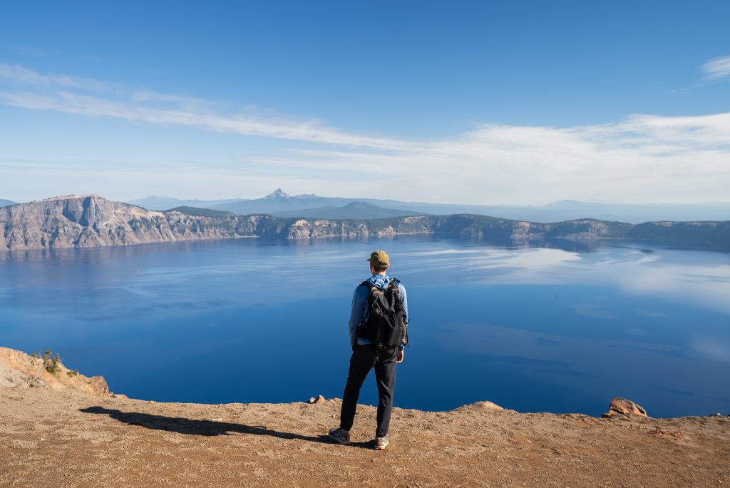
Volcanoes leave a dramatic mark on the landscape, and Crater Lake National Park is a prime example. 7,700 years ago, Mount Mazama, a once-towering volcano, collapsed, leaving behind a massive caldera and creating what is now the deepest lake in the United States (at a staggering 1,949 feet!).
One of the best things to do in the park is the Rim Drive, a 33-mile road that encircles the lake, offering jaw-dropping viewpoints like Rim Village or Castle Point, and iconic hikes like the Watchman Peak Trail. Garfield Peak Trail and Cleetwood Cove Trail, leading down to the lakeshore, are absolute must-dos for the full Crater Lake experience. The park’s boat tours, including a stop at Wizard Island, a cinder cone rising from the lake, are also super popular!


Crater Lake National Park at a Glance
State: Oregon
Cost: Entrance fees vary by season and mode of entry. From May 22 to October 31, it costs $30 for private vehicles and $25 for motorcycles (7-week pass). From November 1 to May 21, the fees drop to $20 for private vehicles and $15 for motorcycles. The fee for each person walking or biking in is $15 year-round.
How to Get There: The park is easily accessible by car and is located near Klamath Falls, Oregon. The closest major airport is Rogue Valley International Medford Airport (MFR), about 80 miles away.
Getting Around: Crater Lake National Park is relatively small, and the best way to get around is by car. There is a seasonal trolly service along Rim Drive, which can be a good option if you don’t want to drive yourself or can’t find parking.
Pet friendly: Leashed pets are allowed on paved surfaces within the park and on certain trails (Lady of the Woods, Godfrey Glen, Annie Spur Trail, Grayback Drive, and the Pacific Crest Trail). However, pets are not allowed on the Cleetwood Cove Trail, and pets cannot enter Crater Lake or any streams or bodies of water within the park.
Campgrounds: There are three developed campgrounds within the park: Mazama Village Campground, Munson Creek Campground, and Cleetwood Cove Campground, and they provide a mix of reservable and first-come, first-served sites. You can also stay at the historic Crater Lake Lodge, built on the edge of the caldera.
Permits and Reservations: While most park activities don’t require permits, backcountry camping permits are required. A valid Oregon fishing license is required to fish in the lake.
Learn More about Crater Lake National Park
Blog posts
15 BEST things to do at Crater Lake National Park in Oregon
A Perfect One Day in Crater Lake National Park Itinerary
8 Best Hikes in Crater Lake National Park
5. Channel Islands National Park

Channel Islands National Park, often referred to as the “Galapagos of North America,” is a secluded paradise off the coast of Southern California. Made up of five islands and the ocean around them, this park is filled with over 2,000 plant and animal species, 145 of which are found nowhere else in the world!
Hiking here is nothing short of amazing, with trails that offer breathtaking views of the Pacific Ocean. One of our favorites is the hike to Potato Harbor on Santa Cruz Island, offering stunning cliffside views that are simply unforgettable. Another top pick is the hike to the Anacapa Island Lighthouse.
Plus, kayaking through the sea caves of Santa Cruz Island is undoubtedly one of the top activities here, especially the Painted Cave, one of the largest sea caves in the world!
Visiting the Channel Islands requires a bit more planning than other parks. You’ll need to catch a boat or a small plane since there’s no bridge connecting these islands to the mainland.

Channel Islands National Park at a Glance
State: California
Cost: There is no entrance fee to enter Channel Islands National Park. However, since the islands are only accessible by boat, you’ll need to factor in the cost of transportation. Prices vary by destination. Expect to pay around $60-$90 per adult for a round-trip ferry ride.
How to Get There: The only way to get to the Channel Islands is by boat! Island Packers operates ferries from Ventura and Oxnard, California. The closest major airport is Los Angeles International Airport (LAX), about 100 miles north of Ventura.
Getting Around: Once on the islands, there is no public transportation and exploring the islands is primarily done by foot.
Pet Friendly: Unfortunately, pets are not allowed on any of the Channel Islands due to the fragile ecosystem and the presence of endangered species.
Campgrounds: Each island has a designated campground offering basic amenities like restrooms, picnic tables, and fire rings. There are limited campsites available, offering a total of about 70 campsites across the park, so reservations are highly recommended.
Permits/Reservations: Permits are not required to land your kayak on any island administered by the National Park Service. But booking a tour is highly recommended due to the dangerous nature of the sea!
Learn more about Channel Islands National Park
Blog posts
How to backpack Santa Cruz Island at Channel Islands National Park
Visiting Santa Cruz Island at Channel Islands National Park
YouTube video
Backpacking Santa Cruz Island at Channel Islands National Park (Prisoners Harbor to Scorpion)
6. Yosemite National Park
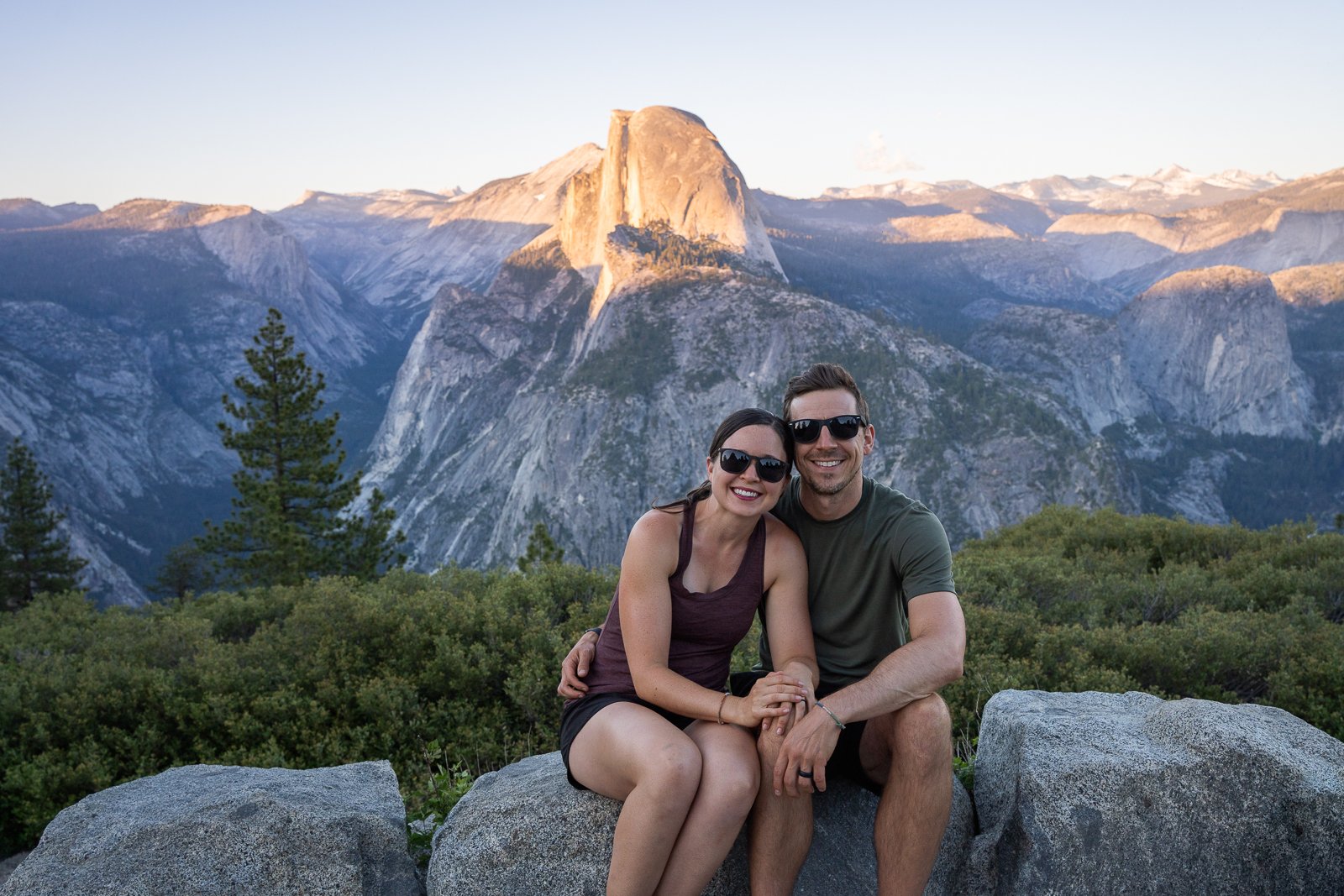
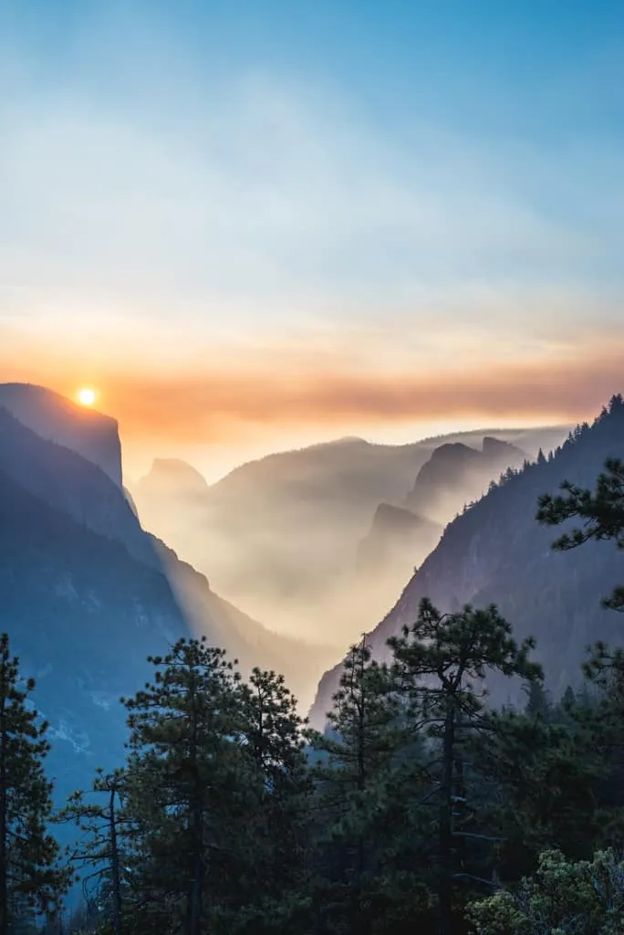
Yosemite National Park, is home to iconic granite cliffs, cascading waterfalls, and ancient sequoia groves. Plus, it’s famous for landmarks like El Capitan, Half Dome, and Yosemite Falls, making it a must-visit National Park on the West Coast.
For those eager to hit the trails, the options are vast and varied. Panorama Trail to the Mist Trail, leading up to Vernal and Nevada Falls, is an absolute must-do. During the hike, you have sweeping views of Half Dome, plus Yosemite Valley, ending with two epic (and mist filled) waterfalls.
Catching a sunrise or sunset at Glacier Point is also pretty epic. Watching the sky light up with hues of orange and pink over Half Dome is an experience that simply can’t be missed.
You can also take a scenic drive or bike ride along Tioga Road. This route offers access to alpine meadows, clear mountain lakes, and breathtaking high-country views that are starkly different from Yosemite Valley but equally stunning. One of our favorite stops along the way is Olmsted Point, where you can see Half Dome and the surrounding peaks. And for a hidden gem, head to Hetch Hetchy to hike the Wapama Falls trail.

Yosemite National Park at a Glance
State: California
Entrance Fees: $35 for private vehicles, $30 for motorcycles, and $20 per person for those walking or biking in (7-day pass). Cash is not accepted, only major credit cards and mobile payments. As of 2024, from April to October, reservations are required to enter the park during specific timeframes. Reservations are $2 and can be obtained online.
How to Get There: Yosemite is about a 3-hour drive from San Francisco. Public transportation options like Amtrak and Greyhound can also get you to Yosemite Valley. Additionally, the Yosemite Area Regional Transportation System (YARTS) provides access to the park from various locations. The closest major airport is Fresno Yosemite International Airport (FAT), located approximately 1 hour away.
Getting Around: You can explore Yosemite by driving, biking, or taking the Yosemite Valley shuttle!
Pet Friendly: Leashed pets (up to 6 feet leash) can go with you on paved roads, sidewalks, bike paths, and some developed areas (like some campgrounds) but NOT on trails, wilderness areas, beaches, meadows, buildings, or shuttle buses.
Campgrounds: Yosemite is home to 13 campgrounds, some of which accommodate RVs. Not all campgrounds are open year-round, and reservations are strongly recommended, especially from April through September, as they often book up months in advance.
Permits/Reservations: Reservations are required for entering the park during peak season. Permits are required for backcountry camping and Half Dome hike. Obtain permits in advance (lottery process for Half Dome).
Learn more about Yosemite National Park
Blog posts
33+ things to do in Yosemite National Park
How to spend ONE day in Yosemite National Park
The PERFECT 2 Day Yosemite National Park itinerary
The Ultimate Yosemite National Park itinerary: Options for 1-6 days!
Where to stay near Yosemite National Park
The Best Day Hike in Yosemite: The Four Mile Trail, Panorama Trail, and Mist Trail
Videos
The BEST 4 days in Yosemite National Park!
7. Sequoia National Park
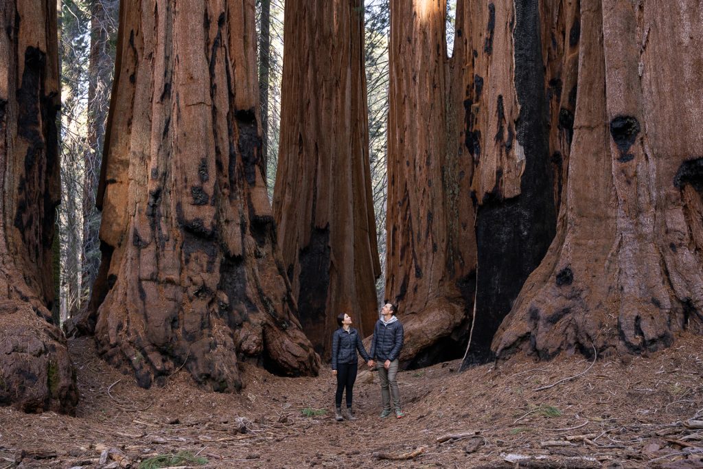
Sequoia National Park is a park full of giants. Here you can find Giant Sequoias, the largest trees in the world, plus the highest peak in the lower 48, Mount Whitney.
A visit to Sequoia is not complete without seeing General Sherman, the world’s largest tree (by volume)! This beast is 274.9 feet tall, has a circumference on the ground of 102.6 feet, and a total volume of 52,508 cubic feet! Make sure to continue onto the Congress Trail afterwards to see even more giant trees.
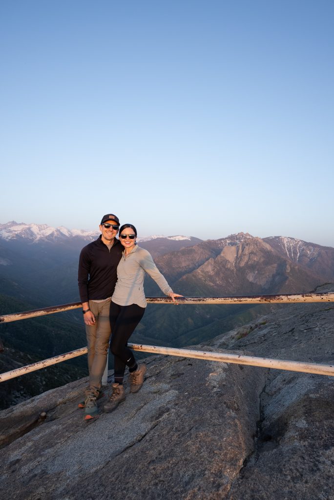
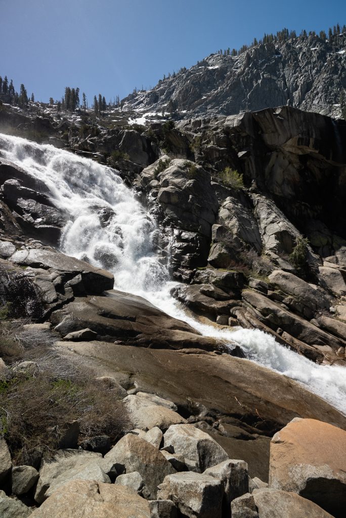
But this park is so much more than just Giant Sequoias! It is also home to rivers, waterfalls, views of the Sierra Nevada Mountains, fun features (like driving through a tree!), and if you’re lucky, wildlife. Some of our favorite experiences in the park were hiking to Tokopah Falls, climbing granite steps up to the top of Moro Rock, and seeing the sunset from Beetle Rock.
Sequoia National Park at a Glance
State: California
Entrance Fees: It costs $35 for private vehicles to enter the park. This entrance fee is good for 7 days and covers you for both Sequoia and Kings Canyon National Parks, as they are managed together.
How to Get There: Sequoia National Park is located just east of Fresno. The closest airport will be the Fresno Yosemite International Airport (FAT), about 1.5 hours away from the park’s Foothill entrance. The park does have some vehicle length limits for those in camper vans and RVs, so make sure to plan ahead.
Besides driving into the park yourself, you can also take a shuttle from Visalia to the Giant Forest Museum, between late May and September. It costs $20 per person round trip, in addition to the park entrance fee. Once arriving, you can take the free park shuttles around to other areas of the park.
Getting Around: Sequoia has 4 different FREE shuttle routes within the park, which start running around Memorial Day.
Pet Friendly: Leashed pets can go with you on paved roads and campgrounds. Pets are NOT allowed on trails, wilderness areas, buildings, or shuttle buses.
Campgrounds: There are 7 front country campgrounds in Sequoia National Park, as well as 7 more in the neighboring Kings Canyon. Two of these, Potwisha (Sequoia) and Azalea (Kings Canyon), are open year-round. The sites vary, but none have electric hookups.
Permits/Reservations: You do not need a reservation to enter the park. But you will need a permit for overnight wilderness backpacking trips and to summit Mount Whitney.
A+K Tip: The park has wide range in elevation. This means that the weather can vary greatly across the park, with the lower elevations being much warmer. Make sure to check the weather forecast for all areas of the park and pack layers!
Learn more about Sequoia National Park
The 17 Best Things to Do in Sequoia National Park
The Perfect One Day in Sequoia National Park Itinerary
General Sherman Tree & Congress Trail: The Ultimate Giant Sequoia Hike!
Video: TWO National Parks in TWO DAYS: Sequoia and Kings Canyon
8. Kings Canyon National Park
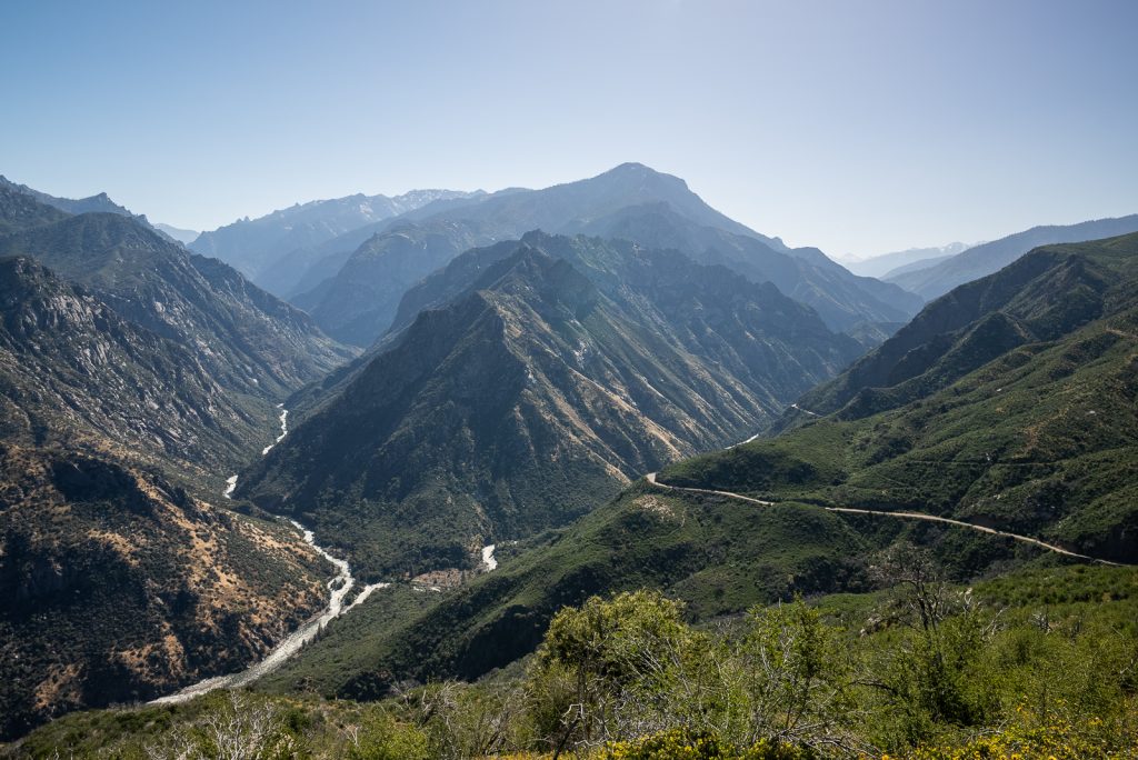
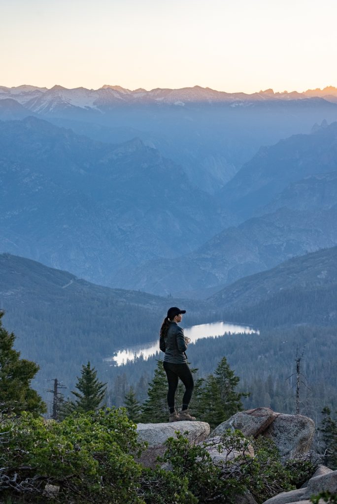
Located right next to Sequoia National Park, Kings Canyon is also home to impressive Giant Sequoias. But what makes the park really shine, is its namesake canyon. With a maximum depth of 8,200 feet, it’s technically deeper than the Grand Canyon and is a sight to behold!
Watch the sunrise at the Panoramic Point Overlook and after a quick stop to see the General Grant Tree (the second largest in the world by volume!), hit the road and drive the epic Kings Canyon National Park Scenic Byway. While most of this drive is technically outside of National Park boundaries, it takes you deep into Kings Canyon and offers spectacular views of the canyon walls and rushing South Fork Kings River. It is a jaw dropping drive!
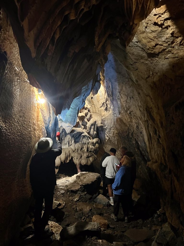
Along this drive, make sure to go for a tour at Boyden Cavern, check out Grizzly Falls, plus stop at the various overlooks along the way. Once you reach the end of the road, there are many hiking possibilities, like Mist Falls and Zumwalt Meadow and Roaring River Falls.
Kings Canyon National Park at a Glance
State: California
Entrance Fees: As we mentioned above, the fee for Kings Canyon National Park ($20-$35 depending on how you enter) covers you for both Sequoia and Kings Canyon, for up to 7 days.
How to Get There: Kings Canyon National Park is located just minutes from Sequoia National Park, along the Generals Highway. Similar to Sequoia, the closest airport will be the Fresno Yosemite International Airport (FAT), located just over 1 hour away from the park’s Big Stump entrance.
The park itself has two main areas, the area near Big Stump, which includes General Grant Grove, plus a much larger region (Cedar Grove) 1 hour down the Kings Canyon National Park Scenic Byway.
Getting Around: Unlike the neighboring Sequoia National Park, Kings Canyon does not have a shuttle system. You will need your own car to get around and there are no vehicle length restrictions to do so.
Pet Friendly: Leashed pets can go with you on paved roads and campgrounds. Pets are NOT allowed on trails, wilderness areas, buildings, or shuttle buses.
Campgrounds: There are 7 front country campgrounds in Kings Canyon National Park, as well as 7 more in the neighboring Sequoia National Park. Two of these, Potwisha (Sequoia) and Azalea (Kings Canyon), are open year-round. The sites vary, with some being tent-only, some requiring a short walk in, and some accommodating large groups. None have electric hookups.
Permits/Reservations: You do not need a reservation to enter the park. Permits are required for overnight wilderness backpacking trips.
Learn more about Kings Canyon National Park
15 Fun Things to Do in Kings Canyon National Park
Video: TWO National Parks in TWO DAYS: Sequoia and Kings Canyon
9. Redwood National and State Parks

Redwood National and State Parks are an incredible complex of several parks in California, known for their towering redwoods, the tallest trees on Earth (some of which have stood for over 2,000 years!). The parks is also home to protected forests, beaches, and grasslands along the northern coast of California.
For us, hiking through the forest is an absolute must. The Tall Trees Grove Trail, for instance, is our top pick. One of our favorite things to do, especially for first-timers, is simply to stand at the base of one of these towering redwoods and just look up!
The drive along the Newton B. Drury Scenic Parkway is another must-do. It cuts right through the heart of the park, with opportunities to spot Roosevelt elk—a fun bonus to an already incredible drive.
We also loved visiting Gold Bluffs Beach with Kona. It’s a big, beautiful beach backed by cliffs and mountains. (It’s also one of the few places in the park where dogs are welcome.) While you’re there, don’t miss visiting Fern Canyon, which has 50-foot-tall walls covered in ferns!


Redwood National & State Parks at a Glance
State: California
Cost: Redwood National Park is free to visit! However, some areas within the state parks do have a fee, including Gold Bluff Beach and Fern Canyon at Prairie Creek Redwoods State Park. They do accept the America the Beautiful National Parks Annual Pass though!
How to Get There: The parks are easily accessible by car and are located along the northern California coast, near Crescent City. The closest airport to Redwood National Park is Humboldt County Airport (ACV), which is about 30 minutes south of the southernmost point of Redwood National Park. However, many visitors choose to fly into San Francisco or Sacramento and drive north along the scenic California coast.
Getting Around: Redwood National and State Parks cover a large area, with several different groves spread out along the coast. Public transportation is pretty limited, so having a car is the best way to get around the parks. Redwood Coast Transit connects some towns near the park, but they don’t go directly to all park locations.
Pet friendly: Even though many areas of Redwood National Park are state parks, dogs are not allowed on trails. However, they are welcome in campgrounds, at paved viewpoints, on several beaches, and on Cal Barrel Road and Walker Road, which go through the redwoods.
Campgrounds: Across all four parks, there are roughly a dozen campgrounds offering various amenities and locations.
Permit/Reservations: You will need a permit for certain hikes, like Fern Canyon.
Learn more about Redwood National & State Parks
Blog posts
The ULTIMATE Guide to visiting Redwood National Park (+ state parks!) in California
How to hike the Fern Canyon Trail in Redwood National Park (Permit info, what to bring, & more!)
YouTube videos
Two days in REDWOOD National & State Parks! (Fern Canyon, Gold Bluff Beach, Stout Grove, & MORE!)
10. Pinnacles National Park

Tucked away in California’s Salinas Valley is the smallest national park in the state—Pinnacles National Park! Here, you’ll find massive rock formations, towering spires, labyrinthine talus caves, and craggy canyons born from ancient volcanic eruptions and sculpted by millions of years of erosion.
The Bear Gulch Cave Trail and the Balconies Cave Trail are our favorite picks for a fun, slightly eerie hike through the park’s talus caves. These are formed by boulders falling into narrow canyons, creating cool, dark passages to navigate. (Cave access can vary seasonally depending on bat activity and weather conditions, so check ahead.)
Plus, did you know that Pinnacles National Park offers world-class climbing opportunities on its namesake spires? With a bunch of different routes for all skill levels, this is a must-visit for climbers. (Proper safety precautions and permits are required for climbing.)
Birdwatching is huge here, too, thanks to the park being a release site for the California condor, one of the largest birds in the world!

Pinnacles National Park at a Glance
State: California
Cost: $30 entrance fee per vehicle, $25 per motorcycle, and $15 per person for those walking or biking which covers 7 days in the park. The Annual National Parks Pass is also accepted.
Getting there: The park is accessible by car, with two entrances, the East Entrance and West Entrance, located about an hour apart. San Francisco International Airport (SFO) is the closest major airport. It’s about a 2 hour drive from the park entrance.
Getting Around: Getting around by car is the best way to explore the park since there are no shuttle services offered. However, be aware that Pinnacles National Park is split into east and west sections, and there’s no road inside the park that connects them.
Pet Friendly: Leashed pets are welcome on developed areas like paved roads, unpaved roads, parking lots, and campgrounds within the park. Pets are not allowed on trails.
Campgrounds: There are two campgrounds within Pinnacles: East Pinnacles Campground and Beetle Rock Campground. Advance reservations are highly recommended, especially during spring and fall, which are the peak seasons.
Permits/Reservations: Permits are required for technical rock climbing. Most other activities don’t require permits, but always check the park website for updates.
Learn more about Pinnacles National Park
Blog post
The BEST Day Hike in Pinnacles National Park
YouTube video
Hiking the Condor Gulch, High Peaks, & Bear Gulch Loop at Pinnacles National Park (California)
11. Death Valley National Park

Death Valley National Park lives up to its name—it’s the hottest, driest, and lowest national park in the contiguous United States. Yet, amidst these inhospitable terrains, Death Valley is filled with life.
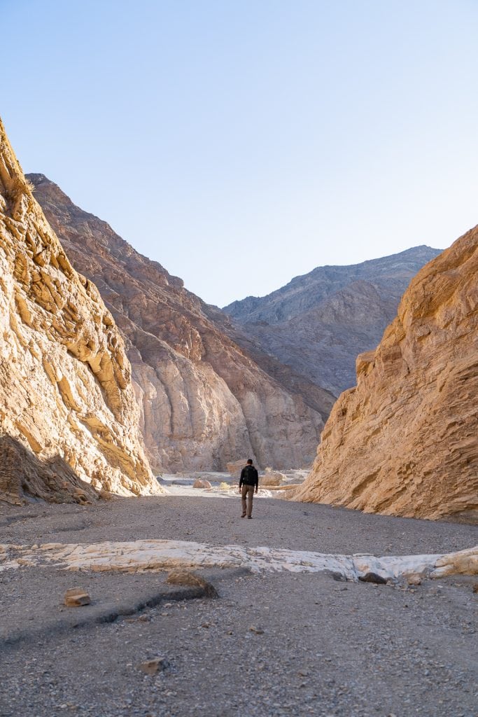
It’s a place where mountains over 11,000 feet high sit right next to the salt flats of Badwater Basin (the nation’s lowest point at 282 feet below sea level). It’s also one of the driest spots on Earth, but you can still see snow on the mountaintops! The park has it all: sand dunes, a waterfall, and rugged canyons.
One of our favorite things to do is catch the sunrise at Zabriskie Point. The point is perched above yellow and brown striped badlands, with the Manly Beacon (a shark fin-shaped formation) rising above at an elevation of 823 feet.
We also made sure to drive through Artist’s Drive, a one-way road that winds through some of the park’s most colorful volcanic and sedimentary hills. Artist’s Palette, especially, is a spot where the minerals have painted the hills in hues of green, pink, red, yellow, and purple. (It’s a bit of a maze to walk through but makes for some good exploring!)
Lastly, no visit to Death Valley would be complete without experiencing the Mesquite Flat Sand Dunes near Stovepipe Wells. Walking among these ever-changing dunes is really fun, especially during the cooler hours of the day.

Death Valley National Park at a Glance
State: California and Nevada
Entrance Fee: $30 per vehicle entrance fee, $25 for a motorcycle, and $15 for each person walking or biking in (7-day pass).
How to Get There: Easily accessible by car, located on the California-Nevada border, near Death Valley Junction and Furnace Creek. The closest major airport is Las Vegas Harry Reid International Airport (LAS) in Nevada, about 2 hours away.
Getting Around: Exploring Death Valley National Park is best done by car due to its massive size. Make sure your vehicle is in good condition, as the extreme temperatures can be tough on engines and tires. Stick to paved roads unless you’re equipped with a high-clearance or 4WD vehicle for rougher trails like the Racetrack Playa.
Fill up your gas tank before entering the park (since in-park gas stations are few and far between with steep prices). While the park lacks official shuttle services, visitors can opt for tours from nearby cities.
Pet Friendly: Pets are not allowed on trails, but are allowed on paved roads, unpaved roads, parking lots, and campgrounds (they must be leashed). Remember, Death Valley gets scorching hot—leave your pet at home if you can’t guarantee their safety in the extreme temperatures.
Campgrounds: Death Valley National Park has 9 campgrounds, offering a range of options from primitive to full-hookup sites.
Permit/Reservations: You do not need a reservation to enter the park. But camping reservations are recommended for Furnace Creek Campground from October through April.
Learn more about Death Valley National Park
Blog posts
The ULTIMATE guide to visiting Death Valley National Park (Things to do + itinerary options)
How to hike Golden Canyon at Death Valley National Park (+ Red Cathedral & Gower Gulch)
Hiking the Mosaic Canyon Trail in Death Valley National Park
How to hike to Darwin Falls in Death Valley National Park (A year round waterfall in the desert!)
YouTube videos
The ULTIMATE 3 days in DEATH VALLEY National Park!
An EPIC drive to Death Valley (Ash Meadows, Wild Burros, Rhyolite GHOST town, & Titus Canyon!)
12. Joshua Tree National Park
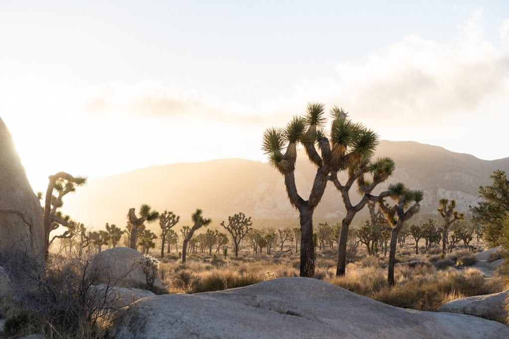
Joshua Tree National Park, located in southern California’s Coachella Valley, is a stunning mix of desert landscapes, with boulders, mountain peaks, and of course, its namesake, the Joshua Tree, which are pretty weird looking, with twisted arms and spiky leaves.
What we love about Joshua Tree National Park is that it’s filled with some incredibly unique sights, and we got to see a lot of them! Skull Rock is one of the most iconic spots in Joshua Tree, and it’s easy to see why. The rock really does look like a skull!
Ryan Mountain is also a must-hike for us. It’s the second-highest peak in the park and offers stunning views after a 1,000 feet steep climb. We could see mountains all around and got a cool view of the boulder fields below.
The Cholla Cactus Garden is another favorite of ours. It’s ten acres of teddybear cholla cacti, which you don’t see much elsewhere in the park. The way they glow in the sunlight, especially at sunrise or sunset, is really cool!


Joshua Tree National Park at a Glance
State: California
Cost: There is a $35 entrance fee per vehicle, $20 per motorcycle, and $15 per individual entering the park. The America the Beautiful Pass is also accepted.
How to Get There: The park can be accessed by car through several entrances, including the West Entrance in Joshua Tree, the North Entrance in Twentynine Palms, and the South Entrance near Cottonwood Springs. If you’re flying in, the closest major airport is the Palm Springs International Airport (PSP), which is about an hour’s drive from both the north and south entrances of Joshua Tree.
Getting Around: To really see everything this park has to offer, you’ll want to drive. There are two main roads that go through the park and unpaved roads reaching more secluded spots (four-wheel drive required). Avoid using GPS for navigation here. The NPS warns it may direct you to backcountry roads unsuitable for your vehicle due to ruts or soft sand.
Pet Friendly: Leashed pets are welcome on paved roads, designated trails, and some campgrounds within Joshua Tree National Park.
Campgrounds: There are 9 campgrounds in Joshua Tree National Park, offering more than 500 campsites in total. Some operate on a first-come, first-served basis, while others require reservations, especially during the busy season from October through May.
Permits/Reservations: You’ll need a backpacking permit for any overnight stays in the backcountry. And a heads-up for climbers: if you’re planning to put in new bolts or fixed anchors, you’re going to need a permit for that, no matter where in the park you are.
A+K Tip: Flash floods can occur after heavy rains, even in seemingly dry areas. Be aware of the weather conditions and avoid hiking in canyons or washes during storms.
Learn more about Joshua Tree National Park
Blog post
The Best Things to do in Joshua Tree National Park (+ a one day itinerary!)
YouTube video
One Day in Joshua Tree National Park (Ryan Mountain, Keys View, Cholla Cactus Garden, & MORE!)
13. Lassen Volcanic National Park

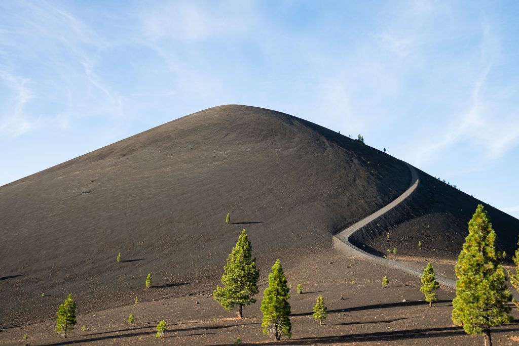
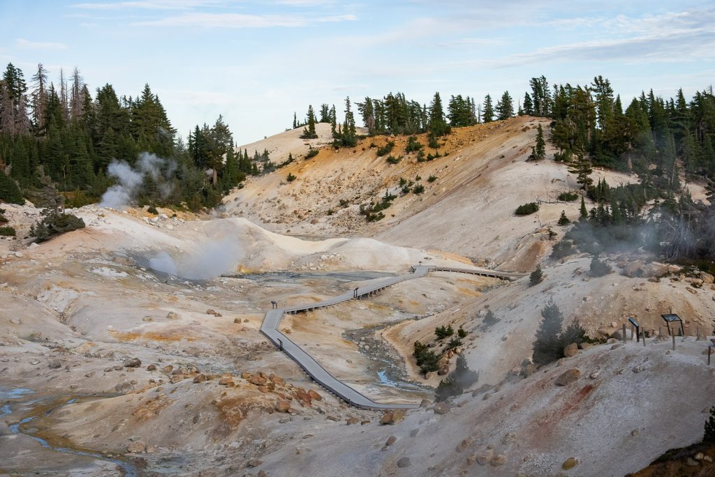
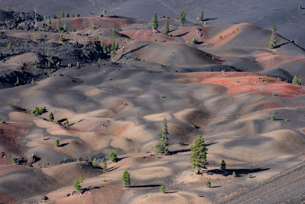
Lassen Volcanic National Park is a standout favorite for those who love a mix of fiery volcanic landscapes and cool mountain scenery. It’s where you can literally walk among bubbling mud pots, steaming fumaroles, and crystal-clear mountain lakes, all in one visit. Plus, did you know that the park is home to all four types of volcanoes found in the world?!
Sulphur Works in Lassen National Park is one of our must-visit spots whenever we’re in the park. Here, the earth bubbles and steams right under your feet! This area is known for its geothermal activity, and you can really see and smell the sulphur vents, which is pretty cool.
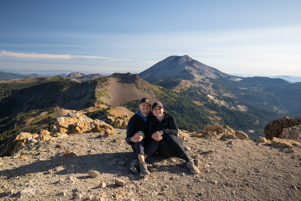
Hiking is also big here, with trails leading to epic views of the park’s volcanic features. To experience hiking on three different volcano types, hike up Lassen Peak, Brokeoff Mountain, and the Cinder Cone Trail.
The Bumpass Hell Trail is another must-visit. It offers easy access to a large hydrothermal area, where you can see more of the park’s bubbling mud pots and steaming vents.
Lassen Volcanic National Park at a Glance
State: California
Cost: From April 15 to November 30, cars cost $30, while motorcycles are $25, and walking or biking in is $15 per person (7-day pass). From December 1 to April 15, cars and motorcycles drop to $10, and so does the per-person fee for walkers and bikers.
Getting There: The park is located near the northern end of the Sacramento Valley, near the cities of Redding and Susanville. The nearest major airport is Sacramento International Airport (SMF), about 3 hours away.
Getting Around: The best way to get around the park is definitely in your own car. There is no public bus service directly to or within Lassen Volcanic National Park. Some tours or shuttles operated by private companies might be available from nearby towns, depending on the season.
Pet Friendly: Pets are allowed in developed areas, campgrounds, and on specific roads, but they must be kept on a leash. Trails and wilderness areas, however, are off-limits to pets to protect the park’s wildlife and ecosystems.
Campgrounds: There are several campgrounds within the park, including Manzanita Lake Campground, Summit Lake Campground, and Butte Camp Campground.
Permit/Reservation Needed: Overnight wilderness permits are required for backcountry camping and can be obtained at the park.
Learn more about Lassen Volcanic National Park
Blog post
How to visit Lassen Volcanic National Park in the winter & spring
YouTube video
Visiting Lassen Volcanic National Park in the SPRING! (Sulphur Works, Chaos Crags, & Manzanita Lake)
14. Glacier National Park
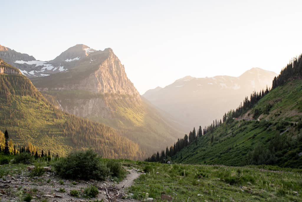
Glacier National Park, sprawling across Montana’s majestic Rocky Mountains, is an absolute gem and undeniably a favorite of ours. With its dramatic peaks, crystal-clear lakes, extensive glacier-carved terrain, and an abundance of huckleberries, we just can’t get enough!
One of our all-time favorite activities is driving the Going-to-the-Sun Road. This iconic route offers epic views and access to some of the most breathtaking hikes in the park (and spotting mountain goats along the way is always a neat bonus!).
Hiking here is absolutely a must, with over 700 miles of trails weaving through the park.
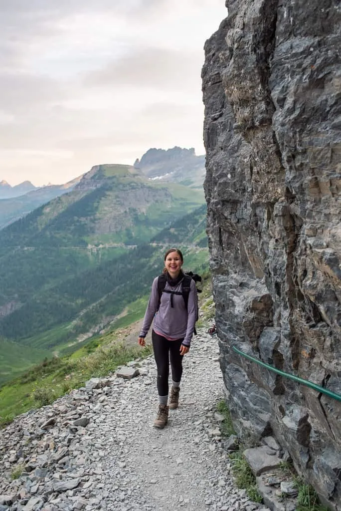
A few of our favorites include the Hidden Lake Trail and the hike to Avalanche Lake via the Trail of the Cedars! But one hike that totally blew us away was the Highline Trail to Grinnell Glacier Overlook. This trail is absolutely stunning and is still one of our favorite hikes in the US!

Glacier National Park at a Glance
State: Montana, bordering Canada
Entrance Fee: $30 per vehicle, $20 per motorcycle, $15 per individual (entrance fee valid for 7 days).
How to Get There: West Glacier and East Glacier are the main park entrances. The nearest major airport is Glacier Park International Airport (FCA) in Kalispell, Montana, about 30 minutes from West Glacier.
Getting Around: There are several ways to explore the park! You can drive, hop on the shuttle, or join a guided tour. Vehicles over 21 feet long or 8 feet wide cannot drive between Avalanche Creek and Rising Sun.
The free shuttle system travels along the Going-to-the-Sun Road, connecting the Apgar Visitor Center to the St. Mary Visitor Center, with stops along the way. Paid shuttles are available to reach destinations beyond the Going-to-the-Sun Road, such as Many Glacier and Two Medicine.
Pet Friendly: Leashed pets are welcome in developed areas, but are not allowed on trails or in the backcountry.
Campgrounds: Glacier National Park boasts 13 campgrounds with over 1,000 sites. Some campgrounds operate on a first-come, first-served basis. Others accept reservations, which are highly recommended during peak season.
Permit/Reservation Needed: If you’re thinking about backcountry camping, you’ll need a permit. It’s important to plan ahead because some spots have a lottery system for permits.
Also, you’ll need to reserve a spot for your vehicle if you want to check out the Going-to-the-Sun Road, Many Glacier, or North Fork areas during the busy season. The reservation fee is $2, and you can easily make it online.
Learn more about Glacier National Park
Blog posts
Hiking the Highline Trail at Glacier National Park (Routes + tips!)
Driving the Going-to-the-Sun Road at Glacier National Park (The Best Stops!)
4 Day Glacier National Park Itinerary (Logan Pass, Lake McDonald, St. Mary, & North Fork)
13 Best Things to Do at Two Medicine in Glacier National Park
YouTube videos
First time at Glacier National Park: Going to the Sun Road, St. Mary Falls, Lake McDonald, & more!
Hiking the Highline Trail to Grinnell Glacier Overlook at Glacier National Park (& huckleberry pie!)
Last day at Glacier: Polebridge Bear Claws, Bowman Lake, & Whitefish (Alpine Slide & food!)
15. Grand Teton National Park

Grand Teton National Park, with its soaring peaks and pristine lakes, easily ranks as one of our top favorites. This park boasts stunning scenery with jagged mountain peaks and pristine lakes (and believe me, it never gets old). The Teton Range itself is unreal. These dramatic mountains dominate the entire landscape, and you just can’t help but stare up at them in awe.
One of our favorite hikes was definitely the climb to Inspiration Point via the Jenny Lake Loop. Feeling ambitious? Try the Hidden Falls, Inspiration Point, and Cascade Canyon hike (a 15-mile adventure). Feeling less energetic? The park shuttle boat can shave off 4 miles!
You can’t miss sunrise at Schwabacher Landing, it’s pure magic! Seeing the Teton Range all lit up with golden light is a photographer’s dream, and honestly, the perfect way to start a day in this gorgeous park.
Oxbow Bend is another must. The view of the Snake River snaking around Mount Moran is incredible. And for a grand finale, head to the Jackson Lake Overlook. The panorama of this massive lake surrounded by the Tetons is simply unforgettable.


Grand Teton National Park at a Glance
State: Wyoming
Entrance Fee: $35 per vehicle, $20 per motorcycle, $15 per individual (entrance fee valid for 7 days).
How to Get There: Jackson, Wyoming is the closest town, only about 40 minutes away. Grand Teton National Park is unique in that it is the only national park that has a commercial airport within its border, Jackson Hole Airport (JAC).
Getting Around: Having a vehicle is the best way to get around Grand Teton National Park. Some lodges provide free shuttles to specific locations around the park and Jackson town. The START bus provides public transportation options around Jackson Hole, with some routes reaching the south entrances of the park.
Pet Friendly: Pets are allowed in the park, but must be kept on a leash at all times. They are restricted to roadsides, campgrounds, and other areas that are close to roads and developed areas, but are not allowed on trails or in the backcountry.
Campgrounds: Grand Teton National Park has 9 campgrounds. Some campgrounds, like Jenny Lake, work for both tents and RVs. Leigh Lake even offers boat-in camping! All park campground sites are reserved by advanced reservations only.
Reservations/Permits: Reservations are highly recommended for campgrounds, especially during peak season. Permits are required for backcountry camping.
Learn more about Grand Teton National Park
Blog post
3 Days at Grand Teton National Park Itinerary
YouTube videos
Grand Teton National Park Day 1: Hiking to Hidden Falls & Inspiration Point
Grand Teton National Park Day 2: Hiking to Delta Lake!
16. Yellowstone National Park
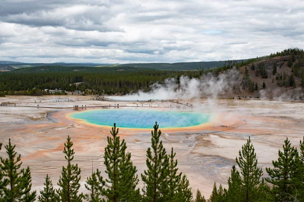
Last, but certainly not least, is Yellowstone National Park. This park spans across Wyoming, Montana, and Idaho, is the first and arguably most famous national park in the world (and it’s easy to see why!)
Everywhere you look, there’s some crazy geothermal feature bubbling away— geysers shooting sky-high (they have over half the world’s geysers!), multicolor hot springs, and gurgling mud pots. It’s hard not to be mind-blown!
When visiting Yellowstone, you have to start with a bang by watching Old Faithful erupt. Seeing that massive geyser shoot water into the air was epic, plus we were able to have a more relaxed day and not worry about scheduling around an eruption (or accidentally missing it).
Another must-visit spot is the Morning Glory Pool, which is absolutely incredible! The colors are so vivid, and the hot spring has a deep hole in the middle that makes you feel like you’ll be sucked into another dimension.
Yellowstone even has a hidden gem—a Grand Canyon! We hiked down to a view of the Lower Falls (steep but short!) and were totally blown away by the views. Who knew there was a canyon here? Yellowstone truly has it all!


Yellowstone National Park at a Glance
State: Primarily Wyoming, but extends into Montana and Idaho
Cost: $35 per vehicle, $30 per snowmobile, $20 per motorcycle, $20 per individual (entrance fee valid for 7 days).
How to Get There: The closest airport is the Yellowstone Airport (33.5 miles to the Old Faithful Visitor Center) in West Yellowstone, Montana. The next closest airport is Jackson Hole Airport (88.7 miles to the Old Faithful Visitor Center).
Getting Around: Driving is the best way to explore Yellowstone, especially because the park is huge and there’s no shuttle service offered by the park. Keep in mind, Yellowstone has five entrances. Since it can take hours to drive between these entrances, make sure to check which roads are open when you’re planning your visit. If you’re looking for guided tours or need to get to specific places, some companies offer shuttle services.
Pet Friendly: Yes, but with restrictions. Pets are allowed in developed areas, roads, and campgrounds, but must be kept on a leash. They’re not allowed on trails or in the backcountry.
Campgrounds: Yellowstone boasts 12 campgrounds with over 2,000 sites. The demand is high, so securing a reservation ahead of time is crucial, especially from May through September.
Permit/Reservation Needed: Backcountry camping requires a permit. For front-country campgrounds, reservations are highly recommended and often necessary during peak season.
Learn more about Yellowstone National Park
Blog post
2 Days at Yellowstone National Park Itinerary
YouTube videos
Yellowstone National Park Day 1: Old Faithful, Grand Prismatic Spring, & Fairy Falls
Yellowstone National Park Day 2: Canyons, Waterfalls, and Mammoth Hot Springs
Tips for Visiting West Coast National Parks
Plan Ahead: National Parks are incredible, but research is key! Check park websites for reservation requirements, closures, and any special events happening during your visit.
Download Maps in Advance: Don’t count on a reliable 5G signal deep in the wilderness. Many national parks have limited or no cell coverage. To stay on the right path, consider downloading offline maps before your trip. Apps like AllTrails (a personal favorite of ours) are a lifesaver for navigating trails even without an internet connection.
Want to get 30% off an AllTrails Plus membership? Use our code aplusk30 (you must redeem this code on the website, not the app)!
We use AllTrails Plus on every single hike and it is the most helpful hiking tool out there! Some of the features we love are offline maps (so we can navigate even without cell service), wrong-turn alerts, and its 3D maps feature, so we can get a feel for trails before we hike.
America the Beautiful Pass: For frequent park visitors, grab an America the Beautiful pass ($80 annually). It grants access to over 2,000 federal recreation sites, including National Parks!
Pet-Friendly Planning: National Parks have varying pet regulations. Check pet restrictions beforehand. Some areas may not be pup-friendly to protect wildlife and the environment. If your furry friend can join, bring waste bags and keep them on a leash.
Be Weather Ready: Pack for all conditions! Mountain weather can change quickly, so bring layers, rain gear, and sunscreen no matter the forecast.
Leave No Trace: Be a responsible park visitor! Pack out all trash, stick to designated trails, and minimize your impact to keep these natural wonders pristine for everyone to enjoy.
About the Author
This blog post was written by our writer Nicoll. Learn a bit about her below!
After six years of full-time travel, Nicoll is now a mountain-loving mama living in Colorado with her husband Jake, their sweet baby girl Teagan, and their pup Gunner. She loves hiking, riding her dirt bike, and finding joy in the little things.
Ready to visit the national parks?
Pin this guide with the best West Coast national parks in the USA!