Last updated on March 9th, 2026
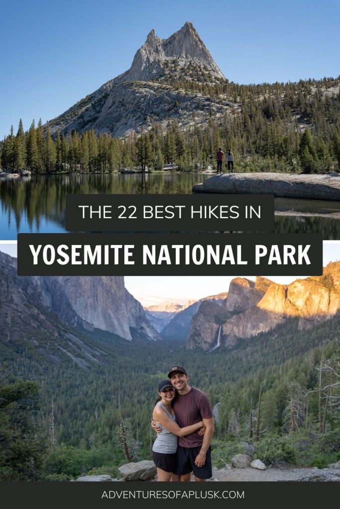
Ready to experience some of the best hikes in Yosemite National Park? We’re sharing our favorite hikes and tips from our multiple trips to the park!
With over 750 miles of trails, Yosemite National Park is a hiker’s paradise. Along these trails you can see raging waterfalls, clear alpine lakes, and striking views of Half Dome and Yosemite Valley. Plus get sprayed by mist and challenge yourself with steep climbs.

And the best part? There is something for everyone! The hikes in Yosemite National Park range from easy strolls to intense elevation gains, providing options for all ability levels.
In this guide we’re sharing the 22 best hikes in Yosemite National Park, so you can choose the trails that are best for you!
Check out all of our Yosemite National Park resources
- Plan the Ultimate California National Parks Road Trip! (3 itineraries)
- The 33+ BEST things to do in Yosemite National Park
- Where to stay in Yosemite National Park
- How to spend ONE day in Yosemite National Park
- The PERFECT two day Yosemite National Park Itinerary
- The Ultimate Yosemite National Park itinerary: Options for 1-6 days!
- The Best Day Hike in Yosemite: Four Mile, Panorama, & Mist Trail
- See more California National Park guides
- The 22 best hikes in Yosemite National Park
- The best hikes in Yosemite Valley
- The best hikes on Glacier Point Road
- The best hikes on Tioga Road
- The best hikes in Wawona and Mariposa Grove
- The best hikes in Hetch Hetchy
- Things to know before hiking in Yosemite National Park
- What to bring to Yosemite National Park
Want to Learn More as you explore?
We highly suggest downloading the Guide Along – Yosemite (totally worth the cost!!) audio tours to navigate you on the road. Even when you don’t have service it knows where you are and provides commentary and history about the area. As well as alerts you when to stop for specific sights. These guides are fun to listen to and the narrator feels like a fun friend in the car with you!
The 22 best hikes in Yosemite National Park
While you can experience many of Yosemite’s iconic views from viewpoints and walking paths, hiking is one of the best things to do in Yosemite National Park.
Below are 22 of the best hikes in Yosemite National Park, broken down by different areas of the park, as well as listed from easiest to most challenging. We’re specifically focusing on day hikes in the park, but if you’re up for a longer adventure or want to camp overnight in the wilderness, the park offers tons of backpacking options (permits required).
Unsure how to choose from this list? We are putting an asterisk next to our absolute favorites!
The best hikes in Yosemite Valley
Yosemite Valley is the most iconic region of Yosemite National Park. This area is accessible by car or bus year round, making it a perfect destination no matter when you visit. Here you’ll find the park’s famous waterfalls and cliffs. Plus some of the most popular hikes in the park. Because of this, the crowds can be pretty wild here (some areas feel a bit like Disney…), so starting early is KEY to having an enjoyable experience.
1. Bridalveil Fall
Miles (round trip): 0.8
Elevation Gain: 114 feet
Trail Map and Current Conditions
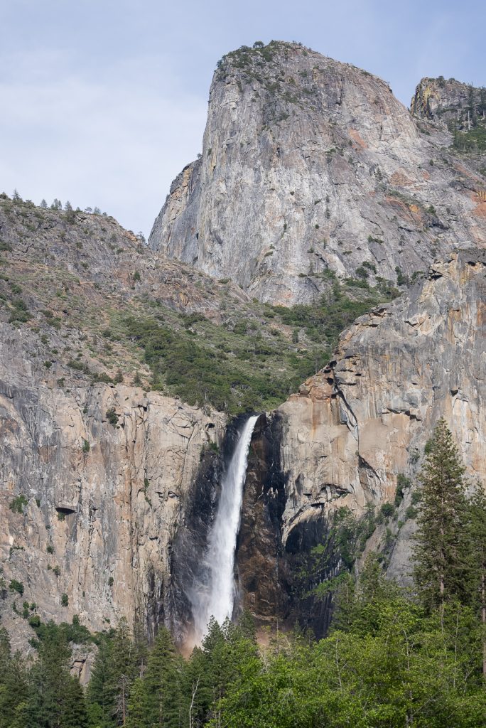
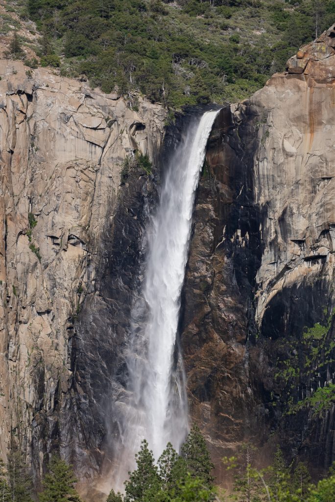
One of the easier and shorter hikes in Yosemite National Park is the Bridalveil Fall Trail. This trail is just under a mile and takes you to a viewpoint of the 620 foot Bridalveil Fall.
The time of year you visit will determine how flowing the waterfall is. In the spring, with lots of snowmelt, the fall will likely be raging and you’ll get some mist. In extreme cases the viewpoint may not be accessible! Other times of the year it’ll be a lighter, swaying flow, which is where its name comes from.
2. Lower Yosemite Falls Trail
Miles (round trip): 1.2
Elevation Gain: 55 feet
Trail Map and Current Conditions
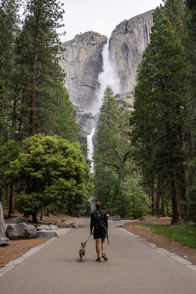
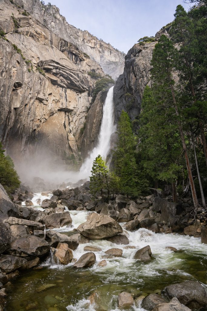
One of the best hikes in Yosemite National Park that doesn’t require much effort is the Lower Yosemite Falls Trail.
Yosemite Falls is one of the largest waterfalls in North America at 2,425 feet. And the paved Lower Yosemite Falls Trail takes you to a viewpoint of the 320 foot tall lower falls. The water during our most recent visit in June was RAGING and we got a nice misting as we approached the base of the falls.
This trail is one of the top things to do in Yosemite National Park for all ages and abilities, so expect lots of people if you go in the afternoon. The early mornings are very quiet though!
PS: This is one of the few dog friendly trails in the park! Our pup Kona loved getting to join us on this one. Just make sure your dog is always leashed when on allowed park trails.
3. Cook’s Meadow Loop
Miles (round trip): 2
Elevation Gain: 78 feet
Trail Map and Current Conditions
For a short, flat trail through some of the valley’s beautiful meadows, check out Cook’s Meadow Loop. On this trail you’ll have views of Yosemite Falls, Half Dome, Glacier Point, and Sentinel Rock. It also passes by the Lower Yosemite Falls Trail (detailed above), so if you haven’t done that trail, this is a great trail to pair.
This is another dog friendly hike in the park. Just be sure to stay on the trail and boardwalk to protect the surrounding meadow and vegetation.
4. Artist Point Trail*
Miles (round trip): 2
Elevation Gain: 751 feet
Trail Map and Current Conditions
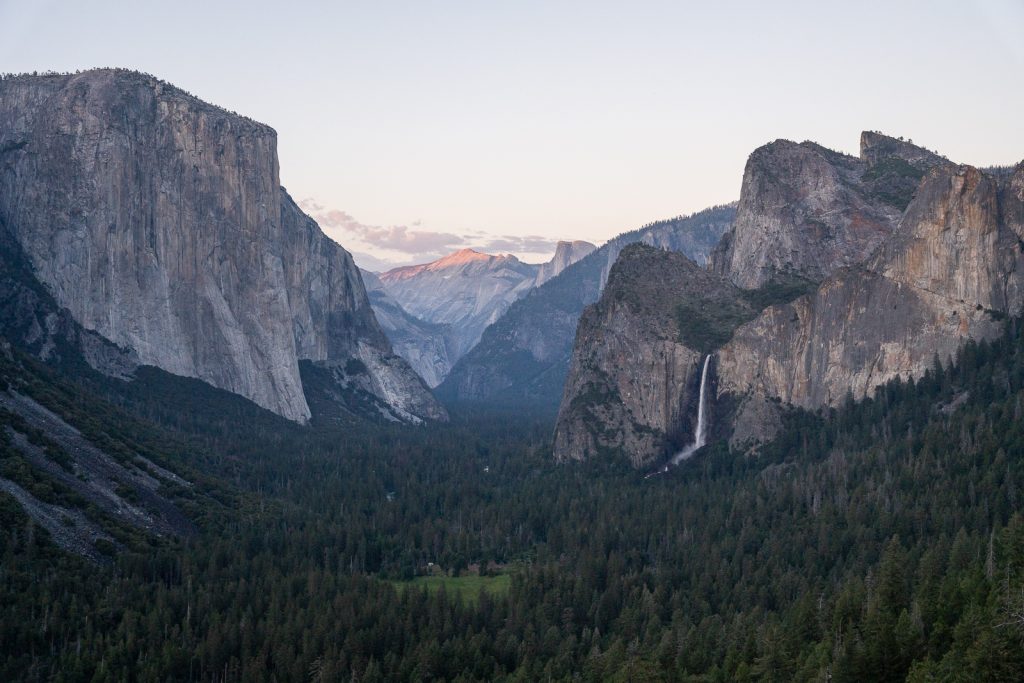
One of the most iconic spots in Yosemite National Park is Tunnel View. But did you know that there is a hidden hike with even higher up views?
Artist Point is located just across the road from the overlook and will give you similar views, but from a few hundred feet higher and with way less crowds! To access this hike you’ll follow the trail that leaves from the parking lot across from Tunnel View.
About half a mile into the hike you’ll reach a junction. You will want to turn left here (the signs will not say Artist Point). It’s then an easy walk down Old Wawona Road, a historic road that was one of the first roads into the valley.
Since there aren’t any signs pointing you to Artist Point along the way, it is WAY less busy. We got to enjoy it all by ourselves for sunset!
5. Mirror Lake Trail
Miles (round trip): 5 (there is also a 2 mile paved option, which is dog friendly)
Elevation Gain: 301 feet
Trail Map and Current Conditions
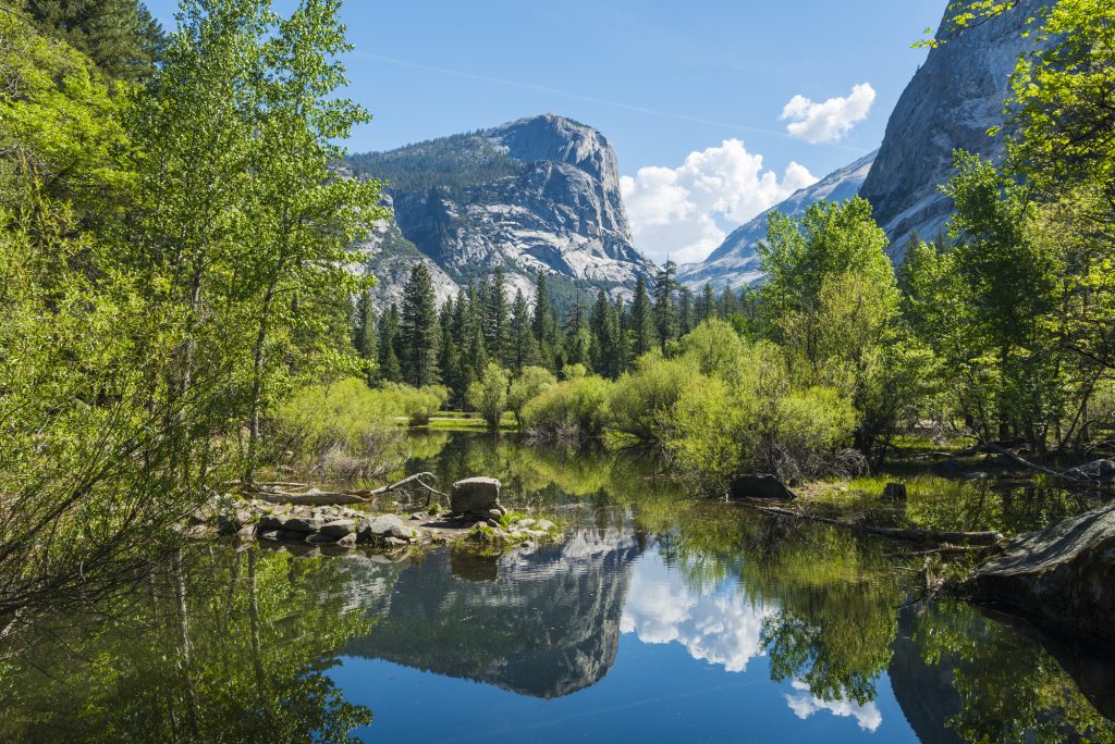
The Mirror Lake Trail sits below Half Dome and takes you to a small lake, which is more like a pond, with towering granite domes and peaks around. During the spring, when the lake is full of water and is calm, you can see reflections of the surrounding mountains in the water.
However, in the summer, the lake usually dries up, sometimes leaving enough water to take a dip on a hot day.
6. Vernal and Nevada Falls via the Mist Trail*


Miles (round trip): 6.4
Elevation Gain: 2,208 feet
Trail Map and Current Conditions
The Mist Trail to Vernal and Nevada Falls is easily one of the best hikes in Yosemite National Park. If it’s your first time visiting, we consider this a must-do!
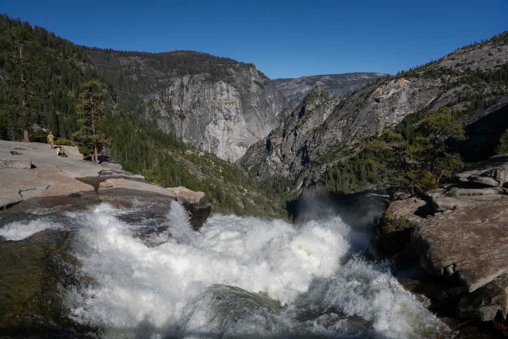
On this steep trail (with many stairs at times), you will hike both alongside and to the top of Vernal and Nevada Falls. And as the name “Mist Trail” implies, you will be blasted with mist, particularly in the section that goes beside Vernal Falls.
Similar to other waterfalls in the park, the water flow will be the most impressive in the late spring or early summer. When we visited in early June, we got SOAKED from Vernal Falls mist!
While many people will bring a rain jacket or poncho, we chose to embrace the mist. This can feel great on a hot day, but is a bit chilly just after sunrise or in colder weather. Even if you are fine getting wet, you may want to bring a pack cover to protect your backpack and belongings.
You could turn around after reaching the top of Vernal Falls or continue on to Nevada Falls, which we recommend. The hike to Nevada Falls will take you near the waterfall, but you won’t get misted. Once at the top of Nevada Falls there is a lot of space to spread out and enjoy a picnic, plus see the water plunge over the edge!
A few important things to know when hiking the Mist Trail in 2024:
Trail closure: You have the option to hike down a different way, avoiding the mist. However, there is currently a closure on the John Muir Trail (JMT) from Nevada Falls to Clark Point due to a rockfall. Normally you can hike down a different way from Nevada Falls, but that is not an option currently.
Instead, you will want to go back the same way you came until just after a bridge that goes over the runoff of Nevada Falls. You will then follow a trail to Clark Point, which will take you down a less busy trail, meeting back up with the Mist Trail near the restrooms. This helps avoid some of the chaos of the mist part of the trail.
Start early: The Mist Trail is VERY busy and popular so get an early start to enjoy any solitude. When hiking down around 10 or 11 AM, the trail is legitimately a conga line at times.
Parking tip: As of 2024, parking is tricky. There is construction to get to the parking lot, which is a large gravel lot and it can fill up early! If the lot is full you’ll need to find other parking and then take the shuttle to the trailhead. We did this hike twice during our most recent visit, starting around 6 AM and had no issues parking.
7. Upper Yosemite Falls Trail*
Miles (round trip): 6.6
Elevation Gain: 3,254 feet
Trail Map and Current Conditions
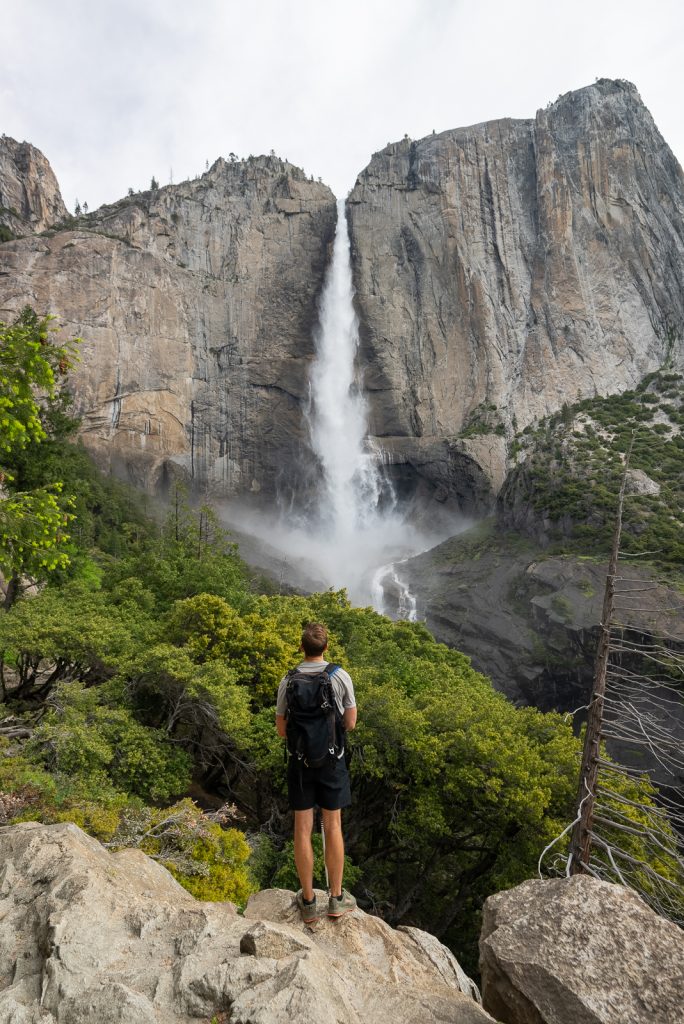
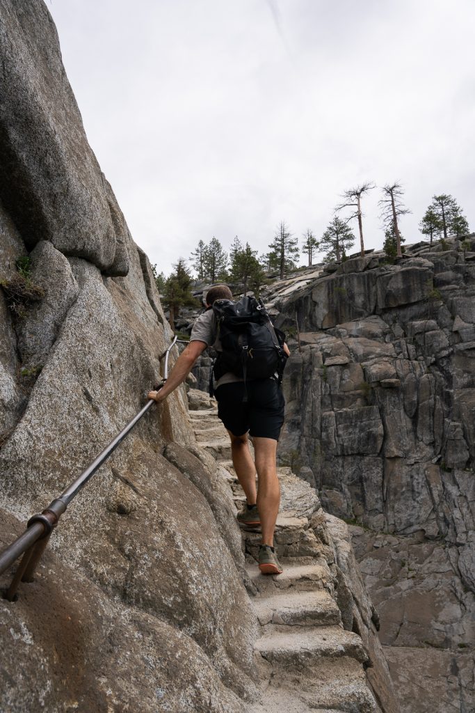
Not only can you view Lower Yosemite Falls from ground level, but you can also climb all the way to the top of Upper Yosemite Falls. But it is one heck of a climb to get up there!
This extremely steep hike gains over 3,200 feet of elevation, so it’s not for everyone. Even as the experienced hikers we are, it kicked our butts! From the second you start hiking from the valley floor the trail is all uphill.
Part of the way up, you will reach a spot called Oh My Gosh Point, which has a great view of the falls. If the rest of the hike seems too difficult for you, this is a great turnaround point!
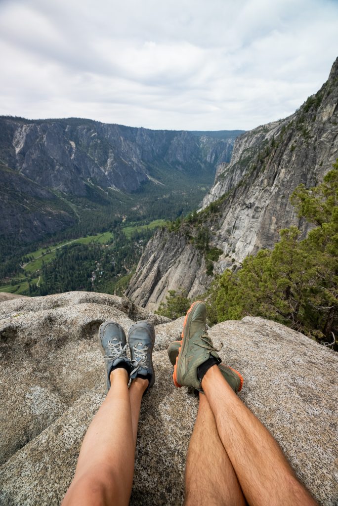
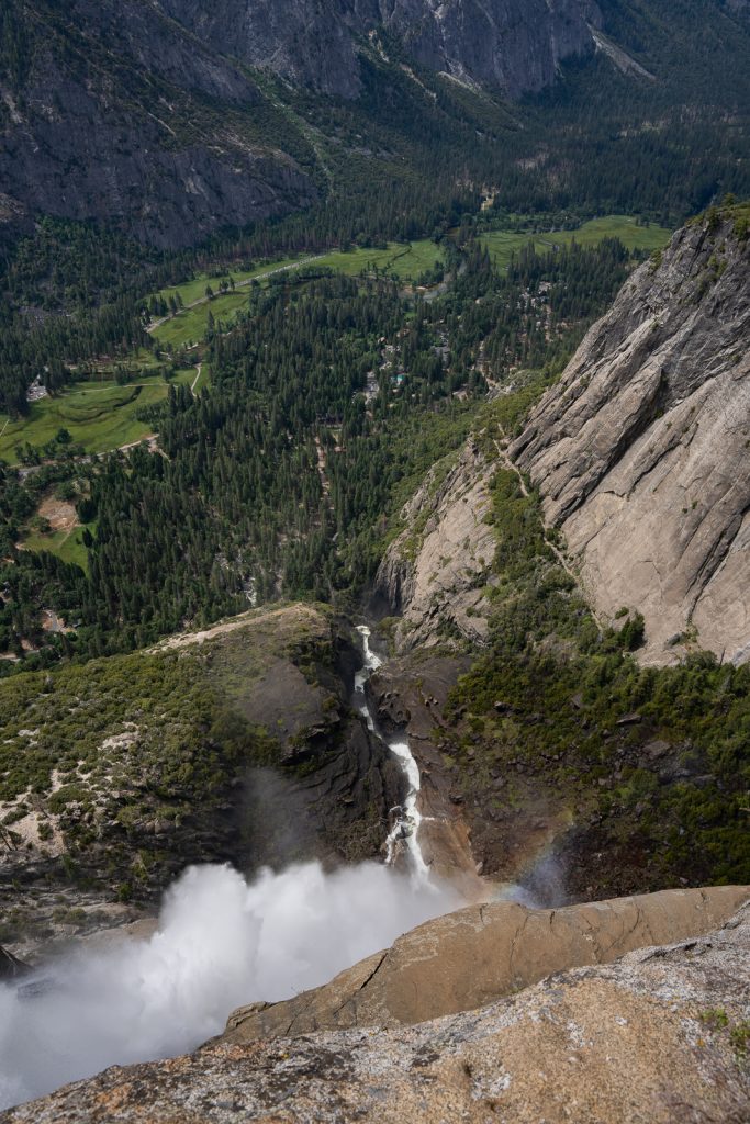
Once you make it to the top, there is an open area to sit and take a break, plus have a picnic, with great views of Yosemite Valley. You can also climb down a narrow section of steps to see the waterfall rushing over the ledge. But it’s important to know that at the top, you won’t see the falls, since you’re on top of them.
If you’re up for even more of an adventure, you can continue on another mile (one way) to Yosemite Point, which we highly recommend! Even though you’ll likely be completely exhausted once you get to Upper Yosemite Falls, the views from Yosemite Point are even better. And it isn’t too much extra effort!
8. Four Mile Trail
Miles (round trip): 9.7
Elevation Gain: 3,418 feet
Trail Map and Current Conditions
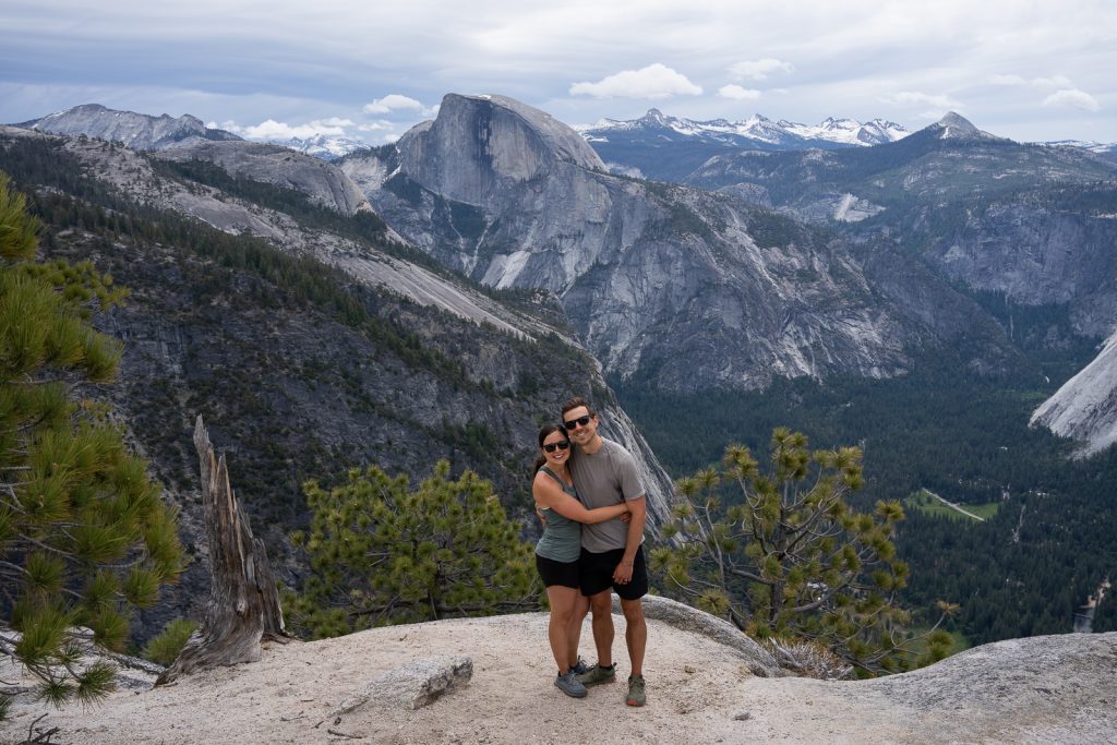
Glacier Point is one of the best views of Yosemite National Park, with the striking Half Dome right in your face. And while most people will drive to this overlook on Glacier Point Road (open in the summer only), if you’re looking for a more challenging way to get to Glacier Point, the Four Mile Trail is it!
Don’t let the name fool you, it is not 4 miles (even one way) or easy. The Four Mile Trail starts in Yosemite Valley and climbs over 3,400 feet up to Glacier Point. It’s a doozy of a hike!
During our first trip to Yosemite National Park we tackled this hike, along with the Panorama Trail and Mist Trail (more on this combo next!). And while it was difficult, we think it is well worth the effort. Not only will you have amazing views of the valley and waterfalls along the way, but you’ll also feel very accomplished at the top. Plus you won’t have to deal with parking at Glacier Point!
Just make sure to start early in the morning to hike in the shade the majority of the way up.
9. Four Mile, Panorama Trail, and Mist Trail*

Miles (round trip): 13.7
Elevation Gain: 4,435 feet
Trail Map and Current Conditions
We personally think that the Four Mile Trail with the Panorama Trail and Mist Trail is the BEST hike in Yosemite National Park. While you can hike each of these trails individually, when combined together it makes for the ultimate day in Yosemite.
Along the way you’ll see Glacier Point, enjoy some solitude on the less busy Panorama Trail (plus have amazing views of Yosemite Valley!), and get to experience the iconic mist on the Mist Trail. Which feels SO good after a tough hike! It really combines everything that makes the Yosemite Valley special, all into one hiking experience.
But beware, it will take all day! We hiked this combination of trails on our first trip to Yosemite National Park and while we were a bit exhausted at the end, it was easily one of our favorite memories in the park.
For even more details on this hike, we have a detailed trail guide, with everything you need to know. Including how to get back to your car afterwards (the trail starts and ends in different areas) and a breakdown of each section of the hike.
NOTE: The Four Mile Trail only opens for the season when it is ice and snow free, typically sometime in May.
10. Half Dome Trail

Miles (round trip): 16.5
Elevation Gain: 5,305 feet
Trail Map and Current Conditions
Half Dome rises 4,737 feet above the valley floor and is known for its iconic shape, with a sheer cliff on one side and 3 smooth, rounded sides. And a bucket list experience in Yosemite National Park is climbing Half Dome. But it’s only for the extra adventurous (and lucky)!
To be able to tackle this experience you’ll need to secure a very competitive permit. But for those who can, it is a once in a lifetime Yosemite adventure. You’ll hike the Mist Trail and the John Muir Trail to the Half Dome Trail. And once on the Half Dome Trail, you’ll reach Sub Dome, which is where the final climb begins. The final section involves using the famous cables and wooden planks to climb up the steep, slick dome.
While we have yet to complete this challenge, it’s on our list for the future!
The best hikes on Glacier Point Road
While experiencing Yosemite Valley from below is extremely special, seeing the valley from high up along the Glacier Point Road area of the park is a must!
However, Glacier Point Road is not accessible year round. It typically opens in late-May and remains open through October or November, depending on conditions. Keep in mind, despite being right above the valley, it does take about an hour to get to from deep within the valley.
But if it’s open and you’re willing to make the trek, it’s home to some of the best hikes in Yosemite National Park!
11. Sentinel Dome*
Miles (round trip): 2.2
Elevation Gain: 459 feet
Trail Map and Current Conditions
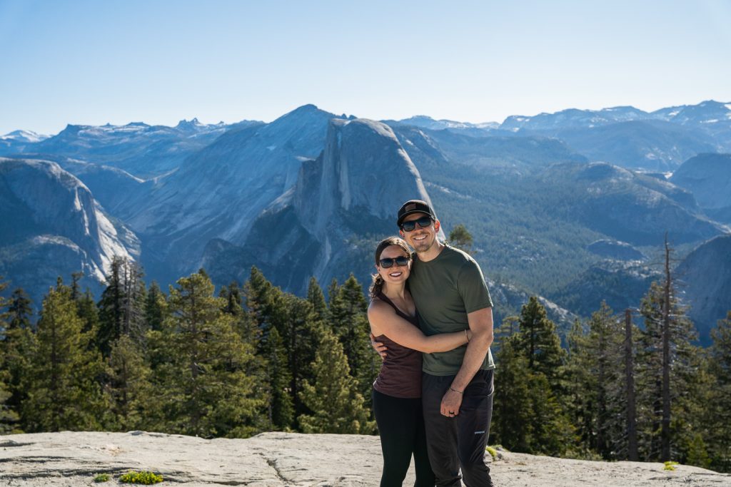
Although Yosemite National Park is known for Half Dome, there are many other domes in the park, including Sentinel Dome! Which offers similar views (some might argue even better) to Glacier Point, but with less crowds.
Because it requires a short hike, it is a bit less crowded. And at the top of the dome you’ll have a head on view of Half Dome, similar to Glacier Point, although a little further away. But what makes this spot arguably even better is that not only can you see Half Dome, but you also have 360º views of the entire area, including multiple angles of Yosemite Valley.
For an even better hike, combine it with Taft Point (more on that next)! You can also hike to Glacier Point from here, which is what we did.
12. Taft Point*

Miles (round trip): 2.3
Elevation Gain: 354 feet
Trail Map and Current Conditions
Taft Point is another iconic spot along Glacier Point Road and one of the best hikes in Yosemite Valley, especially if you’re looking for something shorter.
This trail takes you through the forest right to the edge of a cliff, with Yosemite Valley thousands of feet below. There is both a viewing area with metal railing, as well as multiple areas without any protection that you can admire the view from. Just be very careful!
Because Taft Point has a clear view west, it’s a popular spot for sunset. We chose to hike it for sunrise which was also magical and we had it all to ourselves (for over an hour!), which is a rarity in Yosemite.
13. Panorama Trail*
Miles (round trip): 9.1
Elevation Gain: 2,276 feet
Trail Map and Current Conditions
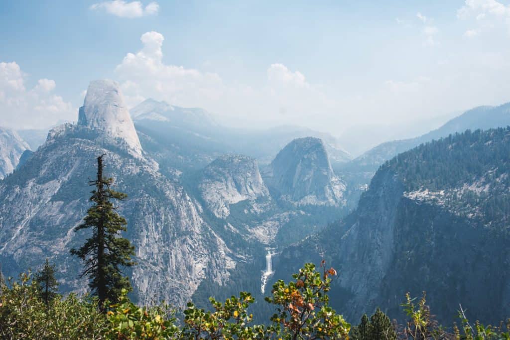
If you want a longer adventure along Glacier Point Road, consider the Panorama Trail. This hike takes you along the edge of the top of Yosemite Valley, past Illilouette Falls and Panorama Point.
While it can be combined with the Four Mile Trail and Mist Trail for the ultimate Yosemite day hike, it can also be completed as an out and back hike from Glacier Point on its own.
And even if you don’t have time to do the entire larger loop, we think it’s worth doing on its own. While Glacier Point is crowded, the second you get on the Panorama Trail you begin to escape the crowds. It gives you the chance to see a side of Yosemite that many visitors don’t experience!
Beware: This hike goes downhill first and then uphill on the way back. So starting early will help you beat some heat for the uphill portion.
The best hikes on Tioga Road
First completed in 1915, the breathtaking Tioga Road spans from Crane Flat all the way to Lee Vining in the Eastern Sierra. And with a maximum elevation of 9,945 feet, it is the highest highway pass in California. Because of this, it is only open in the summer, with its opening date differing year to year.
But if you visit Yosemite National Park in the summer, we highly recommend spending 1-2 days out here. In our opinion, Tioga Road is one of the more underrated parts of the park and offers tons of amazing hikes, plus scenery from the car.
14. Soda Springs and Parsons Lodge Trail

Miles (round trip): 1.4
Elevation Gain: 52 feet
Trail Map and Current Conditions
Tuolumne Meadows is one of our favorite areas along Tioga Road and this short hike is a great way to experience it! You’ll wander down a path through the meadow to a unique carbonated cold water spring and lodge. And along the way you’ll learn about John Muir and Edward Parsons, an early guide for the Sierra Club, who the lodge was built in memory of.
A+K Tip: The mosquitoes were fierce here in early June! Wear lots of bug spray!
15. May Lake
Miles (round trip): 2.3
Elevation Gain: 485 feet
Trail Map and Current Conditions
May Lake is one of the more accessible alpine lakes in the park. With little mileage and elevation gain, it makes for a great bang for your buck hike! You’ll travel through a forest and over granite slabs to reach the clear, beautiful lake with a gorgeous mountain backdrop!
16. Gaylor Lakes
Miles (round trip): 2.4
Elevation Gain: 800 feet
Trail Map and Current Conditions
Looking for an underrated hike in Yosemite National Park? Check out Gaylor Lakes!
From the Tioga Pass Entrance Station (near Lee Vining), you’ll walk to Middle Gaylor Lake with spectacular views of the high country. Mount Dana, the second highest peak in the park, will also be visible from the lake.
After admiring Middle Gaylor Lake you can continue on to Upper Gaylor Lake for an extra 0.4 miles (one way).
17. North Dome
Miles (round trip): 9.2
Elevation Gain: 2,017
Trail Map and Current Conditions
Another popular dome hike in Yosemite National Park is North Dome. This dome overlooks Half Dome and Yosemite Valley and compared to some other hikes in the park, is a bit less popular. Making it a great choice if you want epic views without hordes of hikers.
And for an extra bonus, add on the 0.4 mile (one way) detour to Indian Rock, a granite arch within the park!
18. Cathedral Lakes Trail*
Miles (round trip): 9.5
Elevation Gain: 1,663 feet
Trail Map and Current Conditions
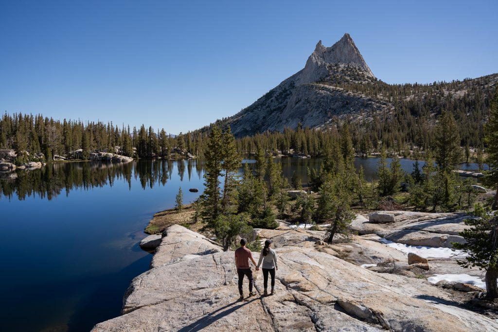
Cathedral Lakes is one of our new favorite hikes in Yosemite National Park!
While most of the hike traverses through the forest, the views at the end more than make up for it! The trail will take you to both Upper and Lower Cathedral Lakes, with the striking Cathedral Peak (and surrounding mountains) behind them.
Both lakes have crystal clear water, with tons of fish swimming (Adam was bummed he didn’t bring his fly rod!). This is also a great spot to backcountry camp. We saw a handful of campers near the lakes and we will 100% be doing that next time!
19. Clouds Rest
Miles (round trip): 13.5
Elevation Gain: 3,152 feet
Trail Map and Current Conditions
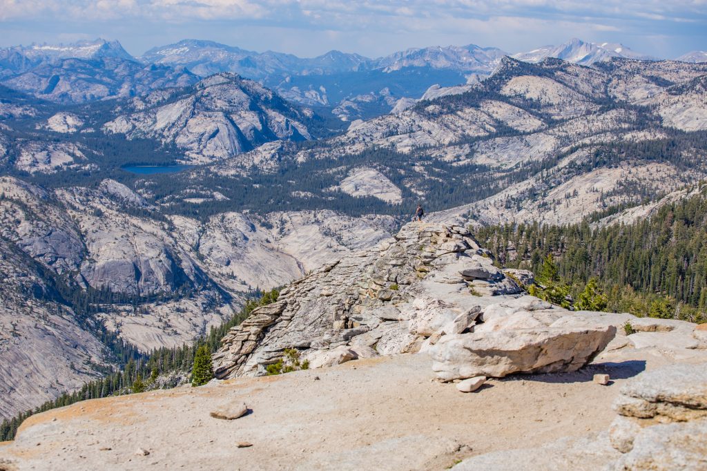
Clouds Rest is said by many to be the best hike in Yosemite National Park. While we unfortunately haven’t had the chance to hike it, due to it being too long to leave our pup Kona, it’s high up on our list for next time!
This steep hike leaves from Tioga Road and takes you about 6.7 miles (one way) to Clouds Rest, an overlook with views of Half Dome, Yosemite Valley, and the surrounding mountains in the park. Be careful getting to the overlook though, as it can be narrow, with drop offs on either side.
Warning: The mosquitoes can be awful here. Bring bug spray and possibly a bug net to avoid being eaten alive.
The best hikes in Wawona and Mariposa Grove
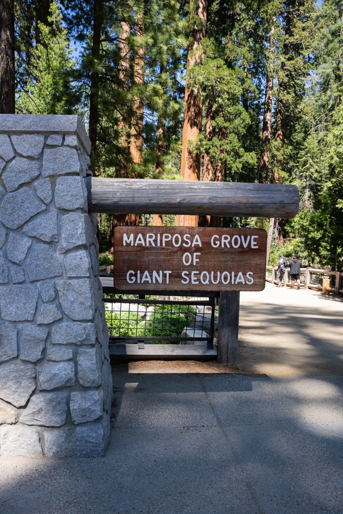
The Mariposa Grove in Yosemite National Park has over 500 mature Giant Sequoias, the largest trees in the world by volume! And if you have yet to witness these humongous trees in real life, we highly recommend visiting Mariposa Grove while in the park. You don’t even have to go to Sequoia National Park to see them, although we do recommend it!
However, hiking the Mariposa Grove isn’t as straightforward as other trails in the park. To visit, you’ll have to take the free shuttle that leaves from the Mariposa Grove Welcome Center. The shuttle usually runs between April 15 to November 30, with varying hours throughout the months. Another option is to hike to the grove or ride your bike on the road (both about 2 miles one way), but be warned it will be a steep climb back.
20. Mariposa Grove
Once in the grove, there are a few hiking loops to check out–
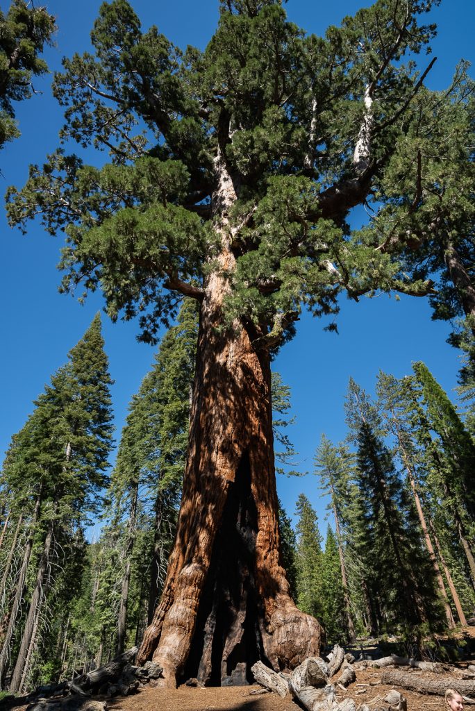
- Grizzly Giant Loop (2 miles): This is the hike we did! We not only got to see the park’s famous Grizzly Giant (the 26th largest tree in the world!), but got to walk through the California Tree Tunnel.
- Guardians Loop Trail (6.5 miles): This is an add on to the Mariposa Grove Trail. The linked map does not include the distance you need to hike to get to this loop. To get here, follow the Mariposa Grove Trail.
- Mariposa Grove Trail (6.7 miles): This trail takes you by the Grizzly Giant and also adds on the scenic Wawona Point!
21. Chilnualna Falls Trail
Miles (round trip): 7.7
Elevation Gain: 2,201 feet
Trail Map and Current Conditions
Looking to chase more waterfalls? Chilnualna Falls is a less visited waterfall hike in Yosemite National Park to check out. Even though it’s less popular it still offers a lot!
You’ll hike to the top of the multi-tiered waterfall and see some amazing views of the area, plus a couple vantage points of the falls along the way.
The best hikes in Hetch Hetchy
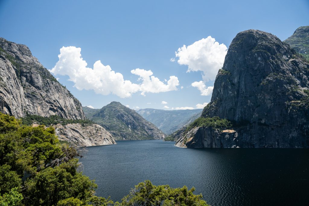
Hetch Hetchy is a less visited part of Yosemite National Park (that is open year-round!) and we think is a hidden gem! It has granite domes, cliffs, and waterfalls, similar to Yosemite Valley, but instead of meadows, the Hetch Hetchy valley is filled with water.
Filling this valley with water was a bit controversial back in the day. But today this reservoir provides the drinking water for the city of San Francisco hundreds of miles to the west. Because of this, swimming and boating are not allowed.
22. Wapama Falls Trail*
Miles (round trip): 4.7
Elevation Gain: 1,108 feet
Trail Map and Current Conditions
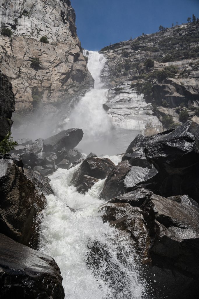
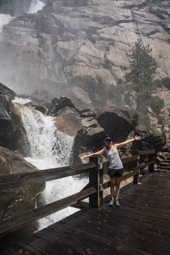
While Yosemite Falls and the Mist Trail are popular for a reason, we think Wapama Falls is the most underrated waterfall hike in Yosemite.
This trail takes you across a dam, through a tunnel, and along bridges right by a raging waterfall, where depending on water levels, you can get soaked! Along the entire trail you can admire amazing views of the Hetch Hetchy Reservoir.
Make sure to start this hike early, as it is very exposed and this part of the park gets HOT!
Things to know before hiking in Yosemite National Park

Leave No Trace
Before hitting the trails for the best hikes in Yosemite National Park, please review the Leave No Trace principles to ensure you leave every place better than you found it, so that others can enjoy these beautiful places for many years to come!
These seven principles include planning ahead and preparing, hiking and camping on durable surfaces, disposing of waste properly (pack out what you pack in!), understanding campfire rules and always fully extinguishing your fires, respecting wildlife, and being considerate of other visitors.
Entrance Fee
It costs $35 per vehicle to enter Yosemite National Park, which is good for 3 days. We highly recommend getting the America the Beautiful pass (especially if you plan to be there more than 3 days), which is $80 per year and gets you into all National Park Service managed sites and federal lands for free.
Reservations
Since the park is so popular, you’ll need to get a reservation to enter the park between 5 AM and 4 PM on certain days between April 13-October 27, 2024. This reservation costs $2 on top of your entry pass.
From April 13 to June 30, you’ll only need a permit to enter on weekends and holidays. From July 1 to August 16, a reservation is required every day. And from August 18 to October 27, it’s back to just weekends and holidays.
However, there are some exceptions to these reservations. If you have an in-park camping, lodging, or vacation rental reservation, Half Dome permit, or wilderness permit you do not need this reservation. Also, if you’re visiting with a tour or by regional transit, you do not need a reservation.
Reservations do sell out, so buy them as soon as possible. If you do not get a reservation, you can enter the park before 5 AM or after 4 PM without one.
Many areas and trails close in the winter
While Yosemite Valley, Mariposa Grove (by foot only), and Hetch Hetchy are open year round, some other parts of the park like Glacier Point Road and Tioga Road will close in the winter. Some roads both in and outside the park may require snow chains during the winter as well.
You can see all current conditions for the park here.

Dogs are NOT allowed everywhere
If you’re bringing your pet with you to the park, there isn’t a ton for them to do, but there are some options.
Pets are allowed in developed areas, on fully paved roads, paved overlooks, sidewalks, and bike paths, unless there is a “no dogs” sign, and in all campgrounds except walk-in campgrounds. They can also hike on a couple trails, but must be on a 6 foot leash.
- Lower Yosemite Fall Trail
- Cook’s Meadow Loop
- Paved pathway to Mirror Lake
- Tuolumne Grove Trail (only on paved parts)
- Wawona Meadow Loop Trail
Curious what we do with Kona when she cannot join us on a hike? Read this guide about how we travel full time with a dog.
Download offline maps
In many areas of the park there is little to no cell service. We recommend downloading Google Maps for offline use. You’ll want to have the area of the park downloaded so that you can get between places, even if you don’t have cell service. While the park has good signage, there are some kind of confusing one way roads, so it’s nice to have Google Maps to direct you.
We also suggest downloading offline AllTrails maps so you can navigate on hikes even without cell service.
Want to get 30% off an AllTrails Plus membership? Use our code aplusk30 (you must redeem this code on the website, not the app)!
We use AllTrails Plus on every single hike and it is the most helpful hiking tool out there! Some of the features we love are offline maps (so we can navigate even without cell service), wrong-turn alerts, and its 3D maps feature, so we can get a feel for trails before we hike.
Traffic and parking
Our biggest tip to avoid overcrowding, traffic, and congested trails is to get into the park as early as possible, preferably, just after sunrise, but ideally, no later than 9 AM.
After that there will likely be long delays at the entrance, traffic congestion on the roads, difficult parking, and busy trails and overlooks.
As we mentioned above, we recommend planning to park in one spot for the entire day. Parking lots fill early so moving to different parking lots will be difficult.
Remember, millions of people visit Yosemite National Park every year. Patience will go a long way here!
Be bear aware
The park is home to hundreds of American black bears. Not only do you need to be bear aware while hiking (and know what to do if you see one), but you also need to practice proper food storage. When bears get access to human food they often get aggressive. This can lead to the bear being killed in order to protect humans.
Not only that, the food storage rules in the park are backed by federal law which can result in impoundment of your car and up to a $5,000 fine. Anything with a scent (even toiletry items) must be properly stored.
During daylight hours you can store food in your car out of sight with the windows rolled up. At night, you must store your food in a food locker. Food storage lockers are available at most trailheads and all campgrounds. If you’re in a hard-sided RV, you are allowed to keep your food in there, but windows and vents must be closed when you’re not there. RVs with cloth pop outs are considered soft sided, so you’ll need to use a food locker.
And as backwards as it may sound, bear spray is not allowed in any California National Park, including Yosemite. During the 9+ days we have spent in Yosemite over the years we have only seen one bear in Mariposa Grove (from the shuttle bus), plus possibly another crossing the highway. So seeing one is rare, but it is good to be aware!
What to bring to Yosemite National Park

Since you’ll be spending tons of time outdoors while in Yosemite, you will want to bring proper outdoor and hiking gear. To see everything we take hiking, check out our hiking gear as well as our guide about how to make a 10 essentials kit.
But here are a few items we want to especially recommend bringing when experiencing the best hikes in Yosemite National Park!
Proper hiking shoes
The trails in Yosemite range in terrain. Some are smooth and easy to walk on, while others may be rocky or wet. Having good hiking shoes is key for safety!
Kathryn rocks either Lowa Women’s Renegade GTX boots or ALTRA Lone Peak 8 trail runners on the trails, depending on how she feels. Adam exclusively wears the ALTRA Lone Peak 8 trail runners, as they are less bulky than boots, but have good traction. They are also great for hiking in water, as they dry fast!
Layers
Different areas of the park lie at drastically different elevations, so the temperatures can range throughout the day. The valley sits around 4,000 feet, but Tioga Road can get to almost 10,000 feet. Every 1,000 feet you go up, the temp will normally drop about 5 degrees. Pack layers so you’re ready for different temperatures and unpredictable weather.
Even in the mornings on 90+ degree days in Yosemite Valley we were a bit chilly.
Headlamp
If you plan to do any sunrise or sunset hikes, make sure you pack a headlamp!
Sun Protection
Because of how exposed the park is to the sun, you’ll definitely want to bring a hat, sunglasses, and sunscreen to protect yourself from its rays.
Bug spray
Many of these hikes are home to lots of mosquitoes, so make sure to pack some bug spray or a bug net. For bug spray, we use either OFF! with DEET or Picaridin (which doesn’t damage gear like DEET does). We also sometimes spray our gear and clothes with Permethrin beforehand (do NOT apply this to your skin).
Water
Make sure to pack lots of water! There are water fountains at the Visitor Center if you need to fill up, but our 3L Camelbak bladders helped ensure we had enough water throughout the day. Even in the winter when it’s cooler, it’s easy to become dehydrated, as you’re at a slightly higher elevation, the air is very dry, and the sun still beats on you.
Packed lunch & snacks
While there are some restaurants in Yosemite Valley, they will be average and pretty pricey. We suggest packing your own lunch + snacks!
Some of our favorite snacks are Bobo Bars, Clif Bars, Kate’s Real Food Bars, Nature’s Bakery fig bars, pepperoni and cheese, trail mix, and Chili Roasted Wonderful Pistachios.
If you need more food (or a treat), head to the Village Store! It’s basically a legit grocery store, with a shockingly wide range of products for being inside the National Park. We grabbed pints of ice cream here and ice cold water multiple times after big hikes.
Check out all of our Yosemite National Park resources
- The 33+ BEST things to do in Yosemite National Park
- Where to stay in Yosemite National Park
- How to spend ONE day in Yosemite National Park
- The PERFECT two day Yosemite National Park Itinerary
- The Ultimate Yosemite National Park itinerary: Options for 1-6 days!
- The Best Day Hike in Yosemite: Four Mile, Panorama, & Mist Trail
- See more California National Park guides
Looking for more things to do in California?
- Plan the Ultimate California National Parks Road Trip! (3 itineraries)
- The Perfect One Day in Sequoia National Park Itinerary
- General Sherman Tree & Congress Trail: The Ultimate Giant Sequoia Hike!
- The 17 Best Things to Do in Sequoia National Park
- 15 Fun Things to Do in Kings Canyon National Park
- The ULTIMATE Guide to visiting Redwood National Park (+ state parks!) in California
- The BEST Hike in Pinnacles National Park (Bear Gulch Cave, High Peaks Trail, & Condor Gulch Trail)
Save this guide with the best hikes in Yosemite National Park