
Last updated on June 11th, 2026
Looking for the best National Parks to visit in March? Experience budding landscapes, the freshness of spring, and temperate climates in the US’s most beautiful national parks!
March is a transitional month for many National Parks across the United States. As winter starts to recede, the beauty of spring begins to radiate with budding trees, fresh blooms, and vibrant greenery.
With the beauty of spring unfolding, it’s the perfect temperature for park exploration—neither too cold nor too hot!


The best part? Most parks aren’t super crowded in March. While there might be some folks heading out for spring break, it’s nothing compared to the summer rush.
We’ve been to 48 national parks, so we know a thing or two about where to go. Stick around, and we’ll show you the 12 best National Parks to visit in March. Cool? Cool.
Quick Disclaimer About Our Monthly National Parks Series
Welcome to our ongoing monthly feature, where we curate a selection of America’s finest National Parks to visit each month! Our mission is to showcase each and every park we’ve personally stepped foot in, giving each its moment to shine. And you might notice that some parks make repeat appearances as the year unfolds—they’re just that good!
Our journey to explore every single U.S. National Park is still a work in progress, so some parks may be missing from this list of the best National Parks to visit in March. But you can count on our recommendations being handpicked and seasoned with personal experience!
- Tips for Visiting National Parks in March
- 12 Best National Parks to Visit in March
- 1. Death Valley National Park
- 2. Gateway Arch National Park
- 3. Grand Canyon National Park
- 4. Petrified Forest National Park
- 5. Pinnacles National Park
- 6. Zion National Park
- 7. Arches National Park
- 8. Bryce Canyon National Park
- 9. Canyonlands National Park
- 10. Capitol Reef National Park
- 11. Channel Islands National Park
- 12. Congaree National Park
- Ready to explore the National Parks?
Tips for Visiting National Parks in March

Plan Ahead: Even during less busy times, popular parks can fill up. Need reservations? Book ahead!
Download Maps in Advance: Expecting 5G? Think again. Many of our national parks have spotty, if any, cell coverage. But, with a little foresight, and downloading maps like AllTrails (we’re huge fans, by the way), you’ll have the park in your pocket, all offline!
Want to get 30% off an AllTrails Plus membership? Use our code aplusk30 (you must redeem this code on the website, not the app)!
We use AllTrails Plus on every single hike and it is the most helpful hiking tool out there! Some of the features we love are offline maps (so we can navigate even without cell service), wrong-turn alerts, and its 3D maps feature, so we can get a feel for trails before we hike.
America the Beautiful Pass: If you’re a National Park enthusiast with a bucket list of parks to conquer throughout the year, consider snagging the America the Beautiful Pass. It unlocks access to over 2,000 federal recreation sites, including National Parks.
Pet Etiquette: Got a fluffy co-pilot? Awesome. Just remember, some trails and areas might be off-limits to pets to ensure the safety of wildlife and protect the park’s natural beauty. So, plan accordingly and make arrangements to keep your furry friends content.
Leave No Trace: It’s our responsibility to maintain these landscapes for future generations. Make a commitment to pack out your trash, stick to designated trails, and minimize your impact on the environment.
12 Best National Parks to Visit in March

1. Death Valley National Park
Spanning the arid expanses of California and Nevada, Death Valley National Park is a place of extremes. Holding the title for the hottest, driest, and lowest national park in the U.S., its stark landscapes range from vast sand dunes and rugged canyons to the salt flats of Badwater Basin (the nation’s lowest point at 282 feet below sea level). Yet, amidst these inhospitable terrains, Death Valley teems with life. Oh, and have you ever heard of a graben? In Death Valley, you’re standing in one, thanks to the park’s tumultuous geological past.

Where is Death Valley National Park?
Occupying over 3.4 million acres, Death Valley National Park sits on the California-Nevada border. The nearest town to its Furnace Creek Visitor Center is Beatty, Nevada, which is around 33 miles away.
Why Visit in March?
Not only is Death Valley National Park one of the best National Parks to visit in March, it’s one of the best parks to visit in the winter. And March itself is a transitional period for Death Valley. Temperatures are more moderate, and if the winter brought rain, wildflower blooms could be starting, especially in the park’s lower elevations.
Weather in March
March in Death Valley isn’t as scorching as its reputation might suggest. Days can be pleasantly warm, hitting the 70s to 80s°F (21-27°C). Evenings? A touch cooler in the 50s to 60s°F (10-15°C). Rain rarely shows up, but when it does, it’s memorable, especially if it brings wildflowers.


Best Things to Do Death Valley National Park
Badwater Basin Salt Flats: At 282 feet below sea level, it’s the lowest point in North America. The vast salt flats provide a surreal, almost alien landscape, especially during sunrise or sunset.
Dante’s View: For those seeking a panoramic vista, this viewpoint provides a bird’s eye view of the Badwater Basin below. In March, the temperatures here are much cooler than in the valley, making it a pleasant spot to take in the sights.
Artist’s Palette: Resulting from the oxidation of different metals, the rocks in this area display a brilliant spectrum of hues, from deep purples to vibrant greens. Artist’s Palette is best viewed in the late afternoon light and is easily accessible by car via the Artist’s Drive scenic loop.
Know Before You Go
It’s vast. Like, really vast: Death Valley stretches across a vast 800 miles of road. Given the limited three gas stops within the park (and just two with diesel), it’s imperative to keep your tank full. The cost of fuel within the park might be on the steeper end.
Bring Along Your Must-Haves: Water and food stops are few and far between. While there are some facilities, options are limited. Bring enough food, water, and other essentials, especially if you plan to camp or spend extended time in the park.
Learn more about Death Valley National Park
Blog posts
The ULTIMATE guide to visiting Death Valley National Park (Things to do + itinerary options)
How to hike Golden Canyon at Death Valley National Park (+ Red Cathedral & Gower Gulch)
Hiking the Mosaic Canyon Trail in Death Valley National Park
How to hike to Darwin Falls in Death Valley National Park (A year round waterfall in the desert!)
YouTube videos
The ULTIMATE 3 days in DEATH VALLEY National Park!
An EPIC drive to Death Valley (Ash Meadows, Wild Burros, Rhyolite GHOST town, & Titus Canyon!)
2. Gateway Arch National Park

Rising along the banks of the Mississippi River, Gateway Arch in St. Louis stands as an iconic symbol of American exploration and westward expansion. As the centerpiece of Gateway Arch National Park, this gleaming stainless steel structure, reaching a monumental height of 630 feet, not only offers a stunning cityscape and views of the ever-flowing Mississippi River from its top, but the park itself offers a window into the past when St. Louis was the bustling gateway for pioneers venturing into the unknown West.
Why Visit in March?
March is a great time to visit St. Louis and the Gateway Arch, walk along the riverfront, and explore indoor exhibits without the summer rush. As the park transitions from winter to spring, you can see the early signs of greenery and blooms around the arch.
Weather in March
In Gateway Arch National Park, specifically St. Louis, the weather in March can be quite variable as it’s a transition month from winter to spring. Average daytime temperatures can range from the upper 40s to mid-60s °F (8-18°C). Nighttime temperatures can drop to the 30s °F (0-4°C), though occasionally it might get colder.


Best things to do Gateway Arch National Park
The Tram Ride to the Top: The Tram Ride is a must-do experience, boasting uniquely crafted, egg-shaped cars that navigate the arch’s curved interior. Taking just 4 minutes to ascend and a swift 3 minutes to descend, riders are rewarded with sweeping panoramic views from 630 feet above.
Old Courthouse: Dive into history at the Old Courthouse, where the famous Dred Scott case was tried. Rotating exhibits shed light on St. Louis’s role in westward expansion and the pioneers who shaped it.
Riverfront Cruise: Take a one-hour leisurely paddlewheel riverboat cruise on the Mississippi, offering some of the best views of the Gateway Arch and insights into the river’s past.
Know Before You Go
Tram Ride? Book Ahead!: The journey to the peak of the Gateway Arch is a hit. Reserve your tickets early to guarantee a seat.
No Parking: Gateway Arch National Park doesn’t have its own visitor parking. For nearby options, browse Explore St. Louis’ downtown parking directory, showcasing preferred spots by the Arch and the Old Courthouse.
Learn more about Gateway Arch National Park
Blog post
Visiting Gateway Arch National Park: The Best Things to Do!
YouTube video
One day in St. Louis: Gateway Arch National Park (tram ride to the top!) + food tour!
3. Grand Canyon National Park

The Grand Canyon is where Earth opens up to tell a two-billion-year-old story. Located in Arizona, Grand Canyon National Park offers more than just jaw-dropping views; it’s a testament to nature’s power and persistence. The Colorado River did quite the number here, didn’t it? Spanning 277 miles in length and 18 miles wide, this vast gorge showcases towering buttes, deep valleys, and steep cliffs. Whether you’re looking to hike, raft, or just soak in the scenery, this mile-deep wonder won’t disappoint. And trust us, sunsets here? Absolutely unreal.
Where is Grand Canyon National Park?
Grand Canyon National Park, covering over 1.2 million acres, is situated in northern Arizona. The town of Tusayan is about 7 miles from the park’s main South Rim entrance.
Why Visit in March?
In March, the Grand Canyon’s South Rim is more accessible, and with snow melting, new viewpoints and perspectives emerge. Visitor numbers are manageable, and there’s a freshness in the air that summer doesn’t offer.
Weather in March
March at the Grand Canyon is a mixed bag. The South Rim has days in the refreshing 40s and 50s°F (4-15°C), but remember, it’s the Grand Canyon; evenings can be cold, often flirting with the 20s°F (-6 to -2°C). While it can be warm at the base of the canyon, the rim can be cooler, with a sprinkle of snow not out of the question. This may sound a bit chilly, but we’d personally much rather be a bit cold at the Grand Canyon than melting in the summer heat.


Best Things to do Grand Canyon National Park
South Kaibab Trail to Ooh Aah Point: This trail provides one of the quickest ways to reach a panoramic viewpoint below the rim. The trek to Ooh Aah Point is about a 1.8-mile round trip and gives you a taste of the canyon’s depth and breadth.
Sunrise at Mather Point: A popular spot, and for good reason. The expansive views of the canyon, illuminated by the morning sun, are simply incredible.
Desert View Drive: This scenic route offers various viewpoints of the canyon, with the Desert View Watchtower being a highlight. Climb to the top of the tower for a 360-degree view, and explore the interpretive displays about the park’s indigenous peoples.
Know Before You Go
Respect the Rim: Falling is a real hazard. Those guardrails are there for a reason. For the best (and safest) views, stay behind them. No photo is worth the risk.
Start Early to Beat the Rush: With its spot as the second most-visited national park, the Grand Canyon draws close to 6 million folks each year. The hours between 10 am and 4 pm are particularly bustling, especially around Grand Canyon Village.
Take the Shuttle: Hopping on the South Rim Shuttle might make your visit smoother. Not only does it ease traffic flow, but it also conveniently stops at key attractions like Hermits Rest and Yaki Point.
North Rim is Closed: Due to winter conditions, the park’s North Rim closes until May. But don’t fret! There is plenty to see and do on the South Rim.
Learn more about Grand Canyon National Park
Blog post
1 Day at the Grand Canyon South Rim Itinerary
YouTube video
24 Hours at the Grand Canyon | Arizona Day 3
4. Petrified Forest National Park


Ever seen wood turned to stone? No wizardry here, just the magic of time at Petrified Forest National Park in Arizona. Known for its vast deposits of petrified wood, the park offers a window into a world that existed over 200 million years ago, showcased through its brilliantly colored fossilized logs. But beyond the stone remnants of ancient forests, the park has tons of geological formations, badlands, and remnants of human history, from ancient petroglyphs to historic structures.
Where is Petrified Forest National Park?
In northeastern Arizona, you’ll find the Petrified Forest National Park, which spans about 221,390 acres. The town of Holbrook is approximately 25 miles west of the park.
Why Visit in March?
Similar to Arizona’s more well known National Park, Petrified Forest can get a bit toasty in the summer. March is a great time to visit to have cooler temperatures! While the mornings and evenings may be chilly, you’ll be able to have comfortable day time weather. And if you’re lucky, you may get to see the park with a dusting of snow!
Weather in March
Daytime temperatures in March typically range from the mid-50s to mid-60s °F (around 12-18°C). Nighttime temperatures, however, can be chillier, often dropping to the low 30s or even upper 20s °F (around -1 to 0°C).


Best things to do at Petrified Forest National Park
Crystal Forest Path: Walk among ancient logs turned to stone in a process taking millions of years. The easy loop, spanning less than a mile, is dotted with large, colorful petrified wood specimens, making it a highlight of the park.
Painted Desert Inn and Overlook: Once a historic inn, it’s now a museum showcasing Puebloan architectural influences. The nearby overlook offers a panoramic view of the Painted Desert’s vibrant hues.
Blue Mesa Trail: A 1-mile loop trail that descends into the badlands, offering up-close views of blue-hued hills and a dense concentration of petrified wood.
Know Before You Go
Historic Route 66: The park also encompasses a portion of the iconic Route 66. Don’t forget to snap a classic road trip photo as you travel through this legendary stretch of highway.
Preserve the Past: Remember that collecting fossils or removing any petrified wood is a no-go. Leave them as you found them.
Dogs ARE allowed: Yes, you heard that right! Unlike most parks, dogs are allowed on paved roads, plus all trails (including wilderness areas) in Petrified Forest National Park. Our pup Kona enjoyed spending an afternoon here with us!
5. Pinnacles National Park

Tucked away in California’s Salinas Valley, Pinnacles National Park has rock formations that look like they’re from another planet. Born from ancient volcanic eruptions and sculpted by millions of years of erosion, the park showcases an array of towering spires, labyrinthine talus caves, and craggy canyons. And if you’re lucky, you might even spot a California condor!
Where is Pinnacles National Park?
Pinnacles National Park, encompassing roughly 26,000 acres, is located in Central California. The closest town, Soledad, is about 30 miles to the west of the park’s east entrance.
Why Visit in March?
There are so many reasons why Pinnacles is one of the best National Parks to visit in March! First off, March in Pinnacles means cooler weather, making hikes more enjoyable. This month also marks the beginning of the California condor nesting season, a highlight for bird enthusiasts. AND to top things off, the caves tend to be open!
Weather in March
Pinnacles in March is pretty agreeable. With daytime temperatures tapping the 60s°F (15-20°C), it’s good hiking weather. When the stars come out, you might need a sweater as temps lean into the 40s°F (4-9°C). A touch of rain isn’t impossible, so maybe keep a poncho on standby.


Best things to do Pinnacles National Park
Bear Gulch Cave Trail: Delve into the heart of the park by exploring this talus cave, home to a colony of Townsend’s big-eared bats. This moderately challenging route leads to the Bear Gulch Reservoir, offering views of the park’s unique rock formations.
Condor Gulch Trail to High Peaks Loop: A must-do trail that provides intimate encounters with the park’s namesake pinnacles. The route, known for its steep and narrow sections, offers panoramic views and opportunities to spot the California condor.
Balconies Cliffs and Cave Loop: This trail combines the best of Pinnacles’ landscapes—from towering cliffs to another of the park’s talus caves. As you meander through the Balconies Cave, be prepared for some scrambling and climbing.
Know Before You Go
Talus Cave Closures: The park’s unique talus caves, Bear Gulch, and Balconies, are seasonal homes to bats. At certain times, the caves may be partially or fully closed to protect the bat populations. March tends to be a guaranteed chance to visit at least one though! We visited in March and got to visit both Bear Gulch caves, which was an amazing experience.
Two separate entrances: The East and West might be in the same park, but there’s no direct road between them. The western access is situated about 10 miles northeast of Soledad, California. This route is tight, meandering, and single-laned, making it unsuitable for RVs or large vehicles. The eastern access, on the other hand, is roughly 35 miles southeast of Hollister, California.
Learn more about Pinnacles National Park
Blog post
The BEST Day Hike in Pinnacles National Park
YouTube video
Hiking the Condor Gulch, High Peaks, & Bear Gulch Loop at Pinnacles National Park (California)
6. Zion National Park

Step into Utah’s first national park, and you’ll see why it’s often dubbed a sanctuary (and honestly, it’s so gorgeous, it’s borderline ridiculous). Zion National Park offers a dramatic landscape of sculpted canyons and soaring cliffs. Navigate The Narrows, or challenge yourself with the Angels Landing hike. With a diversity of plants, animals, and history, Zion isn’t just a destination, it’s an experience. And for those who think they’ve seen it all, the Kolob Canyons section, a lesser-known gem, is basically showing off at this point.
Where is Zion National Park?
Covering around 147,000 acres, Zion National Park is located in southwestern Utah. The gateway town of Springdale is conveniently situated just outside the park’s main entrance.
Why Visit in March?
Visiting Zion in March means experiencing the park’s waterfalls, fed by melting snow from the higher elevations. The Virgin River runs fuller, and trails like the Riverside Walk offer beautiful views of the emerging spring landscape. While there may be Spring Break crowds, overall the crowds are lighter than the peak summer months.
Weather in March
In March, Zion begins to shrug off winter’s chill. Daytime temperatures typically nestle in the 50s to 60s°F (10-20°C). However, as night descends, the park can still feel the remnants of winter, with temperatures dropping to the 30s°F (0-4°C). If you’re lucky, late snow might dust the red cliffs, but rain showers are more common. Either way, pack layers.


Best Things to do Zion National Park
The Narrows Riverside Walk: A leisurely 2.2-mile trail that follows the Virgin River, providing a gateway to the famous Narrows. Lined with cottonwood trees and featuring hanging gardens, it’s an introduction to the canyon’s ecosystem.
Emerald Pools Trails: Comprising Lower, Middle, and Upper Pools, these trails of varying difficulty levels lead to serene waterfalls and pools. The oasis-like setting provides a respite from the desert landscape.
The Watchman Trail: A moderate 3.1-mile hike that offers views of the iconic Watchman Spire and the southern end of Zion Canyon. Ascending 368 feet, it gives a different perspective on the park’s lower elevations.
Know Before You Go
Flash Flood Risks: If you’re thinking about hiking in slot canyons or the Narrows, be aware of the potential for flash floods. Always check weather conditions and heed park warnings.
Shuttle System: Between March and November, Zion eases traffic with a shuttle system. Remember, private cars can’t access the Zion Canyon Scenic Drive. So, be sure to check the shuttle schedule for your must-visit trailheads.
Trail Permits: Dreaming of the Angels Landing or The Subway hikes? You’ll need a permit for those. Apply via the park’s website lottery system.
Learn more about Zion National Park
Blog posts
Hiking the Narrows at Zion National Park (Everything you need to know!)
How to hike to Observation Point at Zion National Park
3 Days at Zion and Bryce Canyon National Parks Itinerary
YouTube videos
Hiking to the AMAZING Kanarra Falls + Kolob Canyons at Zion National Park (Timber Creek Overlook)
The BEST VIEW at Zion National Park: Observation Point (via the East Mesa Trail)
Zion National Park WITHOUT the shuttle | Canyon Overlook, Northgate Peaks, & the Watchman Trail

7. Arches National Park


Arches National Park, located in southeastern Utah, is home to over 2,000 natural stone arches, as well as hundreds of soaring pinnacles, giant fins, and balanced rocks.
Spread across 76,679 acres, this unique landscape has been sculpted over millennia by erosion, creating a stunning array of geological formations. The park attracts visitors from around the world who come to marvel at iconic landmarks like Delicate Arch and Landscape Arch.
Where is Arches National Park?
Arches National Park is located in southeastern Utah. It’s approximately 5 miles north of the town of Moab.
Why Visit in March?
Before the scorching heat of summer sets in, March offers milder temperatures, making it ideal for hiking and exploring without getting too toasted. March is also ahead of the peak tourist season, so you can enjoy the park’s iconic arches and landscapes with fewer folks around. Plus, early spring blooms start to appear, adding bursts of color to the already stunning red rock landscape.
Weather in March
March is a transitional month in Arches. Daytime temperatures often hover between the 50s and 70s°F (10-21°C), while nighttime temperatures can dip into the 30s°F (around 0-4°C).


Best things to do Arches National Park
Delicate Arch Hike: A moderately challenging trail that culminates in a viewpoint of the park’s namesake arch, which stands against the backdrop of the La Sal Mountains. This 3.2-mile round trip hike is particularly breathtaking during sunset.
Fiery Furnace Ranger-led Tour: This natural labyrinth of narrow passages requires a permit or a ranger guide. It’s a hands-on experience, often involving scrambling over rocks and squeezing through tight spots, but offers an adventurous experience.
Windows Loop: An easy 1.2-mile trail that brings you up close with the North and South Window Arches, as well as Turret Arch. Sunrise and sunset provide dramatic lighting, perfect for photography.
Know Before You Go
Tread Carefully: The Arches desert ecosystem is delicate. Always stay on marked paths and avoid stepping on the cryptobiotic soil..
Bring Plenty of Water: This desert landscape is dry, and so will you be if you don’t pack enough water.
Pack layers: Keep in mind that while the days can be pleasantly warm, the nights often bring a chill typical of high-desert landscapes. So, slip in an extra layer for those crisp evenings.
Learn more about Arches National Park
Blog post
The BEST things to do in Arches National Park (+ itineraries)
YouTube videos
Hiking the Devil’s Garden Trail (with 8 arches!) at Arches National Park
Our first time at Arches National Park! (Delicate Arch, Park Avenue, Double Arch, & MORE!)
8. Bryce Canyon National Park


Bryce Canyon National Park, located in southwestern Utah, is renowned for its unique geological formations known as hoodoos. Surprisingly, Bryce isn’t a canyon at all but a series of amphitheaters carved into the Paunsaugunt Plateau, brimming with jagged walls, maze-like corridors, and those ever-photogenic hoodoos, these spire-like red rock pillars, created by millennia of erosion, create a surreal landscape that seems out of this world!
Where is Bryce Canyon National Park?
Covering about 35,835 acres, Bryce Canyon National Park is located in southwestern Utah on the eastern side of the Paunsaugunt Plateau. It’s about 40 miles from another famous park, Zion National Park. The park’s main entrance is around 20 miles southeast of the town of Panguitch.
Why Visit in March?
Visiting Bryce Canyon in March means cooler days, fewer crowds, and possibly catching the last snowfall on the iconic hoodoos. As the snow melts, new streams and waterfalls may form, adding to the park’s beauty.
Weather in March
Bryce Canyon in March can still be quite chilly. Daytime temperatures typically range from the 30s to 50s°F (0-10°C), and nights can easily drop below freezing, sometimes reaching the teens°F (-9 to -4°C). As winter’s chill gives way, it’s a refreshing time to explore the park but pack for a mix of conditions.

Best Things to Do in Bryce Canyon National Park
Queens Garden and Navajo Loop: This is a 3.1-mile trail that shows some of the best rock formations in the park. You start at Sunrise Point and walk down to the Queen’s Garden. There, you’ll see big rock formations like Queen Victoria and Thor’s Hammer. After that, the trail goes to the Navajo Loop, with more great views.
Fairyland Trail: This is a longer 7.9-mile loop that goes to a quieter part of the park. You’ll see different rock shapes like the China Wall and Tower Bridge.
Watching the Sunrise: Start your day by watching the sunrise! The early morning light makes the rocks look even more beautiful. Good places to see the sunrise are Sunrise Point and Inspiration Point.
Know Before You Go
High Altitude: The park’s elevation ranges from 8,000 to 9,000 feet, so drink plenty of water and be prepared for cooler temperatures.
Seasonal Closures: Some trails (like Wall Street), are closed during the spring. It’s always a good idea to check trail conditions before you set out!
Hoodoo You Think You’re Touching? Those stunning rock pillars? As tempting as it is to touch or climb—resist the urge. Keep them standing tall for the next visitor.
Learn more about Bryce Canyon National Park
Blog posts
Hiking the Fairyland Loop Trail at Bryce Canyon National Park
3 Days at Zion and Bryce Canyon National Parks Itinerary
YouTube video
One Day at Bryce Canyon National Park | Queens Garden + Navajo Loop, Fairyland Loop, & more!
9. Canyonlands National Park


Nestled in the heart of Utah’s rugged beauty, Canyonlands National Park is where Mother Nature tried her hand at abstract art—and absolutely nailed it.
Known for its dramatic canyons, mesas, buttes, arches, and the confluence of the Colorado and Green Rivers, (which have carved out the stunning landscape over millions of years), Canyonlands National Park is divided into four distinct districts.
Island in the Sky, the park’s most accessible and popular district, boasts expansive viewpoints. The Needles district showcases colorful sandstone spires, canyons, and rock formations. The Maze, the most remote and least accessible district, is renowned for its isolated canyons, narrow passages, and unparalleled solitude. Lastly, the Colorado and Green Rivers carve through Canyonlands, providing exciting opportunities for river adventures.
Where is Canyonlands National Park?
Nestled in the heart of southeastern Utah, 32 miles from the town of Moab, lies Canyonlands National Park. This expansive park covers 337,598 acres, making it the largest national park in the state!
Why Visit in March?
March in Canyonlands means avoiding the summer heat, making longer hikes more comfortable. The chance of seeing snow on the mesa tops against the deep canyons adds a different dimension to the park’s beauty. Plus, the park boasts breathtaking sunsets that drench the vast canyons in fiery hues, while being way less crowded this time of year.
Weather in March
March in Canyonlands is a bit of a sweet spot. It’s not too hot, with temperatures lounging between the 50s and 70s°F (10-21°C). But as evening approaches, temperatures remind visitors that winter still lingers, often settling in the 30s°F (0-4°C). The park’s vast expanse means the weather can change rapidly, so layered clothing is key.

Best Things to Do Canyonlands National Park
Grand View Point Trail: This easy, 2-mile round trip hike offers panoramic views of the sprawling canyons carved by the Colorado River.
Murphy Point Overlook: A moderate 3.4-mile round trip that offers sweeping vistas of the White Rim Road, the Green River, and the Island in the Sky mesa.
Musselman Arch: Located on White Rim Road, this natural arch is more of a long, narrow bridge, and while it’s tempting, walking on the arch itself is prohibited to protect its fragile structure. And before you go, you’ll need a permit for White Rim Road.
Know Before You Go
Bring Your Own Ride: The park’s vast, and without public transit, you’ll want your own vehicle. For those bumpy trails, a high-clearance one is a plus.
Districts Do Not Connect: To fully experience all the park’s districts, prepare to visit them separately. Unlike what may seem on the map, there are no connecting bridges or roads between them.
No Facilities at Canyonlands: There’s a lack of food, lodging, and gas stations within Canyonlands National Park. Pack all you’ll need and then some.
Learn more about Canyonlands National Park
Blog post
The Best Things to do in the Needles District at Canyonlands National Park
YouTube videos
Hiking to Druid Arch and Chesler Park at Canyonlands National Park (Needles District)
One day at Canyonlands National Park (Island in the Sky) | Mesa Arch, Upheaval Dome, & overlooks!
10. Capitol Reef National Park
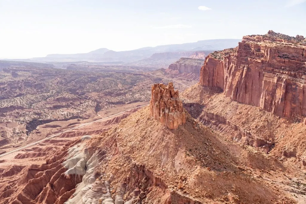
Capitol Reef National Park, located in south-central Utah, is one of the state’s “Mighty 5” national parks. A lesser-known treasure compared to its national park siblings, Capitol Reef is characterized by the Waterpocket Fold, a nearly 100-mile-long wrinkle in the Earth’s crust.
With towering sandstone cliffs, winding canyons, and layers of vibrant rock formations, Capitol Reef National Park is seriously epic. Here, history comes alive with ancient petroglyphs, while orchards planted by early settlers still bear fruit.
Where is Capitol Reef National Park?
Capitol Reef National Park is located in southern Utah. It is situated in the central part of the state, roughly 70 miles east of the town of Moab. The park covers a vast area of approximately 243,921 acres, making it one of the largest national parks in Utah. The park’s central visitor center, known as the Capitol Reef Visitor Center, is located near the town of Torrey, Utah, which serves as the primary gateway to the park.
Why Visit in March?
March in Capitol Reef is when the park puts on its pre-summer show without the summer crowd. As winter retreats, blossoming orchards against the backdrop of red rock formations make March a stunning time to visit. The Waterpocket Fold, the park’s standout geologic feature, is particularly beautiful in the softer spring light. Oh and the top reason this is one of the best National Parks to visit in March? Pie!
Weather in March
In March, Capitol Reef National Park offers delightful early spring weather, with daytime temperatures averaging around 65°F (18°C) and nighttime temperatures hovering around 41°F (5°C). It’s a fantastic time to experience the park without the scorching summer heat.


Best Things to Do Capitol Reef National Park
Eat pie: One unique experience at Capitol Reef is the chance to eat fresh fruit pies at the Gifford House, which is located just a short drive from the park’s visitor center. Starting on Pi Day (March 14) the historic homestead sells fresh pies, cinnamon rolls, and bread. So make sure to time your visit for mid to late March!
Cassidy Arch: Named after the famous outlaw Butch Cassidy, this is a popular hiking destination within Capitol Reef. The trail to Cassidy Arch is about 1.7 miles one way and gains roughly 670 feet in elevation.
Hickman Bridge Trail: A moderately easy hike of about 2 miles round-trip, it leads to the stunning Hickman Bridge, a large natural arch. Along the way, you’ll be treated to views of the Waterpocket Fold and the park’s signature red rock formations.
Know Before You Go
Beware of flash flood dangers: The park can experience sudden and intense thunderstorms. These storms, while often brief, can lead to flash floods, especially in narrow canyons and washes.
Water, Water, Water!: The arid climate means hydration is key. Always bring more water than you think you’ll need.
Respect Cultural Sites: The park is rich in history. Always view petroglyphs and historic sites from a distance, and never touch or deface them.
Learn more about Bryce Canyon National Park
Blog posts
Hiking the Fairyland Loop Trail at Bryce Canyon National Park
3 Days at Zion and Bryce Canyon National Parks Itinerary
YouTube video
One Day at Bryce Canyon National Park | Queens Garden + Navajo Loop, Fairyland Loop, & more!
11. Channel Islands National Park

Amidst the vastness of the Pacific Ocean, just off the coast of Southern California, lies a stunning archipelago—Channel Islands National Park! Comprising five rugged islands and their surrounding marine environment, this national park is a haven of biodiversity, home to unique species not found anywhere else on Earth!
Easily accessible by a short ferry ride, Channel Islands National Park is often referred to as “North America’s Galápagos.” The islands are steeped in history where Ancient Chumash Native Americans called these islands home, and their stories are etched in petroglyphs and village sites. Later, European explorers and settlers left their mark with ranches, lighthouses, and shipwrecks.
Where is Channel Islands National Park?
This park, which covers roughly 249,561 acres, is located off the coast of Southern California. The park comprises five rugged islands, and while they are remote, the park’s visitor center is in the town of Ventura.
Why Visit in March?
In March, Channel Islands sees a burst of wildflower blooms, particularly on the Anacapa and Santa Cruz Islands. Migrating gray whales can often be spotted off the coast during this month. This is also when the island is still green, before turning more of a brown hue in the summer months. We visited the Channel Islands in March and LOVED it!
Weather in March
In March, Channel Islands National Park sees daytime temperatures typically ranging between the mid-50s to mid-60s °F (around 12-18°C), though it can occasionally warm up a tad more. Come nighttime, the temps dip to the mid-40s to low-50s °F (around 7-12°C). March can be a wetter month, as it falls within Southern California’s rainy season. It’s not uncommon to experience rainfall, so it’s a good idea to pack some rain gear if you’re planning a visit.

Best Things to Do Channel Islands National Park
Backpacking Santa Cruz Island: Santa Cruz Island is the largest of the Channel Islands. Backpacking here provides a chance to experience the island’s diverse landscapes, from coastal areas to grassy hills and rugged canyons. The island is home to a variety of endemic species, including the Island scrub jay and the Santa Cruz Island fox.
Anacapa Island Light Station: A beacon for sailors since the 1930s, the lighthouse on Anacapa Island offers panoramic views of the archipelago. The journey to the lighthouse, involving a climb of 150+ steps, also provides a vantage point for spotting migrating gray whales in March.
Hiking the Torrey Pines Trail on Santa Rosa Island: A moderately challenging trail boasting views of pristine beaches, rugged coastlines, and in March, the blooming namesake Torrey Pine trees, which are among the rarest pines in the world.
Know Before You Go
Limited Services on the Islands: Only basic amenities like bathrooms and drinking water are available on the islands. So make sure to pack plenty of food for your adventure. You won’t find any restaurants nearby!
Check boat schedules before you go: Considering the park’s exclusive boat-only entry, check boat schedules and make sure to book in advance.
Learn more about Channel Islands National Park
Blog posts
How to backpack Santa Cruz Island at Channel Islands National Park
Visiting Santa Cruz Island at Channel Islands National Park
YouTube video
Backpacking Santa Cruz Island at Channel Islands National Park (Prisoners Harbor to Scorpion)
12. Congaree National Park
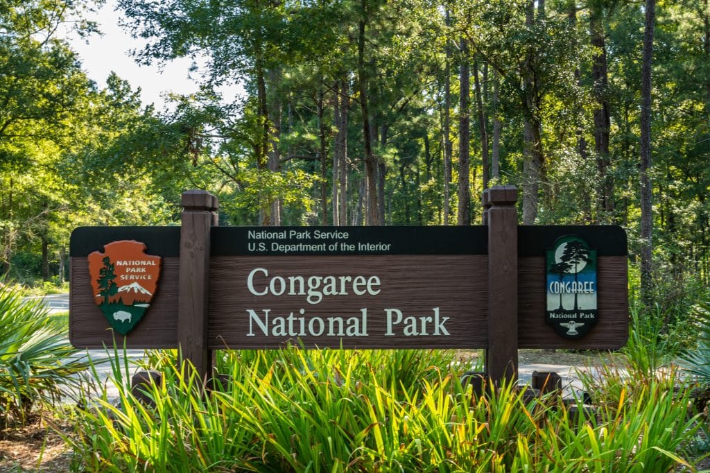
Dive into the largest intact expanse of old-growth bottomland hardwood forest in the southeastern United States at Congaree National Park! Located in South Carolina, this park offers a surreal experience with its soaring trees and winding waterways. How about a kayak ride under towering bald cypresses? Or maybe a hike under the shadows of massive loblolly pines? If ever there was a place where nature shows off, Congaree is it!
Where is Congaree National Park?
Located in South Carolina, Congaree National Park spans approximately 26,276 acres. It’s a short 30-mile drive from the state’s capital, Columbia.
Why Visit in March?
March brings rising water levels in Congaree, making it an excellent time for canoeing and kayaking. The park’s trees begin budding, hinting at the dense green canopy that will form in the coming months.
Weather in March
March in Congaree offers a hint of Southern charm with temperatures leaning towards the 60s and 70s°F (15-25°C) during the day. Once the sun dips, though, evenings take a cooler turn, slipping into the 40s and 50s°F (4-10°C). A light raincoat wouldn’t be a bad idea; spring showers do like to drop by.


Best Things to Do Congaree National Park
Boardwalk Loop Trail: This 2.3-mile trail, much of it elevated, offers a close-up view of the park’s ancient hardwood forests, swampy landscapes, and diverse wildlife without getting your feet wet.
Canoeing or Kayaking: Paddle along Cedar Creek to see the oldest old-growth bottomland hardwood forest in the US! With the higher water levels in March, it’s an ideal time to explore the park’s watery wilderness and spot birds, turtles, and even otters.
Weston Lake Loop Trail: This 4.7-mile trail meanders through a mix of environments, from ancient cypress and tupelo forests to Weston Lake, an oxbow lake.
Know Before You Go
Stay Flood Alert: If you’re planning on canoeing or kayaking, the water levels can greatly impact your experience. Sometimes sections can be too shallow, or conversely, floods might close certain areas.
Bring Bug Spray: Given Congaree’s swampy nature, expect mosquitoes to crash your party. While the park lightens the mood with a daily mosquito meter at the visitors center, their presence isn’t to be underestimated.
Dogs Are Allowed: Another dog friendly park on this list? Heck yes! Congaree allows dogs on all trails. Just make sure you have them leashed!
Visiting the National Parks a different month?
- 10 best National Parks to visit in January
- 15 best National Parks to visit in February
- 12 best National Parks to visit in March
- 11 best National Parks to visit in April
- 17 best National Parks to visit in May
- 15 best National Parks to visit in June
- 14 best National Parks to visit in July
- 15 best National Parks to visit in August
- 19 best National Parks to visit in September
- 16 best National Parks to visit in October
- 10 best National Parks to visit in November
- 10 best National Parks to visit in December
Ready to explore the National Parks?
Pin this guide with the best National Parks to visit in March to plan your adventure!


About the author
This monthly national park series was written by our writer Nicoll, using our monthly lists and incorporating our experiences at each park. Learn a bit about her below!
I’m Nicoll, an adventurous soul fueled by hiking, dirt biking, and traveling. When I’m not busy crafting captivating tales, you’ll find me exploring the world alongside my partner-in-adventure, Jake. Back in 2019, our insatiable wanderlust led us to embrace the nomadic lifestyle with our fearless pack of canine sidekicks, including a mid-content wolf dog. You can catch my adventures and musings on livingtinywithawolf.com.